Category:Freeland, Oxfordshire
village located in West Oxfordshire, United Kingdom  | |||||
| Upload media | |||||
| Instance of | |||||
|---|---|---|---|---|---|
| Location | West Oxfordshire, Oxfordshire, South East England, England | ||||
| Different from | |||||
| official website | |||||
 | |||||
English: Freeland is a village about northeast of Witney in Oxfordshire.
Subcategories
This category has the following 3 subcategories, out of 3 total.
M
W
- Freeland Wesleyan Chapel (3 F)
Media in category "Freeland, Oxfordshire"
The following 52 files are in this category, out of 52 total.
-
 'Heritage Cottage' - geograph.org.uk - 4924168.jpg 1,024 × 683; 210 KB
-
 'Thrift Wood' and outbuilding, Pigeon House Lane - geograph.org.uk - 5015253.jpg 1,024 × 683; 150 KB
-
 Benchmark on 'Heritage Cottage' - geograph.org.uk - 4924148.jpg 683 × 1,024; 243 KB
-
 Benchmark on 'Thrift Wood' outbuilding - geograph.org.uk - 5015242.jpg 683 × 1,024; 311 KB
-
 Benchmark on culvert beside Cuckoo Lane - geograph.org.uk - 4830813.jpg 1,024 × 683; 217 KB
-
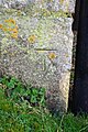
 Benchmark on Freeland Methodist Church - geograph.org.uk - 5015297.jpg 659 × 1,024; 213 KB
-
 BT Notice inside KX100 Phone Box in Freeland - geograph.org.uk - 4972112.jpg 2,592 × 1,944; 1.38 MB
-
 Cricket field at Freeland - geograph.org.uk - 4107549.jpg 3,872 × 2,592; 3.88 MB
-
 Cuckoo Lane runs off this rural road - geograph.org.uk - 4034575.jpg 1,500 × 999; 180 KB
-

-
 East Gate - geograph.org.uk - 3207049.jpg 640 × 427; 217 KB
-
 Entrance to Bowles Farm - geograph.org.uk - 3964156.jpg 1,600 × 952; 463 KB
-
 Field edge at Freeland - geograph.org.uk - 3206857.jpg 640 × 446; 197 KB
-

-
 Fieldside path near Cuckoo Wood Farm - geograph.org.uk - 4107600.jpg 3,872 × 2,592; 5.21 MB
-
 Footpath from The Green - geograph.org.uk - 3206862.jpg 640 × 427; 190 KB
-
 Footpath through Vincents Wood - geograph.org.uk - 4107588.jpg 3,872 × 2,592; 6.78 MB
-
 Footpath towards The Green - geograph.org.uk - 3206858.jpg 640 × 427; 199 KB
-
 Freeland - St Mary the Virgin - geograph.org.uk - 4696379.jpg 1,600 × 1,074; 525 KB
-
 Freeland House - geograph.org.uk - 3964863.jpg 640 × 368; 74 KB
-
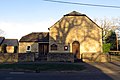 Freeland Methodist Church - geograph.org.uk - 4034567.jpg 1,500 × 999; 163 KB
-
 Freeland Methodist Church - geograph.org.uk - 4107564.jpg 3,768 × 2,512; 3.55 MB
-
 Freeland Village Hall - geograph.org.uk - 3964876.jpg 3,756 × 2,064; 1.7 MB
-
 Freeland Village Hall - geograph.org.uk - 4034566.jpg 1,500 × 999; 132 KB
-
 Gate out of Vincents Wood - geograph.org.uk - 4107593.jpg 3,872 × 2,592; 4.85 MB
-
 Interior of St. Mary's, Freeland, Oxfordshire - geograph.org.uk - 2162534.jpg 1,600 × 1,200; 487 KB
-
 KX100 Phone Box in Wroslyn Road, Freeland - geograph.org.uk - 4972101.jpg 2,592 × 1,944; 1.36 MB
-
 Little Blenheim - geograph.org.uk - 4107560.jpg 3,872 × 2,592; 5.41 MB
-
 Memorial Benches, Wroslyn Road - geograph.org.uk - 3967389.jpg 800 × 493; 93 KB
-
 New field entrance - geograph.org.uk - 3206867.jpg 640 × 427; 206 KB
-
 Notice at the entrance to St Mary's Convent, Freeland - geograph.org.uk - 4955424.jpg 2,592 × 1,944; 1.47 MB
-
 Pond at The Green - geograph.org.uk - 3206840.jpg 640 × 427; 202 KB
-
 Scrubland next to Vincents Wood - geograph.org.uk - 4107590.jpg 3,872 × 2,592; 4.75 MB
-
 Signpost on Freeland Green - geograph.org.uk - 4107572.jpg 3,872 × 2,592; 4.58 MB
-
 St Mary the Virgin parish church in Freeland - geograph.org.uk - 4034568.jpg 1,500 × 999; 149 KB
-
 St Mary the Virgin parish church in Freeland - geograph.org.uk - 4034570.jpg 1,500 × 999; 153 KB
-
 St Mary's Convent, Freeland - geograph.org.uk - 4955417.jpg 2,592 × 1,944; 1.26 MB
-
 The Green - geograph.org.uk - 3206843.jpg 640 × 427; 227 KB
-
 The Green - geograph.org.uk - 3206846.jpg 493 × 640; 211 KB
-
 The Green near Freeland - geograph.org.uk - 4034573.jpg 1,500 × 999; 184 KB
-

-

-
 The Oxfordshire Yeoman on Wroslyn Road - geograph.org.uk - 4034564.jpg 1,500 × 999; 165 KB
-
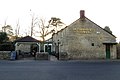 The Oxfordshire Yeoman on Wroslyn Road - geograph.org.uk - 4034565.jpg 1,500 × 999; 135 KB
-
 The road to Eynsham - geograph.org.uk - 4034574.jpg 1,500 × 920; 277 KB
-
 Towards Cuckoo Wood Farm - geograph.org.uk - 3206985.jpg 640 × 428; 205 KB
-
 Vehicles at Cuckoo Wood Farm - geograph.org.uk - 4107609.jpg 3,872 × 2,592; 4.92 MB
-
 Wroslyn Road Industrial Estate - geograph.org.uk - 3967364.jpg 1,600 × 1,039; 452 KB
-
 Wroslyn Road, Freeland - geograph.org.uk - 3967371.jpg 1,024 × 576; 148 KB
-
 Cuckoo Lane towards sunset - geograph.org.uk - 321171.jpg 640 × 480; 136 KB
-
 Ivy-clad trees - geograph.org.uk - 336898.jpg 640 × 480; 158 KB
-
 ^125 Wroslyn Road - geograph.org.uk - 4835551.jpg 1,024 × 683; 159 KB


