Category:Frensham
English: Frensham is a village in Surrey, England beside the A287, 20 km south west of Guildford. Neighbouring villages include Millbridge, Shortfield Common, Dockenfield, Spreakley, Batt's Corner and Rushmoor. Frensham lies on the River Wey. Farnham is the nearest main town and it is to the north. The majority of the land around Frensham is located in a green belt. The non-agricultural land surrounding the village is mainly open heathland and birch woodland.
village and civil parish in Surrey, England, UK  | |||||
| Upload media | |||||
| Instance of | |||||
|---|---|---|---|---|---|
| Location | Waverley, Surrey, South East England, England | ||||
| Population |
| ||||
| Area |
| ||||
 | |||||
Subcategories
This category has the following 5 subcategories, out of 5 total.
Media in category "Frensham"
The following 200 files are in this category, out of 416 total.
(previous page) (next page)-
 "Cat and Fiddle" - geograph.org.uk - 6275856.jpg 480 × 640; 449 KB
-
 "Horses of the Apocalypse" - geograph.org.uk - 6275850.jpg 640 × 480; 433 KB
-
 "Rutting stags" - geograph.org.uk - 6275965.jpg 640 × 480; 425 KB
-
 2016, a year on Geograph (Day 273) - geograph.org.uk - 5138186.jpg 480 × 640; 41 KB
-
 A corbelled corner at Pierrepont Farm - geograph.org.uk - 2555419.jpg 1,024 × 768; 217 KB
-
 A corner of Frensham Little Pond - geograph.org.uk - 4954175.jpg 875 × 1,024; 377 KB
-
 A stretch of The Reeds Road - geograph.org.uk - 2298125.jpg 800 × 600; 149 KB
-
 A Winter's afternoon at Frensham Little Pond - geograph.org.uk - 6442912.jpg 1,799 × 1,199; 437 KB
-
 A Winter's afternoon at Frensham Little Pond - geograph.org.uk - 6442913.jpg 1,799 × 1,199; 488 KB
-
 A287 at Frensham - geograph.org.uk - 3125980.jpg 640 × 481; 65 KB
-
 A287 at Frensham - geograph.org.uk - 3820977.jpg 2,442 × 1,632; 854 KB
-
 A287 at Frensham - geograph.org.uk - 3823842.jpg 640 × 480; 87 KB
-
 A287 at The Bridge, Millbridge - geograph.org.uk - 3125995.jpg 640 × 479; 58 KB
-
 A287 on Frensham Common - geograph.org.uk - 3125969.jpg 640 × 480; 59 KB
-
 A287 to Hindhead - geograph.org.uk - 2282946.jpg 1,600 × 1,200; 639 KB
-

-
 Approaching Pierrepont Farm - geograph.org.uk - 1352232.jpg 640 × 360; 65 KB
-
 Assorted silhouette figures - geograph.org.uk - 6275887.jpg 640 × 480; 403 KB
-

-
 At the Bel and the Dragon Country Inn - geograph.org.uk - 4462812.jpg 4,608 × 3,456; 4.92 MB
-
 At the Devil’s Jumps - geograph.org.uk - 4463133.jpg 4,608 × 3,456; 5.91 MB
-
 Barn and outbuildings at Pierrepont Farm - geograph.org.uk - 2555100.jpg 1,024 × 767; 205 KB
-

-
 Bel and the Dragon Country Inn near to Churt - geograph.org.uk - 4462819.jpg 4,608 × 3,456; 5.41 MB
-
 Bel and the Dragon, Churt - geograph.org.uk - 3887155.jpg 2,048 × 1,536; 472 KB
-
 Bell heather, Frensham Ponds - geograph.org.uk - 4608185.jpg 2,000 × 1,333; 3 MB
-
 Bench on Frensham Common - geograph.org.uk - 5674877.jpg 3,888 × 2,592; 3.29 MB
-
 Bench overlooking Frensham Little Pond - geograph.org.uk - 6275709.jpg 640 × 480; 379 KB
-
 Bench view from the Devil’s Jumps - geograph.org.uk - 4336038.jpg 4,608 × 3,456; 4.76 MB
-
 Blossom and daffs - geograph.org.uk - 1228050.jpg 640 × 360; 51 KB
-

-
 Boardwalk - geograph.org.uk - 6275708.jpg 480 × 640; 430 KB
-

-
 Boundary Road - geograph.org.uk - 4592642.jpg 640 × 480; 147 KB
-
 Boundary Road near Bowlers Farm - geograph.org.uk - 5371829.jpg 800 × 600; 204 KB
-
 Branches on the Bridleway - geograph.org.uk - 5674755.jpg 1,600 × 1,067; 720 KB
-
 Break in woodland near Spreakley - geograph.org.uk - 1265254.jpg 640 × 379; 53 KB
-
 Bridge over the River Wey, Frensham - geograph.org.uk - 3178825.jpg 2,048 × 1,536; 1.18 MB
-
 Bridleway by Rushmoor - geograph.org.uk - 1011313.jpg 640 × 480; 128 KB
-
 Bridleway leaves Jumps Road near Churt - geograph.org.uk - 1622067.jpg 640 × 360; 111 KB
-
 Bridleway on Farnham Heath - geograph.org.uk - 2774408.jpg 4,288 × 3,216; 3.61 MB
-

-
 Bronze Age Barrow, Frensham Common - geograph.org.uk - 1384624.jpg 640 × 480; 104 KB
-
 Bus Stop for Walkers - geograph.org.uk - 5674739.jpg 3,888 × 2,592; 3.36 MB
-
 Car Park for Frensham Ponds - geograph.org.uk - 6346313.jpg 800 × 534; 399 KB
-
 Carved bench - geograph.org.uk - 6275896.jpg 640 × 480; 383 KB
-
 Christmas Day - geograph.org.uk - 75548.jpg 640 × 479; 97 KB
-
 Churt - The Sculpture Park - geograph.org.uk - 6629749.jpg 3,319 × 2,995; 4.32 MB
-
 Churt - The Sculpture Park - geograph.org.uk - 6629762.jpg 3,864 × 4,592; 7.72 MB
-
 Churt - The Sculpture Park - geograph.org.uk - 6630623.jpg 3,864 × 4,296; 6.17 MB
-
 Churt - The Sculpture Park - geograph.org.uk - 6630626.jpg 5,152 × 3,398; 7.75 MB
-
 Churt - The Sculpture Park - geograph.org.uk - 6630637.jpg 5,152 × 3,864; 6.95 MB
-
 Churt - The Sculpture Park - geograph.org.uk - 6630640.jpg 5,152 × 3,864; 6.47 MB
-
 Churt - The Sculpture Park - geograph.org.uk - 6630643.jpg 5,152 × 3,864; 7.64 MB
-
 Churt - The Sculpture Park - geograph.org.uk - 6630651.jpg 3,642 × 2,978; 3.82 MB
-
 Churt - Welsh Dragon - geograph.org.uk - 6638285.jpg 2,576 × 4,698; 6.42 MB
-
 Churt - Welsh Red Dragon - geograph.org.uk - 6638289.jpg 2,964 × 2,718; 3.29 MB
-
 Churt - Welsh Symbols - geograph.org.uk - 6638293.jpg 3,579 × 4,192; 4.87 MB
-
 Churt Sculpture Park - geograph.org.uk - 5958305.jpg 4,000 × 3,000; 4.59 MB
-
 Churt Sculpture Park, '13 Flamingos' by Pierre Diamontopoulo - geograph.org.uk - 5587340.jpg 5,520 × 3,680; 7.51 MB
-
 Churt Sculpture Park, '3 Papillons' by Danu - geograph.org.uk - 5587160.jpg 5,520 × 3,680; 5.63 MB
-
 Churt Sculpture Park, 'Ballerina' by Quentin Clemence - geograph.org.uk - 5587168.jpg 3,680 × 5,520; 5.52 MB
-
 Churt Sculpture Park, 'Basset Hounds' by John Cox - geograph.org.uk - 5587214.jpg 5,520 × 3,680; 5.94 MB
-

-
 Churt Sculpture Park, 'Bluebells' by Jenny Rickford - geograph.org.uk - 5586173.jpg 2,697 × 4,045; 3.73 MB
-
 Churt Sculpture Park, 'Bread Crates' by Ian Dawson - geograph.org.uk - 5587194.jpg 2,667 × 4,000; 3.35 MB
-

-

-
-
 Churt Sculpture Park, 'Ewe-Nicycle' by Garry Jones - geograph.org.uk - 5587257.jpg 2,646 × 3,969; 3.07 MB
-

-
 Churt Sculpture Park, 'Feline Recline' by Francony Kowalski - geograph.org.uk - 5587272.jpg 5,520 × 3,680; 3.55 MB
-
 Churt Sculpture Park, 'Ferryman' by David Goode - geograph.org.uk - 5587148.jpg 3,892 × 2,595; 2.84 MB
-
 Churt Sculpture Park, 'Flora' by Malcolm West - geograph.org.uk - 5587342.jpg 5,520 × 3,680; 3.67 MB
-
 Churt Sculpture Park, 'Flow II' by Yuelong Shi - geograph.org.uk - 5587323.jpg 4,694 × 3,130; 3.29 MB
-
 Churt Sculpture Park, 'Generation' by William Harling - geograph.org.uk - 5586078.jpg 4,879 × 3,253; 4.26 MB
-
 Churt Sculpture Park, 'Giant Iguana' by David Cooke - geograph.org.uk - 5587207.jpg 5,520 × 3,680; 5.1 MB
-
 Churt Sculpture Park, 'Green Man' in oak by Dennis Parson - geograph.org.uk - 5586083.jpg 2,787 × 4,181; 3.46 MB
-

-
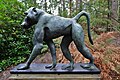
 Churt Sculpture Park, 'Iron Stag' by Dido Crosby - geograph.org.uk - 5587242.jpg 5,520 × 3,680; 6.95 MB
-
 Churt Sculpture Park, 'Jonah' by Paul Richardson - geograph.org.uk - 5587261.jpg 5,520 × 3,680; 5.99 MB
-
 Churt Sculpture Park, 'King and Queen' by Quentin Clemence - geograph.org.uk - 5587250.jpg 3,502 × 5,253; 5.47 MB
-
 Churt Sculpture Park, 'Lady With Air' by Francony Kowalski - geograph.org.uk - 5587229.jpg 5,520 × 3,680; 5.86 MB
-
-
 Churt Sculpture Park, 'Lillies' by Jenny Pickford - geograph.org.uk - 5587319.jpg 5,520 × 3,680; 6.19 MB
-
 Churt Sculpture Park, 'Man Trap' by Wilfred Pritchard - geograph.org.uk - 5587201.jpg 5,520 × 3,680; 6.62 MB
-
 Churt Sculpture Park, 'Meadow Flowers' by Ruth Moilliet - geograph.org.uk - 5586172.jpg 3,680 × 5,520; 6.27 MB
-
 Churt Sculpture Park, 'Modulus TTS' by Ade Grant - geograph.org.uk - 5587249.jpg 3,005 × 4,508; 3.34 MB
-
 Churt Sculpture Park, 'Mother Earth' by Daniel Cordell - geograph.org.uk - 5587221.jpg 4,726 × 3,151; 4.14 MB
-
 Churt Sculpture Park, 'Owl Family' by A.S. Jasi - geograph.org.uk - 5587327.jpg 3,680 × 5,520; 5.8 MB
-
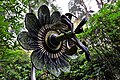 Churt Sculpture Park, 'Passion Flower' by Maylee Christie - geograph.org.uk - 5587268.jpg 5,520 × 3,680; 5.64 MB
-
 Churt Sculpture Park, 'Past and Present' by Eric Duggan - geograph.org.uk - 5587332.jpg 3,397 × 5,095; 5.62 MB
-
 Churt Sculpture Park, 'Penny Farthing' by William Pritchard - geograph.org.uk - 5586087.jpg 3,680 × 5,520; 6.61 MB
-
 Churt Sculpture Park, 'Penny Farthing' by William Pritchard - geograph.org.uk - 5586088.jpg 2,473 × 3,709; 2.88 MB
-
 Churt Sculpture Park, 'Rutting Stags' by James Doran-Webb' - geograph.org.uk - 5586082.jpg 4,557 × 3,038; 4.33 MB
-
 Churt Sculpture Park, 'Scout' by Lucy Kinsella - geograph.org.uk - 5587264.jpg 5,261 × 3,507; 3.66 MB
-
 Churt Sculpture Park, 'Sea Saw' by Paul Cox - geograph.org.uk - 5587246.jpg 5,520 × 3,680; 5.82 MB
-

-
 Churt Sculpture Park, 'Stepping Out' by ESBE - geograph.org.uk - 5586175.jpg 5,520 × 3,680; 7.38 MB
-
 Churt Sculpture Park, 'Sun Canopy II' by Ruth Moilliet - geograph.org.uk - 5587178.jpg 3,140 × 4,710; 5.14 MB
-
 Churt Sculpture Park, 'The Gardener' by Quentin Clemence - geograph.org.uk - 5587174.jpg 3,680 × 5,520; 6.46 MB
-
 Churt Sculpture Park, 'Three Little Birds' by Paul Cox - geograph.org.uk - 5587166.jpg 3,680 × 5,520; 7.19 MB
-
 Churt Sculpture Park, 'Toilet Roll Holder' by Paul Groves - geograph.org.uk - 5586081.jpg 3,192 × 4,787; 4.57 MB
-
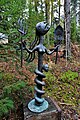
 Churt Sculpture Park, 'Totem Head III' by Patricia Volk - geograph.org.uk - 5587189.jpg 5,199 × 3,465; 3.86 MB
-
 Churt Sculpture Park, 'Tuppin Ram' by Geraldine Knight - geograph.org.uk - 5587280.jpg 5,520 × 3,680; 5.86 MB
-

-
 Churt Sculpture Park, 'Wheels' by Ian Edwards - geograph.org.uk - 5586166.jpg 4,858 × 3,240; 5.07 MB
-
 Churt Sculpture Park, 'Wyvern Dragon' by James Doran-Webb - geograph.org.uk - 5587153.jpg 3,581 × 5,371; 4.82 MB
-
 Churt Sculpture Park, Koi Carp - geograph.org.uk - 5587294.jpg 4,470 × 2,981; 2.41 MB
-

-
 Clearing up - geograph.org.uk - 6275703.jpg 640 × 480; 417 KB
-
 Cormorants on Frensham Little Pond - geograph.org.uk - 5674772.jpg 1,600 × 1,067; 671 KB
-
 Cottage with crocuses - geograph.org.uk - 2292517.jpg 800 × 600; 188 KB
-
 Cottages, Millbridge - geograph.org.uk - 2757431.jpg 4,288 × 3,216; 3.72 MB
-
 Cows and geese - geograph.org.uk - 4601743.jpg 640 × 480; 161 KB
-
 Cricket at Frensham 2011.JPG 3,232 × 2,268; 1.46 MB
-
 Crossroad, Rushmoor - geograph.org.uk - 4040621.jpg 2,048 × 1,536; 1.14 MB
-
 Crosswater Farm - geograph.org.uk - 1011540.jpg 640 × 480; 149 KB
-
 Dead Wood on Frensham Common - geograph.org.uk - 5689966.jpg 3,888 × 2,592; 3.26 MB
-

-
 Dragon Lodge, Millbridge, Frensham - geograph.org.uk - 3839935.jpg 3,264 × 2,448; 1.59 MB
-
 Dragon Lodge, The Reeds Road, Millbridge, Frensham (June 2015).jpg 1,600 × 1,600; 433 KB
-
 Dry Ford - geograph.org.uk - 5069633.jpg 3,264 × 2,448; 3.48 MB
-
 Dry Valley by Ham Ashbed - geograph.org.uk - 2758505.jpg 4,288 × 3,216; 3.65 MB
-
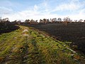
 Edge of the burnt area, Frensham Common - geograph.org.uk - 2151185.jpg 1,600 × 1,200; 791 KB
-
 Ellel Pierrepont - geograph.org.uk - 3820986.jpg 3,001 × 1,896; 1.94 MB
-
 Entrance on West End Lane - geograph.org.uk - 2292505.jpg 800 × 600; 174 KB
-
 Entrance to Alice Holt Forest - geograph.org.uk - 2292804.jpg 800 × 600; 216 KB
-
 Entrance to the Sculpture Park - geograph.org.uk - 3887162.jpg 1,367 × 1,024; 513 KB
-
 Esso Pipeline Marker, The Street, Frensham (June 2015).jpg 1,800 × 2,400; 728 KB
-
 Fallen trees and heathland - geograph.org.uk - 6275699.jpg 640 × 480; 318 KB
-
 Family preening - geograph.org.uk - 1982896.jpg 800 × 512; 91 KB
-
 Fantastic seats - geograph.org.uk - 6275912.jpg 640 × 480; 367 KB
-
 Fantastic shapes - geograph.org.uk - 6275919.jpg 640 × 480; 367 KB
-
 Farm outbuildings at Pierrepont Farm - geograph.org.uk - 2555406.jpg 1,024 × 764; 216 KB
-
 Farm Shop Now Open - geograph.org.uk - 2774395.jpg 4,288 × 3,216; 3.4 MB
-

-
 Fence and Footpath - geograph.org.uk - 5674753.jpg 3,888 × 2,592; 3.57 MB
-
 Fenced path, Frensham Common - geograph.org.uk - 4609474.jpg 2,000 × 1,333; 3.07 MB
-
 Field at Lowicks - geograph.org.uk - 5677821.jpg 640 × 480; 124 KB
-
 Field Gun - geograph.org.uk - 2758372.jpg 4,288 × 3,216; 3.61 MB
-
 Fields at Millbridge - geograph.org.uk - 3839929.jpg 3,264 × 2,448; 1.83 MB
-
 Fingerpost A287 Frensham - geograph.org.uk - 2206833.jpg 1,600 × 1,200; 617 KB
-
 Fingerpost on A287, Frensham - geograph.org.uk - 2310598.jpg 1,600 × 1,200; 606 KB
-
 Fishing In The Pond - geograph.org.uk - 5285719.jpg 2,400 × 1,599; 383 KB
-
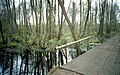
 Footbridge and ford at Tankersford - geograph.org.uk - 40456.jpg 640 × 427; 121 KB
-
 Footbridge and ford on the River Wey (South Branch) - geograph.org.uk - 5069638.jpg 3,264 × 2,448; 3.84 MB
-
 Footbridge beside Sandy Lane - geograph.org.uk - 3887148.jpg 2,048 × 1,536; 939 KB
-
 Footpath East of Hallsgrove Copse - geograph.org.uk - 2758460.jpg 4,288 × 3,216; 3.46 MB
-
 Ford on Sandy Lane - geograph.org.uk - 4919278.jpg 2,878 × 2,160; 3.49 MB
-
 Four Fingers - geograph.org.uk - 2757385.jpg 4,288 × 3,216; 3.66 MB
-
 Fowl Play - geograph.org.uk - 2758468.jpg 4,288 × 3,216; 2.71 MB
-
 Frensham - geograph.org.uk - 5408.jpg 640 × 381; 36 KB
-
 Frensham church - geograph.org.uk - 4601757.jpg 640 × 480; 128 KB
-
 Frensham Common - geograph.org.uk - 2916801.jpg 2,520 × 1,680; 414 KB
-
 Frensham Common - geograph.org.uk - 4353496.jpg 640 × 480; 115 KB
-
 Frensham Common - geograph.org.uk - 4608469.jpg 2,000 × 1,333; 2.57 MB
-
 Frensham Common - geograph.org.uk - 5249879.jpg 2,560 × 1,920; 3.56 MB
-
 Frensham Common - geograph.org.uk - 6265078.jpg 4,608 × 3,456; 6.17 MB
-
 Frensham Common - Memorial - geograph.org.uk - 5249864.jpg 1,920 × 2,560; 3.67 MB
-
 Frensham Common after the fire - geograph.org.uk - 2151175.jpg 1,600 × 1,200; 1.16 MB
-
 Frensham Country Park - geograph.org.uk - 1011562.jpg 640 × 480; 173 KB
-
 Frensham Cricket Club - geograph.org.uk - 2757448.jpg 4,288 × 3,216; 3.41 MB
-
 Frensham Garden Centre, The Reeds Road, Millbridge, Frensham (June 2015).jpg 2,400 × 1,000; 439 KB
-
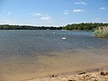
 Frensham Great Pond - geograph.org.uk - 3624120.jpg 640 × 433; 70 KB
-
 Frensham Great Pond - geograph.org.uk - 3630148.jpg 640 × 395; 31 KB
-
 Frensham Great Pond - geograph.org.uk - 3630156.jpg 640 × 279; 41 KB
-
 Frensham Great Pond - geograph.org.uk - 3820980.jpg 3,264 × 2,448; 2.33 MB
-
 Frensham Great Pond - geograph.org.uk - 3820981.jpg 3,264 × 2,448; 2.15 MB
-
 Frensham Great Pond - geograph.org.uk - 4607394.jpg 2,000 × 1,333; 2.73 MB
-
 Frensham Great Pond - geograph.org.uk - 4608174.jpg 2,000 × 1,333; 2.35 MB
-
 Frensham Great Pond - geograph.org.uk - 4608456.jpg 2,000 × 1,333; 2.36 MB
-
 Frensham Great Pond - geograph.org.uk - 4809237.jpg 640 × 480; 158 KB
-
 Frensham Great Pond - geograph.org.uk - 4949286.jpg 1,024 × 768; 240 KB
-
 Frensham Great Pond - geograph.org.uk - 5249874.jpg 2,560 × 1,920; 2.96 MB
-
 Frensham Great Pond - geograph.org.uk - 5629805.jpg 710 × 485; 172 KB
-
 Frensham Great Pond - geograph.org.uk - 5631879.jpg 1,017 × 647; 178 KB
-
 Frensham Great Pond - geograph.org.uk - 6265064.jpg 4,608 × 3,456; 5 MB
-
 Frensham Great Pond from the beach - geograph.org.uk - 1918382.jpg 800 × 600; 92 KB
-
 Frensham Great Puddle - geograph.org.uk - 725185.jpg 640 × 427; 112 KB
-
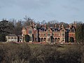
 Frensham Heights - geograph.org.uk - 2758554.jpg 4,288 × 3,216; 3.63 MB
-
 Frensham Heights School - geograph.org.uk - 2758534.jpg 4,288 × 3,216; 3.6 MB
-
 Frensham Little Pond - geograph.org.uk - 2916774.jpg 1,680 × 2,520; 400 KB
-
 Frensham Little Pond - geograph.org.uk - 5629159.jpg 1,012 × 635; 153 KB
-
 Frensham Little Pond - geograph.org.uk - 5629807.jpg 848 × 555; 273 KB
-
 Frensham Little Pond - geograph.org.uk - 5629821.jpg 830 × 555; 200 KB
-
 Frensham Little Pond - geograph.org.uk - 5632567.jpg 837 × 558; 213 KB
-
 Frensham Little Pond - geograph.org.uk - 5632582.jpg 1,010 × 635; 274 KB
-
 Frensham Little Pond - geograph.org.uk - 5674760.jpg 3,888 × 2,592; 5.31 MB
-
 Frensham Little Pond - geograph.org.uk - 6265090.jpg 4,608 × 3,456; 3.98 MB
-
 Frensham Little Pond - geograph.org.uk - 6275698.jpg 640 × 480; 236 KB
-
 Frensham Little Pond - geograph.org.uk - 6346326.jpg 640 × 427; 89 KB
-
 Frensham Little Pond - panoramio.jpg 3,968 × 2,976; 2.69 MB
-

-
 Frensham Little Pond, northernmost end - geograph.org.uk - 2559210.jpg 1,024 × 768; 312 KB
-

-

-
 Frensham Little Pond, view south - geograph.org.uk - 4954047.jpg 1,024 × 768; 158 KB
-
 Frensham Village Shop - geograph.org.uk - 3818521.jpg 1,367 × 1,024; 431 KB
-
 Frensham, aerial 2017 - geograph.org.uk - 5442931.jpg 800 × 533; 86 KB


_-_geograph.org.uk_-_5138186.jpg)


.jpg)


.jpg)


_-_geograph.org.uk_-_5069638.jpg)


.jpg)


_-_geograph.org.uk_-_4954211.jpg)
_-_geograph.org.uk_-_4954230.jpg)


