Category:Friday Street, Surrey
village in Surrey, England, UK  | |||||
| Upload media | |||||
| Instance of | |||||
|---|---|---|---|---|---|
| Location | Wotton, Mole Valley, Surrey, South East England, England | ||||
 | |||||
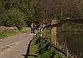
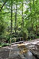
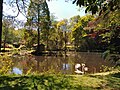
English: Friday Street is a hamlet on the lower slopes of Leith Hill in Surrey, England. It is set well off the main roads around a hammer pond in a steep wooded valley. It lies within the civil parish of Wotton just to the south of the A25 running between Guildford to the west and Dorking to the east. Neighbouring villages include the Abingers of Abinger Hammer and Abinger Common as well as Wotton itself.
Media in category "Friday Street, Surrey"
The following 33 files are in this category, out of 33 total.
-
 Friday Street - geograph.org.uk - 300008.jpg 640 × 480; 119 KB
-
 Friday Street - geograph.org.uk - 575473.jpg 640 × 480; 142 KB
-
 Friday Street - geograph.org.uk - 658524.jpg 640 × 426; 80 KB
-
 Friday Street car park - geograph.org.uk - 2293536.jpg 640 × 480; 145 KB
-
 Friday Street on Good Friday 2012 - geograph.org.uk - 2885715.jpg 4,140 × 2,888; 5.31 MB
-
 Friday Street, Pond - geograph.org.uk - 575477.jpg 640 × 480; 145 KB
-
 Friday Street, Pond Cottage.jpg 3,000 × 1,995; 2.63 MB
-
 Friday Street, Surrey (2) - geograph.org.uk - 573173.jpg 640 × 500; 119 KB
-
 Friday Street, Surrey - geograph.org.uk - 1610141.jpg 640 × 480; 100 KB
-
 Friday Street, Surrey - geograph.org.uk - 573171.jpg 640 × 550; 139 KB
-
 Friday Street, The Mill Pond, spring.jpg 4,500 × 2,992; 4.91 MB
-
 Friday Street, The Mill Pond.jpg 4,000 × 2,250; 3.06 MB
-
 Friday Street, The Stone Bridge over the Tillingbourne Stream, looking nort.jpg 4,000 × 2,660; 4.86 MB
-
 Friday Street, The Stone Bridge over the Tillingbourne Stream, looking south.jpg 4,000 × 2,660; 4.04 MB
-
 Friday Street, water splash by ford.jpg 1,995 × 3,000; 3.41 MB
-
 Mill Pond at Friday Street - geograph.org.uk - 1165885.jpg 640 × 480; 112 KB
-
 Miniature GPO postbox at Friday Street - geograph.org.uk - 2657108.jpg 745 × 1,024; 243 KB
-
 New trees on Wotton estate - geograph.org.uk - 299985.jpg 640 × 480; 136 KB
-
 Old Cottage, Broadmoor.jpg 3,000 × 1,995; 1.99 MB
-
 Path Down Leith Hill - geograph.org.uk - 271642.jpg 426 × 640; 153 KB
-
 Pond in the valley north of Friday Street - geograph.org.uk - 2859738.jpg 768 × 1,024; 256 KB
-
 Pond north of Friday Street - geograph.org.uk - 1166813.jpg 640 × 480; 147 KB
-
 Stephen Langton - geograph.org.uk - 575620.jpg 480 × 640; 122 KB
-
 The devil sculture, Old Cottage, Broadmoor.jpg 1,995 × 3,000; 2.15 MB
-
 The pond at Friday Street, in October (2) - geograph.org.uk - 2657095.jpg 1,024 × 768; 156 KB
-
 The pond at Friday Street, in October (5) - geograph.org.uk - 2663205.jpg 1,024 × 768; 280 KB
-
 The Scarecrow Family, Yew Tree Cottage, Friday Street.jpg 3,000 × 2,035; 1.8 MB
-
 The Stephan Langton Inn, Friday Street - geograph.org.uk - 1285472.jpg 640 × 480; 351 KB
-
 The Stephan Langton Inn, Friday Street - geograph.org.uk - 1285481.jpg 640 × 480; 397 KB
-
 Tilling Springs, Broadmoor, pond.jpg 4,000 × 3,000; 5.5 MB
-
 Woodland path by Friday Street.jpg 3,000 × 1,688; 1.77 MB
-
 Early autumn at Friday Street - geograph.org.uk - 108025.jpg 425 × 640; 149 KB
-
 Millpond at Friday Street - geograph.org.uk - 97870.jpg 640 × 381; 73 KB


_-_geograph.org.uk_-_573173.jpg)


_-_geograph.org.uk_-_2657095.jpg)
_-_geograph.org.uk_-_2663205.jpg)


