Category:Gánt
| Object location | | View all coordinates using: OpenStreetMap |
|---|
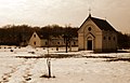
village in Hungary  Roman Catholic church  | |||||
| Upload media | |||||
| Instance of |
| ||||
|---|---|---|---|---|---|
| Location |
| ||||
| Head of government |
| ||||
| Population |
| ||||
| Area |
| ||||
| Elevation above sea level |
| ||||
| official website | |||||
 | |||||
Subcategories
This category has the following 11 subcategories, out of 11 total.
B
- Bauxite mine in Gánt (25 F)
K
L
- Landscapes of Gánt (6 F)
- Lábasbükki Cave (2 F)
- Lábasbükki Cavity (3 F)
S
- Sárkány-lyuk-völgyi Cave (3 F)
- Sárkány-lyuk-völgyi Cavity (1 F)
T
- Turistaház (Gánt) (2 F)
V
Media in category "Gánt"
The following 43 files are in this category, out of 43 total.
-
 Charcoal Pile Gánt 2011 1.jpg 3,008 × 1,605; 5.45 MB
-
 Charcoal Pile Gánt 2011 2.jpg 3,008 × 1,607; 5.51 MB
-
 Colours of the Forest - panoramio - fabiolah (1).jpg 1,748 × 1,088; 1.05 MB
-
 Colours of the Forest - panoramio - fabiolah.jpg 1,563 × 1,286; 875 KB
-
 Colours of the Forest - panoramio.jpg 2,272 × 1,704; 2.05 MB
-
 Gant rovastabla.png 81 × 40; 5 KB
-
 Gánt, Szent Vendel-szobor 2024 01.jpg 1,600 × 2,400; 1.38 MB
-
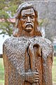 Gánt, Szent Vendel-szobor 2024 02.jpg 1,600 × 2,400; 1.23 MB
-
 Gánt, tourist house - panoramio.jpg 1,704 × 2,272; 1.67 MB
-
 HU-FE Gánt01.JPG 2,048 × 1,536; 714 KB
-
 HU-FE-Gánt13.JPG 2,048 × 1,536; 718 KB
-
 HU-FE-Gánt14.JPG 1,536 × 2,048; 732 KB
-
 HU-FE-Gánt15.JPG 2,048 × 1,536; 733 KB
-
 HU-FE-Gánt16.JPG 2,048 × 1,536; 736 KB
-
 HU-FE-Gánt17.JPG 2,048 × 1,536; 715 KB
-
 HU-FE-Gánt18.JPG 884 × 1,128; 249 KB
-
 HU-FE-Gánt23.JPG 1,536 × 2,048; 738 KB
-
 HU-FE-Gánt24.JPG 984 × 1,420; 158 KB
-
 HU-FE-Gánt25.JPG 2,048 × 1,536; 695 KB
-
 HU-FE-Gánt26.JPG 2,048 × 1,536; 730 KB
-
 HU-FE-Gánt27.JPG 2,048 × 1,536; 712 KB
-
 HU-FE-Gánt28.JPG 2,048 × 1,536; 717 KB
-
 HU-FE-Gánt34.JPG 2,048 × 1,536; 727 KB
-
 HUN Gánt COA.jpg 2,000 × 2,394; 387 KB
-
 HUN Gánt címer.svg 599 × 717; 113 KB
-
 IKARUS népeskocsi Gánt, 2020. 11. 10. (50590672197).jpg 4,016 × 3,007; 4.85 MB
-
 Kőhányás - panoramio - fabiolah.jpg 2,029 × 1,304; 1.1 MB
-
 Kőhányás - panoramio.jpg 2,272 × 1,704; 2.13 MB
-
 Leaf - panoramio - fabiolah (1).jpg 1,171 × 1,635; 1.35 MB
-
 Leaf - panoramio - fabiolah (2).jpg 2,272 × 1,704; 2.4 MB
-
 Leaf - panoramio - fabiolah.jpg 1,299 × 1,989; 1.49 MB
-
 Les - panoramio.jpg 2,203 × 636; 840 KB
-
 Little fluffy clouds - panoramio.jpg 2,263 × 1,543; 1.41 MB
-
 OKT 220417 Kőhányás OKTPH 53.jpg 2,610 × 4,640; 8.16 MB
-
 OKTPH 51 2 Gánt 1.JPG 3,072 × 2,304; 1.36 MB
-
 OKTPH 51 2 Gánt 2.JPG 3,072 × 2,304; 1.31 MB
-
 Országos Kéktúra egyedi pecsételőhely Gánt.jpg 2,604 × 4,624; 7.88 MB
-
 Országos Kéktúra pecsételőhely Gánt egyedi.jpg 3,648 × 2,736; 3.69 MB
-
 Outstander - panoramio.jpg 1,315 × 2,040; 1.81 MB
-
 Romos ház Kápolnapusztán (2023).jpg 4,624 × 3,468; 10.05 MB
-
 Rosa canina Gant.jpg 1,200 × 1,600; 1.2 MB
-
 Sunset - panoramio - fabiolah (4).jpg 2,242 × 1,704; 1.58 MB
-
 Trees - panoramio - fabiolah.jpg 1,704 × 2,272; 1.54 MB


.jpg)


.jpg)


.jpg)
.jpg)


.jpg)

.jpg)
