Category:GOES 16 pictures
Media in category "GOES 16 pictures"
The following 200 files are in this category, out of 489 total.
(previous page) (next page)-
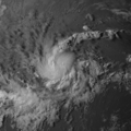
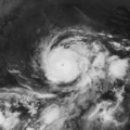
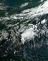
 02L 2022-06-27 1950Z.jpg 1,550 × 2,000; 4.84 MB
-
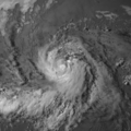
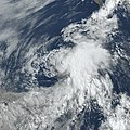
 02L 2022-06-28 1230Z.jpg 1,550 × 2,000; 4.36 MB
-
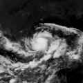
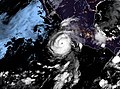
 02L 2022-06-28 1610Z.jpg 1,550 × 2,000; 4.24 MB
-
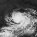
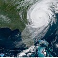
 16L 2017-10-04 GOES-16.png 1,920 × 1,080; 1.34 MB
-
2018 Bomb Cyclone Blizzard - Center of the Storm Satellite Imagery January 4, 2018.webm 4.2 s, 1,440 × 1,080; 3.81 MB
-
 20180728 00Z GOES16 vis 93E.tiff 1,800 × 1,801; 12.38 MB
-
 20180728 06Z GOES16 ir 93E.tiff 1,800 × 1,801; 12.38 MB
-
 20180728 12Z GOES16 ir 93E.tiff 1,801 × 1,800; 12.38 MB
-
 20180728 18Z GOES16 vis 93E.tiff 1,799 × 1,800; 12.37 MB
-
 20180729 00Z GOES16 vis 10E.tif 1,800 × 1,801; 12.38 MB
-
 20180729 06Z GOES16 ir 93E.tiff 1,801 × 1,800; 12.38 MB
-
 20180729 12Z GOES16 ir 93E.tiff 1,800 × 1,801; 12.38 MB
-
 20180729 18Z GOES16 vis 93E.tiff 1,801 × 1,800; 12.38 MB
-
 20180730 00Z GOES16 vis 93E.tiff 1,801 × 1,799; 12.37 MB
-
 20180730 06Z GOES16 ir 93E.tiff 1,800 × 1,801; 12.38 MB
-
 20180730 12Z GOES16 ir 93E.tiff 1,801 × 1,800; 12.38 MB
-
 20180730 18Z GOES16 vis 93E.tiff 1,801 × 1,800; 12.38 MB
-
 20180731 00Z GOES16 vis 93E.tiff 1,801 × 1,800; 12.38 MB
-
 20180731 06Z GOES16 ir 93E.tiff 1,800 × 1,801; 12.38 MB
-
 20180731 12Z GOES16 ir 93E.tiff 1,800 × 1,801; 12.38 MB
-
 20180731 18Z GOES16 vis 10E.tiff 1,801 × 1,800; 12.38 MB
-
 20180801 00Z GOES16 vis 10E.tiff 1,799 × 1,801; 12.37 MB
-
 20180801 06Z GOES16 ir 10E.tiff 1,801 × 1,800; 12.38 MB
-
 20180801 12Z GOES16 ir 10E.tiff 1,801 × 1,800; 12.38 MB
-
 20180801 18Z GOES16 vis 10E.tiff 1,801 × 1,800; 12.38 MB
-
 20180802 00Z GOES16 vis 10E.tiff 1,801 × 1,800; 12.38 MB
-
 20180802 06Z GOES16 ir 10E.tiff 1,801 × 1,800; 12.38 MB
-
 20180802 12Z GOES16 ir 10E.tiff 1,800 × 1,801; 12.38 MB
-
 20180802 18Z GOES16 vis 10E.tiff 1,801 × 1,800; 12.38 MB
-
 20180803 00Z GOES16 vis 10E.tiff 1,801 × 1,800; 12.38 MB
-
 20180803 06Z GOES16 ir 10E.tiff 1,800 × 1,799; 12.37 MB
-
 20180803 12Z GOES16 ir 10E.tiff 1,801 × 1,800; 12.38 MB
-
 20180803 18Z GOES16 vis 10E.tiff 1,801 × 1,800; 12.38 MB
-
 20180804 00Z GOES16 vis 10E.tiff 1,800 × 1,801; 12.38 MB
-
 20180804 06Z GOES16 ir 10E.tiff 1,801 × 1,800; 12.38 MB
-
 20180804 12Z GOES16 ir 10E.tiff 1,801 × 1,800; 12.38 MB
-
 20180804 18Z GOES16 vis 10E.tiff 1,801 × 1,800; 12.38 MB
-
 20180805 00Z GOES16 vis 10E.tiff 1,801 × 1,800; 12.38 MB
-
 20180810 1200Z GOES16 ir 14E.tif 389 × 389; 148 KB
-
 20180810 1800Z GOES16 vis 14E.tif 1,557 × 1,557; 2.31 MB
-
 20180811 0000Z GOES16 vis 14E.tif 1,557 × 1,557; 2.31 MB
-
 20180811 0600Z GOES16 ir 14E.tif 389 × 389; 148 KB
-
 20180811 1200Z GOES16 ir 14E.tif 389 × 389; 148 KB
-
 20180811 1800Z GOES16 vis 14E.tif 1,557 × 1,557; 2.31 MB
-
 20180812 0000Z GOES16 vis 14E.tif 1,557 × 1,557; 2.31 MB
-
 20180812 0600Z GOES16 ir 14E.tif 389 × 389; 148 KB
-
 20180812 1200Z GOES16 ir 14E.tif 389 × 389; 148 KB
-
 20180812 1800Z GOES16 vis 14E.tif 1,557 × 1,557; 2.31 MB
-
 20180813 0000Z GOES16 vis 14E.tif 1,557 × 1,557; 2.31 MB
-
 20180813 0600Z GOES16 ir 14E.tif 389 × 389; 148 KB
-
 20180813 1200Z GOES16 ir 14E.tif 389 × 389; 148 KB
-
 20180813 1800Z GOES16 vis 14E.tif 1,557 × 1,557; 2.31 MB
-
 20180814 0000Z GOES16 vis 14E.tif 1,557 × 1,557; 2.31 MB
-
 20180814 0600Z GOES16 ir 14E.tif 389 × 389; 148 KB
-
 20180814 1200Z GOES16 ir 14E.tif 389 × 389; 148 KB
-
 20180814 1800Z GOES16 vis 14E.tif 1,557 × 1,557; 2.31 MB
-
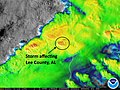 2019-03-03 GOES 16 Lee County Alabama Tornado.jpg 640 × 480; 81 KB
-
2019-03-03 GOES 16 Lee County Alabama Tornado.webm 6.4 s, 640 × 480; 1.33 MB
-
 A Satellite View of a Back-door Cold Front (14295309881).jpg 3,600 × 3,000; 1.54 MB
-
 A View of Deadly Minnesota Thunderstorms from Earth Orbit (NESDIS 2020-07-10).gif 1,920 × 1,080; 143.35 MB
-
 Active MDR in June.jpg 9,006 × 3,195; 38.69 MB
-

-
 Alberto 2018-05-25 1147Z.png 1,000 × 1,000; 1.59 MB
-
 Alberto 2018-05-25 1257Z.jpg 600 × 600; 108 KB
-
 Alberto 2018-05-25 1600Z.png 3,400 × 3,400; 10.58 MB
-
 Alberto 2018-05-25 1630Z (Full size).jpg 798 × 296; 248 KB
-
 Alberto 2018-05-25 1630Z.jpg 798 × 624; 545 KB
-
 Alberto 2018-05-25 231635Z.png 500 × 280; 191 KB
-
 Alberto 2018-05-26 2130Z.jpg 3,774 × 2,505; 5.3 MB
-
 Alberto 2018-05-28 0440Z.jpg 500 × 500; 54 KB
-
 Alberto 2018-05-28 1345Z (Full size).jpg 798 × 296; 218 KB
-
 Alberto 2018-05-28 1345Z.jpg 798 × 655; 555 KB
-
 Alberto 2018-05-28 1515Z.jpg 2,000 × 2,000; 4.3 MB
-
 Annular Solar Eclipse of October 14, 2023 as viewed from GOES-16.jpg 10,848 × 10,848; 89.62 MB
-
 Artemis 1 Launch from GOES 16.gif 1,100 × 619; 12.97 MB
-
 As expected Harvey has intensified into a Hurricane (35973025253).jpg 1,920 × 1,080; 628 KB
-
 Beryl 2018-07-06 1200Z.png 1,600 × 1,600; 3.83 MB
-
 Beryl 2018-07-06 1215Z.jpg 703 × 703; 682 KB
-
 Beryl 2018-07-06 1815Z.jpg 798 × 695; 354 KB
-
 Blas 2022-06-17 1540Z.jpg 1,550 × 2,000; 4.07 MB
-
 Blas 2022-06-20 1910Z.jpg 1,550 × 2,000; 3.97 MB
-
 Bud 2018-06-11 1015Z.jpg 1,105 × 868; 366 KB
-
 Bud 2018-06-11 NOAA.jpg 616 × 372; 64 KB
-
 Bud 2018-06-12 NOAA (Daylight).jpg 800 × 551; 476 KB
-
 Bud 2018-06-12 NOAA.jpg 931 × 524; 54 KB
-
 Bud 2018-06-14 2000Z.jpg 798 × 296; 219 KB
-
 Bud and 04E 2018-06-15 1145Z.jpg 798 × 702; 289 KB
-
 Bud Cat 3 and TS comparison.jpg 600 × 273; 38 KB
-

-
 Category 5 Hurricane Willa Heads Toward Mexico (30576904637).png 1,920 × 1,080; 2.91 MB
-

-
 Celia 2022-06-17 1540Z.jpg 1,200 × 1,500; 2.61 MB
-
 Celia 2022-06-19 1340Z.jpg 1,550 × 2,000; 4.91 MB
-
 Central U.S. storm system 2019-05-20 1330Z.jpg 1,920 × 1,080; 747 KB
-
 Chris 2018-07-11 1445Z.png 743 × 743; 840 KB
-
 Cindy 2017-06-22 1931Z.png 1,682 × 1,487; 4.74 MB
-
 Cindy Geostationary VIS-IR 2017.png 1,581 × 1,549; 4.45 MB
-

-
 Clouds Associated with Tropical Disturbance Bubble Up Over Louisiana (48251040312).jpg 1,920 × 1,080; 1.8 MB
-
 Colin 2022-07-02 1211Z.jpg 1,650 × 2,100; 4.74 MB
-
 Convection in Puerto Rico on October 6, 2017.gif 1,142 × 703; 3.03 MB
-
 Coral Reefs Discovered where Amazon River Flows into the Atlantic Ocean (23782381768).png 1,920 × 1,080; 3.12 MB
-
 Cosme 2019-07-06 1510Z.jpg 1,536 × 1,536; 4.07 MB
-
 Cristobal 2020-06-08 GOES-16 (full).jpg 4,096 × 4,096; 3.21 MB
-
 Cristobal 2020-06-08 GOES-16.jpg 4,463 × 2,975; 2.71 MB
-
 Daniel 2018-06-24 1500Z.jpg 798 × 671; 294 KB
-
 Danielle 2022-09-04 2000Z.jpg 1,550 × 2,000; 5.06 MB
-

-
 Deadly Tornadoes Tear Through Tennessee (NESDIS 2020-03-03 Tornado-gif).gif 600 × 360; 5.04 MB
-

-
 Delta Intensifies into a Major Hurricane (50428786942).jpg 1,920 × 1,080; 1.73 MB
-

-
 Dora 2017-06-26 1215Z.jpg 798 × 592; 151 KB
-
 Dora 2017-06-26 1445Z.jpg 798 × 592; 197 KB
-
 Dorian 2019-08-26 1008Z.jpg 1,920 × 1,080; 1.51 MB
-
 Dorian 2019-08-27 and Large Saharan Dust Plume Blows Across the Atlantic.jpg 1,920 × 1,080; 2.15 MB
-
 Dorian 2019-08-29 1450Z.jpg 1,920 × 1,080; 1.91 MB
-
 Dorian 2019-08-29 1500Z.jpg 5,109 × 3,174; 2.44 MB
-
 Dorian 2019-08-31 1600Z.jpg 3,723 × 2,482; 5.3 MB
-
 Dorian 2019-09-01 1800Z.tiff 2,799 × 2,800; 29.92 MB
-
 Dorian 2019-09-02 0000Z.tiff 559 × 560; 1.2 MB
-
 Dorian 2019-09-02 0600Z.tiff 559 × 560; 1.2 MB
-
 Dorian 2019-09-02 1200Z.tiff 2,799 × 2,799; 29.91 MB
-
 Dorian 2019-09-02 1400Z.jpg 1,920 × 1,080; 1.92 MB
-
 Dorian 2019-09-02 1700Z.png 1,108 × 567; 1.22 MB
-
 Dorian 2019-09-05 1205Z.jpg 2,400 × 2,400; 652 KB
-
 Dorian 2019-09-06 1220Z.jpg 1,920 × 1,080; 1.82 MB
-
 Dorian, Fernand, Gabrielle and Juliette 2019-09-02 1700Z (zoom).jpg 3,108 × 2,119; 2.35 MB
-
 Dorian, Fernand, Gabrielle and Juliette 2019-09-02 1700Z.jpg 5,424 × 5,424; 4.83 MB
-
 Early January 2018 Nor'easter 2018-01-04 1345Z.jpg 2,858 × 2,795; 6.34 MB
-
 Earth 2024-01-15 1810Z.jpg 10,848 × 10,848; 18.5 MB
-
 Earth from Orbit- NOAA Satellites Help Us Prepare for Severe Weather (52737254648).png 1,920 × 1,080; 2.76 MB
-
 Earth from Orbit- NOAA Satellites Monitor Severe Weather and Smoke (53061798238).png 1,920 × 1,080; 3.31 MB
-
 Earth from Orbit- NOAA Satellites Track Blazing Wildfires in Chile (52679478313).png 1,920 × 1,080; 2.75 MB
-
 Earth from Orbit- Rope Clouds (NESDIS 2023-02-02 20210426 RopeCloudStill).png 1,318 × 796; 2.01 MB
-
 Earth from Orbit- Violent Storms Tear Through the South (52781785896).png 1,920 × 1,080; 2.09 MB
-
 Earth June Solstice 2022.jpg 10,848 × 10,848; 109.53 MB
-
 Earth viewed by GOES-16 2023-03-11 1700Z.jpg 10,848 × 10,848; 127.79 MB
-
 Emily 2017-07-31 1230Z.jpg 917 × 698; 264 KB
-

-

-
 Estelle 2022-07-16 1400Z.jpg 1,550 × 2,000; 4.45 MB
-
 Eta 2020-11-03 1700Z.jpg 2,806 × 2,189; 1.67 MB
-
 Everything From Snow to Flooding Rain Across the U S (NESDIS 2019-12-23).jpg 1,920 × 1,080; 1.76 MB
-
 Explosion of Falcon 9 B1046 as seen by GOES 16.gif 1,366 × 625; 314 KB
-
 Falcon 9 Flight 77 plume GOES.gif 1,366 × 654; 6.66 MB
-
 Falcon 9 Flight 78 plume GOES.gif 1,366 × 653; 5.91 MB
-
 February 2021 nor'easter 2021-02-01 2126Z.jpg 1,739 × 2,006; 2.47 MB
-
 February 6-8, 2021 Nor'easter.jpg 2,470 × 2,940; 1.93 MB
-
 Final Pre-Operational GOES-16 Image (25001901108).jpg 1,109 × 660; 234 KB
-
 Fires Ignite Near Oil Tank Facility On Lake Maracaibo (NESDIS 2020-04-30).gif 1,191 × 670; 29.89 MB
-
 First Named Storm of 2019 Atlantic Hurricane Season (40936142943).jpg 1,920 × 1,080; 978 KB
-
 Five Named Atlantic Storms, 2020 (50700750536).jpg 3,840 × 2,160; 2.42 MB
-
 Florence 2018-09-12 1145Z.jpg 1,920 × 1,080; 576 KB
-
 Florence 2018-09-14 1330Z.png 2,000 × 2,000; 5.24 MB
-
 Florence 2018-09-15 1145Z.jpg 1,920 × 1,080; 584 KB
-
 Florence Strengthens to a Category 4 Hurricane (29678024287).png 1,920 × 1,080; 3.79 MB
-
Full Path of East Coast Nor'Easter Blizzard Captured by Satellite January 4, 2018.webm 12 s, 1,440 × 1,080; 8.97 MB
-
 Geocolor Image of Hurricane Irma.jpg 1,619 × 976; 259 KB
-
 Geostationary Satellite imagery.png 10,000 × 10,030; 103.99 MB
-
 GOES 16 1750z 2021-06-15.jpg 10,848 × 10,848; 85.54 MB
-
 GOES 16 2017-09-10 1515Z.jpg 10,848 × 10,848; 125.6 MB
-
 GOES 16 2021-07-04 2150Z.jpg 10,848 × 10,848; 66.43 MB
-
 GOES 16 2021-08-16 1430Z.jpg 10,204 × 7,544; 12.94 MB
-
 GOES 16 2021-08-16 1430Z.png 5,102 × 3,793; 41.51 MB
-
 GOES 16 2021-08-25 2010Z.jpg 12,428 × 6,518; 13.69 MB
-
 GOES 16 2021-08-27 1700Z.jpg 9,456 × 10,228; 11.68 MB
-
 GOES 16 2021-08-28 1400Z.jpg 10,000 × 7,726; 13.42 MB
-
 GOES 16 2021-09-01 1750Z.jpg 7,500 × 4,019; 5.86 MB
-
 GOES 16 2021-09-03 1950Z.jpg 10,848 × 10,848; 78.47 MB
-
 GOES 16 2021-09-21 1440Z.jpg 8,000 × 6,036; 12.33 MB
-
 GOES 16 2021-09-24 1710Z.jpg 10,848 × 10,848; 83.68 MB
-
 GOES 16 2021-10-18 1630Z.jpg 10,848 × 10,848; 86.43 MB
-
 GOES 16 2021-11-01 1440Z.jpg 10,848 × 10,848; 81.66 MB
-
 GOES 16 2022-04-30 1850Z-2240z.gif 678 × 678; 8.43 MB
-
 GOES 16 2022-07-26 1620Z.jpg 21,696 × 21,696; 109.11 MB
-
 GOES 16 2022-12-01 1600Z.jpg 10,848 × 10,848; 115.05 MB
-
 GOES 16 2056z 2021-06-17.jpg 5,000 × 3,000; 12.71 MB
-
 GOES 16 Advanced Baseline Imager multi-channel of North America 20170115 1807.png 2,406 × 1,526; 4.3 MB
-
 GOES 16 Full Western Hemisphere 20170115 1807.jpg 10,848 × 10,824; 26.89 MB
-
 GOES 16 Moon from GEO 20170115.jpg 1,500 × 1,139; 922 KB
-
 GOES 16 on August 21 2017.jpg 10,848 × 10,848; 140.99 MB
-
 GOES 16 September Equinox 2022.jpg 10,848 × 10,848; 13.27 MB
-
 GOES 4th Generation full disk imagery.png 1,175 × 899; 703 KB
-

-

-

-

-
 GOES East Captures SpaceX Falcon Heavy Launch (32651783097).jpg 1,920 × 1,080; 268 KB
-
 GOES East Captures View of Vernal Equinox (47418902822).jpg 1,920 × 1,080; 262 KB
-

-
 GOES East Focuses on Dual Storm Systems (48881835162).jpg 5,000 × 3,000; 13.56 MB
-
 GOES East Focuses on Dual Storm Systems (NESDIS 2019-10-11).jpg 1,920 × 1,080; 1.95 MB
-
 GOES East Focuses on Two Storms Moving Across the US (NESDIS 2019-12-20).jpg 1,920 × 1,080; 308 KB
-
-
 GOES East Monitors Saharan Dust (NESDIS 2019-08-01).png 1,920 × 1,080; 3.75 MB
-

-

-

-
GOES East Sees Fourth Nor’easter this Month.webm 9.8 s, 1,440 × 1,080; 8.29 MB


.jpg)
.gif)
.gif)


.jpg)


.jpg)


.gif)
.png)
.jpg)


.gif)
.jpg)


.png)

.jpg)


.gif)
.gif)
.gif)
.jpg)
.gif)


.jpg)


.png)
.png)
.png)
.png)
.png)


.gif)
.gif)


.jpg)


.jpg)
.gif)
.jpg)
.jpg)


.png)


.gif)
.jpg)
.gif)
.png)
.jpg)
.jpg)
.gif)
.jpg)
.jpg)
.jpg)
_(45173657372).jpg)
.png)
.gif)
.gif)
.gif)
.jpg)
.jpg)