Category:GPS survey equipment
Subcategories
This category has only the following subcategory.
*
- GPS survey equipment on tripods (19 F)
Media in category "GPS survey equipment"
The following 31 files are in this category, out of 31 total.
-
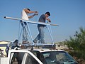
 A little instruction (33974445138).jpg 7,360 × 4,912; 13.27 MB
-
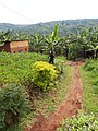
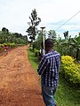
 Banana agriculture in Rwanda.jpg 3,456 × 4,608; 8.35 MB
-

-
-
 F7985CacarongMatandafvf 25.JPG 3,456 × 4,608; 5.86 MB
-
 FEMA - 40586 - Measuring the height of the Red River of the North in Fargo, ND.jpg 3,000 × 2,897; 6.33 MB
-
 FEMA - 40588 - Fargo Engineer uses a GPS to measure the height of the river.jpg 1,993 × 3,000; 4.23 MB
-
 Geodetic survey instruments 06.jpg 5,184 × 3,888; 4.79 MB
-
 Geodetic survey instruments 07.jpg 5,184 × 3,888; 4.73 MB
-
 Geodetic survey instruments 08.jpg 5,184 × 3,888; 4.77 MB
-
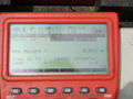
 GisEIEL.jpg 300 × 231; 104 KB
-
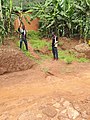
 Housing around Gishwati.jpg 3,456 × 4,608; 8.3 MB
-
 J8016fvfRealdeCacarongMatanda8022 08.JPG 4,608 × 3,456; 6.44 MB
-
 J8016fvfRealdeCacarongMatanda8022 20.JPG 3,456 × 4,608; 6.75 MB
-
 J8016fvfRealdeCacarongMatanda8022 21.JPG 3,456 × 4,608; 6.21 MB
-
 J8016fvfRealdeCacarongMatanda8022 22.JPG 4,608 × 3,456; 6.79 MB
-
 J8016fvfRealdeCacarongMatanda8022 23.JPG 3,456 × 4,608; 5.81 MB
-
 J8016fvfRealdeCacarongMatanda8022 24.JPG 4,608 × 3,456; 5.76 MB
-
 J8016fvfRealdeCacarongMatanda8022 25.JPG 3,456 × 4,608; 6.75 MB
-
 Javad Positioning System antenna atop the Washington Monument.jpg 1,676 × 1,192; 1.17 MB
-
 Land Survey (14000483127).jpg 1,704 × 2,272; 2.79 MB
-
 Landmeter Zandmotor I.JPG 4,288 × 3,216; 3.51 MB
-
 Landmeter Zandmotor II.jpg 3,216 × 4,288; 3.78 MB
-
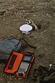
 Montando GPSs - panoramio - panza-rayada.jpg 3,264 × 2,448; 2.04 MB
-
 Montando GPSs - panoramio.jpg 3,264 × 2,448; 2.04 MB
-
 NGEE Arctic (50337941691).jpg 6,000 × 4,000; 9.91 MB
-
 Ordnance Survey Surveyor - geograph.org.uk - 92314.jpg 426 × 640; 72 KB
-
 Surveying around Nyungwe forest.jpg 3,456 × 4,608; 6.59 MB
-

-
 Vermessungsgerät stationär.jpg 2,694 × 2,458; 678 KB
-
 Watersheds mm12 12-01-09 (39045274452).jpg 3,072 × 2,304; 1.48 MB
.jpg)

.jpg)


.jpg)


.jpg)


_STAFF_Sergeants_(SSGT)_George_Dollenger_and_Juan_Orozco_(left),_332nd_Expeditionary_Civil_Engineering_Squadron,_receive_signals_from_a_Global_Positioning_Satelli_-_DPLA_-_1a963146be78a2ab556d40235cf9d7d4.jpeg)

.jpg)