Category:Gadag district
Gadag (Kannada: ) is one of the 30 districts of Karnataka, India. Gadag is the district headquarter. Gadag was formed in 1997, when it was split from Dharwad district. Gadag district, the core area of Kalyani Chalukyas has many monuments, mainly Shiva temples and Jain Basadis. Kalyani Chalukyas propagated Jainism and built temples known for architectural beauty.
15°25′0.01″N 75°37′0.01″E / 15.4166694°N 75.6166694°E
district of Karnataka, India   | |||||
| Upload media | |||||
| Instance of | |||||
|---|---|---|---|---|---|
| Location | Belgaum division, Karnataka, India | ||||
| Capital | |||||
| Official language | |||||
| Inception |
| ||||
| Population |
| ||||
| Area |
| ||||
| official website | |||||
 | |||||
Subcategories
This category has the following 6 subcategories, out of 6 total.
*
Media in category "Gadag district"
The following 8 files are in this category, out of 8 total.
-
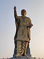 Basaveshwara statue in Gadag.jpg 2,444 × 3,264; 1.29 MB
-
 Harti View.jpg 5,184 × 3,456; 6.54 MB
-
 Life in rural Karnataka.jpg 4,096 × 3,072; 2 MB
-
 Maruti temple Belavanaki.jpg 1,536 × 2,048; 781 KB
-
 North Karnataka Landscape.jpg 4,096 × 3,072; 2.57 MB
-
 Sapta 2.jpg 2,048 × 1,536; 846 KB
-
 Saptamatrikas Belavanaki1.jpg 1,441 × 845; 316 KB
-
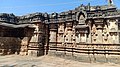 Trikuteshwara Temple Gadag.jpg 3,264 × 1,832; 2.34 MB


