Category:Gaj (Lower Silesian Voivodeship)
| Object location | | View all coordinates using: OpenStreetMap |
|---|
 | |||||
| Upload media | |||||
| Instance of |
| ||||
|---|---|---|---|---|---|
| Location | Gmina Kłodzko, Kłodzko County, Lower Silesian Voivodeship, Poland | ||||
 | |||||
Media in category "Gaj (Lower Silesian Voivodeship)"
The following 11 files are in this category, out of 11 total.
-
 2018 Altana w Gaju.jpg 4,898 × 3,227; 15.37 MB
-
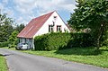
 2018 Dom nr 15 w Gaju 1.jpg 4,610 × 3,114; 12.63 MB
-
 2018 Dom nr 15 w Gaju 2.jpg 4,846 × 3,190; 13.47 MB
-
 2018 Dom nr 5 w Gaju 1.jpg 4,160 × 2,746; 8.68 MB
-
 2018 Dom nr 5 w Gaju 2.jpg 4,874 × 3,200; 14.76 MB
-
 2018 Dom nr 5 w Gaju 3.jpg 4,802 × 3,167; 14.07 MB
-
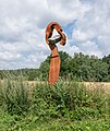
 2018 Rzeźba w Gaju 1.jpg 3,205 × 4,999; 11.33 MB
-
 2018 Rzeźba w Gaju 2.jpg 3,312 × 3,463; 5.79 MB
-
 2018 Rzeźba w Gaju 3.jpg 3,012 × 3,584; 9.18 MB
-
 2018 Rzeźba w Gaju 4.jpg 2,503 × 4,052; 8.8 MB
-
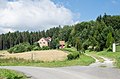
 2018 Strumień w Gaju.jpg 4,578 × 3,179; 15.4 MB


