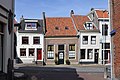
Category:Gamerschestraat 60, Zaltbommel
| Object location | | View all coordinates using: OpenStreetMap |
|---|
building in Zaltbommel, Netherlands  | |||||
| Upload media | |||||
| Instance of | |||||
|---|---|---|---|---|---|
| Location | Zaltbommel, Gelderland, Netherlands | ||||
| Street address |
| ||||
| Heritage designation |
| ||||
 | |||||
|
This is a category about rijksmonument number 40161
|
| Address |
|
Media in category "Gamerschestraat 60, Zaltbommel"
The following 3 files are in this category, out of 3 total.
-
 2010-8 mon 7-1 def; Gamersestraat 60, nr. 40161.jpg 3,972 × 2,648; 1.62 MB
-
 Gevel - Zaltbommel - 20220346 - RCE.jpg 1,200 × 804; 150 KB
-
 Voorgevels - Zaltbommel - 20220345 - RCE.jpg 810 × 1,200; 185 KB

