Category:Gamerschestraat 73, Zaltbommel
| Object location | | View all coordinates using: OpenStreetMap |
|---|
 | |||||
| Upload media | |||||
| Instance of |
| ||||
|---|---|---|---|---|---|
| Location | Zaltbommel, Gelderland, Netherlands | ||||
| Street address |
| ||||
| Heritage designation |
| ||||
 | |||||
|
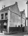
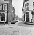
This is a category about rijksmonument number 40148
|
| Address |
|
Media in category "Gamerschestraat 73, Zaltbommel"
The following 9 files are in this category, out of 9 total.
-
 Arya Rangga Pratama.jpg 4,000 × 3,000; 4.73 MB
-
 Gamerschestraat Zandstraat Zaltbommel Nederland.JPG 2,592 × 1,944; 2.32 MB
-
 Gamerschstraat 73.jpg 3,000 × 4,000; 887 KB
-
 Gamerschstraat-73 Zandstraat Zaltbommel Nederland.JPG 2,592 × 1,944; 2.52 MB
-
 Hoek Gamersestraat - Zaltbommel - 20220584 - RCE.jpg 936 × 1,200; 274 KB
-
 Hoek Zandstraat - Zaltbommel - 20220349 - RCE.jpg 802 × 1,200; 215 KB
-
 Overzicht - Zaltbommel - 20220316 - RCE.jpg 1,200 × 960; 241 KB
-
 Overzicht Zandstraat vanaf Gamersestraat - Zaltbommel - 20219610 - RCE.jpg 1,188 × 1,200; 260 KB
-
 Zijgevels in Zandstraat - Zaltbommel - 20220350 - RCE.jpg 802 × 1,200; 235 KB


