Category:Garberville, California
census designated place in Humboldt County, California, United States   | |||||
| Upload media | |||||
| Instance of | |||||
|---|---|---|---|---|---|
| Location | Humboldt County, California, Pacific States Region | ||||
| Population |
| ||||
| Area |
| ||||
| Elevation above sea level |
| ||||
 | |||||
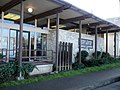
en:Garberville, California is a census-designated place in Humboldt County, California located on the South Fork of the Eel River 52 miles (84 km) south-southeast of Eureka, at an elevation of 535 feet (163 m).
Subcategories
This category has the following 4 subcategories, out of 4 total.
Media in category "Garberville, California"
The following 11 files are in this category, out of 11 total.
-
 2020 Aug 9 101 at Garberville CHP.jpg 620 × 465; 50 KB
-

-

-
 Flowering Bush-Garberville CA1.jpg 720 × 1,280; 722 KB
-
 Flowering Bush-Garberville CA2.jpg 2,208 × 3,928; 3.28 MB
-
 Garberville CA Herb Shop.jpg 3,928 × 2,208; 3.06 MB
-
 Garberville CA Mailbox.jpg 2,208 × 3,928; 2.99 MB
-
 Garberville CA Post Office.jpg 1,024 × 768; 725 KB
-
 Garberville CA Sherwood Forest.jpg 3,928 × 2,208; 3.03 MB
-
 Garberville CA Storefronts and Skyline.jpg 1,024 × 638; 681 KB
-
 Garberville, CA. (21940003631).jpg 2,048 × 1,536; 1.71 MB

.jpg)


.jpg)