Category:Gare de Chelles - Gournay
| Object location | | View all coordinates using: OpenStreetMap |
|---|
railway station in Chelles, France  | |||||
| Upload media | |||||
| Instance of |
| ||||
|---|---|---|---|---|---|
| Location | Chelles, arrondissement of Torcy, Seine-et-Marne, Île-de-France, Metropolitan France, France | ||||
| Transport network | |||||
| Owned by | |||||
| Operator | |||||
| Inception |
| ||||
| Date of official opening |
| ||||
| Elevation above sea level |
| ||||
| Connecting line | |||||
| Adjacent station | |||||
| Interchange station | |||||
 | |||||
Subcategories
This category has the following 2 subcategories, out of 2 total.
G
Media in category "Gare de Chelles - Gournay"
The following 52 files are in this category, out of 52 total.
-
 Acheminement TGV — gare de Chelles.jpg 3,264 × 2,448; 1.84 MB
-
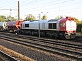 Akiem Class 77 in Chelles-Gournay.jpg 2,816 × 2,112; 2.24 MB
-
 BB 15000 - Gare Chelles.JPG 2,304 × 1,728; 812 KB
-
 BB 15003.jpg 741 × 442; 125 KB
-
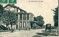
 Chelles (Seine-et-Marne).Gare et voyageurs.jpg 1,189 × 763; 168 KB
-
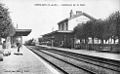
 Chelles (Seine-et-Marne).Gare, vue générale.jpg 987 × 608; 94 KB
-
 Chelles (Seine-et-Marne).Sortie de la gare.jpg 1,192 × 761; 179 KB
-
 ELD 21 - CHELLES - La gare.JPG 1,635 × 1,042; 581 KB
-
 Chelles Entrée de la gare RER E.jpg 1,024 × 768; 101 KB
-
 Chelles Gare RER E.jpg 1,024 × 768; 154 KB
-
 ChellesCarte1839miseàjour1857.jpg 880 × 645; 478 KB
-
 Ecran de gare à la gare de Chelles - Gournay.jpg 3,264 × 2,448; 1.55 MB
-
 Gare Chelles Gournay Chelles 1.jpg 5,184 × 3,456; 6.17 MB
-
 Gare Chelles Gournay Chelles 2.jpg 5,184 × 3,456; 4.39 MB
-
 Gare Chelles Gournay Chelles 3.jpg 5,184 × 3,456; 5.86 MB
-
 Gare Chelles Gournay Chelles 4.jpg 5,184 × 3,456; 4.99 MB
-
 Gare Chelles Gournay Chelles 5.jpg 5,184 × 3,456; 8.12 MB
-
 Gare Chelles Gournay Chelles 6.jpg 5,184 × 3,456; 6.46 MB
-
 Gare Chelles Gournay Chelles 7.jpg 5,184 × 3,456; 4.22 MB
-
 GareChelles.jpg 2,304 × 1,728; 1.1 MB
-
 GareChellesGournay1900bvintérieur.jpg 980 × 608; 444 KB
-
 GareChellesGournay1900train.jpg 994 × 632; 439 KB
-
 LeMondeIllustréChelles1871.jpg 1,303 × 481; 495 KB
-
 Meri chelles.jpg 2,304 × 1,728; 755 KB
-
 MI2N—Gare de Chelles.jpg 3,264 × 2,448; 2.72 MB
-
 Myse Chelles.JPG 2,304 × 1,728; 793 KB
-
 Pyse Chelles.JPG 2,304 × 1,728; 736 KB
-
 RER E - Gare Chelles 2.JPG 3,648 × 2,736; 4.89 MB
-
 RER E - Gare Chelles 3.JPG 3,648 × 2,736; 4.7 MB
-
 RER E - Gare Chelles 4.JPG 3,648 × 2,736; 4.92 MB
-
 RER E - Gare Chelles 4Bis.JPG 2,432 × 1,824; 1.08 MB
-
 RER E - Gare Chelles 5.JPG 2,304 × 1,728; 807 KB
-
 RER E - Gare Chelles 6.JPG 2,304 × 1,728; 819 KB
-
 RER E - Gare Chelles 7.JPG 2,304 × 1,728; 745 KB
-
 RER E - Gare Chelles.JPG 2,304 × 1,728; 830 KB
-
 RER NG (Z 58000) en gare de Chelles-Gournay.jpg 3,952 × 1,824; 1.43 MB
-
 RerE Hisi Chelles.JPG 2,304 × 1,728; 822 KB
-
 SNCF422377ChJPVL.JPG 1,060 × 743; 228 KB
-
 SNCFlignePmeaux PICI chelles RIBrénové.jpg 2,304 × 1,728; 799 KB
-
 TransilienP - Gare Chelles 2.JPG 2,304 × 1,728; 837 KB
-
 TransilienP - Gare Chelles 3.JPG 2,304 × 1,728; 842 KB
-
 TransilienP - Gare Chelles 4.JPG 2,304 × 1,728; 900 KB
-
 TransilienP - Gare Chelles.JPG 2,304 × 1,728; 703 KB
-
 TransilienP Gare Chelles 2.JPG 2,304 × 1,728; 710 KB
-
 TransilienP Gare Chelles.JPG 2,304 × 1,728; 651 KB
-
 TransilienP Pici Chelles.JPG 2,304 × 1,728; 860 KB
-
 UM Z 50000 — gare de Chelles.jpg 3,264 × 2,448; 2.54 MB
-
 Z20500 Zimo Chelles.JPG 3,648 × 2,736; 4.85 MB
-
 Z22500 Cohi 2Chelles.JPG 3,648 × 2,736; 4.82 MB
-
 Z22500 Cohi Chelles.JPG 1,280 × 960; 100 KB
-
 Z22500 Hoci Chelles.JPG 1,280 × 960; 111 KB
-
 Z22500 hole chelles.jpg 2,304 × 1,728; 460 KB


.Gare_et_voyageurs.jpg)
.Gare,_vue_g%C3%A9n%C3%A9rale.jpg)
.Sortie_de_la_gare.jpg)


_en_gare_de_Chelles-Gournay.jpg)


