Category:Gare de Dirinon
| Object location | | View all coordinates using: OpenStreetMap |
|---|
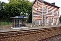
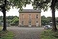
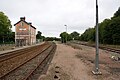
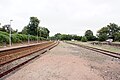
railway station in Loperhet, France  | |||||
| Upload media | |||||
| Instance of | |||||
|---|---|---|---|---|---|
| Location | Loperhet, canton of Daoulas | ||||
| Transport network | |||||
| Owned by | |||||
| Operator | |||||
| Date of official opening |
| ||||
| Elevation above sea level |
| ||||
| Connecting line | |||||
| Adjacent station | |||||
 | |||||
La gare de Dirinon - Loperhet est une gare ferroviaire de la ligne de Savenay à Landerneau, située sur la commune de Loperhet, près de Dirinon, dans le département du Finistère en région Bretagne.
Media in category "Gare de Dirinon"
The following 8 files are in this category, out of 8 total.
-
 Gare-Dirinon-bv-abriTer.jpg 4,592 × 3,056; 2.42 MB
-
 Gare-Dirinon-bv-entrée.jpg 4,592 × 3,056; 2.4 MB
-
 Gare-Dirinon-commandes.jpg 4,592 × 3,056; 1.98 MB
-
 Gare-Dirinon-plan-2008.jpg 4,592 × 3,056; 4.94 MB
-
 Gare-Dirinon-vers-Landerneau-1.jpg 4,592 × 3,056; 1.96 MB
-
 Gare-Dirinon-vers-Landerneau-2.jpg 4,592 × 3,056; 2.28 MB
-
 Gare-Dirinon-vers-Quimper-1.jpg 4,592 × 3,056; 1.96 MB
-
 Gare-Dirinon-vers-Quimper-2.jpg 4,592 × 3,056; 2.22 MB


