<nowiki>Gare de La Chaux-des-Crotenay; Gare de La Chaux-des-Crotenay; La Chaux-des-Crotenay; La Chaux-des-Crotenay; station La Chaux-des-Crotenay; gară din Franța; vasútállomás Franciaországban; estación de tren en Francia; stasiun kereta api di Perancis; stacja kolejowa we Francji; залізнична станція у Франції; spoorwegstation in Frankrijk; estació de tren a França; fervoja stacidomo en Francio; Bahnhof in Frankreich; gare ferroviaire française; railway station in Chaux-des-Crotenay, France; محطة قطار في فرنسا; stazione ferroviaria francese; traukinių stotis Prancūzijoje; Chaux-des-Crotenay; gare de La Chaux-des-Crotenay</nowiki>


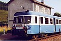 Autorail X 2912.JPG 1,707 × 1,158; 236 KB
 BV de La Chaux-des-Crotenay (1) par Cramos.JPG 3,000 × 2,000; 1.87 MB
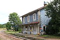 BV de La Chaux-des-Crotenay (2) par Cramos.JPG 3,000 × 2,000; 2.1 MB
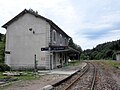 Gare La Chaux des Crotenay.JPG 2,048 × 1,536; 534 KB
 Gare La Chaux des Crotenay2.JPG 2,048 × 1,536; 520 KB
 Serrure centrale d'enclenchement La Chaux des Crotenay.png 1,024 × 1,147; 1.92 MB
 X-2912.JPG 1,690 × 1,110; 339 KB
_par_Cramos.JPG)
_par_Cramos.JPG)


