Category:Gare de La Teste
| Object location | | View all coordinates using: OpenStreetMap |
|---|
railway station in La Teste-de-Buch, France  | |||||
| Upload media | |||||
| Instance of | |||||
|---|---|---|---|---|---|
| Location | La Teste-de-Buch, Gironde, New Aquitaine, Metropolitan France, France | ||||
| Transport network |
| ||||
| Owned by | |||||
| Operator | |||||
| Date of official opening |
| ||||
| Elevation above sea level |
| ||||
| Connecting line | |||||
| Adjacent station |
| ||||
 | |||||
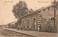
Français : La gare de La Teste est une gare ferroviaire française de la ligne de Lamothe à Arcachon, située sur le territoire de la commune de La Teste-de-Buch dans le département de la Gironde en région Aquitaine.
Media in category "Gare de La Teste"
The following 10 files are in this category, out of 10 total.
-
 Baia 4 Gare de La Teste.JPG 4,608 × 3,456; 2.32 MB
-
 Gare de La Teste.JPG 3,648 × 2,736; 4.67 MB
-
 La Teste-de-Buch - gare.jpg 939 × 610; 146 KB
-
 La Teste-de-Buch - La gare 1.jpg 812 × 519; 149 KB
-
 La Teste-de-Buch - La gare 2.jpg 1,554 × 1,004; 325 KB
-
 La Teste-de-Buch.La nouvelle gare, Côte d'Argent.jpg 1,188 × 772; 159 KB
-
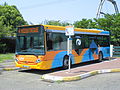
 Photo bus Baïa Arcachon TAD.jpg 550 × 309; 34 KB
-
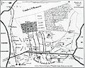 PlaineCazaux1850.jpg 3,882 × 3,106; 5.13 MB
-
 Quais gare La Teste.JPG 3,648 × 2,736; 4.58 MB
-
 Ého H Gare de La Teste.JPG 4,608 × 3,456; 2.18 MB


