Category:Gatteville lighthouse
| Object location | | View all coordinates using: OpenStreetMap |
|---|
|
This building is classé au titre des monuments historiques de la France. It is indexed in the base Mérimée, a database of architectural heritage maintained by the French Ministry of Culture, under the references PA50000065
|
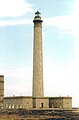
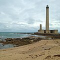
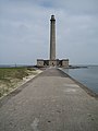
lighthouse in Manche, France  Phare de Gatteville in 2021  | |||||
| Upload media | |||||
| Instance of | |||||
|---|---|---|---|---|---|
| Made from material | |||||
| Location | Gatteville-le-Phare, canton of Saint-Pierre-Église | ||||
| Architect |
| ||||
| Heritage designation |
| ||||
| Service entry |
| ||||
| Inception |
| ||||
| Significant event |
| ||||
| Height |
| ||||
| Replaces | |||||
| official website | |||||
 | |||||
Subcategories
This category has the following 2 subcategories, out of 2 total.
G
P
- Phare de Gatteville (1775) (11 F)
Media in category "Gatteville lighthouse"
The following 66 files are in this category, out of 66 total.
-
 Cotentin IMAG0984.jpg 960 × 1,280; 474 KB
-
 Cotentin IMAG0990.jpg 480 × 640; 133 KB
-
 DSC01236 - panoramio.jpg 2,816 × 2,112; 2.3 MB
-
 Gateville-le-Phare - Phare et sémaphore.JPG 2,896 × 3,861; 1.66 MB
-
 Gatteville - 2012 1.jpg 3,510 × 1,973; 1.85 MB
-
 Gatteville - 2012 2.jpg 2,917 × 1,639; 1.23 MB
-
 Gatteville - 2012 3.jpg 3,159 × 1,776; 1.3 MB
-
 Gatteville - Le Phare.jpg 4,928 × 3,264; 4.61 MB
-
 Gatteville le Phare DSC 2090 2.jpg 729 × 1,072; 280 KB
-
 Gatteville le phare.jpg 3,888 × 5,184; 3.76 MB
-
 Gatteville lighthouse 01.jpg 5,260 × 3,505; 9.71 MB
-
 Gatteville lighthouse 02.jpg 3,505 × 5,260; 8.36 MB
-
 Gatteville lighthouse 03.jpg 5,260 × 3,505; 10.08 MB
-
 Gatteville lighthouse 1.jpg 4,500 × 3,200; 5.43 MB
-
 Gatteville lighthouse 2.jpg 3,200 × 4,500; 5.05 MB
-
 Gatteville lighthouse 3.jpg 4,500 × 3,200; 5.7 MB
-
 Gatteville lighthouse 4.jpg 4,500 × 3,200; 5.51 MB
-
Gatteville lighthouse, Gatteville-le-Phare - aerial view - short version.webm 12 s, 1,920 × 1,080; 29.17 MB
-
 Gatteville lighthouse, Gatteville-le-Phare - aerial view-0675.jpg 5,463 × 3,073; 18.44 MB
-
 Gatteville lighthouse, Gatteville-le-Phare - aerial view-0676.jpg 5,463 × 3,073; 18.34 MB
-
 Gatteville-le-Phare - Phare de 1835 20130817-01.JPG 2,762 × 4,143; 1.93 MB
-
 Gatteville-le-Phare - Phare de 1835 20130817-02.JPG 3,840 × 5,760; 3.01 MB
-
 Gatteville-le-Phare - Phare de 1835 20130817-03.JPG 3,840 × 5,760; 5.83 MB
-
 Gatteville-le-Phare - Phare de 1835 20130817-04.JPG 3,561 × 5,342; 3.65 MB
-
 Gatteville-le-Phare - Phare de 1835 20130817-05.JPG 3,085 × 4,627; 3.14 MB
-
 Gatteville-le-Phare.jpg 2,815 × 2,112; 3.02 MB
-
 Habitants du phare de Gatteville.jpg 1,796 × 523; 314 KB
-
 Jean-Louis Petit-Le Phare de Gatteville.jpg 640 × 457; 27 KB
-
 La Pernelle - Panorama - Phare de Gatteville.JPG 4,928 × 3,264; 4.8 MB
-
 Le phare de Gatteville ( Barfleur).jpeg 643 × 421; 50 KB
-
 Le phare de Gatteville et le sémaphore.jpg 4,272 × 2,848; 3.03 MB
-
 Lighthouse of Gatteville-7870.jpg 6,394 × 3,597; 14.74 MB
-
 Lighthouse of Gatteville-7871.jpg 4,356 × 5,731; 14.35 MB
-
 Lighthouse of Gatteville-7873.jpg 4,179 × 5,415; 13.91 MB
-
 Lighthouse of Gatteville-7875.jpg 5,966 × 3,356; 15.22 MB
-
 Lighthouse of Gatteville-le-Phare.jpg 3,624 × 2,060; 1.69 MB
-
 Perot, Ferdinand - Le Phare de Gatteville.jpg 2,817 × 1,732; 994 KB
-
 Ferdinand Victor Perrot - Phare de Gatteville.jpg 800 × 488; 35 KB
-
 Phare de Gateville.jpg 4,237 × 2,814; 6.73 MB
-
 Phare de Gatteville (2).jpg 3,012 × 2,338; 1.12 MB
-
 Phare de Gatteville (3).jpg 3,872 × 2,592; 1.52 MB
-
 Phare de Gatteville (Manche, NORMANDIE).jpg 3,718 × 2,806; 2.55 MB
-
 Phare de Gatteville - Pointe de Barfleur 01.jpg 1,075 × 1,635; 175 KB
-
 Phare de Gatteville - Pointe de Barfleur 02.jpg 1,649 × 1,083; 309 KB
-
 Phare de Gatteville - Vue de Barfleur.JPG 4,928 × 3,264; 4.56 MB
-
 Phare de Gatteville 50.jpg 2,848 × 2,136; 380 KB
-
 Phare de Gatteville en pleine tempête.jpg 3,872 × 2,592; 1.35 MB
-
 Phare de Gatteville, Gatteville-le-Phare, France-2.jpg 3,211 × 4,816; 12.45 MB
-
 Phare de Gatteville, Gatteville-le-Phare, France.jpg 3,421 × 5,131; 12.57 MB
-
 Phare de Gatteville, photographie aérienne.jpg 3,393 × 2,271; 1.79 MB
-
 Phare de Gatteville-le-Phare.JPG 3,000 × 4,000; 1.66 MB
-
 Phare de Gatteville.jpg 3,872 × 2,592; 1.54 MB
-
 Phare de la Pointe de Barfleur (11073002466).jpg 821 × 1,024; 243 KB
-
 Phare et sémaphore de Gatteville.jpg 3,456 × 2,304; 2.88 MB
-
 Phare et sémaphorede de Gatteville.jpg 900 × 602; 396 KB
-
 Phare gatteville sca1.jpg 2,448 × 3,264; 3.05 MB
-
 Phare gatteville sca2.jpg 2,448 × 2,448; 2.9 MB
-
 Phare-de-Gatteville.jpg 2,592 × 1,944; 2.35 MB
-
 Phare-gatteville.jpg 1,704 × 2,272; 608 KB
-
 Phare-gatteville2.jpg 2,272 × 1,704; 768 KB
-
 Phares de Gatteville-Barfleur (01).JPG 2,990 × 4,611; 2.57 MB
-
 Pointe de Barfleur et phare de Gatteville.JPG 4,928 × 3,264; 5.19 MB
-

-

-
 TallLighthouse (35085427124).jpg 3,240 × 4,320; 2.9 MB
-
 Vue du phare de Gatteville, Petit.jpg 2,027 × 1,480; 638 KB


.jpeg)


.jpg)
.jpg)
.jpg)


.jpg)


.JPG)


.jpg)
