Category:Gee Cross
village and suburb in Tameside, Greater Manchester, England, UK  | |||||
| Upload media | |||||
| Instance of | |||||
|---|---|---|---|---|---|
| Part of | |||||
| Location | Tameside, Greater Manchester, North West England, England | ||||
 | |||||
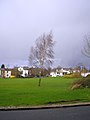
English: Gee Cross is a village—effectively a suburb—within the Metropolitan Borough of Tameside, in Greater Manchester, England. It lies at the edge of the town of Hyde and borders onto Woodley. The centre of the village dates back to the times of the domesday book, however the large nearby town of Hyde grew up in the Industrial Revolution, and now Gee Cross merges into the southern part of Hyde.
Subcategories
This category has the following 7 subcategories, out of 7 total.
B
F
- Gee Cross Festival (141 F)
S
- Stonepit Reservoir, Tameside (15 F)
W
- Well dressing in Gee Cross (145 F)
- Werneth Low Golf Club (15 F)
Media in category "Gee Cross"
The following 200 files are in this category, out of 425 total.
(previous page) (next page)-
 1914 to 1918 - geograph.org.uk - 5962978.jpg 1,280 × 1,423; 1.87 MB
-
 3rd Gee Cross Scout Hut - geograph.org.uk - 5430762.jpg 1,000 × 759; 645 KB
-
 3rd Gee Cross Scouts - geograph.org.uk - 5449226.jpg 1,280 × 960; 977 KB
-
 A canned bicycle - geograph.org.uk - 6273357.jpg 1,280 × 1,216; 1.36 MB
-
 A curtain of poppies - geograph.org.uk - 5962987.jpg 1,280 × 1,415; 1.83 MB
-
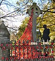
 A curtain of poppies on the Chadwick memorial - geograph.org.uk - 5963288.jpg 1,280 × 960; 1,017 KB
-
 A fresh fall of snow - geograph.org.uk - 4327366.jpg 1,000 × 1,000; 667 KB
-
 A pair of cats - geograph.org.uk - 4306647.jpg 1,000 × 1,000; 830 KB
-
 A possible case of fly-tipping^ - geograph.org.uk - 5715012.jpg 1,280 × 960; 1.43 MB
-
 A560 Gateway signs - geograph.org.uk - 4405142.jpg 1,000 × 1,333; 1.35 MB
-
 A560 Stockport Road, Gee Cross-Hyde - geograph.org.uk - 3372726.jpg 640 × 480; 71 KB
-
 Abandoned railway line - geograph.org.uk - 5140999.jpg 1,000 × 828; 1,020 KB
-
 Access to Trans Pennine Trail - geograph.org.uk - 2740944.jpg 640 × 480; 130 KB
-
 Access to Trans Pennine Trail - geograph.org.uk - 4359390.jpg 1,000 × 750; 680 KB
-
 Access to Trans Pennine Trail from Walkers Fold - geograph.org.uk - 4359558.jpg 1,000 × 750; 668 KB
-
 Accident on Werneth Avenue - geograph.org.uk - 4306663.jpg 1,000 × 1,000; 1.21 MB
-
 Acorn Hill - geograph.org.uk - 2480739.jpg 640 × 544; 173 KB
-
 Acorn Villa date stone - geograph.org.uk - 2472970.jpg 640 × 496; 162 KB
-
 After the race - geograph.org.uk - 6275269.jpg 1,280 × 736; 737 KB
-
 Alder School Display 2008 - geograph.org.uk - 3563329.jpg 640 × 780; 274 KB
-

-
 Alice Street - geograph.org.uk - 3422250.jpg 640 × 450; 146 KB
-
 All Shook Up - geograph.org.uk - 2472593.jpg 640 × 480; 177 KB
-
 Ambulance chasing - geograph.org.uk - 6275260.jpg 1,280 × 960; 1.12 MB
-
 Apple Street - geograph.org.uk - 4327501.jpg 4,048 × 3,040; 3.58 MB
-
 Arnold Avenue - geograph.org.uk - 3050738.jpg 640 × 480; 152 KB
-
 Arnold Hill - geograph.org.uk - 3050796.jpg 640 × 480; 223 KB
-
 At the corner of Knott Lane and Dowson Road - geograph.org.uk - 4261883.jpg 3,264 × 2,448; 5.38 MB
-
 Autumn Footpath - geograph.org.uk - 888893.jpg 640 × 481; 165 KB
-
 Autumn Leaves - geograph.org.uk - 5949855.jpg 1,280 × 1,707; 1.83 MB
-
 Awaiting the Tour of Britain - geograph.org.uk - 6273370.jpg 1,280 × 973; 1.02 MB
-
 Awaiting the Tour of Britain - geograph.org.uk - 6273498.jpg 1,280 × 1,086; 1.22 MB
-
 Awaiting the Tour of Britain - geograph.org.uk - 6273548.jpg 1,280 × 960; 1.09 MB
-
 Awaiting the Tour of Britain - geograph.org.uk - 6273558.jpg 1,280 × 960; 1.13 MB
-
 Awaiting the Tour of Britain - geograph.org.uk - 6274024.jpg 1,280 × 960; 1.22 MB
-
 Back garden snow - geograph.org.uk - 4320752.jpg 1,000 × 787; 926 KB
-
 Back garden snow - geograph.org.uk - 4326363.jpg 1,000 × 750; 721 KB
-
 Back o' th' Hill Farm - geograph.org.uk - 2742991.jpg 4,000 × 3,000; 4.07 MB
-
 Backbower Lane - geograph.org.uk - 4573172.jpg 1,000 × 704; 588 KB
-
 Bagshaw's Farm - geograph.org.uk - 3344207.jpg 640 × 480; 166 KB
-
 Balmoral Avenue entrance - geograph.org.uk - 2306008.jpg 640 × 455; 161 KB
-
 Before the eclipse - geograph.org.uk - 4398245.jpg 1,000 × 760; 562 KB
-
 Behind Alder Community School - geograph.org.uk - 1077131.jpg 640 × 481; 137 KB
-
 Behind Waverley Road - geograph.org.uk - 2747988.jpg 640 × 504; 196 KB
-
 Big Tree Memorial - geograph.org.uk - 1005020.jpg 480 × 640; 153 KB
-
 Big Tree Memorial Stone - geograph.org.uk - 4040043.jpg 1,000 × 642; 422 KB
-
 Bill poster at work - geograph.org.uk - 5299187.jpg 1,000 × 753; 705 KB
-
 Blackbird in a tree - geograph.org.uk - 4303361.jpg 1,000 × 1,000; 1 MB
-
 Bluebell Centre - geograph.org.uk - 1715705.jpg 640 × 521; 175 KB
-
 Bluebell Centre - geograph.org.uk - 2438778.jpg 640 × 471; 200 KB
-
 Bluebell Centre - geograph.org.uk - 2438785.jpg 640 × 480; 241 KB
-
 Bluebell Centre - geograph.org.uk - 2438791.jpg 640 × 486; 202 KB
-
 Bluebell Centre - geograph.org.uk - 2438800.jpg 640 × 480; 198 KB
-
 Bluebell Centre Gardens - geograph.org.uk - 2438731.jpg 640 × 480; 211 KB
-
 Bluebell Centre Pond - geograph.org.uk - 2438771.jpg 640 × 511; 233 KB
-
 Bluebell Centre Pond - geograph.org.uk - 2438803.jpg 640 × 480; 229 KB
-
 Bottom of Treacle Brow - geograph.org.uk - 3139357.jpg 640 × 480; 172 KB
-
 Bowlacre Care Home - geograph.org.uk - 5428292.jpg 1,000 × 774; 626 KB
-
 Bowlacre Farm - geograph.org.uk - 3372707.jpg 640 × 480; 72 KB
-
 Bowlacre Farm - geograph.org.uk - 6082043.jpg 640 × 480; 92 KB
-
 Bowlacre Home - geograph.org.uk - 1778331.jpg 640 × 417; 128 KB
-
 Bowlacre Home - geograph.org.uk - 4986859.jpg 1,000 × 764; 627 KB
-
 Bowlacre Road, Gee Cross-Hyde - geograph.org.uk - 3372710.jpg 640 × 480; 108 KB
-
 Brabyns Road - geograph.org.uk - 5276358.jpg 1,000 × 864; 615 KB
-
 Bridge ^119 - geograph.org.uk - 5141016.jpg 1,000 × 901; 788 KB
-
 Bridge ^126 - geograph.org.uk - 5392750.jpg 1,024 × 787; 849 KB
-
 Broadmeadow Drive - geograph.org.uk - 5428311.jpg 1,000 × 750; 642 KB
-
 Broadmeadow Way - geograph.org.uk - 5329881.jpg 1,024 × 814; 567 KB
-
 Brook Close - geograph.org.uk - 4358332.jpg 1,000 × 858; 732 KB
-
 Brook Close - geograph.org.uk - 4910569.jpg 1,000 × 750; 593 KB
-
 Brookfold Farm - geograph.org.uk - 6250923.jpg 1,280 × 1,074; 1.09 MB
-
 Building a new Scout Hut - geograph.org.uk - 4537163.jpg 1,000 × 750; 609 KB
-
 Building site entrance - geograph.org.uk - 5328770.jpg 1,024 × 819; 530 KB
-
 Building site on Stockport Road - geograph.org.uk - 4986776.jpg 1,000 × 750; 688 KB
-
 Building work on Stockport Road - geograph.org.uk - 4768978.jpg 1,000 × 750; 587 KB
-
 Bus stop on Enfield Street - geograph.org.uk - 5810721.jpg 1,280 × 1,605; 1.12 MB
-
 Buttercup Meadow - geograph.org.uk - 1960552.jpg 640 × 480; 140 KB
-
 Cat crossing Grange Road South - geograph.org.uk - 4254255.jpg 1,000 × 863; 989 KB
-
 Chadwick memorial inscription - geograph.org.uk - 5963231.jpg 1,280 × 922; 1.01 MB
-
 Chartism Sign - geograph.org.uk - 4405293.jpg 1,000 × 1,000; 755 KB
-
 Cheetham Fold - geograph.org.uk - 2371909.jpg 640 × 480; 197 KB
-
 Cheetham Fold Green - geograph.org.uk - 1935715.jpg 640 × 480; 131 KB
-
 Cheetham Fold Road - geograph.org.uk - 2371919.jpg 640 × 480; 184 KB
-
 Cheetham Fold Road - geograph.org.uk - 2371930.jpg 640 × 480; 196 KB
-
 Cheetham Fold Road - geograph.org.uk - 2371943.jpg 640 × 480; 252 KB
-
 Cheetham Fold Road - geograph.org.uk - 2816704.jpg 640 × 480; 236 KB
-
 Cheetham Fold Road - geograph.org.uk - 2816710.jpg 640 × 480; 210 KB
-
 Cheetham Fold Road - geograph.org.uk - 2816715.jpg 640 × 480; 260 KB
-
 Cheetham Fold Road, Hyde - geograph.org.uk - 3362282.jpg 640 × 480; 100 KB
-
 Cherry Blossom - geograph.org.uk - 1006368.jpg 480 × 640; 149 KB
-
 Christmas Day dog walkers - geograph.org.uk - 5634861.jpg 1,280 × 1,280; 1.27 MB
-
 Christmas Eve Sunset - geograph.org.uk - 4291207.jpg 1,000 × 1,000; 772 KB
-
 Christmas holly - geograph.org.uk - 4304759.jpg 1,000 × 1,000; 1.09 MB
-
 Christmas Open Time - geograph.org.uk - 4774391.jpg 1,000 × 584; 428 KB
-
 Church Avenue Steps - geograph.org.uk - 834966.jpg 640 × 480; 166 KB
-
 Conkers on Richmond Hill - geograph.org.uk - 4307083.jpg 1,000 × 758; 971 KB
-
 Construction site on Stockport Road - geograph.org.uk - 5428301.jpg 1,000 × 803; 534 KB
-
 Convenience Store on Grosvenor Road - geograph.org.uk - 5640436.jpg 1,280 × 1,012; 865 KB
-
 Daffodils under a willow tree - geograph.org.uk - 4348651.jpg 1,000 × 750; 948 KB
-
 Daisies instead of daffodils - geograph.org.uk - 4330471.jpg 1,000 × 750; 944 KB
-
 Decorated for the Tour of Britain - geograph.org.uk - 6273924.jpg 1,280 × 1,151; 1.45 MB
-
 Decorated for the Tour of Britain - geograph.org.uk - 6274115.jpg 1,280 × 935; 1.17 MB
-
 Decorated signpost - geograph.org.uk - 6270992.jpg 1,280 × 1,973; 1.78 MB
-
 Decorated signpost at Gee Cross - geograph.org.uk - 6271006.jpg 1,280 × 1,422; 1.69 MB
-
 Denton Brass at Gee Cross Well Dressing - geograph.org.uk - 4576201.jpg 1,000 × 824; 551 KB
-
 Denton Brass crossing Enfield Street - geograph.org.uk - 6215191.jpg 1,280 × 966; 896 KB
-
 Diamond Row Open Space - geograph.org.uk - 1006213.jpg 1,944 × 2,592; 2.48 MB
-
 Diamond Row Open Space - geograph.org.uk - 1529006.jpg 640 × 480; 116 KB
-
 Diamond Row Open Space - geograph.org.uk - 1936173.jpg 640 × 420; 138 KB
-
 Disused railway bridge over Brookfold Lane - geograph.org.uk - 4122710.jpg 1,600 × 1,200; 971 KB
-
 Diversion on Werneth Avenue - geograph.org.uk - 4318448.jpg 1,000 × 751; 592 KB
-
 Dove Farm (site of) - geograph.org.uk - 1800504.jpg 640 × 514; 105 KB
-
 Down Joel Lane - geograph.org.uk - 972734.jpg 640 × 480; 139 KB
-
 Dowson Playing Fields - geograph.org.uk - 1958527.jpg 640 × 480; 118 KB
-
 Dowson Primary Playing Fields - geograph.org.uk - 6007799.jpg 1,280 × 960; 812 KB
-
 Dowson Primary School - geograph.org.uk - 1958532.jpg 640 × 480; 130 KB
-
 Dowson Road Stockport Road Junction - geograph.org.uk - 798149.jpg 640 × 480; 115 KB
-
 Dowson Trail - geograph.org.uk - 1958522.jpg 640 × 480; 141 KB
-
 Drain cleaning at the Werneth - geograph.org.uk - 4327865.jpg 1,000 × 750; 819 KB
-
 Drone up a tree - geograph.org.uk - 5242068.jpg 1,000 × 818; 937 KB
-
 Early daffodils - geograph.org.uk - 4293740.jpg 1,000 × 840; 1.09 MB
-
 Easy Way to Werneth Low - geograph.org.uk - 1077699.jpg 584 × 621; 135 KB
-
 Eclipse shadows - geograph.org.uk - 4398275.jpg 1,000 × 1,000; 827 KB
-
 EIIR postbox (SK14 17D) - geograph.org.uk - 5444541.jpg 1,280 × 1,673; 1.36 MB
-
 EIIR Postbox SK14 20 - geograph.org.uk - 4041247.jpg 1,000 × 787; 329 KB
-
 End of the race - geograph.org.uk - 2343994.jpg 640 × 480; 150 KB
-
 Enfield Street - geograph.org.uk - 5898004.jpg 1,280 × 960; 883 KB
-
 Entering Tameside from Stockport on the A560 - geograph.org.uk - 1906004.jpg 3,872 × 2,475; 3.77 MB
-
 Entrance to Long Acre Farm - geograph.org.uk - 1518277.jpg 640 × 589; 162 KB
-
 Entrance to Sam Redfern Green - geograph.org.uk - 4327905.jpg 1,000 × 750; 681 KB
-
 Exercise Bars - geograph.org.uk - 1013086.jpg 640 × 480; 128 KB
-
 Exercise Bars - geograph.org.uk - 1013090.jpg 640 × 480; 135 KB
-
 Farm Lane - geograph.org.uk - 1823755.jpg 640 × 480; 138 KB
-
 Fenced-off fencing - geograph.org.uk - 4704385.jpg 1,000 × 750; 638 KB
-
 Fernbank Court - geograph.org.uk - 3049802.jpg 640 × 480; 163 KB
-
 Field at Pole Bank - geograph.org.uk - 1892890.jpg 640 × 480; 137 KB
-
 Field at Pole Bank - geograph.org.uk - 4704934.jpg 1,000 × 750; 811 KB
-
 Finishing the race - geograph.org.uk - 2343997.jpg 640 × 520; 191 KB
-
 First come the police - geograph.org.uk - 6275116.jpg 1,280 × 992; 1.11 MB
-
 First snow of 2016 - geograph.org.uk - 4799664.jpg 1,000 × 769; 505 KB
-
 First snow of winter 2016-17 - geograph.org.uk - 5397008.jpg 1,024 × 768; 875 KB
-
 Footpath alongside Alder School - geograph.org.uk - 4307050.jpg 1,000 × 751; 1 MB
-
 Footpath behind Cheetham Fold Road - geograph.org.uk - 2747973.jpg 640 × 480; 221 KB
-
 Footpath behind Grosvenor Road - geograph.org.uk - 4444457.jpg 1,000 × 750; 1.07 MB
-
 Footpath behind Waverley Road - geograph.org.uk - 2747979.jpg 640 × 480; 141 KB
-
 Footpath to Dowson Road - geograph.org.uk - 4262134.jpg 1,000 × 855; 680 KB
-
 Footpath to Dowson Road - geograph.org.uk - 5528718.jpg 1,280 × 960; 1.02 MB
-
 Footpath to Laburnum Avenue - geograph.org.uk - 2747992.jpg 640 × 480; 115 KB
-
 Footpath to Osborne Road - geograph.org.uk - 5120451.jpg 1,000 × 750; 791 KB
-
 Footpath to Woodfield Avenue - geograph.org.uk - 4262140.jpg 1,000 × 750; 750 KB
-
 Footpath towards Bowlacre Farm - geograph.org.uk - 2246777.jpg 640 × 480; 176 KB
-
 Footprints in the snow - geograph.org.uk - 5421016.jpg 1,000 × 866; 755 KB
-
 Former Cheetham Fold Post Office - geograph.org.uk - 4865993.jpg 1,000 × 759; 561 KB
-
 Former College Land - geograph.org.uk - 4212352.jpg 1,000 × 698; 615 KB
-
 Former Godley Junction to Apethorn railway line - geograph.org.uk - 4422247.jpg 1,000 × 750; 996 KB
-
 Four Lane Ends Phone Box - geograph.org.uk - 6249520.jpg 1,289 × 865; 989 KB
-
 Foxholes Field - geograph.org.uk - 2371899.jpg 640 × 480; 175 KB
-
 Foxholes Field - geograph.org.uk - 2816764.jpg 640 × 616; 245 KB
-
 Foxholes Oak - geograph.org.uk - 2816768.jpg 1,280 × 1,707; 1.15 MB
-
 Foxholes Oak Tree - geograph.org.uk - 5910689.jpg 1,280 × 1,158; 1.58 MB
-
 Freezing Fog - geograph.org.uk - 4319112.jpg 1,000 × 1,000; 566 KB
-
 Freshly cut field - geograph.org.uk - 5801214.jpg 5,152 × 3,864; 6.75 MB
-
 Friends of Tejrjwne wheel - geograph.org.uk - 6273934.jpg 1,280 × 1,542; 1.56 MB
-
 Frogmore Avenue - geograph.org.uk - 5458710.jpg 1,280 × 915; 774 KB
-
 Frost on Thornley Street - geograph.org.uk - 5242398.jpg 1,000 × 750; 582 KB
-
 Garden at Pole Bank - geograph.org.uk - 3338428.jpg 640 × 480; 171 KB
-
 Garden of Remembrance - geograph.org.uk - 5688096.jpg 1,280 × 1,010; 1.33 MB
-
 Gatehouse Pigeons - geograph.org.uk - 4910590.jpg 1,000 × 750; 598 KB
-
 Gatestone to The Grange - geograph.org.uk - 1454333.jpg 558 × 640; 135 KB
-
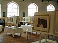 Gee Cross Art Group Exhibition - geograph.org.uk - 4315529.jpg 1,000 × 751; 549 KB
-
 Gee Cross bus terminus - geograph.org.uk - 5834189.jpg 1,280 × 960; 900 KB
-
 Gee Cross Community Centre - geograph.org.uk - 5606252.jpg 1,280 × 960; 795 KB
-
 Gee Cross Play Area - geograph.org.uk - 3139458.jpg 640 × 480; 199 KB
-
 Gee Cross Play Area - geograph.org.uk - 3139474.jpg 640 × 480; 165 KB
-
 Gee Cross Village Stocks - geograph.org.uk - 6109082.jpg 1,280 × 960; 1.36 MB
-
 Gee Cross Woods - geograph.org.uk - 1013062.jpg 640 × 480; 163 KB
-
 Gee Cross.jpg 640 × 480; 134 KB
-
 George at the top of Grosvenor Road - geograph.org.uk - 5441881.jpg 1,000 × 750; 675 KB
-
 Gerrard's Hollow - geograph.org.uk - 3422185.jpg 640 × 480; 248 KB
-
 Gerrards Hollow - geograph.org.uk - 4337280.jpg 1,000 × 750; 1.09 MB
-
 Gerrards Hollow - geograph.org.uk - 4337282.jpg 1,000 × 750; 1.05 MB
-
 Gerrards Wood - geograph.org.uk - 2371956.jpg 640 × 480; 190 KB
-
 Gerrards Wood - geograph.org.uk - 2371982.jpg 640 × 480; 242 KB
-
 Gerrards, Gee Cross - geograph.org.uk - 5328591.jpg 1,024 × 768; 615 KB
-
 God's Garden - geograph.org.uk - 4079449.jpg 1,000 × 750; 332 KB
-
 Godley Arches - geograph.org.uk - 1732767.jpg 640 × 480; 132 KB
-
 Godley Junction - geograph.org.uk - 1800751.jpg 640 × 480; 189 KB
-
 Godley to Apethorn Railway Track - geograph.org.uk - 1279187.jpg 640 × 567; 181 KB
-
 Godley Turntable - geograph.org.uk - 1005818.jpg 640 × 480; 145 KB
-
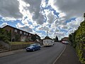
 Grange Road South - geograph.org.uk - 1066781.jpg 640 × 480; 140 KB
-
 Grange Road South - geograph.org.uk - 1762452.jpg 640 × 480; 99 KB
-
 Grange Road South - geograph.org.uk - 1762458.jpg 640 × 480; 102 KB
-
 Grange Road South - geograph.org.uk - 4358303.jpg 1,000 × 1,000; 602 KB
-
 Grange Road South - geograph.org.uk - 4483072.jpg 1,000 × 750; 633 KB
-
 Grange Road South - geograph.org.uk - 4483081.jpg 1,000 × 750; 501 KB
-
 Green Lane footpath junction - geograph.org.uk - 4422238.jpg 1,000 × 883; 990 KB
-
 Greenside Farm - geograph.org.uk - 4349146.jpg 1,000 × 750; 581 KB
-
 Grosvenor Road at sunset - geograph.org.uk - 4778875.jpg 1,000 × 750; 455 KB
-
 Hailstones on Werneth Avenue - geograph.org.uk - 4326355.jpg 1,000 × 939; 1.12 MB
-
 Halloween Race - geograph.org.uk - 2145279.jpg 640 × 508; 169 KB


_-_geograph.org.uk_-_1800504.jpg)


_-_geograph.org.uk_-_5444541.jpg)


