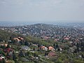
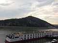
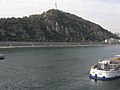
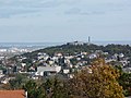
Category:Gellért Hill
English: : Location: Gellérthegy neighborhood of Budapest, District XI and Tabán neighborhood of Budapest, District I, (Castle District).
Magyar: : Helyszíne a Gellérthegy városrész Újbudán és a Tabán városrész a Várkerületben. Magassága: 235 m tszf.
| Object location | | View all coordinates using: OpenStreetMap |
|---|
mountain  | |||||
| Upload media | |||||
| Instance of | |||||
|---|---|---|---|---|---|
| Named after | |||||
| Located in protected area | |||||
| Location | Budapest, Hungary | ||||
| Mountain range | |||||
| Elevation above sea level |
| ||||
 | |||||
Subcategories
This category has the following 23 subcategories, out of 23 total.
A
- Aragonit Cave (19 F)
B
C
- Cave of Mátyás Spring (1 F)
F
G
- Gellért Hill Observatory (5 F)
- Gellért Hill Waterfall (31 F)
- Gellért-hegyi No 9 Cave (2 F)
- Gülbaba Cave (3 F)
H
J
O
P
- Pauline Monastery (Újbuda) (13 F)
S
- Számadó Street, Budapest (2 F)
V
Media in category "Gellért Hill"
The following 200 files are in this category, out of 262 total.
(previous page) (next page)-
 14-05-06-budapest-RalfR-53.jpg 7,360 × 4,912; 18.83 MB
-
 20130612 Budapest 75.jpg 3,968 × 2,976; 2.82 MB
-
 20151003 082 Budapest - Gellért Hill (21733573719).jpg 5,184 × 3,888; 12.93 MB
-
 20151003 087 Budapest - Gellért Hill (21733555529).jpg 5,184 × 3,888; 9.27 MB
-
 20230421.Donau.Budapest.-045.jpg 4,624 × 3,468; 4.87 MB
-
 20230421.Donau.Budapest.-046.jpg 9,228 × 5,537; 12.81 MB
-
 A Gellért-hegy a Duna felől.jpg 4,608 × 3,456; 5.82 MB
-
 A-Rosa Donna (Schiff, 2002), Gellértberg, 2023 Budapest.jpg 2,272 × 1,704; 1,012 KB
-
 A-Rosa Donna und Bolero in Budapest.jpg 3,869 × 2,585; 4.17 MB
-

-
 Amadeus Rhapsody (ship, 1998) 008.jpg 2,048 × 1,371; 1.37 MB
-
 Art on the Gellért Hill (Gellérthegy).jpg 3,264 × 2,448; 4.7 MB
-
 Avalon Impression (ship, 2014) - Budapest, 2015.10.22.jpg 4,320 × 3,240; 5.13 MB
-
 Buda Sport and Recreation Centre and Gellért Hill North. - Budapest.JPG 2,272 × 1,704; 974 KB
-
 Buda Sport and Recreation Centre. - Budapest.JPG 2,272 × 1,704; 1,015 KB
-
 Buda-Gellert panorama 01.JPG 8,733 × 2,918; 18.06 MB
-
 Budai Vár - panoramio (1).jpg 4,096 × 3,072; 1.7 MB
-
 Budai Várnegyed, Ferdinánd-kapu belülről kilátással.JPG 2,448 × 3,264; 1.73 MB
-
 Budai Várnegyed, Kilátás a Buzogány-torony udvarából.JPG 2,448 × 3,264; 1.85 MB
-
 Budapest (agost 2012) - panoramio (18).jpg 3,648 × 2,736; 3.92 MB
-
 Budapest (agost 2012) - panoramio (36).jpg 3,648 × 2,736; 3.49 MB
-
 Budapest (agost 2012) - panoramio (40).jpg 3,648 × 2,736; 6.32 MB
-
 Budapest (Shiff, 1988), Ponton 4, Gellértberg, 2021 Belváros-Lipótváros.jpg 2,272 × 1,704; 971 KB
-
 Budapest - Gellért-hegy 4289.JPG 1,944 × 2,592; 1.85 MB
-
 Budapest - Iglesia Rupestre - 01.jpg 3,121 × 4,810; 3.05 MB
-
 Budapest december 2011-Pesti alsó rakpart - panoramio (3).jpg 3,648 × 2,736; 1.34 MB
-
 Budapest Dunaj noc 1.jpg 5,184 × 3,456; 10.34 MB
-
 Budapest Gellert hill 1.jpg 2,400 × 1,600; 2.4 MB
-
 Budapest Gellert hill 2.jpg 2,400 × 1,600; 2.18 MB
-
 Budapest Gellértberg 1.JPG 3,444 × 2,586; 5.07 MB
-
 Budapest Gellértberg 2.JPG 3,444 × 2,586; 4.97 MB
-
 Budapest I., Gellérthegy, Gül Baba forrás - 2009 BudapestDSCN3940.jpg 3,648 × 2,736; 1.64 MB
-
 Budapest I., Gellérthegy, Gül Baba forrás - 2009 BudapestDSCN3941.jpg 3,648 × 2,736; 1.45 MB
-
 Budapest Most Elzbiety.jpg 6,000 × 4,000; 7.03 MB
-
 Budapest Szabadsag szobor felhok.jpg 3,288 × 2,494; 1.29 MB
-
 Budapest widok z zamku 8.jpg 6,000 × 4,000; 7.73 MB
-
 Budapest Wzgorze Gellerta klasztor.jpg 2,816 × 2,112; 4.07 MB
-
 Budapest wzgorze Gellerta.jpg 2,816 × 2,112; 3.53 MB
-
 Budapest, Ferencváros, 1097 Hungary - panoramio (11).jpg 4,272 × 2,848; 2.61 MB
-
 Budapest, Gellért-hegy, 2.jpg 4,288 × 2,848; 6.21 MB
-
 Budapest, Gellért-hegy, 3.jpg 4,288 × 2,848; 5.55 MB
-
 Budapest, Gellért-hegy, Rudas fürdő.jpg 4,288 × 2,848; 6.55 MB
-
 Budapest, Gellért-hegy.jpg 1,024 × 760; 336 KB
-
 Budapest, Gellérthegy, Gellért-hegy, 1118 Hungary - panoramio.jpg 2,816 × 2,112; 2.92 MB
-

-
 Budapest, Inner City, 1056 Hungary - panoramio (1).jpg 1,626 × 926; 269 KB
-
 Budapest, Inner City, 1056 Hungary - panoramio (3).jpg 1,625 × 926; 299 KB
-
 Budapest, Inner City, 1056 Hungary - panoramio (4).jpg 1,626 × 926; 265 KB
-
 Budapest, Inner City, 1056 Hungary - panoramio - Verőczi Zoltán (2).jpg 2,560 × 1,920; 1.44 MB
-
 Budapest, Inner City, Hungary - panoramio (9).jpg 2,048 × 1,536; 969 KB
-
 Budapest, kilátás a Gellért-hegyre és a Pesti alsó rakpart.jpg 3,872 × 2,592; 6.14 MB
-
 Budapest, Kissvábhegy, Hungary - panoramio (1).jpg 2,048 × 1,536; 405 KB
-
 Budapest, Lipótváros, Hungary - panoramio (41).jpg 2,048 × 1,536; 857 KB
-
 Budapest, Lipótváros, Hungary - panoramio (55).jpg 2,048 × 1,536; 946 KB
-
 Budapest, Magyarország (Hungary) - panoramio (9).jpg 1,024 × 613; 526 KB
-
 Budapest, September 2013 115.jpg 4,000 × 3,000; 2.31 MB
-
 Budapest, September 2013 90.jpg 4,000 × 3,000; 2.34 MB
-
 Budapest, St.-Stephans-Basilika, Blick nach S 2014-08.jpg 1,980 × 1,485; 2.38 MB
-

-
 Budapest, Swiss Tiara an der Elisabethbrücke, 1.jpeg 2,080 × 784; 608 KB
-
 Budapest, Tabán, 1016 Hungary - panoramio (10).jpg 2,048 × 1,536; 1.1 MB
-
 Budapest, Tabán, 1016 Hungary - panoramio (13).jpg 2,048 × 1,536; 851 KB
-
 Budapest, Tabán, Hungary - panoramio (19).jpg 2,048 × 1,536; 996 KB
-
 Budapest, Tabán, Hungary - panoramio (23).jpg 2,048 × 1,536; 1.35 MB
-
 Budapest, Tabán, Hungary - panoramio (24).jpg 2,048 × 1,536; 1.09 MB
-
 Budapest, Tabán, Hungary - panoramio (4).jpg 2,560 × 1,920; 1.46 MB
-
 Budapest, Tabán, Hungary - panoramio (6).jpg 2,560 × 1,920; 1.45 MB
-
 Budapest, Tabán, Hungary - panoramio (8).jpg 1,920 × 2,560; 1.53 MB
-
 Budapest, the Gellért Hill.jpg 1,687 × 2,437; 996 KB
-
 Budapest, view from Buda Castle to the Gellért Hill.jpg 2,551 × 1,701; 1.31 MB
-
 BudapestDSCN3904.JPG 2,736 × 3,648; 1.58 MB
-
 BudapestDSCN3943.JPG 2,736 × 3,648; 1.38 MB
-

-
 Budapešť 0304.jpg 3,312 × 4,416; 2.13 MB
-
 Budapešť 0355.jpg 4,416 × 3,312; 2.19 MB
-
 Budapešť 0356.jpg 3,312 × 4,416; 1.38 MB
-
 Budapešť 0361.jpg 2,816 × 2,112; 1.11 MB
-
 Budapešť 0362.jpg 4,416 × 3,312; 2.6 MB
-
 Budapešť 0370.jpg 2,112 × 2,816; 424 KB
-
 Budapešť 0371.jpg 2,816 × 2,112; 1.26 MB
-
 Budapešť 0405.jpg 2,816 × 2,112; 770 KB
-
 Budapešť 0408.jpg 2,816 × 2,112; 570 KB
-
 Budapešť 1064.jpg 2,816 × 2,112; 1.62 MB
-
 Castle Hill, East Side, Southern cortina wall, View. Lower section of the Descent.JPG 2,448 × 3,264; 1.76 MB
-
 Celtic mould for ring Gellert Hill 1st cent BC IMG 1064.JPG 1,661 × 1,113; 417 KB
-
 Celtic mould for ring Gellert Hill 1st cent BC IMG 1065.JPG 1,524 × 943; 332 KB
-
 Chain bridge and the Gellert hill, Budapest 05 2009 A 003.jpg 2,637 × 1,978; 1.63 MB
-
 Citadel of Buda partial demolition works in 1897.jpg 2,230 × 1,184; 2.83 MB
-
 Danube in Budapest 1503062027.jpg 5,019 × 2,800; 5.94 MB
-
 Dealul Gellert.jpg 3,072 × 2,304; 700 KB
-
 Der kleine Prinz (ship, 1990) 005.jpg 800 × 539; 146 KB
-
 Dock 8A, Elisabeth Bridge and Gellért Hill, 2017 Budapest.jpg 2,272 × 1,704; 1.06 MB
-
 Dunapartlatkep3.jpg 600 × 391; 103 KB
-
 Dunav rijeka.JPG 1,024 × 768; 493 KB
-
 Díszkert a Gellért-hegyen.jpg 4,608 × 3,456; 6.99 MB
-
 Elisabeth Bridge and Gellért-hill.JPG 4,752 × 3,168; 8.48 MB
-
 Elisabeth Bridge, Budapest - Sarah Stierch.jpg 3,923 × 1,872; 3.62 MB
-
 Fakockás járda - panoramio.jpg 3,648 × 2,736; 8.48 MB
-
 Felhők a Szabadság-híd felett a Szabadság-szoborral, Budapest.jpg 3,648 × 2,736; 3.39 MB
-
 Flood on the Danube with the Gellért Hill.jpg 3,888 × 2,592; 2.09 MB
-
 A Gellért-hegy és a Szabadság híd a Petőfi híd felől nézve. Fortepan 4424.jpg 6,756 × 4,577; 10.74 MB
-

-
 Szent Gellért szobor a Gellérthegyen. Fortepan 9889.jpg 1,943 × 1,626; 1.98 MB
-
 Szent Gellért tér, Sziklakápolna. Fortepan 10416.jpg 3,776 × 2,222; 4.65 MB
-
 Budapest I., Gellérthegy, Tabán (1872 körül) - Fortepan 15109.jpg 3,574 × 2,167; 4.59 MB
-

-
 Budapest I. és V., Erzsébet híd a Szent Gellért szobor felé nézve. - Fortepan 17933.jpg 3,195 × 2,573; 4.55 MB
-
 Szent Gellért szobor alatti híd a vízesésnél. Fortepan 17997.jpg 3,166 × 2,660; 4.85 MB
-
 Kilátás a Hegedűs villából a Citadellára. Fortepan 18130.jpg 3,261 × 3,227; 5.99 MB
-

-

-
 A Gellérthegy és az Erzsébet híd a Petőfi tér felől. Fortepan 22474.jpg 4,996 × 3,128; 8.84 MB
-

-
 Budapest I., Tabán és a Gellért-hegy. - Fortepan 27084.jpg 3,525 × 2,187; 5.17 MB
-
 Budapest, a Gellért-hegy és a lerombolt Erzsébet híd Pest felől nézve. Fortepan 30252.jpg 5,510 × 3,493; 10.09 MB
-
 Szabadság szobor. Fortepan 50875.jpg 3,625 × 5,513; 9.6 MB
-
 Budapest I., Kilátás a Gellért-hegy felé. Fortepan 51625.jpg 5,716 × 3,465; 9.29 MB
-

-
 Park a Citadella sétánynál. Fortepan 55006.jpg 1,632 × 1,056; 1.03 MB
-

-
 Szemben a Közraktár utca épületei. Fortepan 58444.jpg 5,000 × 4,396; 7.43 MB
-
 Budapest I., Szemben a Gellért-hegy az Orom utca és a Bérc utca házaival. Fortepan 58516.jpg 5,000 × 4,538; 9.47 MB
-
 Belgrád rakpart, szemben a Gellért-hegy. Fortepan 60747.jpg 6,310 × 5,307; 9.69 MB
-

-
 Gellérthegy, játszótér, Hamupipőke kútszobor (Kallós Ede, 1931.). Fortepan 75501.jpg 4,143 × 6,020; 12.89 MB
-
-
 Szarvas tér a Gellért-hegy felé nézve. Fortepan 77587.jpg 2,745 × 1,486; 1.4 MB
-
 Gellért-hegy, Citadella, Felszabadulási emlékmű. Fortepan 78581.jpg 5,670 × 3,568; 12.65 MB
-
 Belgrád rakpart a nemzetközi hajóállomásnál, a túlparton a Rudas fürdő. Fortepan 78737.jpg 5,637 × 3,661; 10.03 MB
-
 A Gellérthegy és az épülő Erzsébet híd budai hídfője. Fortepan 80301.jpg 3,636 × 4,121; 8.97 MB
-
 Budapest. A Gellért-hegy a Citadella és a hegy lábánál a Sáros fürdő. - Fortepan 82453.jpg 5,954 × 4,730; 16.3 MB
-
 Hungary Fortepan 82537.jpg 6,024 × 4,730; 16.23 MB
-
 Kis-Gellért-hegy a kőbánya felől a Citadella felé nézve. Fortepan 86968.jpg 4,421 × 3,532; 6.88 MB
-
 Az Erzsébet híd budai hídfőjének makettje. Fortepan 91743.jpg 5,129 × 3,478; 7.24 MB
-
 Flood Fortepan 93787.jpg 3,642 × 5,450; 10.96 MB
-
 Budapest, Belváros-Lipótváros, Belváros, Petőfi tér. - Fortepan 102636.jpg 3,049 × 4,697; 6.01 MB
-

-

-

-
 Gellert Hill Conservation Area. - Budapest.JPG 2,448 × 3,264; 1.78 MB
-
 Gellert Hill Conservation Area. Orom Street's Grassland park (E). - Budapest.JPG 3,264 × 2,448; 1.86 MB
-
 Gellert Hill Conservation Area. Orom Street's Grassland park (NE). - Budapest.JPG 3,264 × 2,448; 1.86 MB
-
 Gellert Hill IMG 1021.JPG 5,184 × 2,123; 5.73 MB
-
 Gellert Hill IMG 1022.JPG 5,184 × 2,572; 5.3 MB
-
 Gellert Hill IMG 1031.JPG 5,029 × 2,575; 4.3 MB
-
 Gellert hill.jpg 5,100 × 3,400; 6.83 MB
-
 Gellérhegy - 2014.08.29 (2).JPG 4,320 × 3,240; 5.2 MB
-
 Gellérhegy - 2014.08.29 (3).JPG 4,320 × 3,240; 5.13 MB
-
 Gellért hegy 2018-10-18 17-04-34.jpg 4,160 × 3,120; 4.28 MB
-
 Gellért hegy 2018-10-26 17-33-25.jpg 4,160 × 3,120; 4.16 MB
-
 Gellért Hill 2004.jpg 2,936 × 1,622; 667 KB
-
 Gellért Hill above the water.JPG 4,752 × 3,168; 9.17 MB
-
 Gellért Hill from Chain Bridge, Budapest.jpg 1,200 × 675; 251 KB
-
 Gellért Hill from Liberty Bridge, Hungary - Budapest (28493201865).jpg 2,500 × 1,482; 1.52 MB
-
 Gellért Hill from Tűzkő Hill, 2017 Budaörs.jpg 2,272 × 1,704; 980 KB
-
 Gellért Hill in background.JPG 3,264 × 2,448; 1.84 MB
-
 Gellért Hill.jpg 2,304 × 924; 196 KB
-
 Gellért-hegy 2023 áprilisában.jpg 3,264 × 1,840; 1.16 MB
-
 Gellért-hegy Duna.jpg 3,072 × 2,304; 2.46 MB
-
 Gellért-hegy.jpg 600 × 389; 108 KB
-
 Gellért-hegyi csúszdák.jpg 1,024 × 760; 314 KB
-
 Gellért-hegyi sétány.JPG 640 × 480; 185 KB
-
 Gellértberg Kreuz, Paulinerkloster und Tatra Tram, 2021 Belváros-Lipótváros.jpg 2,215 × 1,246; 695 KB
-
 Gellérthegy (2).jpg 4,000 × 3,000; 4.75 MB
-
 Gellérthegy (3).jpg 4,000 × 3,000; 4.66 MB
-
 Gellérthegy - 2014.08.29 (1).JPG 4,320 × 3,240; 5.09 MB
-
 Gellérthegy -.jpg 3,615 × 1,688; 1.06 MB
-
 Gellérthegy 2012.JPG 4,320 × 3,240; 5.32 MB
-
 Gellérthegy.jpg 4,000 × 3,000; 1.86 MB
-
 Gelért 01.jpg 2,272 × 1,704; 1.84 MB
-
 Gelért 02.jpg 2,272 × 1,704; 1.73 MB
-
 Hegyalja út - Buda.JPG 3,240 × 4,320; 4.85 MB
-
 Hungarian Parliament 030 - Flickr - granada turnier.jpg 1,600 × 1,200; 256 KB
-
 Hungary 0012 - Budapest and Danube River.jpg 4,288 × 2,848; 9.72 MB
-
 Hungary 2010-02-27 (4631520236).jpg 4,650 × 3,168; 1.62 MB
-
 Hungary 2010-02-27 (4637608679).jpg 4,752 × 3,168; 1.48 MB
-
 Hungary 2010-02-28 (4645238303).jpg 3,168 × 4,752; 1.36 MB
-
 Hungary 2010-02-28 (4645853098).jpg 4,752 × 3,168; 1.52 MB
-
 Hungary and the Hungarians (1908) (14595463207).jpg 2,208 × 1,540; 762 KB
-
 Hungary-2504 - Old Fortifications (7814516750).jpg 4,338 × 2,923; 10.96 MB
-
 Hungary-2508 - Old Forifications (7814521998).jpg 3,073 × 4,437; 9.94 MB
-
 IEC-52 Bp713-Gellerthegy.jpg 4,896 × 3,672; 4.28 MB
-
 IMG 0203 - Hungary, Buda.JPG 2,592 × 1,944; 1.53 MB
-
 IMG 0293 - Hungary, Buda - Gellért Hill (Gellérthegy).JPG 1,944 × 2,592; 2.02 MB
-
 IMG 0294 - Hungary, Buda - Gellért Hill (Gellérthegy).JPG 2,592 × 1,944; 2.1 MB
-
 IMG 0308 - Hungary, Buda - Statue of Liberty (Szabadság Szobor).JPG 2,592 × 1,944; 1.3 MB
-
 IMG 0323 - Hungary, Buda - Gellért Hill (Gellérthegy).JPG 2,592 × 1,944; 2.11 MB
-
 Ismeretlen férfi portré (1966) FP 77585.jpg 928 × 660; 86 KB
-
 Kereszt a kálvárián.png 387 × 258; 164 KB
-
 Kilátás a Gellért-hegyre - panoramio.jpg 6,101 × 1,080; 552 KB
-
 Kilátás a Gellért-hegyről a János-hegyre.jpg 4,608 × 3,456; 4.66 MB
-
 Kilátás a Gellért-hegyről.jpg 4,608 × 3,456; 4.2 MB
-
 Kilátás a MOL Toronyból (2).jpg 3,648 × 2,736; 2.1 MB
-
 Kilátás a MOL Toronyból (3).jpg 3,648 × 2,736; 1.98 MB
-
 Kilátás a várból a Gellért-hegyre - panoramio.jpg 576 × 768; 293 KB
-
 Kilátás a Zikkuratról - 2013.10.03 (4).JPG 4,320 × 3,240; 5.13 MB
-
 Križ u Budimpešti.JPG 1,024 × 768; 494 KB
-
 Laika ac Budapest (10089479033).jpg 4,840 × 3,223; 5.29 MB
-
 Lto-bud2016-gellértberg-überdonau.jpg 4,608 × 3,456; 3.23 MB
-
 Lágymányosi dunapart a Műegyetem helyével.tif 1,857 × 1,355; 3.03 MB


.jpg)
.jpg)


,_Gell%C3%A9rtberg,_2023_Budapest.jpg)

,_Hotel_Gell%C3%A9rt,_Gell%C3%A9rt_Hill,_Liberty_Bridge,_2019_Ferencv%C3%A1ros.jpg)
_008.jpg)
.jpg)
_-_Budapest,_2015.10.22.jpg)


.jpg)


_-_panoramio_(18).jpg)
_-_panoramio_(36).jpg)
_-_panoramio_(40).jpg)
,_Ponton_4,_Gell%C3%A9rtberg,_2021_Belv%C3%A1ros-Lip%C3%B3tv%C3%A1ros.jpg)


.jpg)


.jpg)


,_Royal_Palace_on_the_Castle_Hill_(right).jpg)
.jpg)
.jpg)
.jpg)
.jpg)
.jpg)

.jpg)
.jpg)
.jpg)
_-_panoramio_(9).jpg)


.jpg)
.jpg)
.jpg)
.jpg)
.jpg)
.jpg)
.jpg)
.jpg)
.jpg)


_(12010._sz%C3%A1m%C3%BA_m%C5%B1eml%C3%A9k).jpg)


_005.jpg)


_t%C3%A9r_fel%C3%A9._Fortepan_6622.jpg)


_-_Fortepan_15109.jpg)
_t%C3%A9r,_a_lerombolt_Erzs%C3%A9bet_h%C3%ADd_pesti_h%C3%ADdf%C5%91je,_h%C3%A1tt%C3%A9rben_a_Gell%C3%A9rt-hegy._Fortepan_16254.jpg)


._Fortepan_75501.jpg)
_h%C3%ADdr%C3%B3l_n%C3%A9zve,_k%C3%B6z%C3%A9pen_a_P%C3%A1los_kolostor_%C3%A9p%C3%BClete._Fortepan_76657.jpg)


,_L%27Europe_(Schiff,_2006),_Jane_Haining_Kai,_Gell%C3%A9rtberg,_2023_Budapest.jpg)

._-_Budapest.JPG)
._-_Budapest.JPG)


.JPG)
.JPG)


.jpg)


.jpg)
.jpg)
.JPG)


.jpg)
.jpg)
.jpg)
.jpg)
_(14595463207).jpg)
.jpg)
.jpg)


.JPG)
.JPG)
.JPG)
.JPG)
_FP_77585.jpg)


.jpg)
.jpg)

.JPG)

.jpg)
