Category:Gemeentehuis (Katwijk)
| Object location | | View all coordinates using: OpenStreetMap |
|---|
 | |||||
| Upload media | |||||
| Instance of | |||||
|---|---|---|---|---|---|
| Location | Katwijk, South Holland, Netherlands | ||||
| Street address |
| ||||
| Located on street |
| ||||
| Architectural style | |||||
| Heritage designation |
| ||||
| Inception |
| ||||
 | |||||
|
This is a category about rijksmonument number 509335
|
| Address |
|
Media in category "Gemeentehuis (Katwijk)"
The following 21 files are in this category, out of 21 total.
-
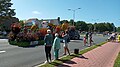 Bloemencorso 12 augustus 2023 - 5.jpg 4,096 × 2,304; 2.94 MB
-
 Bus 31 bij Halte Gemeentehuis 2, Zeeweg - 6 dec. 2020.jpg 4,160 × 3,120; 6.6 MB
-
 Bushalte Gemeentehuis (2) Zeeweg bij Mierenweidepad en Gemeentehuis.jpg 4,160 × 3,120; 1.77 MB
-
 Dorpsomroeper bij nieuwe ingang gemeentehuis Katwijk met stalen logo.jpg 3,438 × 2,217; 5.13 MB
-
 Gemeentehuis Katwijk 2013.JPG 4,288 × 3,216; 742 KB
-
 Gemeentehuis Katwijk met nieuwbouw (1).jpg 3,120 × 4,160; 4.76 MB
-
 Gemeentehuis Katwijk met nieuwbouw (2).jpg 3,120 × 4,160; 4.81 MB
-
 Gemeentehuis Katwijk met nieuwbouw (3).jpg 4,160 × 3,120; 896 KB
-
 Gemeentehuis Katwijk met nieuwbouw (4) en Katwijks Wapen COA.jpg 3,120 × 4,160; 5.69 MB
-
 Gemeentehuis Katwijk met verlichting 20 januari 2020 om 1755h.jpg 4,160 × 3,120; 756 KB
-
 Gemeentehuis Katwijk, januari 2004 - 20365438 - RCE.jpg 1,200 × 1,200; 265 KB
-
 Gemeentehuis Katwijk, zijkant, met kunstraam, oostzijde.jpg 4,160 × 3,120; 7.04 MB
-
 Gemeentehuis Katwijk, zijkant, met voorm. burgemeesterswoning.jpg 4,016 × 2,644; 6.47 MB
-
 Gemeentehuis Katwijk, zijkant, oostzijde, met renovatie.jpg 4,160 × 3,120; 4.49 MB
-
 Gemeentehuis Katwijk, zijkant, oostzijde.jpg 4,160 × 3,120; 4.72 MB
-
 Gemeentehuis Katwijk2.JPG 4,288 × 3,216; 767 KB
-
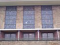 Glas-in-lood-ramen Gemeentehuis Katwijk.JPG 2,560 × 1,920; 435 KB
-
 Katwijk Gemeentehuis.jpg 3,648 × 2,736; 5.27 MB
-
 Leeuwen bij oude ingang gemeentehuis Katwijk.jpg 2,560 × 1,920; 1.21 MB
-
 Natuurspeelplaats nabij het gemeentehuis 6 dec. 2020.jpg 4,160 × 3,120; 8.84 MB
-
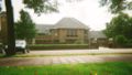 Stadhuis Katwijk.jpg 1,012 × 577; 444 KB


_Zeeweg_bij_Mierenweidepad_en_Gemeentehuis.jpg)

.jpg)
.jpg)
.jpg)
_en_Katwijks_Wapen_COA.jpg)


