Category:Gemeentehuis (Winschoten)
| Object location | | View all coordinates using: OpenStreetMap |
|---|
_11.jpg) | |||||
| Upload media | |||||
| Instance of | |||||
|---|---|---|---|---|---|
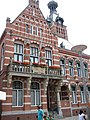
| Location | Winschoten, Oldambt, Groningen, Netherlands | ||||
| Street address |
| ||||
| Located on street | |||||
| Heritage designation |
| ||||
 | |||||
Nederlands: Voormalig gemeentehuis
|
This is a category about rijksmonument number 521771
|
| Address |
|
Media in category "Gemeentehuis (Winschoten)"
The following 48 files are in this category, out of 48 total.
-
 Gemeentehuis van de Gemeente Oldambt, Winschoten (2019) 01.jpg 2,736 × 4,864; 4.96 MB
-
 Gemeentehuis van de Gemeente Oldambt, Winschoten (2019) 02.jpg 4,864 × 2,736; 4.35 MB
-
 Gemeentehuis van de Gemeente Oldambt, Winschoten (2019) 03.jpg 2,736 × 4,864; 4.39 MB
-
 Gemeentehuis van de Gemeente Oldambt, Winschoten (2019) 04.jpg 2,736 × 4,864; 3.83 MB
-
 Gemeentehuis van de Gemeente Oldambt, Winschoten (2019) 05.jpg 4,864 × 2,736; 3.83 MB
-
 Gemeentehuis van de Gemeente Oldambt, Winschoten (2019) 06.jpg 2,736 × 4,864; 3.91 MB
-
 Gemeentehuis van de Gemeente Oldambt, Winschoten (2019) 07.jpg 4,864 × 2,736; 2.88 MB
-
 Gemeentehuis van de Gemeente Oldambt, Winschoten (2019) 08.jpg 2,736 × 4,864; 2.72 MB
-
 Gemeentehuis van de Gemeente Oldambt, Winschoten (2019) 09.jpg 2,736 × 4,864; 4.8 MB
-
 Gemeentehuis van de Gemeente Oldambt, Winschoten (2019) 10.jpg 4,864 × 2,736; 4.11 MB
-
 Gemeentehuis van de Gemeente Oldambt, Winschoten (2019) 11.jpg 4,864 × 2,736; 4.21 MB
-
 Gemeentehuis van de Gemeente Oldambt, Winschoten (2019) 12.jpg 4,864 × 2,736; 4.37 MB
-
 Gemeentehuis van de Gemeente Oldambt, Winschoten (2019) 13.jpg 2,736 × 4,864; 3.93 MB
-
 Gemeentehuis van de Gemeente Oldambt, Winschoten (2019) 14.jpg 4,864 × 2,736; 3.75 MB
-
 Gemeentehuis van de Gemeente Oldambt, Winschoten (2019) 15.jpg 4,864 × 2,736; 3.69 MB
-
 Gemeentehuis van de Gemeente Oldambt, Winschoten (2019) 16.jpg 4,864 × 2,736; 3.88 MB
-
 Gemeentehuis van de Gemeente Oldambt, Winschoten (2019) 17.jpg 2,736 × 4,864; 2.93 MB
-
 Gemeentehuis van de Gemeente Oldambt, Winschoten (2019) 18.jpg 4,864 × 2,736; 2.89 MB
-
 Gemeentehuis van de Gemeente Oldambt, Winschoten (2019) 19.jpg 2,736 × 4,864; 3.54 MB
-
 Gemeentehuis van de Gemeente Oldambt, Winschoten (2019) 20.jpg 4,864 × 2,736; 3.57 MB
-
 Gemeentehuis van de Gemeente Oldambt, Winschoten (2019) 21.jpg 4,864 × 2,736; 3.02 MB
-
 Gemeentehuis van de Gemeente Oldambt, Winschoten (2019) 22.jpg 2,736 × 4,864; 2.98 MB
-
 Gemeentehuis van de Gemeente Oldambt, Winschoten (2019) 23.jpg 4,864 × 2,736; 3.43 MB
-
 Gemeentehuis van de Gemeente Oldambt, Winschoten (2019) 24.jpg 2,736 × 4,864; 3.7 MB
-
 Gemeentehuis van de Gemeente Oldambt, Winschoten (2019) 25.jpg 4,864 × 2,736; 3.84 MB
-
 Gemeentehuis van de Gemeente Oldambt, Winschoten (2019) 26.jpg 2,736 × 4,864; 4.36 MB
-
 Gemeentehuis van de Gemeente Oldambt, Winschoten (2019) 27.jpg 2,736 × 4,864; 5.05 MB
-
 Gemeentehuis van de Gemeente Oldambt, Winschoten (2019) 28.jpg 2,736 × 4,864; 3.8 MB
-
 Gemeentehuis van de Gemeente Oldambt, Winschoten (2019) 29.jpg 4,864 × 2,736; 3.92 MB
-
 Gemeentehuis van de Gemeente Oldambt, Winschoten (2019) 30.jpg 2,736 × 4,864; 4.85 MB
-
 Gemeentehuis van de Gemeente Oldambt, Winschoten (2019) 31.jpg 2,736 × 4,864; 4.5 MB
-
 Gemeentehuis van de Gemeente Oldambt, Winschoten (2019) 32.jpg 4,864 × 2,736; 4.02 MB
-
 Gemeentehuis van de Gemeente Oldambt, Winschoten (2019) 33.jpg 2,736 × 4,864; 5.2 MB
-
 Gemeentehuis van de Gemeente Oldambt, Winschoten (2019) 34.jpg 4,864 × 2,736; 4.73 MB
-
 Gemeentehuis van de Gemeente Oldambt, Winschoten (2019) 35.jpg 2,736 × 4,864; 3.09 MB
-
 Gemeentehuis van de Gemeente Oldambt, Winschoten (2019) 36.jpg 4,864 × 2,736; 4.11 MB
-
 Gemeentehuis van de Gemeente Oldambt, Winschoten (2019) 37.jpg 2,736 × 4,864; 4.43 MB
-
 Gemeentehuis van de Gemeente Oldambt, Winschoten (2019) 38.jpg 4,864 × 2,736; 3.98 MB
-
 Gemeentehuis van de Gemeente Oldambt, Winschoten (2019) 39.jpg 2,736 × 4,864; 2.98 MB
-
 Gemeentehuis van de Gemeente Oldambt, Winschoten (2019) 40.jpg 2,736 × 4,864; 4.62 MB
-
 Gemeentehuis van de Gemeente Oldambt, Winschoten (2019) 41.jpg 4,864 × 2,736; 4.08 MB
-
 Gemeentehuis van de Gemeente Oldambt, Winschoten (2019) 42.jpg 2,736 × 4,864; 4.37 MB
-
 Gobelin koningin Wilhelmina van Anton Trautwein (1905).jpg 2,143 × 3,440; 1.38 MB
-

-
 Rathaus Winschoten.jpg 1,944 × 2,592; 244 KB
-
 Voormalig gemeentehuis 1895-'96 - 1.jpg 2,736 × 3,648; 2.27 MB
-
 Voormalig gemeentehuis 1895-'96 - 2.jpg 2,736 × 3,648; 2.23 MB
-
 Voormalig gemeentehuis 1895-'96 - 3.jpg 3,648 × 2,736; 2.3 MB
_01.jpg)
_02.jpg)
_03.jpg)
_04.jpg)
_05.jpg)
_06.jpg)
_07.jpg)
_08.jpg)
_09.jpg)
_10.jpg)
_12.jpg)
_13.jpg)
_14.jpg)
_15.jpg)
_16.jpg)
_17.jpg)
_18.jpg)
_19.jpg)
_20.jpg)
_21.jpg)
_22.jpg)
_23.jpg)
_24.jpg)
_25.jpg)
_26.jpg)
_27.jpg)
_28.jpg)
_29.jpg)
_30.jpg)
_31.jpg)
_32.jpg)
_33.jpg)
_34.jpg)
_35.jpg)
_36.jpg)
_37.jpg)
_38.jpg)
_39.jpg)
_40.jpg)
_41.jpg)
_42.jpg)
.jpg)


