Category:Geography of Noshiro
Wikimedia category | |||||
| Upload media | |||||
| Instance of | |||||
|---|---|---|---|---|---|
| |||||
Subcategories
This category has the following 16 subcategories, out of 16 total.
*
A
- Asanai Marsh (4 F)
- Asanaihama Coast (6 F)
C
K
- Kaze no Matsubara (13 F)
M
- Mount Nanakura (6 F)
- Mount Moya (Noshiro) (2 F)
N
- Noshiro Onsen (3 F)
O
- Ochiaihama Coast (6 F)
- Otomo-numa (5 F)
P
R
S
- Sugisawadai Site (2 F)
Y
Media in category "Geography of Noshiro"
The following 22 files are in this category, out of 22 total.
-
 A sign (49645548).jpg 1,280 × 960; 144 KB
-
 CORS Noshiro.jpg 4,000 × 6,000; 4.01 MB
-
 Development and expantion area of Noshiro industrial park.jpg 6,000 × 4,000; 9.61 MB
-
 Divided residential area in Noshiro City (1).jpg 6,000 × 3,375; 12.11 MB
-
 Divided residential area in Noshiro City (2).jpg 6,000 × 3,375; 11.61 MB
-
 Divided residential area in Noshiro City (3).jpg 6,000 × 3,375; 13.08 MB
-
 Funazawa Onsen.jpg 6,000 × 3,375; 13.45 MB
-
 Irrigation sprinkler in Noshiro City.jpg 6,000 × 3,375; 10.52 MB
-
 Japan, Noshiro - Yoneshiro river.jpg 1,750 × 1,080; 1.37 MB
-
 Municipalities Disaster administration wireless Outdoor Speaker.JPG 2,112 × 2,816; 1.11 MB
-
 Noshiro city center area Aerial photograph.1975.jpg 6,655 × 4,480; 28.27 MB
-
 Noshiro Space Square.jpg 4,608 × 2,592; 4.57 MB
-
 Otiainuma1.jpg 4,000 × 2,250; 4.07 MB
-
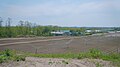
 Paddy fields in Noshiro Plain.jpg 3,264 × 2,448; 3.44 MB
-
 Rural seanery of Shinonome plateau, Noshiro.jpg 3,264 × 2,448; 3.51 MB
-
 Santônuma1.jpg 5,472 × 3,648; 8.31 MB
-
 Santônuma2.jpg 4,000 × 2,250; 3.99 MB
-

-
 Skyline of Noshiro City.jpg 3,264 × 1,840; 2.68 MB
-
 Tasiro gata.jpg 4,000 × 2,250; 3.99 MB
-
 Ôgara no Taki.jpg 5,472 × 3,648; 8.06 MB
-
 房住山山頂.JPG 4,000 × 3,000; 2.97 MB
.jpg)


.jpg)
.jpg)
.jpg)


