Category:Geological maps of Poland
Subcategories
This category has the following 3 subcategories, out of 3 total.
Media in category "Geological maps of Poland"
The following 28 files are in this category, out of 28 total.
-
 Geological map of Moravia and Austrian Silesia.jpg 2,144 × 1,646; 1.67 MB
-
 Geol map.png 3,000 × 2,701; 1.57 MB
-
 Geo map Balt shield1 no Precambrian.png 620 × 650; 231 KB
-
 Góry Bystrzyckie-geologia.png 1,396 × 1,645; 189 KB
-
 Hercynian structures Europe-en.svg 850 × 555; 131 KB
-
 Hercynian structures Europe-es.svg 2,239 × 1,455; 516 KB
-
 Hercynian structures Europe-it.svg 850 × 555; 104 KB
-
 Location of teschenite rocks.jpg 4,720 × 1,777; 372 KB
-
 Mémoires de la Société géologique de France BHL42352651.jpg 4,747 × 3,435; 1.61 MB
-
 Nw europe grav plot 2.png 742 × 841; 880 KB
-
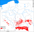
 PL andezyt złoża.png 4,562 × 4,280; 298 KB
-
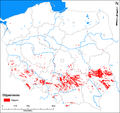
 PL bazalt złoża.png 4,561 × 4,280; 308 KB
-
 PL gabro złoża.png 4,561 × 4,280; 298 KB
-
 PL gaz ziemny złoża.png 2,693 × 2,514; 242 KB
-
 PL piaskowiec złoża.png 4,561 × 4,280; 402 KB
-
 PL ropa naftowa złoża.png 2,691 × 2,513; 229 KB
-
 PL siarka złoża.png 2,697 × 2,516; 226 KB
-
 PL wapień złoża.png 4,561 × 4,279; 381 KB
-
 PL węgiel brunatny złoża.png 4,562 × 4,279; 336 KB
-
 PL węgiel kamienny złoża.png 6,339 × 5,748; 2.5 MB
-
 POL Racibórz - szkic geologiczny.svg 546 × 950; 314 KB
-
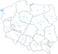
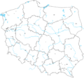
 Poland geology basement.png 2,353 × 2,295; 195 KB
-
 Polen BV043434210.jpg 4,281 × 3,502; 1.5 MB
-
 USEIA Shale Gas Poland.png 561 × 581; 314 KB
-
 Varisztidák.png 603 × 288; 116 KB
-
 Zapadlisko przedkarpackie.jpg 507 × 402; 61 KB
-
 Złoża węgla brunatnego w Polsce.svg 861 × 837; 276 KB
-
 Złoża węgla kamiennego w Polsce.svg 861 × 837; 264 KB


