Category:Geology of Saga prefecture

English: Geology of Saga prefecture, Japan
日本語: 日本の佐賀県の地質
Subcategories
This category has the following 2 subcategories, out of 2 total.
M
- Minerals of Saga prefecture (2 F)
Media in category "Geology of Saga prefecture"
The following 21 files are in this category, out of 21 total.
-
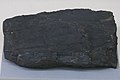
 A coal has luster from Nishiki Mine, displays at Kitagata Shikinooka Museum.jpg 4,800 × 3,200; 12.43 MB
-
 Bota coal spoil stones at Botayama Wanpaku Park.jpg 4,608 × 3,456; 6.2 MB
-
 Coal from Nishiki coal mine Saga 1972.jpg 3,400 × 2,263; 3.46 MB
-
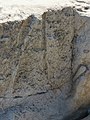
 Eocene sandstone riverbed of Imaide River.jpg 5,448 × 3,632; 13 MB
-
 Fossil of Aturia Yokoyamai Nagaoexvacuted in Kitahata, Karatsu 35Ma.JPG 3,000 × 3,000; 3.59 MB
-
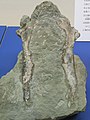 Fossil of sternum of Copepteryx from Kitahata Karatsu Japan.JPG 3,000 × 4,000; 4.88 MB
-
 Fukutomi Meteorite.jpg 3,084 × 1,736; 3 MB
-
 Granite wall cubic joints near Fudonotaki Ogi.jpg 5,448 × 3,632; 15.07 MB
-
 Orbicular diorite from Ainoura, Taku at History and Folklore Museum.jpg 4,608 × 3,456; 5.53 MB
-
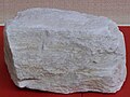 Pottery stone from Arita Izumi-yama Saga.JPG 3,500 × 2,625; 3.87 MB
-
 Sandstone at riverbed of Imaide River.jpg 5,010 × 3,340; 8.74 MB
-
 Scoria on a road in Michigoshi, Tara 02.jpg 4,800 × 3,200; 11.69 MB
-
 Trace fossil in sandstone at Imaide River 01.jpg 2,220 × 2,960; 4.21 MB
-
 Trace fossil in sandstone at Imaide River 02.jpg 4,800 × 3,200; 10.36 MB
-
 Tuff, east of Takezaki island 01.jpg 5,448 × 3,632; 17.67 MB
-
 Tuff, east of Takezaki island 02.jpg 5,456 × 3,069; 14.77 MB
-
 Tuff, east of Takezaki island 03.jpg 5,448 × 3,632; 17.45 MB
-
 Tuff, east of Takezaki island 04.jpg 3,632 × 5,448; 17.66 MB
-
 Yoshinotani Subgroup coal seams in Sunahara, Taku 01.jpg 5,448 × 2,724; 14.66 MB
-
 Yoshinotani Subgroup coal seams in Sunahara, Taku 02.jpg 5,448 × 3,632; 17.71 MB
-
 Yoshinotani Subgroup coal seams in Sunahara, Taku 03.jpg 5,448 × 3,632; 18.36 MB


