Category:Geology of the Isle of Skye
| Upload media | |||||
| Subclass of | |||||
|---|---|---|---|---|---|
| Location |
| ||||
| |||||
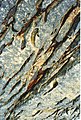
The geology of Isle of Skye is highly variable, ranging in age from Archaean to Quaternary, with sedimentary, igneous and metamorphic rocks all present, leading to a wide variety of landscapes, depending on the rock type.
Subcategories
This category has the following 36 subcategories, out of 36 total.
*
B
C
- Castle Ewen (17 F)
- Cullaidh Shale Formation (4 F)
D
E
- Elgol Sandstone Formation (10 F)
- Eriboll Formation (2 F)
G
- Ghrudaidh Formation (1 F)
I
K
L
M
O
- Ord Window (2 F)
P
R
S
- Sailmhor Formation (2 F)
- Skye Dike Swarm (1 F)
- Skye Lava Group (2 F)
- Skye Marble quarry (4 F)
T
V
Media in category "Geology of the Isle of Skye"
The following 72 files are in this category, out of 72 total.
-
 2016 - Skye (26355141065).jpg 4,928 × 3,264; 3.45 MB
-
 A geographer on the Bad Step - geograph.org.uk - 1704799.jpg 878 × 593; 94 KB
-
 Approaching the Bad Step - geograph.org.uk - 853798.jpg 640 × 402; 81 KB
-
 Beach at Elgol - geograph.org.uk - 1171997.jpg 640 × 480; 79 KB
-
 Beareraig Bay.jpg 3,253 × 2,154; 1.57 MB
-
 Cliff overhang, Elgol, Skye - geograph.org.uk - 223678.jpg 640 × 427; 141 KB
-
 Columnar basalt on Preshal Beag - geograph.org.uk - 798506.jpg 640 × 461; 209 KB
-
 Columnar basalt, Skriaig - geograph.org.uk - 2085446.jpg 480 × 640; 148 KB
-
 Coruisk Memorial Hut - geograph.org.uk - 833111.jpg 581 × 565; 123 KB
-
 Crossing the Bad Step - geograph.org.uk - 829277.jpg 414 × 640; 87 KB
-
 Cuillin April.jpg 2,048 × 3,072; 3.55 MB
-
 Cuillin Backdrop - geograph.org.uk - 1241175.jpg 640 × 429; 75 KB
-
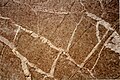
 Dinoprint.jpg 717 × 956; 327 KB
-
 Dinosaur footprint on Staffin beach - geograph.org.uk - 744987.jpg 640 × 426; 157 KB
-
 Dunite intrusion - geograph.org.uk - 1427165.jpg 640 × 480; 138 KB
-
 Dyke exposed by the Allt Beinn Deirge - geograph.org.uk - 2481676.jpg 640 × 421; 227 KB
-
 Dyke on the cliffs of Sron Vourlinn - geograph.org.uk - 1266672.jpg 480 × 640; 109 KB
-
 Elgol banner Cuillins from Pier.JPG 2,800 × 400; 559 KB
-
 Elgol beach - geograph.org.uk - 391555.jpg 640 × 480; 89 KB
-
 Elgol Jetty - geograph.org.uk - 106990.jpg 640 × 480; 59 KB
-
 Elgol shoreline and the Cuillin - geograph.org.uk - 891418.jpg 640 × 418; 147 KB
-
 Elgol Shoreline, Isle of Skye, Scotland. - geograph.org.uk - 1525184.jpg 640 × 481; 118 KB
-

-

-

-
 Honeycomb rock - geograph.org.uk - 1172000.jpg 480 × 640; 104 KB
-
 Jetty at Elgol - geograph.org.uk - 1231573.jpg 640 × 480; 283 KB
-
-
 Kilt Rock2jpg.jpg 2,896 × 1,944; 6.18 MB
-
 Lava on Limestone (geograph 5410391).jpg 427 × 640; 444 KB
-
 Limestone outcrop - geograph.org.uk - 901042.jpg 640 × 480; 101 KB
-
 Limestone pavement on Bheinn Shuardail - geograph.org.uk - 2929724.jpg 1,024 × 768; 285 KB
-
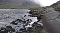
 Loch na Leachd - geograph.org.uk - 853780.jpg 447 × 640; 84 KB
-
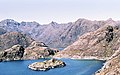
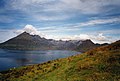
 Loch Scavaig, Skye - geograph.org.uk - 136324.jpg 548 × 403; 29 KB
-
 Massive slabs of Gabbro along the shoreline at Coruisk - geograph.org.uk - 1914288.jpg 2,112 × 1,188; 757 KB
-
 Over the Bad Step^ - geograph.org.uk - 866828.jpg 640 × 427; 113 KB
-
 Palaeogene dyke - geograph.org.uk - 901088.jpg 640 × 480; 99 KB
-
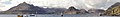
 Panorama in the Village of Elgol 3.JPG 2,592 × 1,728; 1.8 MB
-
 Panorama in the Village of Elgol 4.JPG 2,592 × 1,728; 2.3 MB
-
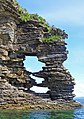 Perforated headland below Glasnakille - geograph.org.uk - 2542017.jpg 800 × 1,138; 761 KB
-

-
 Quartzite outcrop - geograph.org.uk - 901061.jpg 640 × 480; 105 KB
-
 Quiraing - The Needle - geograph.org.uk - 240457.jpg 640 × 480; 364 KB
-
 Roches moutonnées on Carn Mor - geograph.org.uk - 1027501.jpg 640 × 480; 199 KB
-
 Rock Outcrop near Bruach na Frithe on Skye.jpg 3,456 × 2,304; 5.61 MB
-
 Rocks near Bruach na Frithe on Skye in Scotland.jpg 3,456 × 2,304; 4.69 MB
-
 Schotland Elgol en Cuillins 11-05-2010 17-15-37 P-ISLE.JPG 3,216 × 464; 758 KB
-
 Schotland Elgol en Cuillins 11-05-2010 17-15-37.JPG 3,216 × 2,136; 3.47 MB
-
 Schotland ruïne Kilchrist in Swordale 12-05-2010 11-40-11.JPG 2,144 × 1,424; 1.57 MB
-
 Sgurr nan Gillean - geograph.org.uk - 1617807.jpg 640 × 480; 30 KB
-
 Small water-filled cave - geograph.org.uk - 569405.jpg 640 × 479; 173 KB
-
 Suishnish Sandstone Formation - geograph.org.uk - 901129.jpg 640 × 480; 109 KB
-
 Tafoni at Elgol, Isle of Skye.jpg 1,899 × 1,251; 1.64 MB
-
 Tarskavaig Cave - geograph.org.uk - 486098.jpg 640 × 480; 132 KB
-
 The 'Bad Step', Skye - geograph.org.uk - 23932.jpg 480 × 640; 113 KB
-
 The Bad Step seen from the water - geograph.org.uk - 545012.jpg 640 × 428; 76 KB
-

-
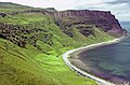
 The Cuillin from Elgol - geograph.org.uk - 922630.jpg 640 × 304; 34 KB
-
 The school and the croft house, Elgol - geograph.org.uk - 933841.jpg 640 × 427; 102 KB
-
 The shore at Elgol - geograph.org.uk - 1420435.jpg 640 × 422; 174 KB
-
 The world's smallest dinosaur footprint, the Hunterian Museum, Glasgow..JPG 4,288 × 2,848; 7.59 MB
-
 Undercut sandstone cliff at Inver Tote - geograph.org.uk - 719575.jpg 640 × 426; 190 KB
-
 Veined Gabbro with 90 degree cracks, Sgurr na Stri, Skye.jpg 2,364 × 1,582; 1.42 MB
-
-
 View over Loch Slapin - geograph.org.uk - 1054531.jpg 800 × 600; 156 KB
-
 Back from Coruisk - geograph.org.uk - 817120.jpg 423 × 640; 99 KB
-
 Elgol Beach - geograph.org.uk - 264204.jpg 640 × 480; 272 KB
-
 Elgol Jetty - geograph.org.uk - 520494.jpg 640 × 425; 302 KB
-
 Limestone pavement, Lon Buidhe. - geograph.org.uk - 68696.jpg 640 × 480; 84 KB
-
 Limestone quarry - geograph.org.uk - 461964.jpg 640 × 425; 421 KB
-
 Rock slabs, Elgol - geograph.org.uk - 267212.jpg 640 × 437; 78 KB
-
 Soay Harbour - geograph.org.uk - 634874.jpg 500 × 375; 47 KB
.jpg)


.jpg)


