Category:Geomorphological maps
English: Geomorphological maps
· Italiano: Carte geomorfologiche
· English: Maps of Geomorphology.
- Primarily sorted by geomorphological structures.
- Note: please tag geomorphological SVG maps also with Category: SVG geology.
Subcategories
This category has the following 13 subcategories, out of 13 total.
Media in category "Geomorphological maps"
The following 11 files are in this category, out of 11 total.
-
 344 of 'Physiography ... New edition' (11167514125).jpg 1,872 × 1,245; 524 KB
-
 Drylandmap.jpg 1,041 × 634; 150 KB
-
 EROSIEgevoeligheidskaart.jpg 600 × 1,147; 307 KB
-
 Geomorphology of Middle-earth.svg 738 × 583; 663 KB
-
 Landforms-Worldmap.png 4,127 × 2,312; 1.52 MB
-
 Multibeam-map awi.jpg 2,211 × 3,104; 941 KB
-
 Rainfall erosivity estimates.jpg 1,280 × 779; 238 KB
-
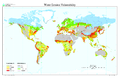
 Water erosion map.jpg 6,800 × 4,400; 4.23 MB
-
 Water erosion map.png 3,400 × 2,200; 2.01 MB
-
 Wind erosion map.jpg 800 × 409; 64 KB
-
 World soil degradation.jpg 850 × 388; 77 KB
.jpg)


