Category:George Hayward
American artist, lithographer, engraver and printer | |||||
| Upload media | |||||
| Date of birth | c. 1800 England | ||||
|---|---|---|---|---|---|
| Date of death | c. 1872 | ||||
| Country of citizenship | |||||
| Occupation | |||||
| Work location | |||||
| |||||
Subcategories
This category has only the following subcategory.
1
Pages in category "George Hayward"
This category contains only the following page.
Media in category "George Hayward"
The following 55 files are in this category, out of 55 total.
-
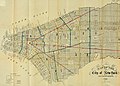
 1858 Map of the City and County of New York.jpg 2,088 × 2,560; 1.63 MB
-
-

-

-
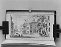
 Bourne book and print shop, New York City.png 922 × 1,001; 1.36 MB
-
 Bourne's store, on Broadway near Franklin Street, New York City.jpg 1,466 × 2,122; 2.22 MB
-

-
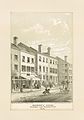
 Brooks Clothing Store, Catharine St. N.Y. 1845.jpg 527 × 332; 75 KB
-
 George Hayward - Sketch of Two Wagons - B1979.12.780 - Yale Center for British Art.jpg 1,920 × 1,108; 240 KB
-
 Government house NY 1795 Hayward.jpg 3,344 × 2,182; 881 KB
-
 Government House, New York City.png 1,517 × 953; 940 KB
-
 Government House, New York, 1795.jpg 737 × 486; 221 KB
-
 Historical North America 1621 (cropped).jpg 2,390 × 1,833; 5.37 MB
-
 Historical North America 1621.jpg 2,560 × 1,994; 5.89 MB
-
 Historical Society Building, New York City. Coloured lithogr Wellcome V0014015.jpg 2,066 × 3,382; 3.13 MB
-
 Manual of the corporation of the city of New York (1857) (14763440612).jpg 3,436 × 2,364; 1.03 MB
-
 Manual of the corporation of the city of New York (1859) (14577073310).jpg 3,040 × 1,616; 1.78 MB
-
 Manual of the Corporation of the City of New York for 1856 MET MM10262.jpg 4,000 × 3,121; 2.7 MB
-
 Map of British Military Operations in New York and New Jersey in 1776 (6 MB).jpg 1,846 × 2,559; 5.27 MB
-
 Map of British Military Operations in New York and New Jersey in 1776 (73 MB).jpg 7,510 × 10,412; 69.28 MB
-
 Map of Brooklyn and Lower Manhattan in September 1776 (34 MB).jpg 8,663 × 6,154; 32.79 MB
-
 Map of Brooklyn and Lower Manhattan in September 1776 (4 MB).jpg 2,559 × 1,818; 3.48 MB
-
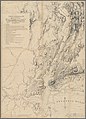
 Map of New York City with fire and watch districts 1841.jpg 4,231 × 3,038; 15.58 MB
-
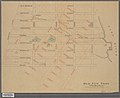
 Map of New York City, high water line, farms and estates (cropped).jpg 1,573 × 2,256; 5.75 MB
-
 Map of New York City, high water line, farms and estates.jpg 1,804 × 2,560; 1.38 MB
-
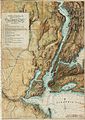
 Map of New York State, Census of 1850, Valentine's Manual 1851.jpg 2,559 × 2,008; 5.49 MB
-
 Map of the City and County of New York 1860.jpg 2,018 × 2,559; 5.97 MB
-
 Map of the City and County of New York 1861.jpg 2,090 × 2,559; 6.44 MB
-
 Map of the City of New York, high water line, farms and estates (cropped).jpg 1,240 × 1,761; 4.06 MB
-
 Map of the City of New York, high water line, farms and estates.jpg 1,676 × 2,560; 4.25 MB
-
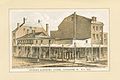
 New York Bunkers Mansion House Hotel 1831.jpg 716 × 447; 166 KB
-
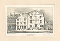
 New York Second Presidential Mansion.jpg 685 × 395; 143 KB
-
 New York Vauxhall Gardens 1803.jpg 648 × 375; 64 KB
-
 View of the New-York Quarantine, Staten Island (NYPL b13476046-EM11393).jpg 5,062 × 3,768; 5.13 MB
-
 View of the New-York Quarantine, Staten Island (NYPL b13476046-EM11393).tiff 5,062 × 3,768; 54.58 MB
-
 Brooks Clothing Store, Catharine St. N.Y. 1845 (NYPL b13476048-423249).jpg 3,056 × 2,047; 2.03 MB
-
 Bourne's store Broadway near Franklin St. N.Y (NYPL b13476048-422103).jpg 2,008 × 2,868; 1.54 MB
-
 Bourne's store Broadway near Franklin St. N.Y (NYPL b13476048-422103).tiff 2,008 × 2,868; 16.48 MB
-
 Old Brewery Five Points 1852 (NYPL Hades-165407-EM11567).jpg 3,194 × 2,216; 1.95 MB
-
 Old Brewery Five Points 1852 (NYPL Hades-165407-EM11567).tiff 3,194 × 2,216; 20.26 MB
-
 View of the New York Quarantine, Staten Island (NYPL Hades-1803853-1659392).tiff 7,230 × 5,428; 112.28 MB
-

-
 Col. Roger Morris' house, Washington's headquarters Sep.r 1776 (NYPL Hades-255611-430639).tiff 6,000 × 3,673; 63.06 MB
-
 Government house, New-York, 1795 (NYPL Hades-255791-430816).jpg 6,000 × 3,692; 4.34 MB
-
 Old New York, The Bouwery, from Valentine's Manual 1862.jpg 2,560 × 2,083; 5.57 MB
-
 Old Sugar House and Middle Dutch Church.jpg 823 × 526; 208 KB
-
 Plan of the City of New York, made and swamp land, Valentine's Manual 1856.jpg 1,867 × 2,560; 923 KB
-
 The First Presidential Mansion.jpg 1,961 × 1,260; 576 KB
-

-
 The Quarantine Hospital on Staten Island, 1858.png 2,414 × 885; 2.57 MB
-

-
 View of New Amsterdam, 17th century.jpg 3,059 × 1,035; 3.63 MB
-
 View of New York from the North, 1679 MET MM87195.jpg 4,000 × 3,363; 2.59 MB
-
 View of the quarantine grounds and buildings, Staten Island, May 1858.jpg 2,560 × 1,195; 729 KB
-
 Wall Street 1789 - Federal Hall and the Verplanck Mansion MET MM10262 (cropped).jpg 2,748 × 1,728; 1.28 MB


_-_overall.jpg)


.jpg)


_(14763440612).jpg)
_(14577073310).jpg)

.jpg)
.jpg)
.jpg)
.jpg)

.jpg)


.jpg)


.jpg)
.jpg)
.jpg)
.jpg)
.jpg)
.jpg)


_MET_DP823429.jpg)


.jpg)