Category:Georgia State Route 36
 | number: | (thirty-six) |
|---|---|---|
| State highways in Georgia (U.S. state): | 16 · 17 · 18 · 19 · 20 · 21 · 22 · 23 · 24 · 25 · 26 · 27 · 28 · 29 · 30 · 31 · 32 · 33 · 34 · 35 · 36 · 37 · 38 · 39 · 40 · 41 · 42 · 43 · 44 · 45 · 46 · 47 · 48 · 49 · 50 · 51 · 52 · 53 · 54 · 55 · 56 |
English: State Route 36 (SR 36) is a long state highway that runs southwest-to-northeast through portions of Harris, Talbot, Upson, Lamar, Butts, and Newton counties in the central part of the U.S. state of Georgia. The route connects the Waverly Hall area with Covington.
State highway in west-central and northern Georgia  | |||||
| Upload media | |||||
| Instance of | |||||
|---|---|---|---|---|---|
| Location | Georgia | ||||
| Transport network | |||||
| Owned by | |||||
| Maintained by | |||||
| Inception |
| ||||
| Length |
| ||||
| |||||
Subcategories
This category has the following 3 subcategories, out of 3 total.
G
J
- Jackson Veterans Memorial Park (12 F)
Media in category "Georgia State Route 36"
The following 13 files are in this category, out of 13 total.
-
 Bank of America, Jackson Georgia.JPG 4,320 × 3,240; 4.5 MB
-
 Georgia 36.svg 600 × 600; 6 KB
-
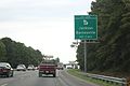
 Georgia I75nb exit 201 .5 mile.jpg 5,184 × 3,456; 4.38 MB
-
 Georgia I75nb exit 201 1 mile.jpg 5,184 × 3,456; 3.96 MB
-
 Georgia I75nb exit 201.jpg 5,184 × 3,456; 4.49 MB
-
 Georgia I75nb GA36 Overpass.jpg 5,184 × 3,456; 4.09 MB
-
 Georgia I75sb Exit 201 .5 mile.jpg 5,184 × 3,456; 4.07 MB
-
 Georgia I75sb Exit 201 1 mile.jpg 5,184 × 3,456; 5.7 MB
-
 Georgia I75sb Exit 201.jpg 5,184 × 3,456; 5.15 MB
-
 Georgia state route 36 map.png 819 × 603; 186 KB
-
 Jackson Municipal Court, Jackson Georgia.JPG 4,320 × 3,240; 4.49 MB
-
 SouthCrest Bank, Thomaston (SE corner).JPG 4,320 × 3,240; 4.45 MB
-
 United Bible Church, Jackson Georgia.JPG 4,320 × 3,240; 4.25 MB


.JPG)
