Category:Georgia State Route 62
 | number: | (sixty-two) |
|---|---|---|
| State highways in Georgia (U.S. state): | 42 · 43 · 44 · 45 · 46 · 47 · 48 · 49 · 50 · 51 · 52 · 53 · 54 · 55 · 56 · 57 · 59 · 60 · 61 · 62 · 63 · 64 · 68 · 70 · 72 · 73 · 74 · 75 · 76 · 77 · 79 · 81 · 82 |
State highway in southwestern Georgia  | |||||
| Upload media | |||||
| Instance of | |||||
|---|---|---|---|---|---|
| Location | Georgia | ||||
| Transport network | |||||
| Owned by | |||||
| Maintained by | |||||
| Length |
| ||||
| |||||
English: State Route 62 (SR 62) is a state highway in the southwestern part of the U.S. state of Georgia. It connects Columbia with Albany.
Subcategories
This category has only the following subcategory.
Media in category "Georgia State Route 62"
The following 18 files are in this category, out of 18 total.
-
 Georgia 62 Bypass.svg 600 × 600; 9 KB
-
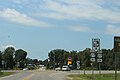
 Blakely limit, GA62.jpg 5,184 × 3,456; 5.62 MB
-
 Calhoun County, GA62 WB.JPG 4,320 × 3,240; 4.59 MB
-
 Former convenience store, Pretoria.JPG 4,320 × 3,240; 4.45 MB
-
 GA200WB end, Blakely.jpg 5,184 × 3,456; 8.33 MB
-
 GA39 GA62 US27Bus Blakely Square.jpg 5,184 × 3,456; 6.2 MB
-
 GA62 Bypass EB end, Blakely.jpg 5,184 × 3,456; 4.25 MB
-
 GA62 Bypass WB end, Blakely.jpg 5,184 × 3,456; 7.01 MB
-
 GA62 railroad crossing NB, Leary.JPG 4,320 × 3,240; 4.54 MB
-
 GA62 US27 Intersection, Blakely.jpg 5,184 × 3,456; 4.91 MB
-
 Georgia 62.svg 600 × 600; 6 KB
-
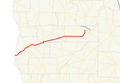 Georgia state route 62 map.png 606 × 420; 61 KB
-
 Leary limit, GA62 WB.JPG 4,320 × 3,240; 4.51 MB
-
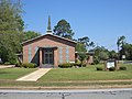 Leary Methodist Church.JPG 4,320 × 3,240; 4.43 MB
-
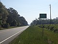
 Pretoria limit, GA 62 EB.JPG 4,320 × 3,240; 4.54 MB
-
 Pretoria limit, GA 62 WB.JPG 4,320 × 3,240; 4.45 MB
-
 Pure gas, Leary.JPG 4,320 × 3,240; 4.45 MB
-
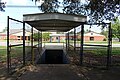 Stairs to tunnel leading to Early County Middle School from High School.jpg 5,184 × 3,456; 8.69 MB


