Category:Georgia State Route 90
 | number: | (ninety-) |
|---|---|---|
| State highways in Georgia (U.S. state): | 70 · 72 · 73 · 74 · 75 · 76 · 77 · 79 · 81 · 82 · 83 · 85 · 87 · 89 · 90 · 91 · 92 · 93 · 94 · 96 · 97 · 99 · 100 · 101 · 102 · 103 · 104 · 105 · 107 · 108 · 109 · 110 |
highway in Georgia  | |||||
| Upload media | |||||
| Instance of | |||||
|---|---|---|---|---|---|
| Location | Georgia | ||||
| Transport network | |||||
| Owned by | |||||
| Maintained by | |||||
| Length |
| ||||
| |||||
English: State Route 90 (SR 90) is a state highway that runs southeast-to-northwest through portions of Atkinson, Coffee, Irwin, Ben Hill, Turner, Wilcox, Crisp, Dooly, Macon, Taylor, and Talbot counties from southern to west-central Georgia. The route runs from its southeastern terminus at US 82 and SR 520 in Willacoochee to its northwestern terminus at US 80, SR 22, and SR 41 in Talbotton.
Subcategories
This category has the following 6 subcategories, out of 6 total.
A
C
G
I
Media in category "Georgia State Route 90"
The following 33 files are in this category, out of 33 total.
-
 Georgia 90 Connector.svg 600 × 600; 10 KB
-
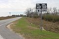
 Ben Hill County border, GA90EB.JPG 4,608 × 3,456; 4.19 MB
-
 Byromville city limit, GA90NB.JPG 4,608 × 3,456; 5.4 MB
-
 Fitzgerald city limit, GA90SB.jpg 5,184 × 3,456; 5.6 MB
-
 GA107sUS319US129GA90signsFitzgerald (32868746416).jpg 2,400 × 1,600; 2.22 MB
-
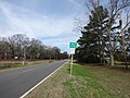
 GA215 end, Ben Hill County.jpg 5,184 × 3,456; 7.99 MB
-
 GA233EndSign-GA90ew (30707030500).jpg 2,400 × 1,600; 2.3 MB
-
 Georgia 90.svg 600 × 600; 6 KB
-
 Georgia I75sb Exit 101 .5 mile.JPG 5,184 × 3,456; 3.97 MB
-
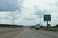 Georgia I75sb Exit 101 1 mile.JPG 5,184 × 3,456; 3.95 MB
-
 Georgia I75sb Exit 101.JPG 5,184 × 3,456; 4.2 MB
-
 Georgia State Road 90 NB begin Willacoochee.jpg 4,320 × 3,240; 4.44 MB
-
 Georgia state route 90 map.png 1,146 × 774; 266 KB
-
 Georiga State Route 233 southern terminus.JPG 4,608 × 3,456; 5.14 MB
-
 Lilly city limit, GA90NB.JPG 4,608 × 3,456; 5.9 MB
-
 Lilly city limit, GA90SB.JPG 4,608 × 3,456; 5.29 MB
-
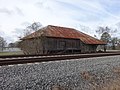 Lilly Depot (East corner).JPG 4,608 × 3,456; 5.4 MB
-
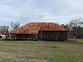
 Lilly Depot (NorthEast face).JPG 4,608 × 3,456; 4.76 MB
-
 Lilly Depot (SouthWest face).JPG 4,608 × 3,456; 5.46 MB
-
 Lilly store and gas station, Lilly.JPG 4,608 × 3,456; 5.89 MB
-
 Looking north up GA90 from SE corner of intersection with W Sultana Dr.jpg 5,184 × 3,456; 8.81 MB
-
 Looking south down GA90 from NE corner of intersection with Jack Allen Road.jpg 5,184 × 3,456; 8.16 MB
-
 Looking south down GA90 from NW corner of intersection with Jack Allen Road.jpg 5,184 × 3,456; 9.77 MB
-
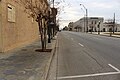
 Looking south down Grant St from NW corner of intersection with Central Ave.jpg 5,184 × 3,456; 6.76 MB
-
 Looking south down Grant St from SE corner of intersection with Central Ave.jpg 5,184 × 3,456; 8.43 MB
-
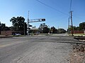 Looking West at Ashley St E RR Crossing.JPG 4,608 × 3,456; 5.68 MB
-
 Macon County border, GA90NB.JPG 4,608 × 3,456; 5.94 MB
-
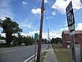
 Montezuma City limit, GA90NB.JPG 4,608 × 3,456; 6.11 MB
-
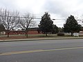 National Guard Armory (Boys & Girls Club), Montezuma.JPG 4,608 × 3,456; 5.02 MB
-
 Oglethorpe City Limit, GA90NB.JPG 4,608 × 3,456; 6.42 MB
-
 RR Crossing 638355S, Lilly.JPG 4,608 × 3,456; 5.06 MB
-
 Solar panels, Rebecca.JPG 4,608 × 3,456; 5.1 MB
-
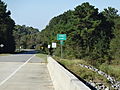 Turner County border, GA90WB.JPG 4,608 × 3,456; 5.21 MB


.jpg)

.jpg)


.JPG)
.JPG)
.JPG)


,_Montezuma.JPG)


