Category:Glusburn
village in United Kingdom | |||||
| Upload media | |||||
| Instance of |
| ||||
|---|---|---|---|---|---|
| Location | Glusburn and Cross Hills, Craven, North Yorkshire, Yorkshire and the Humber, England | ||||
 | |||||
English: Glusburn is a village situated in Craven in North Yorkshire, England, with a population of 3,902. It is located on the edge of the Yorkshire Dales. Glusburn is the name of the old parish, but the newer part of the village is known as Cross Hills.
Media in category "Glusburn"
The following 34 files are in this category, out of 34 total.
-
 Allotments - Colne Road - geograph.org.uk - 1025627.jpg 640 × 438; 229 KB
-
 Chimney at Glusburn mill - geograph.org.uk - 1250431.jpg 479 × 640; 47 KB
-
 Chimney at Glusburn mill - geograph.org.uk - 1250441.jpg 479 × 640; 47 KB
-
 Gill Beck - geograph.org.uk - 792836.jpg 640 × 480; 137 KB
-
 Gill Beck. Compare to an adjacent photo^ - geograph.org.uk - 792828.jpg 640 × 480; 133 KB
-
 Glusburn Milepost - geograph.org.uk - 1702786.jpg 3,000 × 4,000; 3.65 MB
-
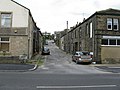
 Glusburn, Colne Road, looking east - geograph.org.uk - 1471347.jpg 640 × 480; 59 KB
-
 Glusburn, Green Lane - geograph.org.uk - 1471362.jpg 640 × 480; 84 KB
-
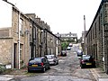
 Glusburn, Hartley Street - geograph.org.uk - 1471320.jpg 640 × 480; 71 KB
-
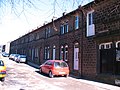
 Glusburn, Lodge Street - geograph.org.uk - 1471333.jpg 640 × 480; 103 KB
-
 Glusburn, Old Hall Farm - geograph.org.uk - 1471369.jpg 640 × 480; 111 KB
-
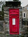 GR Postbox, Glusburn - geograph.org.uk - 1702787.jpg 2,400 × 3,200; 2.2 MB
-
 Green End - Green Lane - geograph.org.uk - 1025100.jpg 640 × 504; 230 KB
-
 Green Lane - geograph.org.uk - 1025109.jpg 640 × 480; 228 KB
-
 Hartley Street - Colne Road - geograph.org.uk - 1025119.jpg 640 × 480; 232 KB
-
 Hayfield Mills, Glusburn - geograph.org.uk - 1743373.jpg 2,967 × 1,632; 977 KB
-
 Institute Street, Glusburn - geograph.org.uk - 1743401.jpg 3,264 × 2,448; 1.75 MB
-
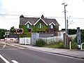 Level crossing on the A 6068 near Glusburn - geograph.org.uk - 1975836.jpg 1,600 × 1,200; 388 KB
-
 Lodge, Malsis School - geograph.org.uk - 858777.jpg 640 × 480; 80 KB
-
 Main Street, Glusburn - geograph.org.uk - 2650936.jpg 640 × 480; 49 KB
-
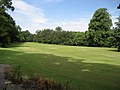 Malsis School, Golf Course - geograph.org.uk - 858771.jpg 640 × 480; 77 KB
-
 Milestone - Colne Road - geograph.org.uk - 1025116.jpg 440 × 640; 273 KB
-
 Park Lane, Glusburn - geograph.org.uk - 3016479.jpg 640 × 480; 167 KB
-
 Road to Lingsted Hall, Glusburn - geograph.org.uk - 3016480.jpg 640 × 480; 201 KB
-
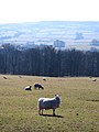 Sheep pasture, Scott House Farm - geograph.org.uk - 1743982.jpg 2,448 × 3,264; 2.02 MB
-
 Wheatlands Lane, Glusburn - geograph.org.uk - 3016478.jpg 640 × 480; 122 KB
-
 Albert Road - Holme Lane - geograph.org.uk - 1025644.jpg 640 × 463; 192 KB
-
 Ash Street - Victoria Road - geograph.org.uk - 1025646.jpg 640 × 480; 239 KB
-
 Beanlands Care Home, Glusburn, Yorkshire - geograph.org.uk - 1471283.jpg 640 × 480; 122 KB
-

-
 Gill Beck, Glusburn - geograph.org.uk - 724718.jpg 640 × 480; 94 KB
-
 Gill Beck, Glusburn - geograph.org.uk - 724725.jpg 640 × 480; 82 KB
-
 House near Lane Ends Bridge - geograph.org.uk - 130321.jpg 640 × 480; 85 KB
-
 Kings Arms, Sutton in Craven - geograph.org.uk - 126215.jpg 640 × 480; 64 KB


