Category:Goarem-ar-Manec'h
|
This building is inscrit au titre des monuments historiques de la France. It is indexed in the base Mérimée, a database of architectural heritage maintained by the French Ministry of Culture, under the reference PA29000004
|
| Object location | | View all coordinates using: OpenStreetMap |
|---|
village in France  | |||||
| Upload media | |||||
| Instance of | |||||
|---|---|---|---|---|---|
| Location | La Feuillée, canton of Huelgoat | ||||
| Heritage designation |
| ||||
 | |||||
Media in category "Goarem-ar-Manec'h"
The following 2 files are in this category, out of 2 total.
-
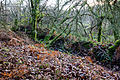 Talus et douve présumés de l'enceinte, Goarem-ar-Manec'h, La Feuillée, France-2.jpg 5,184 × 3,456; 13.42 MB
-
 Talus et douve présumés de l'enceinte, Goarem-ar-Manec'h, La Feuillée, France.jpg 3,456 × 5,184; 11.06 MB
