Category:Goathland
village and civil parish in the Scarborough district of North Yorkshire, England  | |||||
| Upload media | |||||
| Instance of | |||||
|---|---|---|---|---|---|
| Location | Scarborough, North Yorkshire, Yorkshire and the Humber, England | ||||
| Said to be the same as | Goathland (Wikimedia duplicated page, civil parish) | ||||
 | |||||
Deutsch: Goathland ist ein Dorf im North York Moors National Park in North Yorkshire, England. Es hat 407 Einwohner und einen Bahnhof der North Yorkshire Moors Railway. National bekannt ist es, da in dem Dorf seit mehreren Jahren die erfolgreiche Fernsehserie Heartbeat spielt, international, da der Bahnhof Goathland als Hogsmeade Station in den Harry-Potter-Filmen vorkommt. Nationalpark, Heartbeat und Harry Potter zusammen sorgen für etwa 1,2 Millionen Besucher im Jahr.
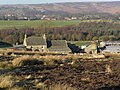
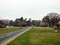
English: Goathland is a village and civil parish in the Scarborough district of North Yorkshire, England. It is in the North York Moors national park situated due north of Pickering, off the A169 to Whitby. It is surrounded by beautiful scenery, and has the advantage of having a station on the North Yorkshire Moors steam railway line.
Norsk bokmål: Goathland er en landsby i North Yorkshire i England, Storbritannia. Byen har mindre enn 500 innbyggere og er mest kjent som den fiktive byen Aidensfield i serien Med hjartet på rette staden, da det er her denne serien innspilles. Flere av stedene fra serien, som postkontoret, baren og verkstedet, er faktiske steder i landsbyen, og flere av innbyggerne har vært statister.
Subcategories
This category has the following 16 subcategories, out of 16 total.
A
- Aidensfield Garage, Goathland (10 F)
B
D
E
G
- The Goathland Hotel (20 F)
- Goathland War Memorial (1 F)
- Goathland, vintage images (1 F)
M
- Mallyan Spout, North Yorkshire (15 F)
P
- Pinfold, Goathland (2 F)
S
- St Mary's church, Goathland (10 F)
T
- Three guidestones, Goathland (3 F)
W
Media in category "Goathland"
The following 200 files are in this category, out of 1,248 total.
(previous page) (next page)-
 ...and we follow , just like sheep! (5910367936).jpg 3,618 × 1,386; 4.48 MB
-
 4MT 76079 at Eller Beck - geograph.org.uk - 5882390.jpg 1,024 × 768; 169 KB
-
 53809 at Beck Hole - geograph.org.uk - 4140930.jpg 768 × 1,024; 317 KB
-
 60103 Flying Scotsman on the NYMR - geograph.org.uk - 4875292.jpg 3,756 × 2,512; 1.19 MB
-

-
 60103 Flying Scotsman on the NYMR, Goathland - geograph.org.uk - 4874214.jpg 1,600 × 836; 442 KB
-
 60103 Flying Scotsman on the NYMR, Goathland - geograph.org.uk - 4875298.jpg 3,888 × 2,592; 1.4 MB
-

-
 80135 at Beck Hole - geograph.org.uk - 4140934.jpg 768 × 1,024; 256 KB
-

-
 A field of sheep in the Murk Esk valley - geograph.org.uk - 4161238.jpg 3,872 × 2,592; 4.25 MB
-
 A little bit of Lancaster in Yorkshire - geograph.org.uk - 2754084.jpg 640 × 427; 207 KB
-
 A marshy pool beside the railway south of Goathland - geograph.org.uk - 4583076.jpg 1,600 × 1,066; 1.17 MB
-
 A minor road heading towards the A169 - geograph.org.uk - 2500574.jpg 800 × 600; 222 KB
-
 A Tornado passes - geograph.org.uk - 5706986.jpg 4,000 × 3,000; 3.05 MB
-

-
 A view of Goathland in 1984 - geograph.org.uk - 2233157.jpg 1,090 × 740; 149 KB
-
 A View To Snod Hill And RAF Fylingdales - geograph.org.uk - 2856666.jpg 4,592 × 3,448; 2.04 MB
-
 A well trodden path to Lilla Cross - geograph.org.uk - 1832565.jpg 4,000 × 3,000; 2.56 MB
-
 A169 approaching Brocka Beck Bridge - geograph.org.uk - 3348651.jpg 1,024 × 539; 128 KB
-
 A169 approaching the bend for Eller Beck Bridge - geograph.org.uk - 4577054.jpg 1,600 × 800; 843 KB
-
 A169 at Goathland turning - geograph.org.uk - 3989368.jpg 640 × 476; 55 KB
-
 A169 from Goathland road - geograph.org.uk - 3989374.jpg 640 × 351; 38 KB
-
 A169 heading for Low Moor - geograph.org.uk - 3177833.jpg 640 × 427; 69 KB
-
 A169 heading south towards Pickering - geograph.org.uk - 2711029.jpg 1,024 × 592; 67 KB
-
 A169 Moor Road - geograph.org.uk - 125074.jpg 640 × 480; 52 KB
-
 A169 northbound - geograph.org.uk - 3348652.jpg 640 × 391; 61 KB
-
 A169 road over Goathland Moor - geograph.org.uk - 198674.jpg 640 × 480; 121 KB
-
 A169 towards Pickering - geograph.org.uk - 2728134.jpg 800 × 532; 45 KB
-
 A169 Whitby to Pickering - geograph.org.uk - 125083.jpg 640 × 480; 61 KB
-
 A169, Low Moor - geograph.org.uk - 3177836.jpg 640 × 391; 83 KB
-
 Abbot's Bridge - geograph.org.uk - 3107320.jpg 640 × 480; 86 KB
-

-
 Abbot's House - geograph.org.uk - 2915510.jpg 640 × 480; 68 KB
-
 Abbot's House - geograph.org.uk - 3620260.jpg 3,968 × 2,232; 5.58 MB
-
 Abbot's House south of Goathland - geograph.org.uk - 5138677.jpg 1,800 × 1,013; 1.95 MB
-
 Abbot's House, Goathland - geograph.org.uk - 1376286.jpg 640 × 424; 69 KB
-
 Abbot's House, Goathland - geograph.org.uk - 2553914.jpg 640 × 480; 152 KB
-
 Abbot's House, south of Goathland - geograph.org.uk - 4586672.jpg 1,600 × 1,067; 1.06 MB
-
 Access road to Goathland House - geograph.org.uk - 3989404.jpg 640 × 405; 90 KB
-
 Across Goathland Moor - geograph.org.uk - 4874221.jpg 640 × 427; 82 KB
-
 Across the moor towards 'the pyramid' - geograph.org.uk - 5489593.jpg 3,240 × 4,320; 3.15 MB
-
 Across the moor towards Fen Bogs - geograph.org.uk - 5489584.jpg 4,320 × 3,240; 3.43 MB
-
 Across Wheeldale Beck - geograph.org.uk - 2624076.jpg 640 × 427; 173 KB
-
 Adensfield aka Goathland - geograph.org.uk - 1072959.jpg 640 × 480; 58 KB
-
 Agricultural Rubbish - geograph.org.uk - 4866580.jpg 640 × 480; 160 KB
-

-
 Aidensfield Stores - geograph.org.uk - 2936692.jpg 1,500 × 1,000; 149 KB
-
 Aidensfield Stores and iconic 1960s police panda car - geograph.org.uk - 2381706.jpg 2,048 × 1,266; 514 KB
-
 Aidensfield Stores and Post Office - geograph.org.uk - 2553152.jpg 1,280 × 960; 589 KB
-
 Aidensfield Stores, Goathland - geograph.org.uk - 5123857.jpg 3,838 × 3,625; 4.52 MB
-
 Along the former railway south of Goathland - geograph.org.uk - 5319019.jpg 1,600 × 1,200; 914 KB
-
 Ambiguous road signs, Darnholme - geograph.org.uk - 5608135.jpg 640 × 471; 54 KB
-
 Ann's Cross on Tumulus - geograph.org.uk - 1833218.jpg 4,000 × 3,000; 2.96 MB
-
 Ann's Cross, Foster Howes Rigg - geograph.org.uk - 5174658.jpg 1,600 × 1,065; 444 KB
-
 Ann's Cross, Foster Howes Rigg - geograph.org.uk - 5174662.jpg 1,065 × 1,600; 469 KB
-
 Apple orchard by Rail Trail, Beck Hole - geograph.org.uk - 5826301.jpg 1,024 × 768; 389 KB
-
 Approaching Eller Beck Bridge - geograph.org.uk - 2728138.jpg 640 × 397; 55 KB
-

-

-
 Approaching Lilla Howe - geograph.org.uk - 3693866.jpg 2,560 × 1,920; 2.07 MB
-
 Approaching Moorgates from Goathland - geograph.org.uk - 2427779.jpg 1,024 × 768; 186 KB
-
 Approaching Partridge Hill Farm - geograph.org.uk - 3524700.jpg 4,320 × 2,418; 1.63 MB
-
 Approaching the bottom of the incline - geograph.org.uk - 2604846.jpg 1,024 × 768; 207 KB
-
 Approaching the engine shed at Grosmont - geograph.org.uk - 2606166.jpg 2,048 × 1,536; 523 KB
-
 At The Station - geograph.org.uk - 1907318.jpg 1,200 × 1,600; 449 KB
-
 Bank leading down to the Murk Esk - geograph.org.uk - 4161260.jpg 3,872 × 2,592; 5.37 MB
-
 Barn at Hunt House - geograph.org.uk - 2621106.jpg 521 × 640; 285 KB
-
 Barn in the Esk Valley - geograph.org.uk - 4161216.jpg 3,872 × 2,592; 5.51 MB
-
 Beck and Gill combine - geograph.org.uk - 3522092.jpg 4,320 × 3,240; 3.67 MB
-
 Beck beside the NYMR - geograph.org.uk - 3107201.jpg 640 × 480; 150 KB
-
 Beck Hole - geograph.org.uk - 4161390.jpg 3,872 × 2,592; 4.13 MB
-
 Beck Hole - geograph.org.uk - 5882675.jpg 1,024 × 768; 234 KB
-
 Beck Hole Road - geograph.org.uk - 2751981.jpg 640 × 436; 244 KB
-
 Beck Hole Road - geograph.org.uk - 4194627.jpg 683 × 1,024; 446 KB
-
 Beck Hole Road - geograph.org.uk - 4194634.jpg 1,024 × 683; 457 KB
-
 Beck Hole Road - geograph.org.uk - 6078547.jpg 1,280 × 960; 1.03 MB
-
 Beck Hole Road bridge over railway - geograph.org.uk - 4583119.jpg 899 × 1,600; 1.11 MB
-
 Beck Hole Road, towards Beck Hole - geograph.org.uk - 2500490.jpg 800 × 600; 248 KB
-
 Bent by the prevailing winds - geograph.org.uk - 2427789.jpg 1,024 × 768; 242 KB
-
 Beside Carr Wood - geograph.org.uk - 296377.jpg 640 × 417; 83 KB
-
 Between Grosmont and Goathland - geograph.org.uk - 87144.jpg 640 × 480; 59 KB
-
 Birch Hall Inn, Beck Hall - geograph.org.uk - 6277623.jpg 4,807 × 3,197; 1.55 MB
-
 Birch Hall Inn, Beck Hall - geograph.org.uk - 6277627.jpg 5,456 × 3,632; 1.43 MB
-
 Birch Hall Inn, Beck Hall - geograph.org.uk - 6277779.jpg 5,456 × 3,632; 1.78 MB
-
 Birch Hall Inn, Beck Hole - geograph.org.uk - 4194592.jpg 683 × 1,024; 490 KB
-
 Birch Hall Inn, Beck Hole - geograph.org.uk - 4770506.jpg 1,192 × 1,762; 492 KB
-
 Birch Hall Inn, Beck Hole - geograph.org.uk - 5826646.jpg 1,024 × 768; 266 KB
-
 Birchwood Farm - geograph.org.uk - 2095626.jpg 4,000 × 3,000; 2.58 MB
-
 Birchwood Farm - geograph.org.uk - 2754144.jpg 640 × 427; 208 KB
-
 Birchwood Farm - geograph.org.uk - 2754148.jpg 640 × 424; 243 KB
-
 Bits of an old boiler - geograph.org.uk - 2606173.jpg 2,048 × 1,536; 533 KB
-

-
 Border crossing (30317785221).jpg 4,511 × 3,007; 1.04 MB
-
 Boundary Stones east of the A169 - geograph.org.uk - 5174044.jpg 1,065 × 1,600; 436 KB
-

-
 Boundary Stones Panoramic View - geograph.org.uk - 4016153.jpg 1,400 × 308; 581 KB
-
 Breckon Howe - geograph.org.uk - 3163348.jpg 1,024 × 768; 239 KB
-
 Bridge 30 - geograph.org.uk - 3010842.jpg 2,000 × 1,333; 2.44 MB
-
 Bridge on Cow Wath Bank - geograph.org.uk - 2754064.jpg 640 × 429; 242 KB
-
 Bridge on long disused section of railway - geograph.org.uk - 5138681.jpg 1,800 × 1,013; 1.27 MB
-
 Bridge over Eller Beck - geograph.org.uk - 2385447.jpg 640 × 480; 107 KB
-
 Bridge over Eller Beck - geograph.org.uk - 5586005.jpg 640 × 481; 615 KB
-
 Bridge over Eller Beck near Moorgates - geograph.org.uk - 5319010.jpg 1,600 × 1,200; 910 KB
-
 Bridge Over Eller Beck, Moorlands - geograph.org.uk - 3609300.jpg 3,968 × 2,232; 5.89 MB
-
 Bridge over Eller Beck, near Moorgates - geograph.org.uk - 4474654.jpg 1,024 × 768; 124 KB
-
 Bridge over the Eller Beck at Moorgates - geograph.org.uk - 4873075.jpg 1,024 × 768; 132 KB
-
 Bridge over the Murk Esk - geograph.org.uk - 2444796.jpg 1,200 × 800; 381 KB
-
 Bridge over the Murk Esk - geograph.org.uk - 2751995.jpg 640 × 427; 243 KB
-
 Bridge over West Beck - geograph.org.uk - 1865519.jpg 640 × 426; 322 KB
-
 Bridge that originally carried the railway - geograph.org.uk - 5369233.jpg 1,600 × 1,074; 370 KB
-
 Bridleway at Crag Dike - geograph.org.uk - 3973685.jpg 2,048 × 1,536; 1.45 MB
-
 Bridleway at Partridge Hill - geograph.org.uk - 2754138.jpg 640 × 438; 207 KB
-
 Bridleway crossing Brocka Beck - geograph.org.uk - 2655712.jpg 1,500 × 1,125; 2.25 MB
-
 Bridleway Crossing Two Howes Rigg - geograph.org.uk - 2504019.jpg 3,296 × 2,472; 1.05 MB
-
 Bridleway leading to York Cross Rigg - geograph.org.uk - 5174033.jpg 1,600 × 1,065; 483 KB
-
 Bridleway on Simon Howe Rigg - geograph.org.uk - 5354054.jpg 2,292 × 1,712; 1.51 MB
-
 Bridleway on Simon Howe Rigg - geograph.org.uk - 5354060.jpg 2,304 × 1,728; 1.82 MB
-
 British Isles rural and coastal (6133861877).jpg 4,288 × 2,848; 1.95 MB
-
 Broardwalk in Spring Wood - geograph.org.uk - 5747689.jpg 2,048 × 1,536; 1.88 MB
-
 Brocka Beck Bridge - geograph.org.uk - 3177839.jpg 640 × 389; 100 KB
-
 Brocka Beck from the bridge - geograph.org.uk - 3989648.jpg 640 × 361; 45 KB
-
 Broken arm - geograph.org.uk - 2427670.jpg 730 × 1,024; 269 KB
-
 Brow Cottages near Hollin Garth Farm (geograph 5826696).jpg 1,024 × 768; 191 KB
-
 Brow House Farm - geograph.org.uk - 1908671.jpg 1,600 × 1,200; 508 KB
-
 Brow House Farm - geograph.org.uk - 2420634.jpg 1,600 × 1,200; 465 KB
-
 Brow House Farm - geograph.org.uk - 2656685.jpg 1,500 × 926; 1.21 MB
-
 Brow House Farm - geograph.org.uk - 329094.jpg 640 × 479; 112 KB
-
 Brow House Farm - geograph.org.uk - 4576340.jpg 1,600 × 639; 619 KB
-
 Brow House Farm, Goathland - geograph.org.uk - 2500439.jpg 800 × 600; 224 KB
-
 Cairn and stone circle on Simon Howe - geograph.org.uk - 1866242.jpg 640 × 426; 285 KB
-
 Cairn on Simon Howe toward RAF Fylingdales - geograph.org.uk - 5354125.jpg 2,304 × 1,728; 1.55 MB
-
 Cairn on Two Howes - geograph.org.uk - 1865981.jpg 640 × 426; 227 KB
-
 Cairn, Two Howes Rigg - geograph.org.uk - 6069803.jpg 640 × 360; 99 KB
-
 Camping coach, Goathland Station - geograph.org.uk - 3111750.jpg 640 × 480; 96 KB
-

-
 Cars parked at Goathland - geograph.org.uk - 71001.jpg 640 × 480; 66 KB
-
 Cars parking just outside the restricted zone in Goathland - geograph.org.uk - 4162648.jpg 3,872 × 2,592; 3.45 MB
-
 Cattle grid at Moorgates - geograph.org.uk - 4576355.jpg 1,600 × 1,068; 1.1 MB
-
 Cattle grid on road across Goathland Moor - geograph.org.uk - 4576155.jpg 1,600 × 711; 714 KB
-
 Cattle grid on road from Goathland to A169 - geograph.org.uk - 4577046.jpg 1,600 × 799; 797 KB
-
 Cattle on Arundel Hill - geograph.org.uk - 2753981.jpg 640 × 427; 183 KB
-
 Chaffinch at Birch Hall Inn, Beck Hall - geograph.org.uk - 6277635.jpg 4,129 × 2,968; 522 KB
-
 Church at Goathland - geograph.org.uk - 5764884.jpg 1,600 × 1,067; 538 KB
-
 Church, Goathland - geograph.org.uk - 4219000.jpg 2,000 × 1,500; 466 KB
-
 Classic car line up in the station car park - geograph.org.uk - 3524682.jpg 4,320 × 3,240; 2.38 MB
-
 Clear directions from Blue Ber Wood - geograph.org.uk - 2605116.jpg 768 × 1,024; 249 KB
-
 Cleveland Dyke - geograph.org.uk - 5070053.jpg 640 × 427; 295 KB
-
 Cliff on the bank of West Beck, Goathland - geograph.org.uk - 4576312.jpg 1,600 × 1,067; 1.82 MB
-
 Contented Sheep - geograph.org.uk - 2409221.jpg 640 × 427; 66 KB
-

-
 Cottages facing The Common, Goathland - geograph.org.uk - 4162663.jpg 3,872 × 2,592; 3.78 MB
-
 Cottages, Goathland, Yorkshire - geograph.org.uk - 4924361.jpg 1,400 × 933; 1.34 MB
-
 Cow Wath Bank - geograph.org.uk - 2754076.jpg 640 × 436; 267 KB
-
 Cow Wath Bank - geograph.org.uk - 2935362.jpg 1,500 × 1,000; 341 KB
-
 Cow Wath Bank near Goathland - geograph.org.uk - 3111734.jpg 640 × 480; 81 KB
-
 Cow Wath Bridge - geograph.org.uk - 4576188.jpg 1,600 × 1,199; 1.4 MB
-
 Cow Wath Bridge over Eller Beck - geograph.org.uk - 2935357.jpg 1,500 × 1,000; 295 KB
-
 Cross, Lilla Howe - geograph.org.uk - 3693863.jpg 1,920 × 2,560; 2.1 MB
-
 Crossing Eller Beck (1975) - geograph.org.uk - 3732120.jpg 1,680 × 2,592; 928 KB
-
 Crossing Eller Beck, Darnholm - geograph.org.uk - 5608131.jpg 640 × 414; 52 KB
-
 Crossing Goathland Station North Yorkshire - geograph.org.uk - 5474280.jpg 2,592 × 3,872; 2.86 MB
-
 Crossing Howl Moor - geograph.org.uk - 1865977.jpg 640 × 426; 289 KB
-
 Crossroad near Goathland - geograph.org.uk - 549726.jpg 640 × 480; 81 KB
-
 Curlew on Low Moor - geograph.org.uk - 5369893.jpg 1,826 × 1,467; 541 KB
-
 Cyclist on road west of Goathland - geograph.org.uk - 5368645.jpg 1,600 × 1,067; 266 KB
-
 Daisy the diesel at Goathland - geograph.org.uk - 5566482.jpg 5,376 × 3,024; 5.12 MB
-

-
 Darnholm Ford - geograph.org.uk - 3807351.jpg 3,872 × 2,592; 4.65 MB
-
 Darnholm Grange - geograph.org.uk - 3107601.jpg 640 × 449; 95 KB
-
 Darnholm Grange - geograph.org.uk - 5359654.jpg 640 × 427; 97 KB
-
 Darnholm Lane Bridge - geograph.org.uk - 3620281.jpg 3,968 × 2,232; 5.56 MB
-
 Darnholm North Yorkshire - geograph.org.uk - 3641061.jpg 1,600 × 1,200; 784 KB
-
 Darnholm, near Goathland - geograph.org.uk - 2915508.jpg 640 × 480; 108 KB
-
 Darnholme Curve - geograph.org.uk - 2412106.jpg 640 × 427; 55 KB
-
 Darnholme Lane - geograph.org.uk - 6056727.jpg 1,200 × 1,600; 476 KB
-
 Darnholme Lane - geograph.org.uk - 6080158.jpg 1,280 × 960; 889 KB
-
 Darnholme Lane bridge - geograph.org.uk - 4583107.jpg 1,600 × 1,201; 1.83 MB
-
 Dead tree in the Murk Esk valley - geograph.org.uk - 4473927.jpg 768 × 1,024; 552 KB
-
 Decisions, decisions - geograph.org.uk - 2604921.jpg 800 × 600; 177 KB
-
 Defibrillator at Goathland - geograph.org.uk - 6080711.jpg 1,280 × 885; 775 KB
-
 Detail of outbuilding - geograph.org.uk - 4866617.jpg 640 × 480; 179 KB
-
 Diesel Train at Thomason Foss - geograph.org.uk - 2995624.jpg 1,024 × 683; 966 KB
-

-
 Disused Telephone Kiosk, Beck Hole - geograph.org.uk - 6277784.jpg 3,632 × 5,456; 1.85 MB
-
 Don't tell him your name, Pike (29773224894).jpg 4,092 × 2,728; 1.31 MB
-
 Down hill into Beck Hole - geograph.org.uk - 2500494.jpg 800 × 600; 341 KB
-
 Down the incline at Goathland - geograph.org.uk - 3106315.jpg 2,592 × 1,936; 2.05 MB
-
 Down to Eller Beck - geograph.org.uk - 5689918.jpg 5,472 × 3,648; 5.98 MB
-
 Drought at the Ford Darnholme - geograph.org.uk - 2071908.jpg 4,000 × 3,000; 5.06 MB
-
 Eastwards from Combs Wood - geograph.org.uk - 5880238.jpg 800 × 533; 156 KB
-
 Eggs for sale at Thornhill Farm - geograph.org.uk - 4576346.jpg 1,600 × 1,068; 965 KB
-
 Ella Bridge A169 - geograph.org.uk - 6274681.jpg 5,456 × 3,632; 6.23 MB
-
 Eller Beck - geograph.org.uk - 3726817.jpg 4,000 × 3,000; 5.06 MB
-
 Eller Beck - geograph.org.uk - 4866589.jpg 640 × 427; 144 KB
-
 Eller Beck - geograph.org.uk - 5229549.jpg 3,240 × 4,320; 3.93 MB
-
 Eller Beck - geograph.org.uk - 5369212.jpg 1,600 × 1,067; 344 KB
-
 Eller Beck - geograph.org.uk - 5566347.jpg 5,376 × 3,024; 4.13 MB
-
 Eller Beck and Goathland Station - geograph.org.uk - 3111743.jpg 640 × 480; 120 KB
-
 Eller Beck at Beck Hole - geograph.org.uk - 2751972.jpg 452 × 640; 244 KB


.jpg)


.jpg)


.jpg)


.jpg)


_-_geograph.org.uk_-_3732120.jpg)


.jpg)


.jpg)