Category:Godmanstone
English: Godmanstone is a village in west Dorset, England, situated in the Cerne valley four miles north of Dorchester and south of Cerne Abbas. The village has a population of 144 (2001) in about 60 homes.
village and civil parish in Dorset, United Kingdom  | |||||
| Upload media | |||||
| Instance of | |||||
|---|---|---|---|---|---|
| Location | Dorset, South West England, England | ||||
| Said to be the same as | Godmanstone (Wikimedia duplicated page, civil parish) | ||||
 | |||||
Subcategories
This category has the following 2 subcategories, out of 2 total.
S
- Smith's Arms, Godmanstone (12 F)
T
Media in category "Godmanstone"
The following 62 files are in this category, out of 62 total.
-
 Badger Latrine - geograph.org.uk - 2103662.jpg 640 × 480; 151 KB
-
 Barn in Crete Bottom - geograph.org.uk - 2103602.jpg 640 × 480; 70 KB
-

-
 Bridle Path on Crete Hill - geograph.org.uk - 2103650.jpg 640 × 480; 88 KB
-

-
 Bushes Barn "bell tower" - geograph.org.uk - 4125062.jpg 1,600 × 1,200; 619 KB
-
 Bushes Barn Crete Bottom - geograph.org.uk - 2103612.jpg 640 × 480; 100 KB
-
 Cerne Valley - geograph.org.uk - 997970.jpg 640 × 428; 87 KB
-
 Cottages beside the A352, Godmanstone - geograph.org.uk - 6181518.jpg 1,024 × 717; 139 KB
-
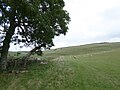
 Crete Bottom - geograph.org.uk - 2103609.jpg 640 × 480; 73 KB
-
 Crete Bottom - geograph.org.uk - 545331.jpg 640 × 480; 128 KB
-
 Crete Bottom - geograph.org.uk - 545387.jpg 640 × 480; 139 KB
-
 Crete Bottom - geograph.org.uk - 545390.jpg 640 × 480; 129 KB
-
 Crete Bottom - geograph.org.uk - 545402.jpg 640 × 480; 149 KB
-
 Crete Bottom - geograph.org.uk - 545406.jpg 640 × 480; 148 KB
-
 Crete Bottom - geograph.org.uk - 545412.jpg 640 × 480; 140 KB
-
 Crete Bottom - geograph.org.uk - 5865563.jpg 640 × 427; 69 KB
-
 Crete Bottom - geograph.org.uk - 5865572.jpg 640 × 427; 52 KB
-
 Crete Bottom - geograph.org.uk - 6257922.jpg 1,024 × 768; 186 KB
-
 Crete Bottom from Crete Hill - geograph.org.uk - 2103626.jpg 640 × 480; 52 KB
-
 Crete Bottom, approaching Bushes Barn - geograph.org.uk - 6257933.jpg 1,024 × 768; 197 KB
-
 Crete Hill - geograph.org.uk - 2103635.jpg 640 × 480; 67 KB
-
 Crete Hill - geograph.org.uk - 540163.jpg 640 × 480; 147 KB
-
 Crete Hill Godmanstone - geograph.org.uk - 1049673.jpg 640 × 428; 102 KB
-
 Downland view from above Crete Bottom - geograph.org.uk - 545310.jpg 640 × 480; 129 KB
-
-
 Entering Godmanstone on the A352 - geograph.org.uk - 6181516.jpg 1,024 × 684; 172 KB
-
 Farmland, Crete Bottom - geograph.org.uk - 540166.jpg 640 × 480; 150 KB
-
 Field Barn, Fry's Lane, Godmanstone - geograph.org.uk - 4124936.jpg 1,600 × 1,200; 884 KB
-

-

-
 Godmanston Burial Mound - geograph.org.uk - 3248507.jpg 3,264 × 2,448; 2.62 MB
-
 Godmanstone and the Cerne Valley - geograph.org.uk - 4123245.jpg 1,600 × 1,200; 331 KB
-
 Godmanstone Church and Glebe Barn - geograph.org.uk - 4124918.jpg 1,600 × 1,200; 579 KB
-
 Godmanstone Mill - geograph.org.uk - 1156976.jpg 640 × 480; 224 KB
-
 Godmanstone Mill - geograph.org.uk - 4718758.jpg 1,024 × 768; 273 KB
-
 Godmanstone Mill - geograph.org.uk - 975611.jpg 640 × 360; 92 KB
-
 Godmanstone Sewage Treatment Works - geograph.org.uk - 997971.jpg 640 × 428; 72 KB
-
 Godmanstone Village Hall - geograph.org.uk - 3161237.jpg 480 × 640; 109 KB
-
 Godmanstone Village Hall - geograph.org.uk - 4718782.jpg 1,024 × 768; 174 KB
-
 Godmanstone, Church Lane - geograph.org.uk - 4718773.jpg 1,024 × 768; 285 KB
-
 Godmanstone, farm buildings - geograph.org.uk - 4718727.jpg 1,024 × 768; 205 KB
-
 Godmanstone, mill stream - geograph.org.uk - 1912741.jpg 800 × 600; 191 KB
-
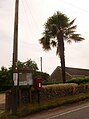 Godmanstone, postbox No. DT2 51 - geograph.org.uk - 1344324.jpg 477 × 640; 54 KB
-
 Godmanstone, River Cerne - geograph.org.uk - 4718740.jpg 1,024 × 768; 291 KB
-
 Harvested farmland, Godmanstone - geograph.org.uk - 545425.jpg 640 × 480; 140 KB
-

-
 Looking up stream - geograph.org.uk - 726143.jpg 640 × 425; 146 KB
-
 Memorial cairn on Crete Hill - geograph.org.uk - 545380.jpg 480 × 640; 111 KB
-
 New "art-work" bell tower at Bushes Barn, Godmanstone - geograph.org.uk - 4121327.jpg 1,200 × 1,600; 686 KB
-
 Reynard's Copse - geograph.org.uk - 5865590.jpg 640 × 427; 63 KB
-
 River Cerne south of Nether Cerne - geograph.org.uk - 5115698.jpg 640 × 480; 101 KB
-
 River Cerne, Godmanstone Mill - geograph.org.uk - 1157037.jpg 640 × 480; 144 KB
-
 Sheep farming, Crete Bottom - geograph.org.uk - 6287353.jpg 1,024 × 768; 208 KB
-
 Telephone box, Godmanstone - geograph.org.uk - 1156941.jpg 640 × 480; 188 KB
-
 The Great Godmanstone cattle drive - geograph.org.uk - 4123306.jpg 1,600 × 1,200; 663 KB
-

-
 The River Cerne at Godmanstone - geograph.org.uk - 376883.jpg 640 × 480; 133 KB
-
 Threshing at Manor Farm, Godmanstone - geograph.org.uk - 4124898.jpg 1,600 × 1,200; 457 KB
-

-

-
 New turf labyrinth - geograph.org.uk - 340951.jpg 640 × 480; 161 KB


