Category:Goring Heath
hamlet and civil parish in South Oxfordshire, England  | |||||
| Upload media | |||||
| Instance of | |||||
|---|---|---|---|---|---|
| Location | South Oxfordshire, Oxfordshire, South East England, England | ||||
| Area |
| ||||
| official website | |||||
 | |||||
English: Goring Heath is a hamlet and civil parish in the Chiltern Hills in South Oxfordshire. The civil parish includes the villages of Whitchurch Hill and Crays Pond and some small hamlets. Goring Heath is about northwest of Reading.
Subcategories
This category has the following 3 subcategories, out of 3 total.
A
- Alnutts Hospital (10 F)
W
Media in category "Goring Heath"
The following 200 files are in this category, out of 351 total.
(previous page) (next page)-
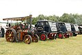
 A Blue Engine - geograph.org.uk - 4568816.jpg 1,024 × 683; 225 KB
-
 A Chiltern Valley - geograph.org.uk - 2553411.jpg 1,024 × 680; 172 KB
-
 A Green Fordson - geograph.org.uk - 4570032.jpg 1,024 × 683; 186 KB
-
 A line of Classics - geograph.org.uk - 4571481.jpg 1,024 × 683; 141 KB
-
 A line of Lorries - geograph.org.uk - 4571793.jpg 1,024 × 683; 160 KB
-
 A Orange Fordson - geograph.org.uk - 4570211.jpg 1,024 × 683; 192 KB
-
 A Row of Fordsons - geograph.org.uk - 4570029.jpg 1,024 × 683; 157 KB
-
 A thatched barn, Goring Heath - geograph.org.uk - 1934697.jpg 640 × 480; 301 KB
-
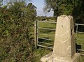
 A triangle at Whitchurch Hill - geograph.org.uk - 2719355.jpg 3,447 × 2,409; 2.12 MB
-
 Agricultural Contractor - geograph.org.uk - 4568811.jpg 1,024 × 683; 153 KB
-
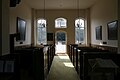
 Almshouse Chapel - geograph.org.uk - 6084333.jpg 1,024 × 683; 90 KB
-
 Almshouse memorial - geograph.org.uk - 6084325.jpg 1,024 × 683; 178 KB
-
 Almshouse pulpit - geograph.org.uk - 6084355.jpg 533 × 800; 71 KB
-
 Almshouses through the trees - geograph.org.uk - 6087012.jpg 1,024 × 768; 162 KB
-
 Alpaca at Goring Heath - geograph.org.uk - 1166851.jpg 424 × 640; 163 KB
-
 Alpaca at Goring Heath - geograph.org.uk - 1166873.jpg 426 × 640; 186 KB
-
 Alpacas at Goring Heath - geograph.org.uk - 1166848.jpg 427 × 640; 184 KB
-
 Alpacas at Goring Heath - geograph.org.uk - 1166856.jpg 640 × 427; 176 KB
-
 Alpacas at Goring Heath - geograph.org.uk - 1166860.jpg 640 × 428; 158 KB
-
 Alpacas at Goring Heath - geograph.org.uk - 1166864.jpg 426 × 640; 192 KB
-
 Alpacas at Goring Heath - geograph.org.uk - 1166868.jpg 640 × 426; 184 KB
-
 Alpacas at Goring Heath - geograph.org.uk - 1166875.jpg 640 × 427; 207 KB
-
 Alpacas at Goring Heath - geograph.org.uk - 1166879.jpg 640 × 425; 216 KB
-
 Altar and window - geograph.org.uk - 6085422.jpg 533 × 800; 123 KB
-
 Altar rails ^ kneeler - geograph.org.uk - 6086472.jpg 1,024 × 683; 146 KB
-
 An old Vault - geograph.org.uk - 5443780.jpg 1,024 × 683; 242 KB
-
 Approaching the A4074 - geograph.org.uk - 591807.jpg 640 × 473; 111 KB
-
 Apse at the chapel - geograph.org.uk - 6084364.jpg 1,024 × 683; 91 KB
-
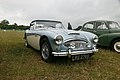 Austin Healey - geograph.org.uk - 4571590.jpg 1,024 × 683; 159 KB
-
 Autumn in Gutteridge's Wood - geograph.org.uk - 1071601.jpg 479 × 640; 144 KB
-
 B4526 and Deadman's Lane diverge - geograph.org.uk - 2820366.jpg 3,636 × 2,549; 2.06 MB
-
 B4526 approaches crossroads at Cray's Pond - geograph.org.uk - 2820368.jpg 3,557 × 2,544; 1.56 MB
-
 B4526 enters Cray's Pond - geograph.org.uk - 2889876.jpg 3,572 × 2,618; 1.21 MB
-
 B4526 southeast of Cray's Pond - geograph.org.uk - 2820367.jpg 3,130 × 2,381; 1.38 MB
-
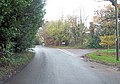
 B471 enters Whitchurch Hill - geograph.org.uk - 2820369.jpg 3,567 × 2,656; 1.67 MB
-
 B471 south into Cray's Pond - geograph.org.uk - 3010788.jpg 2,560 × 1,920; 1.12 MB
-
 Back of the chapel - geograph.org.uk - 6086492.jpg 533 × 800; 126 KB
-
 Back to the door - geograph.org.uk - 6085435.jpg 1,024 × 683; 80 KB
-
 Baker Memorial - geograph.org.uk - 6085411.jpg 533 × 800; 49 KB
-
 Bec Tithe, Whitchurch Hill - geograph.org.uk - 3250071.jpg 2,424 × 1,680; 1.11 MB
-
 Beech and holly - geograph.org.uk - 590528.jpg 640 × 477; 179 KB
-
 Beech wood from Long Toll - geograph.org.uk - 37071.jpg 640 × 481; 344 KB
-
 Before and after - geograph.org.uk - 2719828.jpg 3,648 × 2,617; 1.96 MB
-
 Below Merricroft's Wood - geograph.org.uk - 1386234.jpg 640 × 426; 169 KB
-
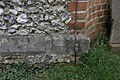 Benchmark by the Earth Strap - geograph.org.uk - 5450168.jpg 1,024 × 683; 211 KB
-
 Benchmark on St John - geograph.org.uk - 5450167.jpg 533 × 800; 125 KB
-
 Birchen Copse - geograph.org.uk - 590717.jpg 640 × 477; 154 KB
-
 Birchen Copse - geograph.org.uk - 590735.jpg 640 × 477; 150 KB
-
 Bluebells in Coxsetter's Wood - geograph.org.uk - 1149585.jpg 479 × 640; 145 KB
-
 Bottom Farm, Blackbird's Bottom - geograph.org.uk - 2182526.jpg 640 × 480; 117 KB
-

-
 Bridleway to Wroxhills Wood - geograph.org.uk - 2158295.jpg 640 × 480; 137 KB
-
 Bridleway, Nuney Green, Oxfordshire - geograph.org.uk - 4807076.jpg 5,788 × 3,909; 7.81 MB
-
 Bridleway, Woodcote, Oxfordshire - geograph.org.uk - 4821216.jpg 544 × 640; 244 KB
-
 Broken Cross - geograph.org.uk - 5443782.jpg 533 × 800; 132 KB
-
 Bunches of Daffodils - geograph.org.uk - 5449851.jpg 1,024 × 683; 211 KB
-
 Bus Shelter at Hill Bottom, Oxfordshire - geograph.org.uk - 4453887.jpg 571 × 800; 179 KB
-
 Bus Shelter, Hill Bottom - geograph.org.uk - 3250058.jpg 2,424 × 1,713; 1.21 MB
-
 By the Boundary - geograph.org.uk - 5450162.jpg 1,024 × 683; 223 KB
-
 Byway at Hill Bottom near Whitchurch Hill - geograph.org.uk - 26725.jpg 450 × 600; 161 KB
-
 Byway to Coombe End Farm - geograph.org.uk - 1386408.jpg 640 × 425; 186 KB
-
 Chapel Altar - geograph.org.uk - 6085439.jpg 1,024 × 683; 156 KB
-
 Chapel apse - geograph.org.uk - 6086483.jpg 1,024 × 683; 93 KB
-
 Chapel cemetery - geograph.org.uk - 6086994.jpg 1,024 × 683; 189 KB
-
 Chapel in the middle - geograph.org.uk - 6081075.jpg 1,024 × 682; 219 KB
-
 Chapel organ - geograph.org.uk - 6085419.jpg 533 × 800; 73 KB
-
 Charles Slater - geograph.org.uk - 5444444.jpg 533 × 800; 109 KB
-
 Chiltern Way approaching Collins End - geograph.org.uk - 6179273.jpg 4,608 × 3,456; 6.97 MB
-
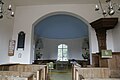
 Church of St John the Baptist, Whitchurch Hill, Oxfordshire - geograph.org.uk - 4760947.jpg 5,350 × 3,967; 4.57 MB
-
 Church ^ Rocking Horse - geograph.org.uk - 3250035.jpg 1,971 × 1,413; 971 KB
-
 Churchyard on the North side of St John - geograph.org.uk - 5443561.jpg 1,024 × 683; 207 KB
-
 Classic Cars - geograph.org.uk - 4571480.jpg 1,024 × 683; 168 KB
-
 Classic Trucks - geograph.org.uk - 4571446.jpg 1,024 × 683; 135 KB
-
 Clerk's desk - geograph.org.uk - 6085427.jpg 1,024 × 683; 120 KB
-
 Clock on the Chapel - geograph.org.uk - 6084322.jpg 533 × 800; 133 KB
-
 Coat of arms over the door - geograph.org.uk - 6084329.jpg 1,024 × 683; 107 KB
-
 Collins End - geograph.org.uk - 1166735.jpg 640 × 425; 188 KB
-
 Combe at Collins End - geograph.org.uk - 1166884.jpg 640 × 426; 164 KB
-
 Commemorative plaque - geograph.org.uk - 6085416.jpg 1,024 × 683; 50 KB
-
 Common Covert - geograph.org.uk - 3715266.jpg 1,600 × 1,067; 761 KB
-
 Coombe End Farm - geograph.org.uk - 1386444.jpg 640 × 427; 191 KB
-
 Copyhold Farm, Goring Heath - geograph.org.uk - 2326150.jpg 640 × 480; 120 KB
-
 Cottage at Collinsend Common - geograph.org.uk - 1141954.jpg 640 × 480; 94 KB
-
 Country Lane, Woodcote, Oxfordshire - geograph.org.uk - 4821180.jpg 640 × 507; 194 KB
-
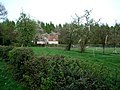
 Country properties, Goring Heath - geograph.org.uk - 1934696.jpg 640 × 480; 314 KB
-
 Country road, Crays Pond, Oxfordshire - geograph.org.uk - 4693461.jpg 640 × 457; 183 KB
-
 Couple of Farmalls - geograph.org.uk - 4570220.jpg 1,024 × 683; 185 KB
-
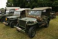 Couple of Jeeps - geograph.org.uk - 4571278.jpg 1,024 × 683; 188 KB
-
 Couple of Steam Rollers - geograph.org.uk - 4568994.jpg 1,024 × 683; 177 KB
-
 Cowboys in Town - geograph.org.uk - 4569128.jpg 1,024 × 683; 187 KB
-
 Cross Amongst the Graves - geograph.org.uk - 5444759.jpg 1,024 × 683; 200 KB
-
 Cross and Hall - geograph.org.uk - 5443788.jpg 533 × 800; 156 KB
-
 Cut away Engine - geograph.org.uk - 4571303.jpg 533 × 800; 102 KB
-
 Daffodils at St John - geograph.org.uk - 5449855.jpg 1,024 × 683; 215 KB
-
 Daffodils in Bloom - geograph.org.uk - 5449849.jpg 1,024 × 683; 194 KB
-
 Dancing beech trees, Woodcote, Oxfordshire - geograph.org.uk - 4824224.jpg 3,104 × 3,377; 5.17 MB
-
 Dandelions in a field off part of the Chiltern Way - geograph.org.uk - 6179266.jpg 4,608 × 3,456; 4.86 MB
-
 Deadmans Lane - geograph.org.uk - 2851033.jpg 3,676 × 2,232; 1.47 MB
-
 Decorative cross - geograph.org.uk - 6087000.jpg 533 × 800; 126 KB
-
 Dog by the Pole - geograph.org.uk - 4569004.jpg 533 × 800; 122 KB
-
 Downland, Goring Heath, Oxfordshire - geograph.org.uk - 4843765.jpg 4,259 × 2,169; 858 KB
-
 Dressage arena - geograph.org.uk - 2311887.jpg 2,272 × 1,704; 2.47 MB
-
 Drive to the almshouses - geograph.org.uk - 6087016.jpg 1,024 × 768; 244 KB
-
 Dry Path - geograph.org.uk - 3506890.jpg 3,888 × 2,592; 2.65 MB
-
 Dry valley below Merricroft's Wood - geograph.org.uk - 950832.jpg 640 × 480; 57 KB
-
 Eastfield Lane in Little Oaks Wood - geograph.org.uk - 2182500.jpg 640 × 480; 171 KB
-
 Elephant grass, Cold Harbour, Whitchurch Hill - geograph.org.uk - 2747619.jpg 4,133 × 2,756; 5.48 MB
-
 Elevendon Lane - geograph.org.uk - 6078113.jpg 640 × 480; 119 KB
-
 Elvendon Lane climbs through Old Elvendon Wood - geograph.org.uk - 2826195.jpg 3,648 × 2,736; 2.59 MB
-
 Enclosure, Little Oaken Wood - geograph.org.uk - 2534717.jpg 3,648 × 2,736; 2.69 MB
-
 End of the Building - geograph.org.uk - 5450085.jpg 1,024 × 683; 160 KB
-
 Engine ^ Truck - geograph.org.uk - 4568605.jpg 1,024 × 683; 154 KB
-
 Engines at the Rally - geograph.org.uk - 4571706.jpg 1,024 × 683; 155 KB
-
 Engines in a Line - geograph.org.uk - 4571783.jpg 1,024 × 683; 143 KB
-
 Entrance to Gutteridge's Wood - geograph.org.uk - 1166935.jpg 640 × 426; 187 KB
-

-
 Farmland and woodland, Goring Heath - geograph.org.uk - 2680139.jpg 640 × 480; 166 KB
-

-
 Farmland below Coombe Court Farm - geograph.org.uk - 4442638.jpg 2,592 × 1,944; 1.41 MB
-
 Farmland, Goring Heath - geograph.org.uk - 2680131.jpg 640 × 480; 176 KB
-
 Farmland, Goring Heath - geograph.org.uk - 2818692.jpg 640 × 480; 153 KB
-
 Five houses - geograph.org.uk - 6081078.jpg 1,024 × 683; 133 KB
-
 Five point candelabra - geograph.org.uk - 6086480.jpg 1,024 × 683; 40 KB
-
 Flag at the almshouses - geograph.org.uk - 6087002.jpg 1,024 × 683; 96 KB
-
 Flint House - geograph.org.uk - 2831905.jpg 1,600 × 1,109; 533 KB
-
 Flower bed at the almshouses - geograph.org.uk - 6081069.jpg 1,024 × 683; 231 KB
-
 Flowerbed at the almshouse - geograph.org.uk - 6087024.jpg 1,024 × 768; 196 KB
-
 Flowers in the corner - geograph.org.uk - 6085437.jpg 533 × 800; 69 KB
-
 Flowers under the bust - geograph.org.uk - 6086465.jpg 533 × 800; 56 KB
-
 Flying the flag - geograph.org.uk - 6087019.jpg 600 × 800; 97 KB
-
 Footpath to Cray's Pond - geograph.org.uk - 590794.jpg 640 × 477; 93 KB
-
 Footpath to Woodcote - geograph.org.uk - 2158307.jpg 640 × 480; 135 KB
-
 Forgotten Corner - geograph.org.uk - 5444550.jpg 1,024 × 683; 246 KB
-
 Former Goring Heath school - geograph.org.uk - 6078303.jpg 1,024 × 683; 134 KB
-
 Fowler Steam Roller - geograph.org.uk - 4568813.jpg 533 × 800; 101 KB
-
 From BeechFarm - geograph.org.uk - 1386461.jpg 640 × 425; 205 KB
-
 From the South East - geograph.org.uk - 5444766.jpg 1,024 × 683; 175 KB
-
 Frost and tree shadows, Goring Heath, Oxfordshire - geograph.org.uk - 4843763.jpg 4,353 × 2,962; 4.11 MB
-
 Frost pocket at Goring Heath - geograph.org.uk - 2716714.jpg 3,648 × 2,509; 1.59 MB
-
 Frosty hillside, Goring Heath, Oxfordshire - geograph.org.uk - 4803221.jpg 3,539 × 2,614; 1.06 MB
-
 Frosty morning, Goring Heath, Oxfordshire - geograph.org.uk - 4801847.jpg 2,480 × 1,795; 2.64 MB
-
 G. Ward - geograph.org.uk - 5443565.jpg 533 × 800; 102 KB
-
 Garden, Whitchurch Hill, Oxfordshire - geograph.org.uk - 4761038.jpg 4,000 × 3,982; 4.45 MB
-
 Gate and barn - geograph.org.uk - 2310775.jpg 2,272 × 1,704; 1.58 MB
-
 Gate and concrete pillar at Goring Heath, Oxfordshire.jpg 640 × 477; 131 KB
-
 Gate near Coombe End Farm - geograph.org.uk - 1386440.jpg 640 × 425; 206 KB
-
 Gate to the almshouses - geograph.org.uk - 6081076.jpg 533 × 800; 114 KB
-
 German Sausage ^ Fries - geograph.org.uk - 4569010.jpg 1,024 × 683; 147 KB
-
 Goodbye, King Charles Head - geograph.org.uk - 2836576.jpg 640 × 480; 327 KB
-
 Byway from Coombe End Farm - geograph.org.uk - 1386424.jpg 640 × 425; 181 KB
-
 Chiltern tile hanging - geograph.org.uk - 1386419.jpg 640 × 426; 234 KB
-
 Coombe End Farm - geograph.org.uk - 1386432.jpg 640 × 426; 201 KB
-
 Copyhold Farm - geograph.org.uk - 1166838.jpg 640 × 426; 193 KB
-
 Goring Heath bowls club - geograph.org.uk - 6078301.jpg 1,024 × 683; 125 KB
-
 Goring Heath Post Office - geograph.org.uk - 1166895.jpg 640 × 427; 221 KB
-
 Goring Heath Village Hall - geograph.org.uk - 5450900.jpg 1,024 × 683; 148 KB
-
 Goring Heath, path north-east of Allnutt's Almshouses - geograph.org.uk - 2680149.jpg 1,064 × 1,600; 369 KB
-
 Goring Road Cray's Pond - geograph.org.uk - 3284727.jpg 640 × 480; 71 KB
-
 Goring Road from the B4526 - geograph.org.uk - 4607614.jpg 2,304 × 1,667; 616 KB
-
 Goring Road, Cray's Pond - geograph.org.uk - 4621994.jpg 2,204 × 1,588; 912 KB
-
 Grassland, Goring Heath - geograph.org.uk - 2818637.jpg 640 × 480; 146 KB
-
 Grave in the cemetery - geograph.org.uk - 6086496.jpg 533 × 800; 130 KB
-
 Green, Whitchurch Hill - geograph.org.uk - 2330992.jpg 640 × 480; 202 KB
-
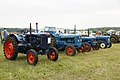
 Grey Tractors - geograph.org.uk - 4570209.jpg 1,024 × 683; 135 KB
-
 Gunner G.W.Goff - geograph.org.uk - 5444448.jpg 533 × 800; 86 KB
-
-
 Harold D Tuck - geograph.org.uk - 5450072.jpg 533 × 800; 119 KB
-
 Hawhill Dip adjacent to Hawhill Wood and farmland - geograph.org.uk - 3005646.jpg 2,560 × 1,920; 535 KB
-
 Hawhill Wood - geograph.org.uk - 26740.jpg 640 × 480; 310 KB
-
 Headstone by the Porch - geograph.org.uk - 5450164.jpg 1,024 × 683; 194 KB
-
 Headstones in the Brambles - geograph.org.uk - 5444457.jpg 1,024 × 683; 253 KB
-
 Heath End, Cray's Pond - geograph.org.uk - 2830144.jpg 3,356 × 2,620; 2.65 MB
-
 Hedgeline with grey-blue clouds - geograph.org.uk - 4819671.jpg 640 × 419; 93 KB
-

-
 Hedgerow trees and mottled clouds - geograph.org.uk - 4811248.jpg 800 × 471; 140 KB
-
 Hedgerow trees, blue light - geograph.org.uk - 4810710.jpg 800 × 524; 179 KB
-
 Henry Alnut - geograph.org.uk - 6086466.jpg 533 × 800; 52 KB
-
 High hedges beside Pilgrim Cottage - geograph.org.uk - 2716701.jpg 3,648 × 2,642; 2.01 MB
-
 Hillman Imp - geograph.org.uk - 4571592.jpg 1,024 × 683; 181 KB
-
 Holly Copse - geograph.org.uk - 1166738.jpg 640 × 426; 168 KB
-
 Holly in College Wood, Goring Heath, Oxfordshire.jpg 640 × 477; 164 KB
-
 Holmes's Farm - geograph.org.uk - 1166746.jpg 640 × 427; 178 KB
-
 Horse chestnut tree, Collinsend Common - geograph.org.uk - 1149217.jpg 640 × 480; 107 KB
-
 Horses on the Ride - geograph.org.uk - 4571447.jpg 533 × 800; 138 KB
-
 House by Allnuts Almshouses - geograph.org.uk - 3252134.jpg 1,024 × 645; 263 KB
-
 Huge Engine - geograph.org.uk - 4568619.jpg 1,024 × 683; 146 KB
-
 Hymn list in the corner - geograph.org.uk - 6084348.jpg 533 × 800; 48 KB
-
 Indian Camp - geograph.org.uk - 4568996.jpg 1,024 × 683; 172 KB
-
 Jane Eyre - geograph.org.uk - 4571704.jpg 1,024 × 683; 176 KB
-
 Jeeps in the Corner - geograph.org.uk - 4570221.jpg 1,024 × 683; 188 KB
-

-
-

-
 Ladygrove Farm near Goring Heath - geograph.org.uk - 26736.jpg 640 × 480; 184 KB
-
 Ladygrove Farmhouse - geograph.org.uk - 2719822.jpg 3,648 × 2,736; 1.83 MB
-
 Lane passes Copyhold Farm - geograph.org.uk - 2719378.jpg 3,648 × 2,736; 1.51 MB
-
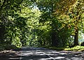
 Lane south of Whitchurch Hill - geograph.org.uk - 2719369.jpg 3,644 × 2,595; 2.42 MB
-
 Lanz Bulldog - geograph.org.uk - 4570216.jpg 1,024 × 683; 175 KB
-
 Leaf fall in College Wood, Goring Heath, Oxfordshire.jpg 640 × 477; 132 KB
-
 Leaning on the Plank - geograph.org.uk - 4568804.jpg 1,024 × 683; 185 KB


