Category:Gotthardreussbrücke (Hospental, 1681)
| Object location | | View all coordinates using: OpenStreetMap |
|---|
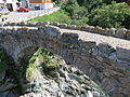
bridge in Switzerland  Brücke über die Gotthardreuss von Norden gesehen (2013) | |||||
| Upload media | |||||
| Instance of | |||||
|---|---|---|---|---|---|
| Part of | |||||
| Location | Hospental, Uri, Switzerland | ||||
| Street address |
| ||||
| Crosses | |||||
| Heritage designation | |||||
| Inception |
| ||||
| Length |
| ||||
 | |||||
Media in category "Gotthardreussbrücke (Hospental, 1681)"
The following 7 files are in this category, out of 7 total.
-
 Dorfbrücke Gotthardreuss Hospental UR 20160826-jag9889.jpg 4,608 × 3,456; 11.14 MB
-
 Gasthaus St. Gotthard Hospental.jpg 2,848 × 4,288; 2.29 MB
-
 Gasthaus St. Gotthard in Hospental-UR.jpg 2,250 × 3,000; 4.07 MB
-
 Gotthardreussbrücke (1681) über die Gotthardreuss, Hospental UR 20160826-jag9889.jpg 4,320 × 2,430; 10.28 MB
-
 Gotthardreussbrücke Fussweg (1681) über die Gotthardreuss, Hospental UR 20160826-jag9889.jpg 4,608 × 3,456; 14.36 MB
-
 Hospental Dorfbrücke.JPG 2,816 × 2,112; 2.31 MB
-
 Hospental Gotthard.jpg 2,155 × 3,232; 2.48 MB


_%C3%BCber_die_Gotthardreuss,_Hospental_UR_20160826-jag9889.jpg)
_%C3%BCber_die_Gotthardreuss,_Hospental_UR_20160826-jag9889.jpg)
