Category:Grade II listed houses in West Yorkshire
Ceremonial counties of England: Bedfordshire · Berkshire · Buckinghamshire · Cambridgeshire · Cheshire · Cornwall · Cumbria · Derbyshire · Devon · Dorset · Durham · East Riding of Yorkshire · East Sussex · Essex · Gloucestershire · Greater London · Greater Manchester · Hampshire · Herefordshire · Hertfordshire · Kent · Lancashire · Leicestershire · Lincolnshire · Merseyside · North Yorkshire · Northamptonshire · Northumberland · Nottinghamshire · Oxfordshire · Rutland · Shropshire · Somerset · South Yorkshire · Staffordshire · Suffolk · Surrey · Tyne and Wear · Warwickshire · West Midlands · West Sussex · West Yorkshire · Wiltshire · Worcestershire
City-counties: Bristol · City of London
Former historic counties:
Other former counties:
City-counties: Bristol · City of London
Former historic counties:
Other former counties:
Subcategories
This category has the following 41 subcategories, out of 41 total.
1
2
- 259 Upper Town Street (2 F)
3
- 3 Thunder Bridge Lane (2 F)
4
- 4 The Village, Thurstonland (2 F)
6
A
- Arthington Hall (3 F)
B
- Deutsche Kirche, Bradford (3 F)
C
- Cliff House, Wortley (10 F)
- Cloth Hall, Heptonstall (3 F)
D
- Denton House, Ripponden (2 F)
E
- Ebor House (1 F)
F
- Firth House, Rastrick (2 F)
- Freedom House, Tingley (9 F)
G
- Greave House (6 F)
- Greengates House (4 F)
H
- Kirkburton Hall (4 F)
- Hanover Square, Bradford (3 F)
- Hopton Hall, West Yorkshire (5 F)
- Hopwood Hall, Halifax (4 F)
L
- Lawns House, Farnley (6 F)
- Low Fold Farm, Thurstonland (2 F)
M
- Marsh Hall, Kirklees (3 F)
O
- Oakworth Hall (5 F)
- Otley Manor House (2 F)
P
T
- The Terrace, Boston Spa (3 F)
U
W
- Whitkirk Manor House (3 F)
Media in category "Grade II listed houses in West Yorkshire"
The following 200 files are in this category, out of 715 total.
(previous page) (next page)-
 "Claremont", Clarendon Road, Leeds - geograph.org.uk - 1390776.jpg 640 × 480; 103 KB
-
 1 and 2 New House.jpg 2,000 × 1,500; 1.19 MB
-
 1 and 2, Church Lane.jpg 3,456 × 2,304; 1,016 KB
-
 1 and 3 Town End, Golcar.jpg 1,600 × 1,222; 601 KB
-
 1, 2, 3 And 4, Myrtle Place.jpg 3,984 × 2,655; 2.38 MB
-
 1, 2, 3, 4, 5 And 6, Harold Place.jpg 3,793 × 2,529; 1.82 MB
-
 1-10 Mawson Street.jpg 3,331 × 2,220; 1.37 MB
-
 1-4 Waterloo Crescent, Apperley.jpg 1,280 × 853; 649 KB
-
 1-7 Tannery Square, Meanwood.jpg 1,024 × 768; 243 KB
-
 10 Wesley Street, Morley.jpg 1,024 × 768; 131 KB
-
 10-18 Main Street, Esholt.jpg 4,320 × 3,240; 5.8 MB
-
 10-23 St John's Square - geograph.org.uk - 1120655.jpg 640 × 480; 329 KB
-
 104 Moor Lane, Netherton.jpg 640 × 459; 57 KB
-
 11 Hanover Square, Woodhouse.jpg 1,280 × 990; 505 KB
-
 118 Paddock Road, Highburton.jpg 4,752 × 3,168; 6.39 MB
-
 119, 121 and 123 Fartown, Pudsey.jpg 1,024 × 683; 170 KB
-
 125 Main Street, Shadwell.jpg 1,024 × 768; 140 KB
-
 128 Town Gate, Netherthong.jpg 444 × 640; 88 KB
-
 133-139 Main Street, Shadwell.jpg 1,024 × 768; 196 KB
-
 134, 136 And 138, Town Street.jpg 4,272 × 2,848; 6.16 MB
-
 14 and 16 Station Road, Low Ackworth.jpg 640 × 434; 62 KB
-
 14, Gay Lane.jpg 3,242 × 2,161; 1.3 MB
-
 14-24 Foster Lane, Hebden Bridge.jpg 2,048 × 1,536; 762 KB
-
 140, Town Street.jpg 2,439 × 3,657; 1.8 MB
-
 149, Main Street, Addingham.jpg 600 × 800; 105 KB
-
 15 and 17, Thunder Bridge Lane.jpg 4,000 × 3,000; 2.08 MB
-
 15a Wentworth Street - geograph.org.uk - 1128439.jpg 640 × 487; 325 KB
-
 161 New Line, Greengates.jpg 1,839 × 1,594; 739 KB
-

-
 18 and 20, Dam Hill, Shelley.jpg 4,000 × 3,000; 2.07 MB
-
 19, Crow Lane.jpg 1,899 × 2,848; 1.34 MB
-

-
 1–9, Knowl Top, Heptonstall.jpg 4,000 × 3,000; 4.88 MB
-
 2 Old Lane, Drighlington.jpg 640 × 402; 61 KB
-
 2, Town Gate, Highburton.jpg 3,168 × 4,752; 5.28 MB
-
 2-18 Moorfields - geograph.org.uk - 590061.jpg 640 × 429; 253 KB
-
 20–26, Church Street, Heptonstall.jpg 4,000 × 3,000; 1.81 MB
-
 21, Crow Lane.jpg 1,855 × 2,784; 1.07 MB
-
 21, Far Dean, Highburton.jpg 4,752 × 3,168; 7.2 MB
-
 29, 31 and 33 Main Street, Haworth, W Yorks.jpg 4,096 × 3,072; 4.41 MB
-
 31 and 33 Far Dean, Highburton.jpg 4,752 × 3,168; 4.82 MB
-
 31 Moorside Road, Eccleshill.jpg 1,600 × 1,065; 550 KB
-
 33, Ilkley Road.jpg 3,457 × 2,304; 2.17 MB
-
 34 and 36 Rock Lane, Bramley.jpg 1,280 × 960; 678 KB
-
 35, Ilkley Road.jpg 1,791 × 2,686; 787 KB
-
 4 Calverley Bridge.jpg 1,280 × 720; 561 KB
-
 4 Town Gate, Holmfirth.jpg 1,819 × 1,342; 1.19 MB
-
 41 And 43, Ilkley Road.jpg 2,685 × 4,027; 2.18 MB
-
 420 Aberford Road - geograph.org.uk - 1182515.jpg 640 × 480; 394 KB
-
 428-430 Broad Lane - geograph.org.uk - 590048.jpg 640 × 445; 249 KB
-
 45 Ropergate, Pontefract.jpg 1,600 × 1,207; 601 KB
-
 47-51 Tithe Barn Street, Horbury.jpg 1,024 × 768; 169 KB
-
 5 and 7, Northgate, Heptonstall 01.jpg 4,000 × 3,000; 4.67 MB
-
 5 and 7, Northgate, Heptonstall 02.jpg 4,000 × 3,000; 4.77 MB
-
 5 Clifton Villas, Manningham.jpg 640 × 480; 110 KB
-
 5 Commercial Road, Skelmanthorpe.jpg 640 × 480; 76 KB
-
 5 Laburnum Place, Apperley Bridge.jpg 1,704 × 2,272; 943 KB
-
 5, 9 and 11, Thunder Bridge Lane.jpg 4,000 × 3,000; 1.56 MB
-
 50 And 51, Titus Street.jpg 4,163 × 2,775; 2.2 MB
-
 50 and 52, The Village, Thurstonland.jpg 4,000 × 3,000; 1.13 MB
-
 52-61, Titus Street.jpg 4,030 × 2,686; 2.11 MB
-
 53, 55 and 57 Branch Road, Dewsbury.jpg 1,024 × 768; 187 KB
-
 54, The Village, Thurstonland.jpg 4,000 × 3,000; 1.15 MB
-
 541 Gibbet Street, Halifax - geograph.org.uk - 868059.jpg 639 × 488; 59 KB
-
 56 and 58, The Village, Thurstonland.jpg 4,000 × 3,000; 1.07 MB
-
 56 Lumb Lane, Almondbury.jpg 1,600 × 1,200; 343 KB
-
 58 and 60, Halifax Road, Catherine Slack.jpg 4,000 × 3,000; 1.01 MB
-
 6 and 8 Main Street, Esholt.jpg 1,750 × 1,538; 740 KB
-
 6 and 8 Melbourne Place, Bradford.jpg 1,024 × 683; 237 KB
-
 6-10 Beck Hill, Buttershaw.jpg 2,000 × 1,337; 839 KB
-
 60 and 62 Town Street, Guiseley.jpg 640 × 480; 106 KB
-
 60, The Village, Thurstonland.jpg 4,000 × 3,000; 1.21 MB
-
 63 And 65, Albert Road.jpg 3,891 × 2,594; 2.24 MB
-
 643 Little Horton lane - geograph.org.uk - 391894.jpg 640 × 429; 229 KB
-
 67, 69, 71 And 73, Albert Road.jpg 3,940 × 2,626; 2.27 MB
-
 67, Frizinghall Road, Heaton.jpg 1,024 × 768; 193 KB
-
 70 and 72 Main Street, Haworth, W Yorks.jpg 4,096 × 3,072; 3.43 MB
-
 71 And 73, Bondgate.jpg 3,222 × 2,148; 1.49 MB
-
 72, Little Horton Lane - geograph.org.uk - 400625.jpg 640 × 499; 324 KB
-
 72, The Village, Thurstonland.jpg 4,000 × 3,000; 1.25 MB
-
 74 Main Street, Haworth, W Yorks.jpg 2,338 × 3,979; 1.89 MB
-
 75 And 77, Albert Road.jpg 3,762 × 2,537; 2.36 MB
-
 76 Main Street, Haworth, W Yorks.jpg 3,072 × 4,096; 3.98 MB
-
 8, Boroughgate.jpg 2,304 × 3,456; 1.3 MB
-
 8-14, Charles Street.jpg 4,013 × 2,675; 1.97 MB
-
 8-14, Katherine Street.jpg 4,075 × 2,717; 1.87 MB
-
 80 Dob Lane, Sowerby - geograph.org.uk - 824538.jpg 640 × 526; 194 KB
-
 81 Lockwood Road, Huddersfield.jpg 800 × 593; 82 KB
-
 81-83 Huddersfield Road - geograph.org.uk - 500201.jpg 640 × 572; 49 KB
-
 86-90 New North Road, Huddersfield (13567240705).jpg 2,981 × 2,534; 4.63 MB
-
 87 and 89 Main Street, Haworth, W Yorks.jpg 4,096 × 3,072; 4.04 MB
-
 9-11 Claremont - geograph.org.uk - 400677.jpg 640 × 404; 223 KB
-
 92 New North Road, Huddersfield (12874725013).jpg 1,397 × 1,723; 2.16 MB
-
 94 and 96 Green Road.jpg 4,608 × 3,456; 4.24 MB
-
 99-101 Main Street - geograph.org.uk - 1188272.jpg 640 × 443; 192 KB
-
 A corner of Ripponden - geograph.org.uk - 518910.jpg 640 × 359; 91 KB
-
 Ackworth - Ackworth Grange.jpg 640 × 480; 98 KB
-
 Ackworth House, Pontefract Road, High Ackworth - geograph.org.uk - 2102769.jpg 1,024 × 768; 217 KB
-
 Adders Gate Farmhouse.jpg 4,000 × 3,000; 4.63 MB
-
 Addersgate Cottages.jpg 4,000 × 3,000; 5.03 MB
-
 Addingham - 114a Main Street - geograph.org.uk - 369532.jpg 640 × 590; 172 KB
-
 Addingham - 155 Main Street - geograph.org.uk - 369548.jpg 640 × 623; 250 KB
-
 Addingham - 32-34 Main Street - geograph.org.uk - 369492.jpg 638 × 609; 51 KB
-
 Akroydon (2271806749).jpg 2,560 × 1,920; 4.2 MB
-
 All Saints Vicarage, Otley.jpg 1,024 × 684; 183 KB
-
 Allerton Hall, Chapel Allerton.jpg 1,024 × 768; 265 KB
-

-
 Apperley Cottage.jpg 685 × 1,024; 195 KB
-
 Apsley Crescent - Marlborough Road - geograph.org.uk - 1042148.jpg 640 × 480; 302 KB
-
 Architect born here - geograph.org.uk - 880463.jpg 480 × 640; 66 KB
-
 Ashes Lane, Almondbury.jpg 5,051 × 3,738; 5.22 MB
-
 Ashfield House, Thornton.jpg 1,498 × 2,000; 850 KB
-
 Ashgrove (17407280902).jpg 2,858 × 2,959; 5.4 MB
-
 Ashley House - High Street, Boston Spa - geograph.org.uk - 958624.jpg 640 × 458; 214 KB
-
 Ashling House, Adel.jpg 1,024 × 768; 237 KB
-
 Austonley School - geograph.org.uk - 104418.jpg 640 × 480; 129 KB
-
 Back Lane, Guiseley.jpg 640 × 480; 72 KB
-
 Back Princes Grove - off Shaw Lane - geograph.org.uk - 604456.jpg 640 × 446; 40 KB
-
 Balks House, Lower Wortley.jpg 1,024 × 768; 210 KB
-
 Ball Green, Well Head Lane - geograph.org.uk - 824516.jpg 640 × 480; 253 KB
-
 Bank Buildings, Meltham.jpg 640 × 480; 136 KB
-
 Bank Hall Farmhouse.jpg 2,025 × 1,431; 1.03 MB
-
 Bar House, Doncaster Road - geograph.org.uk - 2250225.jpg 1,024 × 772; 684 KB
-
 Barleywood House, Barnsley Road, Sandal - geograph.org.uk - 2309718.jpg 1,024 × 768; 781 KB
-
 Barwick Lodge, Parlington Estate.jpg 2,048 × 1,536; 637 KB
-
 Bay Hall, Huddersfield - geograph.org.uk - 346682.jpg 640 × 464; 89 KB
-
 Becca Hall - geograph.org.uk - 54545.jpg 640 × 476; 105 KB
-
 Beckfoot Cottage - geograph.org.uk - 5418194.jpg 1,024 × 768; 1.05 MB
-
 Beech Lawn, Heath.jpg 640 × 461; 112 KB
-
 Beehive Street - geograph.org.uk - 1284774.jpg 640 × 480; 85 KB
-
 Bell House, Cragg Vale.jpg 2,816 × 2,112; 1.41 MB
-
 Belle Vue, Manningham.jpg 1,024 × 683; 181 KB
-
 Bent Head Farmhouse.jpg 4,000 × 3,000; 4.88 MB
-
 Bermerside House, Skircoat Green.jpg 640 × 425; 61 KB
-
 Bethesda Row, Mytholmroyd.jpg 640 × 480; 122 KB
-
 Betty's Lodge, St Ives Estate.jpg 1,024 × 768; 194 KB
-
 Binn Royd Farm.jpg 4,000 × 3,000; 4.78 MB
-
 Binn Royd Farmhouse.jpg 2,000 × 1,500; 943 KB
-
 Birkby Grange - Birkby Hall Road - geograph.org.uk - 929707.jpg 640 × 481; 250 KB
-
 Birks Gate, Thunder Bridge.jpg 4,000 × 3,000; 1.65 MB
-
 Black Hey Farmhouse.jpg 2,048 × 1,536; 649 KB
-
 Blackshaw Head - geograph.org.uk - 717136.jpg 640 × 427; 66 KB
-
 Blayd's Yard, Leeds.jpg 971 × 1,280; 360 KB
-
 Bloomfield House.jpg 3,084 × 2,056; 1.13 MB
-
 Blue Bell Lodge, Mill Bank.jpg 2,048 × 1,536; 650 KB
-
 Boldshay Hall, Byron Street, Bradford (geograph 7370724).jpg 1,600 × 1,200; 320 KB
-
 Bond Street Wakefield - geograph.org.uk - 994522.jpg 640 × 480; 85 KB
-
 Boston House - geograph.org.uk - 617997.jpg 640 × 480; 81 KB
-
 Boston Spa - High Street.jpg 640 × 493; 230 KB
-
-
 Bowcliffe Hall-Bramham-Wetherby.jpg 3,300 × 2,200; 2.38 MB
-
-
 Bradford - 898-906 And 896A, Great Horton Road - 20221027125526.jpeg 3,024 × 4,032; 4.46 MB
-
 Bradford - 910, Great Horton Road - 20221027125549.jpeg 3,024 × 4,032; 3.65 MB
-
 Bradford - Numbers 24, 28, 32 34A And 34 (Hill End) - 20221025120221.jpeg 3,024 × 4,032; 4.42 MB
-
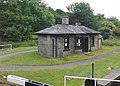
 Bradley - canal cottage at Lock 1.jpg 1,600 × 1,178; 741 KB
-
 Bremen House, Huddersfield - geograph.org.uk - 1508822.jpg 640 × 480; 105 KB
-
 Briarcourt, Lindley.jpg 2,000 × 1,348; 932 KB
-
 Bridge End - geograph.org.uk - 1129425.jpg 640 × 480; 199 KB
-
 Bridge over Hebden Water at Gibson Mill.jpg 3,567 × 5,350; 16.07 MB
-
 Bridge Street - Thornton Road - geograph.org.uk - 1067168.jpg 640 × 480; 303 KB
-
 Bridge Street, Lane End - geograph.org.uk - 73719.jpg 640 × 480; 126 KB
-
 Brighouse Wood Row.jpg 2,000 × 1,332; 926 KB
-
 Broad Oaks, Mirfield.jpg 2,048 × 1,536; 556 KB
-
 Broadfolds - geograph.org.uk - 401868.jpg 640 × 521; 280 KB
-
 Broadstone, Colden.jpg 1,597 × 1,083; 352 KB
-
 Brockwell Gate, Sowerby.jpg 640 × 480; 95 KB
-
-
 Brookfoot Lock Keeper's Cottage, Brighouse.jpg 800 × 572; 154 KB
-
 Bungalows, Little Horton Lane.jpg 1,600 × 1,065; 645 KB
-
 Bunkers Hill, Esholt.jpg 3,771 × 2,829; 2.94 MB
-
 Burley in Wharfedale (2685617867).jpg 2,069 × 1,909; 4.22 MB
-

-
 Burton House - Burton Avenue - geograph.org.uk - 963970.jpg 640 × 483; 284 KB
-
-
 Carr Bottom Road, Greengates.jpg 1,803 × 1,548; 649 KB
-
 Carr House Gate.jpg 1,024 × 673; 176 KB
-
 Carr Lodge Park and Mansion - geograph.org.uk - 827711.jpg 640 × 480; 61 KB
-
 Castle Garth, Pontefract.JPG 1,364 × 1,024; 479 KB
-
 Castle House - Bridge Lane - geograph.org.uk - 475497.jpg 640 × 564; 78 KB
-
 Chantry House, Heptonstall - geograph.org.uk - 193516.jpg 640 × 470; 141 KB
-
 Chapel Lane - Esholt - geograph.org.uk - 996932.jpg 640 × 434; 95 KB
-
 Chapel Row, Wilsden.jpg 640 × 480; 93 KB
-
 Cherry Tree Farmhouse, South Elmsall.jpg 1,600 × 1,200; 302 KB
-
 Church House, Darrington.jpg 1,024 × 768; 207 KB
-
 Church Lane - Esholt - geograph.org.uk - 996933.jpg 640 × 480; 138 KB
-
 Church Yard Bottom, Heptonstall.jpg 4,000 × 3,000; 1.36 MB
-
 Clare Hill, Huddersfield.jpg 640 × 480; 71 KB
-
 Claremont, Woodhouse.jpg 1,280 × 720; 520 KB
-
 Clay House, near Ripponden.jpg 2,000 × 1,506; 985 KB
-
 Cleveland Lodge, Ackworth.jpg 1,024 × 682; 610 KB
-
 Cliff Field House, Burton Street - geograph.org.uk - 1128451.jpg 640 × 466; 404 KB
-

-
 Cliffe Ash - Church Street, Golcar - geograph.org.uk - 920842.jpg 640 × 460; 241 KB
-
 Cloggers Row, Thornton.jpg 2,000 × 1,500; 738 KB
-

-
 Club Houses - geograph.org.uk - 1077274.jpg 640 × 480; 79 KB
-
 Cobbler's Hall, Heath.jpg 1,280 × 960; 398 KB
-
 Coffin End - geograph.org.uk - 38728.jpg 640 × 480; 154 KB
-
 Colne Road (Goodley) - geograph.org.uk - 518906.jpg 640 × 450; 55 KB


.jpg)


.jpg)


.jpg)


.jpg)


.jpg)


_-_20221025120221.jpeg)


.jpg)


_-_geograph.org.uk_-_1138093.jpg)


_-_geograph.org.uk_-_518906.jpg)