Category:Grappenhall
English: Grappenhall is a village in Cheshire, England near Warrington. It is situated along the Bridgewater Canal, and forms one of the principal settlements of Grappenhall and Thelwall civil parish. According to the 2001 UK census, the population of the entire civil parish was 9,377.
village in Warrington, Cheshire, United Kingdom  | |||||
| Upload media | |||||
| Instance of | |||||
|---|---|---|---|---|---|
| Location | Grappenhall and Thelwall, Warrington, Cheshire, North West England, England | ||||
 | |||||
Subcategories
This category has the following 3 subcategories, out of 3 total.
Media in category "Grappenhall"
The following 20 files are in this category, out of 20 total.
-
 Bridge Stores, Grappenhall.jpg 1,280 × 856; 313 KB
-
 Bridgewater Canal at Grappenhall - geograph.org.uk - 1725802.jpg 2,816 × 2,112; 1.77 MB
-

-
 Grappenhall and Thelwall - Grappenhall Street Scene.jpg 640 × 467; 146 KB
-
 Grappenhall Bridge - geograph.org.uk - 2524876.jpg 640 × 417; 98 KB
-
 Grappenhall, Cliff Lane - geograph.org.uk - 3521682.jpg 640 × 481; 563 KB
-
 Hill Top Road bus stop - geograph.org.uk - 733984.jpg 640 × 479; 116 KB
-
 Hill Top Road, Grappenhall - geograph.org.uk - 745461.jpg 640 × 480; 120 KB
-
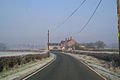
 Houses by the Knutsford Road (A50) - geograph.org.uk - 2779442.jpg 640 × 480; 63 KB
-
 Houses on Knutsford Road - geograph.org.uk - 3354322.jpg 1,024 × 747; 178 KB
-
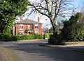
 Large houses in Grappenhall - geograph.org.uk - 733796.jpg 640 × 480; 82 KB
-
 Loaded - geograph.org.uk - 131688.jpg 640 × 426; 112 KB
-
 Narrow boats on the Bridgewater Canal - geograph.org.uk - 39271.jpg 640 × 480; 130 KB
-
 Opening gambit - geograph.org.uk - 109019.jpg 640 × 426; 182 KB
-
 St. Wilfrid's Church, Grappenhall - geograph.org.uk - 131683.jpg 640 × 426; 112 KB
-
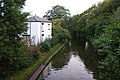 The Bridgewater Canal at Grappenhall - geograph.org.uk - 3702547.jpg 3,872 × 2,592; 4.41 MB
-
 The Spingbrook pub, Grappenhall - geograph.org.uk - 3354327.jpg 1,024 × 582; 111 KB
-

-
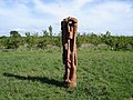 Wood sculpture in Grappenhall Wood - geograph.org.uk - 39804.jpg 640 × 480; 107 KB
-
 Whitehouse Farm - geograph.org.uk - 131686.jpg 640 × 426; 72 KB


_-_geograph.org.uk_-_2779442.jpg)


