Category:Great Ellingham
English: Great Ellingham is a village situated in the Breckland District of Norfolk and covers an area of 1114 hectares (4.3 square miles) with a population of 1108 as of UK census 2001, though the district's 2007 estimate suggests that this may have risen to 1165. The village lies 2.5 miles north west of Attleborough, 2 miles south east of its sister village of Little Ellingham and 12 miles by road south from Dereham.
village in Norfolk, England, UK | |||||
| Upload media | |||||
| Instance of | |||||
|---|---|---|---|---|---|
| Location | Breckland, Norfolk, East of England, England | ||||
| Area |
| ||||
 | |||||
Subcategories
This category has the following 3 subcategories, out of 3 total.
E
J
S
Media in category "Great Ellingham"
The following 167 files are in this category, out of 167 total.
-

-
 A group of trees beside the road - geograph.org.uk - 4096212.jpg 640 × 480; 204 KB
-
 A personal tribute on what was Deopham Airfield Runway - geograph.org.uk - 5866547.jpg 3,456 × 2,592; 3.92 MB
-
 A relic of RAF Deopham Green and WW2 - geograph.org.uk - 5866460.jpg 3,456 × 2,592; 3.91 MB
-

-
 Anchor Corner meets the Watton Road - geograph.org.uk - 378129.jpg 640 × 480; 95 KB
-

-
 Attractive thatched cottage - geograph.org.uk - 704315.jpg 640 × 480; 115 KB
-
 Bean crop by Stallard Farm - geograph.org.uk - 4096240.jpg 640 × 480; 198 KB
-

-

-

-

-
 Cherry Tree Farm House - geograph.org.uk - 2245621.jpg 640 × 480; 115 KB
-
 Cherry Tree Farm, Great Ellingham - geograph.org.uk - 2243933.jpg 640 × 463; 99 KB
-
 Concreted road on Deopham airfield - geograph.org.uk - 4096196.jpg 640 × 480; 143 KB
-
 Cottage in Penhill Lane - geograph.org.uk - 2229697.jpg 640 × 455; 119 KB
-
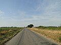
 Country road near Great Ellingham - geograph.org.uk - 5305068.jpg 640 × 480; 127 KB
-
 Crop field on the old aerodrome - geograph.org.uk - 4096305.jpg 640 × 480; 185 KB
-
 Cultivated field east of Great Ellingham - geograph.org.uk - 2244246.jpg 640 × 480; 166 KB
-

-
 Deopham airfield memorial - geograph.org.uk - 5866526.jpg 3,456 × 2,592; 3.87 MB
-
 Deopham airfield memorial - geograph.org.uk - 5866534.jpg 3,456 × 2,592; 3.94 MB
-

-

-
 Driveway to Penhill Farm, Rockland All Saints - geograph.org.uk - 5866371.jpg 3,456 × 2,592; 3.81 MB
-
 Entering Great Ellingham from the west - geograph.org.uk - 5866456.jpg 3,456 × 2,592; 3.99 MB
-
 Entrance to Broadland Poultry Limited - geograph.org.uk - 4096243.jpg 640 × 476; 167 KB
-
 Exiting the layby onto Attleborough Road at Gt. Ellingham - geograph.org.uk - 5866486.jpg 3,456 × 2,592; 3.86 MB
-
 Farmland near Little Ellingham - geograph.org.uk - 3719115.jpg 2,592 × 1,944; 2.4 MB
-
 Fields at Bush Green - geograph.org.uk - 4096155.jpg 640 × 480; 233 KB
-
 Fields by Stalland Common - geograph.org.uk - 4096224.jpg 640 × 480; 151 KB
-

-

-

-
 Great Ellingham entrance sign - geograph.org.uk - 2282291.jpg 640 × 441; 52 KB
-
 Great Ellingham Mill.jpg 640 × 480; 147 KB
-
 Great Ellingham St James (war memorial) - geograph.org.uk - 5189345.jpg 556 × 640; 461 KB
-
 Great Ellingham St James (war memorial) - geograph.org.uk - 5189348.jpg 480 × 640; 360 KB
-

-
 Great Ellingham towermill - geograph.org.uk - 2229678.jpg 640 × 477; 168 KB
-
 Great Ellingham towermill - geograph.org.uk - 2229683.jpg 510 × 640; 172 KB
-
 Great Ellingham towermill - geograph.org.uk - 2229685.jpg 505 × 640; 145 KB
-
 Great Ellingham Village Sign - geograph.org.uk - 5585532.jpg 480 × 640; 105 KB
-
 Hardstanding left over from WW2 - geograph.org.uk - 5866466.jpg 3,456 × 2,592; 3.92 MB
-
 Hardstanding north of Attleborough Road - geograph.org.uk - 4096239.jpg 640 × 480; 163 KB
-
 Hardstanding on Deopham airfield - geograph.org.uk - 4096204.jpg 640 × 480; 196 KB
-
 Hardstanding on the Industrial Estate - geograph.org.uk - 4096277.jpg 640 × 612; 157 KB
-
 Hardstanding which was once part of Deopham Airfield runway - geograph.org.uk - 6160386.jpg 3,300 × 2,475; 2.07 MB
-
 High View, in Long Street - geograph.org.uk - 2229655.jpg 640 × 480; 117 KB
-
 Houses in Penhill Lane - geograph.org.uk - 2229702.jpg 640 × 448; 108 KB
-
 Industrial estate at Stalland Common - geograph.org.uk - 4096263.jpg 640 × 480; 138 KB
-
 Industrial estate at Stalland Common - geograph.org.uk - 4096264.jpg 640 × 480; 154 KB
-
 Industrial estate at Stalland Common - geograph.org.uk - 4096265.jpg 640 × 549; 189 KB
-
 Industrial estate at Stalland Common - geograph.org.uk - 4096267.jpg 640 × 480; 187 KB
-
 Industrial estate at Stalland Common - geograph.org.uk - 4096268.jpg 640 × 480; 184 KB
-
 Industrial shed by Bush Green - geograph.org.uk - 2434708.jpg 640 × 480; 162 KB
-

-
 Large shed at Stalland Common - geograph.org.uk - 4096231.jpg 640 × 480; 107 KB
-
 Layby and access road - geograph.org.uk - 5866483.jpg 3,456 × 2,592; 3.96 MB
-
 Long Street, Great Ellingham - geograph.org.uk - 5866637.jpg 3,456 × 2,592; 3.9 MB
-
 Lorries parked on hardstanding - geograph.org.uk - 4096278.jpg 640 × 480; 160 KB
-
 Major Horace G Oliver's house - geograph.org.uk - 4096289.jpg 640 × 473; 178 KB
-
 Major Horace G Oliver's house - geograph.org.uk - 4096293.jpg 640 × 480; 212 KB
-
 Mill Lane, Great Ellingham - geograph.org.uk - 4518237.jpg 1,024 × 768; 280 KB
-
 Minor road across Deopham airfield - geograph.org.uk - 4096198.jpg 640 × 480; 156 KB
-
 New house in Penhill Lane - geograph.org.uk - 2229699.jpg 640 × 480; 97 KB
-
 Nice place for B^B - geograph.org.uk - 2084883.jpg 1,280 × 960; 309 KB
-

-

-

-

-

-
 Old concreted road - geograph.org.uk - 4096187.jpg 640 × 470; 148 KB
-
 Old concreted road - geograph.org.uk - 4096245.jpg 640 × 480; 172 KB
-
 Old latrine building - geograph.org.uk - 4096285.jpg 640 × 480; 170 KB
-
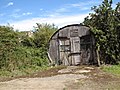
 Old Nissen hut beside the road - geograph.org.uk - 4096170.jpg 640 × 480; 245 KB
-
 Old RAF building - geograph.org.uk - 4096246.jpg 640 × 480; 190 KB
-
 Old water tank - geograph.org.uk - 4096253.jpg 480 × 640; 304 KB
-
 Once a runway, now a highway - geograph.org.uk - 5866594.jpg 3,456 × 2,592; 3.96 MB
-
 Ordnance Survey Cut Mark - geograph.org.uk - 4217826.jpg 640 × 480; 137 KB
-
 Overgrown RAF building - geograph.org.uk - 4096237.jpg 640 × 480; 254 KB
-

-
 Path alongside a ditch by Penhill Farm - geograph.org.uk - 2229691.jpg 640 × 480; 159 KB
-
 Penhill Farm, between Rockland and Gt. Ellingham - geograph.org.uk - 5866445.jpg 3,456 × 2,592; 3.85 MB
-
 Post Box in Lay-by - geograph.org.uk - 377989.jpg 640 × 480; 133 KB
-

-
 Primitive Methodist Chapel - geograph.org.uk - 704335.jpg 640 × 452; 97 KB
-
 RAF building beside Hingham Road - geograph.org.uk - 4096283.jpg 640 × 480; 260 KB
-
 RAF buildings beside the road - geograph.org.uk - 4096168.jpg 640 × 480; 208 KB
-
 Red House Cottage in Long Street - geograph.org.uk - 2229653.jpg 640 × 480; 112 KB
-

-
 Remains of the main runway - geograph.org.uk - 4096202.jpg 640 × 480; 154 KB
-
 Residential windmill - geograph.org.uk - 2084908.jpg 960 × 1,280; 381 KB
-
 Ripening barley by Bush Green Farm - geograph.org.uk - 4096158.jpg 640 × 480; 182 KB
-
 Runway 06 Deopham Green - geograph.org.uk - 2083973.jpg 1,280 × 960; 201 KB
-
 Runway reduced to farm track - geograph.org.uk - 4096216.jpg 640 × 480; 164 KB
-
 Sentry hut beside track - geograph.org.uk - 4096162.jpg 640 × 480; 215 KB
-
 Shrugg's Lane, Great Ellingham - geograph.org.uk - 2243945.jpg 640 × 480; 179 KB
-
 Shrugg's Lane, Great Ellingham - geograph.org.uk - 2243984.jpg 640 × 480; 142 KB
-
 Shrugg's Lane, Great Ellingham - geograph.org.uk - 5866469.jpg 3,456 × 2,592; 3.99 MB
-
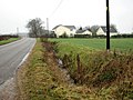
 Side Road to Hospital - geograph.org.uk - 377979.jpg 640 × 480; 92 KB
-
 St James's Church - geograph.org.uk - 2084899.jpg 960 × 1,280; 243 KB
-

-
 Stubble field at White House Farm - geograph.org.uk - 5866473.jpg 3,456 × 2,592; 3.97 MB
-
 Stubble field by Stallard Farm - geograph.org.uk - 4096220.jpg 640 × 480; 197 KB
-
 Stubble field on the old airfield - geograph.org.uk - 4096176.jpg 640 × 480; 182 KB
-
 Thatched Cottage - geograph.org.uk - 378017.jpg 640 × 480; 107 KB
-
 Thatched cottage and millpond - geograph.org.uk - 704330.jpg 640 × 480; 157 KB
-
 The Breckland Lodge - geograph.org.uk - 5515045.jpg 640 × 434; 63 KB
-
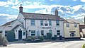
 The Crown - geograph.org.uk - 2084885.jpg 1,280 × 960; 269 KB
-
 The Crown pub.jpg 2,953 × 1,679; 1.16 MB
-
 The Manse in Great Ellingham - geograph.org.uk - 2229664.jpg 640 × 486; 119 KB
-
 The NW-SE runway - geograph.org.uk - 4096215.jpg 640 × 480; 188 KB
-
 The old borehole pump house - geograph.org.uk - 4096233.jpg 640 × 480; 235 KB
-

-
 The remains of a shower block - geograph.org.uk - 4096251.jpg 635 × 640; 288 KB
-
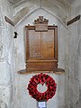 The War Memorial in Great Ellingham church - geograph.org.uk - 4518357.jpg 2,592 × 3,456; 3.03 MB
-
 TheCrownAtNight.jpg 2,560 × 1,920; 980 KB
-
 To Great Ellingham on Penhill Lane - geograph.org.uk - 2229693.jpg 640 × 437; 101 KB
-
 To the B1077 road on Shrugg's Lane - geograph.org.uk - 2244236.jpg 640 × 480; 146 KB
-
 Track into the Sub-ordnance depot site - geograph.org.uk - 4096234.jpg 640 × 480; 236 KB
-

-
 Trim thatch - geograph.org.uk - 2084890.jpg 1,280 × 960; 224 KB
-
 View across Deopham Green airfield - geograph.org.uk - 4096181.jpg 640 × 480; 195 KB
-

-

-

-

-
 View along the runway - geograph.org.uk - 4096304.jpg 640 × 480; 173 KB
-
 View towards buildings on Stallard Farm - geograph.org.uk - 4096218.jpg 640 × 480; 215 KB
-
 View towards Stalland Common - geograph.org.uk - 4096194.jpg 640 × 462; 174 KB
-
 Village post office - geograph.org.uk - 2084912.jpg 1,280 × 960; 253 KB
-
 War Memorial plaque on Gt. Ellingham church tower - geograph.org.uk - 5863379.jpg 2,592 × 3,456; 3.26 MB
-
 Wind turbine, Great Ellingham - geograph.org.uk - 4351421.jpg 1,280 × 1,024; 201 KB
-
 WW2 aviator goggles - geograph.org.uk - 4096271.jpg 640 × 480; 285 KB
-
 Ye Olde Thatched Shoppe.jpg 2,542 × 1,691; 979 KB
-
 Bridleway from Penhill Lane - geograph.org.uk - 378051.jpg 640 × 480; 84 KB
-
 Bush Green Farm - geograph.org.uk - 702153.jpg 640 × 480; 107 KB
-
 Cereal field beside Hingham Road - geograph.org.uk - 704271.jpg 640 × 437; 90 KB
-
 Entrance to Portwood Farm - geograph.org.uk - 377950.jpg 640 × 480; 121 KB
-
 Farm track leading east - geograph.org.uk - 704286.jpg 480 × 640; 143 KB
-
 Farmtrack off Stalland Lane - geograph.org.uk - 772750.jpg 640 × 480; 151 KB
-

-
 Footpath Gate and Track into Goose Common - geograph.org.uk - 378110.jpg 640 × 480; 115 KB
-
 Garden Centre, West Carr - geograph.org.uk - 382538.jpg 640 × 480; 106 KB
-
 Gate and Driveway to Penhill Farm - geograph.org.uk - 378061.jpg 640 × 480; 78 KB
-
 Goose Common - geograph.org.uk - 378100.jpg 640 × 480; 102 KB
-

-
 Green Lane (Track) - geograph.org.uk - 377970.jpg 640 × 480; 116 KB
-
 Horsy business at Lyngwhite Farm - geograph.org.uk - 536615.jpg 640 × 480; 146 KB
-

-
 Left to Bush Green - geograph.org.uk - 702144.jpg 640 × 480; 84 KB
-
 Looking down Swamp Lane - geograph.org.uk - 378001.jpg 640 × 480; 84 KB
-
 Looking north along Hingham Road - geograph.org.uk - 704283.jpg 640 × 480; 117 KB
-
 Looks like a chicken farm - geograph.org.uk - 704295.jpg 640 × 454; 113 KB
-
 New Development at Bow Street - geograph.org.uk - 378166.jpg 640 × 480; 63 KB
-

-
 Not painted, yet - geograph.org.uk - 702179.jpg 480 × 640; 123 KB
-
 Road along Disused Airfield Runway - geograph.org.uk - 377884.jpg 640 × 480; 61 KB
-
 Road along Disused Airfield Runway - geograph.org.uk - 377895.jpg 640 × 480; 100 KB
-

-
 St James's church - churchyard - geograph.org.uk - 702122.jpg 480 × 640; 119 KB
-
 Tanyard Farm - geograph.org.uk - 377960.jpg 640 × 480; 114 KB
-
 The former Deopham airfield - geograph.org.uk - 702157.jpg 640 × 480; 125 KB
-
 This year's cereal crop - geograph.org.uk - 704260.jpg 640 × 452; 100 KB
-
 View southwest along Church Street - geograph.org.uk - 702128.jpg 480 × 640; 140 KB


_-_geograph.org.uk_-_5189345.jpg)
_-_geograph.org.uk_-_5189348.jpg)


_-_geograph.org.uk_-_377970.jpg)


