Category:Greetham with Somersby
Greetham with Somersby is a civil parish in the East Lindsey district of Lincolnshire, England.

civil parish in Lincolnshire, UK | |||||
| Upload media | |||||
| Instance of | |||||
|---|---|---|---|---|---|
| Named after | |||||
| Location | East Lindsey, Lincolnshire, East Midlands, England | ||||
 | |||||
Subcategories
This category has the following 13 subcategories, out of 13 total.
Media in category "Greetham with Somersby"
The following 159 files are in this category, out of 159 total.
-
 A158 west of Highfield Farm - geograph.org.uk - 3661958.jpg 640 × 481; 37 KB
-
-
 Approaching Bag Enderby - geograph.org.uk - 1939231.jpg 640 × 480; 113 KB
-

-
 Asymmetric verges on Long Hedge Lane - geograph.org.uk - 3598952.jpg 1,024 × 768; 158 KB
-
 Bag Enderby view - geograph.org.uk - 2075278.jpg 640 × 426; 72 KB
-
 Bag Enderby, Guide Post - geograph.org.uk - 5747037.jpg 1,280 × 960; 562 KB
-
 Barn Holt - geograph.org.uk - 2046527.jpg 640 × 426; 90 KB
-
 Barn Holt - geograph.org.uk - 5174326.jpg 640 × 480; 77 KB
-
 Barn Holt Lane - geograph.org.uk - 2046530.jpg 640 × 426; 98 KB
-
 Barn Holt Plantation - geograph.org.uk - 2046532.jpg 640 × 426; 91 KB
-

-

-

-
 Bridge over Brook, near Old Woman's Holt - geograph.org.uk - 3087706.jpg 1,504 × 2,256; 1.56 MB
-
 Bridge Road, leading to Somersby - geograph.org.uk - 3924677.jpg 640 × 427; 98 KB
-
 Bridleway near Fulletby - geograph.org.uk - 1878357.jpg 640 × 480; 138 KB
-
 Bridleway near Fulletby - geograph.org.uk - 1878374.jpg 480 × 640; 60 KB
-
 Bridleway near Fulletby - geograph.org.uk - 1884194.jpg 640 × 480; 141 KB
-
 Bridleway near Fulletby - geograph.org.uk - 1884220.jpg 640 × 480; 97 KB
-
 Bridleway near Fulletby - geograph.org.uk - 1884261.jpg 640 × 480; 89 KB
-
 Bridleway to Somersby - geograph.org.uk - 3546023.jpg 640 × 427; 42 KB
-
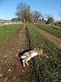 Casualty - geograph.org.uk - 4831562.jpg 3,700 × 4,957; 5.7 MB
-

-
 Church gates - geograph.org.uk - 4033486.jpg 1,024 × 683; 363 KB
-
 Church path - geograph.org.uk - 4033476.jpg 1,024 × 683; 261 KB
-
 Churchyard Cross - geograph.org.uk - 4029918.jpg 683 × 1,024; 259 KB
-
 Cottage and barn in Bag Enderby - geograph.org.uk - 3924700.jpg 640 × 427; 92 KB
-

-
 Crop and fallow land by Fox Covert - geograph.org.uk - 4045243.jpg 640 × 427; 54 KB
-
 Crossroads at the 109 metre spot height - geograph.org.uk - 3599331.jpg 1,024 × 768; 135 KB
-
 Cut Mark, Bag Enderby, Guide Post - geograph.org.uk - 5747035.jpg 1,280 × 960; 480 KB
-
 Cut Mark, Greetham, by Cliff Carr, Ruin - geograph.org.uk - 6126676.jpg 1,280 × 960; 253 KB
-
 Cut Mark, Somersby, Wardenhill Farm - geograph.org.uk - 5746214.jpg 1,280 × 960; 652 KB
-

-

-
 Disused cart - geograph.org.uk - 2046535.jpg 640 × 426; 131 KB
-
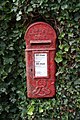 Edwardian postbox - geograph.org.uk - 2041827.jpg 426 × 640; 133 KB
-
-
 Fairy Wood, Bag Enderby - geograph.org.uk - 4044957.jpg 640 × 427; 63 KB
-
-
 Farm building at Wardenhill Farm, Somersby - geograph.org.uk - 5746217.jpg 1,280 × 960; 484 KB
-
 Farm buildings at Bag Enderby - geograph.org.uk - 4150047.jpg 1,600 × 1,200; 492 KB
-
 Farm ruin by Barn Holt - geograph.org.uk - 4831564.jpg 5,184 × 3,888; 6.63 MB
-

-
 Farmland, Thunker Hollow - geograph.org.uk - 3491278.jpg 640 × 480; 62 KB
-
 Field of Wheat - geograph.org.uk - 530074.jpg 640 × 428; 84 KB
-
 Field off Jolls Lane - geograph.org.uk - 3266469.jpg 2,256 × 1,504; 1.12 MB
-
 Flag Iris - geograph.org.uk - 4305892.jpg 682 × 1,024; 143 KB
-
 Footpath and Finger Post - geograph.org.uk - 5174479.jpg 640 × 480; 71 KB
-
 Footpath at edge of crops - geograph.org.uk - 6215895.jpg 1,024 × 683; 233 KB
-
 Footpath to Ashby Puerorum - geograph.org.uk - 3912673.jpg 640 × 427; 63 KB
-
 Footpath toward Hoe Hill - geograph.org.uk - 6215896.jpg 1,024 × 683; 241 KB
-
 Ford and footbridge - geograph.org.uk - 5174314.jpg 640 × 480; 119 KB
-
 Ford and Footbridge on Bridleway near Bag Enderby - geograph.org.uk - 1858386.jpg 3,872 × 2,592; 2.4 MB
-
 Ford on the bridleway to Hagworthingham - geograph.org.uk - 3924705.jpg 640 × 427; 107 KB
-
 Former cattle pens near Horncastle - geograph.org.uk - 2968512.jpg 640 × 480; 75 KB
-
 Gaps at the edge of a wheatfield - geograph.org.uk - 3598950.jpg 1,024 × 768; 158 KB
-
 Gates at entrance to track off A158 - geograph.org.uk - 2640491.jpg 1,280 × 960; 377 KB
-
 George Littlebury - geograph.org.uk - 4029867.jpg 775 × 1,024; 257 KB
-
 Greetham, by Cliff Carr, Ruin - geograph.org.uk - 6126679.jpg 1,280 × 960; 221 KB
-
 Grimsby Ice Company hand cart - geograph.org.uk - 3912687.jpg 640 × 427; 90 KB
-
 Hagworthingham, aerial 2016 - geograph.org.uk - 5229214.jpg 427 × 640; 71 KB
-
 Hagworthingham, aerial 2016 - geograph.org.uk - 5229223.jpg 640 × 427; 60 KB
-
 Hall Farm - geograph.org.uk - 5174330.jpg 640 × 480; 57 KB
-
 Hall Farmhouse, Bag Enderby (geograph 7224978).jpg 1,024 × 768; 213 KB
-
 Hare Crossing - geograph.org.uk - 2919392.jpg 1,058 × 660; 692 KB
-
 Harrington Hall, aerial 2014 - geograph.org.uk - 3891932.jpg 1,024 × 712; 119 KB
-

-
 Hoe Hill, aerial 2014 - geograph.org.uk - 3891850.jpg 1,024 × 683; 126 KB
-
 Holbeck Manor from Hoe Hill - geograph.org.uk - 3911984.jpg 640 × 427; 54 KB
-

-
 Icy track north of Bag Enderby - geograph.org.uk - 4831560.jpg 3,888 × 5,184; 6.13 MB
-
 Interior, St Andrew's church, Ashby Puerorum - geograph.org.uk - 5432828.jpg 4,662 × 3,061; 5.81 MB
-
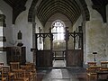
 Interior, St Margaret's church, Somersby - geograph.org.uk - 5433129.jpg 2,968 × 4,526; 5.94 MB
-
 Ivy House - geograph.org.uk - 2041718.jpg 640 × 426; 122 KB
-
 Ivy House barn - geograph.org.uk - 2075186.jpg 640 × 426; 94 KB
-
 Ivy House, Bag Enderby (geograph 7224919).jpg 1,024 × 768; 313 KB
-
-
 Junction of Long Hedge Lane and the A158 - geograph.org.uk - 3912730.jpg 1,024 × 683; 110 KB
-
 Lake near Holbeck Manor - geograph.org.uk - 2640486.jpg 1,280 × 960; 287 KB
-
-
 Lane north of Knowle Carr - geograph.org.uk - 4831477.jpg 5,184 × 3,888; 5.77 MB
-
 Lane to the church in Bag Enderby - geograph.org.uk - 3924695.jpg 640 × 427; 106 KB
-
 Lincolnshire Wolds View - geograph.org.uk - 4831453.jpg 5,077 × 3,695; 4.17 MB
-
 Lone pine by the bridleway to Hagworthingham - geograph.org.uk - 3924704.jpg 1,024 × 683; 157 KB
-
 Long Hedge Lane view of A158 - geograph.org.uk - 1938050.jpg 640 × 480; 44 KB
-
 Long Hedge Lane, looking north - geograph.org.uk - 3598944.jpg 979 × 740; 146 KB
-

-

-
 Lytleburye Brasses, St Andrew's church, Ashby Puerorum - geograph.org.uk - 5429797.jpg 3,120 × 4,624; 7.79 MB
-
 Melbourn'e Hill - geograph.org.uk - 3925097.jpg 640 × 427; 40 KB
-
 Memorial, St Margaret's church, Somersby - geograph.org.uk - 5433142.jpg 2,640 × 4,352; 4.66 MB
-
 Millam's Hill - geograph.org.uk - 3925091.jpg 1,024 × 683; 112 KB
-

-

-
 Old Ivy Farmhouse - geograph.org.uk - 2041814.jpg 640 × 426; 77 KB
-
 Paradise Holt - geograph.org.uk - 2041756.jpg 640 × 426; 104 KB
-
 Path through Paradise Holt - geograph.org.uk - 4831569.jpg 3,888 × 5,184; 6.8 MB
-
 Ploughed field - geograph.org.uk - 5174482.jpg 640 × 480; 54 KB
-
 Power lines crossing a wheatfield - geograph.org.uk - 3598948.jpg 1,024 × 768; 142 KB
-
 Private track to Beech Farm - geograph.org.uk - 3598954.jpg 1,024 × 768; 155 KB
-
 Public footpath - geograph.org.uk - 5174358.jpg 640 × 480; 69 KB
-

-

-

-
 River Lymn ford - geograph.org.uk - 2046483.jpg 640 × 426; 162 KB
-

-

-
 Road leading to Ashby Puerorum - geograph.org.uk - 4150033.jpg 1,600 × 1,200; 543 KB
-
 Road to Stainsby - geograph.org.uk - 3087712.jpg 2,256 × 1,504; 899 KB
-
 Roadside pond at Greetham - geograph.org.uk - 6210858.jpg 1,024 × 683; 283 KB
-
 Rushes in a marshy pasture next to Hoe Hill - geograph.org.uk - 3911951.jpg 1,024 × 683; 104 KB
-
 Salmonby sandstone outcrops - geograph.org.uk - 3924670.jpg 640 × 427; 100 KB
-
 Salmonby sandstone outcrops - geograph.org.uk - 3924674.jpg 640 × 427; 106 KB
-
 Salmonby sandstone outcrops - geograph.org.uk - 3924675.jpg 1,024 × 683; 219 KB
-
 Salmonby, former cattle pens - geograph.org.uk - 3912768.jpg 800 × 533; 55 KB
-

-

-

-

-
-
 Spalding U3A walking group - geograph.org.uk - 5174321.jpg 640 × 480; 136 KB
-
 St Andrew's church, Ashby Puerorum - geograph.org.uk - 5429792.jpg 4,928 × 3,264; 4.89 MB
-
 St Margaret's Church - geograph.org.uk - 5174337.jpg 640 × 480; 94 KB
-
 St Margaret's Church - geograph.org.uk - 5174342.jpg 640 × 480; 64 KB
-
 St Margaret's Church - geograph.org.uk - 5174344.jpg 640 × 480; 71 KB
-
 St Margaret's church, Bag Enderby - geograph.org.uk - 5436306.jpg 4,024 × 2,700; 4.76 MB
-
 St Margaret's church, Somersby - geograph.org.uk - 5433122.jpg 4,511 × 2,980; 7.79 MB
-
 St.Margaret's church - geograph.org.uk - 4028450.jpg 1,024 × 683; 297 KB
-
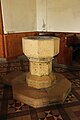 St.Margaret's font - geograph.org.uk - 4028470.jpg 683 × 1,024; 129 KB
-
 St.Margaret's nave - geograph.org.uk - 4028457.jpg 1,024 × 683; 174 KB
-
 Stainsby Gate Cottages - geograph.org.uk - 4030252.jpg 1,024 × 683; 233 KB
-
 Stubble field - geograph.org.uk - 5174481.jpg 640 × 480; 73 KB
-
 Tennyson Bust, St Margaret's church, Somersby - geograph.org.uk - 5433147.jpg 2,703 × 4,357; 5.67 MB
-
 Tetford Lane - geograph.org.uk - 2643060.jpg 1,280 × 960; 312 KB
-
 The anonymous lane from Greetham to Belchford - geograph.org.uk - 3598958.jpg 1,024 × 768; 120 KB
-

-
 Thunker Hollow heading westwards - geograph.org.uk - 1218565.jpg 640 × 480; 67 KB
-
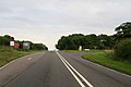
 Thunker Hollow on the A158 - geograph.org.uk - 423860.jpg 640 × 480; 69 KB
-

-
 Track at edge of Fairy Wood - geograph.org.uk - 2919441.jpg 682 × 1,024; 290 KB
-
 Track to Ashby Puerorum - geograph.org.uk - 2640499.jpg 1,280 × 960; 350 KB
-
 Track to Wetherton Hill Plantation - geograph.org.uk - 3089609.jpg 2,256 × 1,504; 1.28 MB
-
 Track to White House Farm - geograph.org.uk - 3087036.jpg 2,256 × 1,504; 1.13 MB
-
 Track to White House Farm - geograph.org.uk - 6210854.jpg 1,024 × 683; 185 KB
-
 Trees along Tetford Road - geograph.org.uk - 3599328.jpg 640 × 480; 86 KB
-
-
 Tyre tracks and weeds at a field entrance - geograph.org.uk - 3599318.jpg 1,024 × 768; 172 KB
-
 Unclassified County Road to Winceby - geograph.org.uk - 3925064.jpg 640 × 427; 96 KB
-
 Unclassified County Road to Winceby - geograph.org.uk - 3925067.jpg 1,024 × 683; 113 KB
-
 Warden Hill (113m) from Clay Lane - geograph.org.uk - 3972002.jpg 640 × 427; 86 KB
-
-
 Wetherton Hill view - geograph.org.uk - 642425.jpg 640 × 427; 52 KB
-
 Willow Bank Wood - geograph.org.uk - 3545979.jpg 640 × 427; 90 KB
-
 Winter wheat starting to show - geograph.org.uk - 5174375.jpg 640 × 480; 49 KB
-
 Wold Cottage - geograph.org.uk - 4035927.jpg 1,024 × 683; 301 KB
-
 Wolds view - geograph.org.uk - 700841.jpg 640 × 427; 50 KB
-


.jpg)


.jpg)


_-_geograph.org.uk_-_6361355.jpg)
_-_geograph.org.uk_-_6361358.jpg)


_-_geograph.org.uk_-_5391323.jpg)
_-_geograph.org.uk_-_5391326.jpg)


_from_Clay_Lane_-_geograph.org.uk_-_3972002.jpg)
_from_the_old_Roman_Road_(course_of)_-_geograph.org.uk_-_3972157.jpg)


