Category:Grendon, Warwickshire
civil parish in North Warwickshire, Warwickshire, England | |||||
| Upload media | |||||
| Instance of | |||||
|---|---|---|---|---|---|
| Location | North Warwickshire, Warwickshire, West Midlands, England | ||||
| Population |
| ||||
| Area |
| ||||
 | |||||
English: Grendon, Warwickshire is technically one, but logically two small villages situated three miles (5 km) west of Atherstone and five miles (8 km) east of Tamworth. (.)
Subcategories
This category has the following 2 subcategories, out of 2 total.
G
W
- Whittington, Warwickshire (1 F)
Media in category "Grendon, Warwickshire"
The following 115 files are in this category, out of 115 total.
-

-
 A5 Watling Street in Grendon - geograph.org.uk - 4877305.jpg 640 × 480; 44 KB
-
 Alder Mill across the mill pond. - geograph.org.uk - 1415834.jpg 640 × 480; 179 KB
-
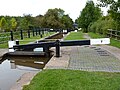
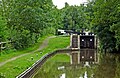
 Atherstone Bottom Lock No 11 - geograph.org.uk - 4834691.jpg 800 × 602; 153 KB
-

-
-

-

-

-
 Atherstone Locks - geograph.org.uk - 210826.jpg 640 × 480; 43 KB
-
 B5000 at Grendon - geograph.org.uk - 848424.jpg 640 × 480; 96 KB
-
 B5000 entering Warwickshire - geograph.org.uk - 848401.jpg 640 × 418; 75 KB
-
 B5000 heading east, Grendon - geograph.org.uk - 3852081.jpg 640 × 480; 96 KB
-
 Baddesley Bridge No 45 - geograph.org.uk - 4834465.jpg 800 × 570; 170 KB
-
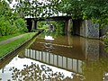
 Baddesley Railway Bridge No 44A - geograph.org.uk - 4834459.jpg 800 × 600; 142 KB
-
 Blue brick houses west of Atherstone - geograph.org.uk - 2756815.jpg 1,444 × 1,000; 1.02 MB
-
 Bradley Green - geograph.org.uk - 2226372.jpg 640 × 430; 104 KB
-
 Bradley Green - geograph.org.uk - 2834161.jpg 640 × 430; 44 KB
-
 Bradley Green - geograph.org.uk - 3657627.jpg 640 × 430; 54 KB
-
 Bradley Green - geograph.org.uk - 3851327.jpg 640 × 430; 44 KB
-
 Bradley Green - geograph.org.uk - 4894925.jpg 640 × 426; 43 KB
-
 Bradley Green Bridge No 48 - geograph.org.uk - 4834701.jpg 800 × 598; 182 KB
-
 Bradley Green Cottage - geograph.org.uk - 3367473.jpg 5,076 × 3,650; 3.67 MB
-
 Bradley Green Cottages - geograph.org.uk - 4199872.jpg 1,024 × 768; 78 KB
-
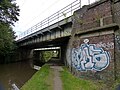
 Bridge No 46 on the Coventry Canal - geograph.org.uk - 4834669.jpg 800 × 602; 172 KB
-
-

-
 Canal at Atherstone Locks in Warwickshire - geograph.org.uk - 5710481.jpg 1,280 × 852; 1.28 MB
-
 Canal wharf at Atherstone - geograph.org.uk - 5047709.jpg 640 × 427; 103 KB
-
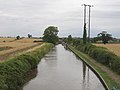
 Coventry Canal - geograph.org.uk - 210828.jpg 640 × 480; 62 KB
-
-
 Coventry Canal near Whitley Bridge No 47 - geograph.org.uk - 4834677.jpg 800 × 542; 104 KB
-

-
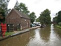
 Coventry Canal, Baddesley Basin - geograph.org.uk - 3143495.jpg 640 × 480; 57 KB
-
 Coventry Canal, Bradley Green Wharf - geograph.org.uk - 3143095.jpg 640 × 480; 82 KB
-

-

-

-

-
 Crop field and woodland near Grendon - geograph.org.uk - 3852083.jpg 640 × 480; 91 KB
-
 Crops in a field - geograph.org.uk - 4894929.jpg 640 × 426; 56 KB
-
 Crossing a frozen Coventry Canal - geograph.org.uk - 2226395.jpg 640 × 430; 146 KB
-
 Dairy House Farm - geograph.org.uk - 4363189.jpg 640 × 430; 35 KB
-
 Dairy House Farm - geograph.org.uk - 4761403.jpg 640 × 426; 43 KB
-
 Dark Brick House on the A5 - geograph.org.uk - 3836804.jpg 2,434 × 2,078; 2.14 MB
-
 Disused footbridge over Coventry Canal - geograph.org.uk - 413381.jpg 640 × 480; 106 KB
-
 Entering Leicestershire - geograph.org.uk - 3852087.jpg 640 × 480; 77 KB
-

-
-
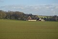
 Farmland and woodland, Grendon - geograph.org.uk - 3852080.jpg 640 × 480; 92 KB
-
 Farmland by Baddesley Bridge - geograph.org.uk - 3657623.jpg 640 × 292; 28 KB
-
 Farmland by Baddesley Bridge - geograph.org.uk - 3856434.jpg 640 × 430; 54 KB
-
 Farmland by the WCML - geograph.org.uk - 3657624.jpg 640 × 430; 39 KB
-
 Farmland by the West Coast Main Line - geograph.org.uk - 3856439.jpg 640 × 430; 44 KB
-
-
 Farmland near Bradley Green - geograph.org.uk - 2834168.jpg 640 × 430; 50 KB
-

-

-
 Farmland near Sparrowdale Wood - geograph.org.uk - 4761408.jpg 487 × 640; 39 KB
-
 Farmland next to the Coventry Canal - geograph.org.uk - 4834676.jpg 800 × 537; 145 KB
-

-
 Footbridge leading To Grendon Plantation - geograph.org.uk - 1933978.jpg 2,608 × 1,952; 1.71 MB
-
 Footpath to Fields Farm - geograph.org.uk - 3852078.jpg 480 × 640; 102 KB
-

-
 Freightliner train near Whittington - geograph.org.uk - 2511385.jpg 640 × 426; 54 KB
-
 Grendon, UK - panoramio (1).jpg 5,472 × 3,648; 5.44 MB
-
 Grendon, UK - panoramio (2).jpg 5,472 × 3,648; 6.46 MB
-
 Grendon, UK - panoramio (3).jpg 5,472 × 3,648; 8.03 MB
-
 Grendon, UK - panoramio.jpg 5,472 × 3,648; 7.07 MB
-
 Grendon, Warwickshire, Domed ceiling of Ice House.jpg 567 × 427; 117 KB
-
 Grendon, Warwickshire, entrance to Ice House.jpg 567 × 427; 124 KB
-

-
 Hedge, Dairy House Farm - geograph.org.uk - 4335285.jpg 640 × 430; 39 KB
-
 House built of Engineering Bricks - geograph.org.uk - 2756822.jpg 1,452 × 1,000; 774 KB
-
 Lock No 7 near Atherstone in Warwickshire - geograph.org.uk - 5711297.jpg 1,280 × 837; 1.45 MB
-
 Lock sidepond north-west of Atherstone, Warwickshire - geograph.org.uk - 5710510.jpg 1,280 × 960; 1.71 MB
-
 Lock sidepond north-west of Atherstone, Warwickshire - geograph.org.uk - 5710724.jpg 1,280 × 960; 1.94 MB
-
-
 Minor road heading north west - geograph.org.uk - 3852084.jpg 640 × 480; 77 KB
-
-
 Old Barn at Waste Hill - geograph.org.uk - 2731782.jpg 640 × 378; 74 KB
-
 Semis on Watling Street - geograph.org.uk - 3855504.jpg 4,245 × 2,476; 4.32 MB
-

-
 Sparrowdale Wood - geograph.org.uk - 4363184.jpg 640 × 430; 32 KB
-
 Sparrowdale Wood - geograph.org.uk - 5358574.jpg 640 × 426; 32 KB
-
 Sparrowdale Wood - geograph.org.uk - 5704335.jpg 640 × 426; 34 KB
-
-
 The Black Swan at Grendon, Staffs - geograph.org.uk - 2880310.jpg 640 × 425; 52 KB
-
 The Boot Inn - Grendon - geograph.org.uk - 3835434.jpg 3,501 × 2,868; 3.96 MB
-
 The Coventry Canal at Bradley Green - geograph.org.uk - 4834698.jpg 800 × 488; 142 KB
-
 TNT Distribution Centre - geograph.org.uk - 4894931.jpg 640 × 426; 56 KB
-
 TNT Distribution Centre - geograph.org.uk - 4902499.jpg 640 × 426; 46 KB
-
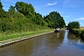
 Towpath along the Coventry Canal - geograph.org.uk - 4834694.jpg 800 × 619; 222 KB
-
 Trees in a hedge - geograph.org.uk - 5704336.jpg 640 × 542; 52 KB
-

-

-
 View from a Rugby-Crewe train - Outskirts of Atherstone - geograph.org.uk - 5819621.jpg 1,600 × 1,200; 520 KB
-
 View towards the wood - geograph.org.uk - 848417.jpg 640 × 480; 125 KB
-

-
 Watling Street - geograph.org.uk - 3855505.jpg 2,654 × 1,902; 2.04 MB
-
 West Coast Main Line (Trent Valley) near Atherstone - geograph.org.uk - 5711350.jpg 1,600 × 1,006; 1.88 MB
-
 West Coast Main Line (Trent Valley) near Atherstone - geograph.org.uk - 5711353.jpg 1,440 × 1,001; 1.74 MB
-
 Whitley Bridge No 47 - geograph.org.uk - 4834682.jpg 800 × 600; 152 KB
-
-

-

-

-
 Drive to Grendon House Farm - geograph.org.uk - 285457.jpg 640 × 316; 45 KB
-
 Field near Brook Farm - geograph.org.uk - 285462.jpg 640 × 421; 74 KB
-
 Lane past Brook House - geograph.org.uk - 285464.jpg 640 × 480; 103 KB
-
 North of Grendon - geograph.org.uk - 285466.jpg 615 × 640; 134 KB
-
 Roadside Trees - geograph.org.uk - 285458.jpg 640 × 293; 37 KB
-
 Royal Oak pub - geograph.org.uk - 337492.jpg 640 × 480; 64 KB
-
 The Paddy Line, Waste Hill - geograph.org.uk - 110779.jpg 480 × 640; 197 KB
-
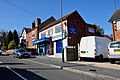
 The Smithy Farm Shop - geograph.org.uk - 124567.jpg 640 × 480; 93 KB


.jpg)
.jpg)
.jpg)


.jpg)


_near_Atherstone_-_geograph.org.uk_-_5711350.jpg)
_near_Atherstone_-_geograph.org.uk_-_5711353.jpg)


