Category:Grids (map and image overlays)
English: Grids which allow the setting of coordinates, for example on maps, and to reference features of images such as maps, plans, schematics, geophotographs, etc.
Media in category "Grids (map and image overlays)"
The following 17 files are in this category, out of 17 total.
-
 Azimutmessung,Meridiankonvergenz.JPG 487 × 566; 26 KB
-
 Bell telephone magazine (1922) (14756059322).jpg 2,512 × 1,494; 1.23 MB
-
 BritishCassiniGridMilitaryMap.jpg 4,150 × 2,443; 4.65 MB
-
 Division of the Earth into Gauss-Krueger zones - Globe.svg 948 × 948; 205 KB
-
 Division of the Earth into Gauss-Krueger zones - Net.svg 2,918 × 1,496; 2.71 MB
-
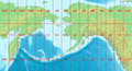 LA2-Bering-Sea-UTM-zones.png 960 × 516; 103 KB
-
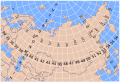
 LA2-India-UTM-zones.png 1,070 × 936; 222 KB
-
 Layout grid.gif 1,200 × 800; 32 KB
-
 Soviet topographic map codes.svg 251 × 172; 342 KB
-
 Soviet topographic map globe.svg 7,360 × 6,240; 1.01 MB
-
 Soviet topographic map kilometer grid.svg 630 × 654; 239 KB
-
 Soviet topographic map segmentation of N-36-41.svg 976 × 992; 118 KB
-
 Soviet topographic map segmentation of N-36.svg 974 × 948; 516 KB
-
 Strahlenbüschel.jpg 1,292 × 795; 212 KB
-
 US grid.png 616 × 415; 79 KB
-
 UTM-Zone.png 1,170 × 763; 37 KB
-
 World Map 1-2,500,000 grid.svg 1,278 × 640; 4.38 MB

_(14756059322).jpg)


