Category:Guadalupe Peak
| Object location | | View all coordinates using: OpenStreetMap |
|---|
highest point in the US state of Texas  | |||||
| Upload media | |||||
| Instance of | |||||
|---|---|---|---|---|---|
| Located in protected area | |||||
| Location | Texas | ||||
| Mountain range | |||||
| Topographic prominence |
| ||||
| Climbing route | |||||
| Elevation above sea level |
| ||||
 | |||||
Media in category "Guadalupe Peak"
The following 54 files are in this category, out of 54 total.
-
 Bush Mountain Trail.JPG 11,067 × 2,446; 20.02 MB
-
 Guadalupe Mountains and El Capitan 2006.jpg 3,072 × 2,048; 882 KB
-
 Guadalupe Mountains El Capitan 2006.jpg 3,072 × 2,048; 1.72 MB
-
 Guadalupe Mountains from Bush Mountain Trail.JPG 13,881 × 2,481; 25.88 MB
-
 Guadalupe Mountains March 2014.JPG 13,888 × 2,456; 24.33 MB
-
 Guadalupe Mountains National Park P1012848.jpg 2,288 × 1,712; 780 KB
-
 Guadalupe Nima1.JPG 3,264 × 1,785; 2 MB
-
 Guadalupe Nima2.JPG 3,264 × 2,235; 2.42 MB
-
 Guadalupe Nima6.JPG 3,264 × 2,043; 2.46 MB
-
 Guadalupe Peak and El Capitan from ridge.JPG 5,938 × 2,322; 8.88 MB
-
 Guadalupe Peak and El Capitan.jpg 590 × 380; 40 KB
-
 Guadalupe Peak at sunset 2006.JPG 3,072 × 2,048; 799 KB
-
 Guadalupe Peak Campground area.JPG 3,648 × 2,736; 3.66 MB
-
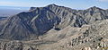
 Guadalupe Peak from Bowl Trail.JPG 7,913 × 2,515; 13.66 MB
-
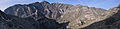
 Guadalupe Peak from Hunter Peak.jpg 6,160 × 3,168; 6.31 MB
-
 Guadalupe Peak from Tejas Trail - panoramio.jpg 12,714 × 2,528; 21.26 MB
-
 Guadalupe Peak from Tejas Trail 2014.JPG 6,488 × 2,397; 10.19 MB
-
 Guadalupe Peak from Tejas.JPG 4,288 × 2,848; 4.74 MB
-
 Guadalupe Peak from the trail DSC 5510 ad.JPG 3,872 × 2,592; 4.43 MB
-
 Guadalupe peak from top.jpg 1,000 × 750; 326 KB
-
 Guadalupe Peak from US Route 62 DSC 5499 ed ad.jpg 3,872 × 2,592; 4.08 MB
-
 Guadalupe Peak GUMO.jpg 3,648 × 2,736; 1.55 MB
-
 Guadalupe Peak March 2014.JPG 12,654 × 4,580; 45.89 MB
-
 Guadalupe Peak summit 2005-03-12.JPG 1,536 × 2,304; 1.35 MB
-
Guadalupe Peak sunset.webm 29 s, 1,077 × 606; 5.28 MB
-
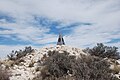
 Guadalupe Peak, Texas - National Historical Marker.JPG 5,472 × 3,648; 6.38 MB
-
 Guadalupe Peak.JPG 1,600 × 1,200; 972 KB
-
 GuadalupeMtns 2006 cropped.jpg 3,021 × 1,446; 1.29 MB
-
 GuadalupeMtsUSGS.jpg 1,400 × 1,067; 868 KB
-
 GuadalupePeakTexasOctober2012.JPG 2,848 × 4,272; 5.22 MB
-
 Guadlaupe Peak at right.JPG 6,708 × 2,791; 12.72 MB
-
 Gudalupe Peak from Hunter.JPG 4,288 × 2,848; 5.64 MB
-
 Gumo IMG 3971.jpg 1,620 × 1,080; 546 KB
-
 Gumo IMG 3998.jpg 1,620 × 1,080; 652 KB
-
 Gumo IMG 4099.jpg 1,620 × 1,080; 694 KB
-
 Lang 1935 GuadalupeMountains USGS.jpg 1,400 × 917; 593 KB
-
 Pine Spring Canyon and Guadalupe Peak from Tejas Trail - panoramio.jpg 8,677 × 2,262; 14.64 MB
-
 Pine Springs Canyon from Tejas Trail.JPG 12,100 × 2,431; 21.29 MB
-
 Summit of the Guadalupe Peak DSC 5528 ad.JPG 3,872 × 2,592; 3.91 MB
-
 Summit of the Guadalupe Peak DSC 5530 ad.JPG 3,872 × 2,592; 3.92 MB
-
 Summit of the Guadalupe Peak DSC 5539 ad.JPG 3,872 × 2,592; 4.22 MB
-
 Tejas Trail view of Pine Springs Canyon.JPG 9,850 × 2,393; 16.84 MB
-
 Texas - Guadalupe Peak - NARA - 68149389.jpg 6,923 × 5,485; 19.71 MB
-
 Texas - Guadalupe Peak - NARA - 68149395.jpg 6,923 × 5,485; 17.27 MB
-
 Texas - Guadalupe Peak - NARA - 68149397.jpg 6,923 × 5,485; 18.32 MB
-
 Texas - Guadalupe Peak - NARA - 68149399.jpg 6,923 × 5,485; 17.09 MB
-
 Texas - Guadalupe Peak - NARA - 68149401.jpg 6,923 × 5,485; 16.93 MB
-
 Texas - Guadalupe Peak - NARA - 68149403.jpg 6,923 × 5,485; 17.42 MB
-
 Top of Texas Pano.jpg 23,501 × 2,892; 10.13 MB
-
 USA Guadalupe Mountains from Linda Lake TX.jpg 2,272 × 1,704; 735 KB
-
 View from Bush Mountain Trail.JPG 12,483 × 2,180; 18.37 MB
-
 View from Hunter Peak.JPG 5,042 × 2,373; 9.34 MB
-
 ViewWestFromTopOfGuadalupePeakTexas.JPG 4,272 × 2,848; 3.12 MB
-
 West face of Guadalupe Mountains at sunset 2006.jpg 3,072 × 2,048; 735 KB


