Category:Guisborough
town in Redcar and Cleveland, North Yorkshire, England .jpg) | |||||
| Upload media | |||||
| Instance of | |||||
|---|---|---|---|---|---|
| Location | Redcar and Cleveland, North Yorkshire, North East England, England | ||||
| Replaced by | |||||
| Different from | |||||
| Said to be the same as | Guisborough (Wikimedia duplicated page, civil parish) | ||||
 | |||||
English: Guisborough is a village and a civil parish in Redcar and Cleveland, England
Subcategories
This category has the following 13 subcategories, out of 13 total.
B
G
- Guisborough War Memorial (3 F)
H
- Hutton Hall, Guisborough (5 F)
N
P
R
S
T
- Tockett's Mill (2 F)
Media in category "Guisborough"
The following 200 files are in this category, out of 750 total.
(previous page) (next page)-
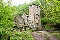 "SS Castle", Guibal Fan House, Lazenby Bank - geograph.org.uk - 4017663.jpg 2,990 × 1,994; 4.17 MB
-
 A clear view from Highcliff Nab to the south - geograph.org.uk - 1884471.jpg 2,816 × 2,112; 2.76 MB
-
 A fine day for a stroll up Roseberry - geograph.org.uk - 5973091.jpg 640 × 427; 83 KB
-

-
 A path leading to Park Lane - geograph.org.uk - 3098710.jpg 800 × 600; 83 KB
-
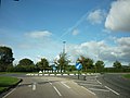 A roundabout on the A171 with the A173 - geograph.org.uk - 2656802.jpg 800 × 600; 218 KB
-

-
 A view of the eastern end of Gisborough Priory - geograph.org.uk - 5429855.jpg 4,708 × 3,579; 3.17 MB
-

-

-

-
 A171 heading east - geograph.org.uk - 2703450.jpg 640 × 490; 68 KB
-
 A171 heading east near Guisborough - geograph.org.uk - 2703464.jpg 800 × 537; 58 KB
-
 A171 heading east near Guisborough - geograph.org.uk - 2703471.jpg 640 × 480; 44 KB
-
 A171 towards Whitby - geograph.org.uk - 2703468.jpg 640 × 480; 41 KB
-
 A171 towards Whitby - geograph.org.uk - 2703483.jpg 640 × 480; 47 KB
-
 A171 Whitby Road - geograph.org.uk - 2648268.jpg 640 × 428; 73 KB
-
 A173 heading north - geograph.org.uk - 4813486.jpg 640 × 428; 152 KB
-
 A173 passes Pinchinthorpe House - geograph.org.uk - 2647781.jpg 640 × 428; 128 KB
-
 A173 Railway Bridge - geograph.org.uk - 954325.jpg 640 × 427; 268 KB
-
 A173 road bridge over the railway north of Great Ayton - geograph.org.uk - 5023816.jpg 1,600 × 1,200; 813 KB
-
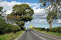
 A173 towards Guisborough - geograph.org.uk - 3841443.jpg 640 × 480; 50 KB
-
 Above Hanging Stone - geograph.org.uk - 5467901.jpg 1,920 × 1,280; 511 KB
-
 Access track to Barnaby Grange Farm - geograph.org.uk - 1717397.jpg 3,088 × 2,056; 4.2 MB
-
 Access track to Mill Farm - geograph.org.uk - 1630514.jpg 640 × 480; 60 KB
-
 Access track to Park Wood - geograph.org.uk - 1717486.jpg 3,088 × 2,056; 3.67 MB
-
 Aeroplane trails across the sky - geograph.org.uk - 2128510.jpg 640 × 480; 47 KB
-
 Apple Orchard Bank (A174) - geograph.org.uk - 3841417.jpg 640 × 480; 99 KB
-
 Approaching Eston Nab - geograph.org.uk - 5023676.jpg 1,600 × 1,200; 647 KB
-
 Approaching Howlbeck Mill Farm from the west - geograph.org.uk - 5822298.jpg 1,600 × 1,200; 599 KB
-
 Approaching Park Farm - geograph.org.uk - 5822283.jpg 1,600 × 1,200; 413 KB
-
 Approaching Poplar Farm from the north - geograph.org.uk - 5822234.jpg 1,600 × 1,200; 404 KB
-
 Approaching Spite Hall Farm - geograph.org.uk - 5023723.jpg 1,600 × 1,200; 460 KB
-
 Approaching Tocketts Mill - geograph.org.uk - 5822335.jpg 1,600 × 1,200; 1.13 MB
-
 Arable Field Near Dunsdale Farm - geograph.org.uk - 484316.jpg 427 × 640; 93 KB
-

-
 Autumn Equinox - geograph.org.uk - 6281375.jpg 640 × 360; 131 KB
-
 B1268 towards Upleatham - geograph.org.uk - 3841413.jpg 640 × 480; 64 KB
-
 B1268 towards Upleatham - geograph.org.uk - 3841415.jpg 640 × 480; 86 KB
-
 Bakehouse Square - geograph.org.uk - 638132.jpg 640 × 427; 331 KB
-
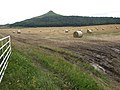
 Bales - geograph.org.uk - 3131014.jpg 640 × 360; 259 KB
-
 Bank Top Farm - geograph.org.uk - 565472.jpg 640 × 427; 89 KB
-
 Barnaby Moor - geograph.org.uk - 6106823.jpg 640 × 360; 76 KB
-
 Belman Bank and an 1937 air crash - geograph.org.uk - 5906918.jpg 640 × 427; 105 KB
-
 Belmont Ironstone Mine - geograph.org.uk - 6013958.jpg 640 × 360; 76 KB
-
 Bend on A171 - geograph.org.uk - 2648281.jpg 640 × 428; 93 KB
-
 Bike Scene, Park Lane, Guisborough - geograph.org.uk - 4419523.jpg 1,024 × 768; 123 KB
-
 Birch trees in Hutton Lowcross Woods - geograph.org.uk - 1923623.jpg 4,000 × 3,000; 2.02 MB
-
 Black Swan, Guisborough, Yorkshire.JPG 5,472 × 3,648; 2.89 MB
-
 Blackthorn thicket, Newton Wood - geograph.org.uk - 6114035.jpg 640 × 360; 86 KB
-
 Blue Lake - geograph.org.uk - 2704278.jpg 640 × 427; 302 KB
-
 Blue Lake - geograph.org.uk - 6179609.jpg 640 × 360; 120 KB
-
 Blue Lake, Overflow Channels - geograph.org.uk - 233575.jpg 480 × 640; 138 KB
-
 Bluebell Clearing, Newton Wood - geograph.org.uk - 1877127.jpg 640 × 427; 316 KB
-

-
 Bluebells, Newton Wood - geograph.org.uk - 6135348.jpg 640 × 427; 176 KB
-
 Bold Venture Gill - geograph.org.uk - 5234266.jpg 640 × 427; 63 KB
-
 Bomber Decoy Command Bunker - geograph.org.uk - 865345.jpg 640 × 427; 197 KB
-
 Boundary Stone, Black Nab - geograph.org.uk - 4781977.jpg 640 × 480; 146 KB
-
 Boundary Stone, Hutton Wood - geograph.org.uk - 1106914.jpg 427 × 640; 87 KB
-
 Boundary Stone, Newton Moor - geograph.org.uk - 4301737.jpg 640 × 360; 99 KB
-
 Boundary stone, Ryston Bank - geograph.org.uk - 5915384.jpg 640 × 427; 141 KB
-
 Boundary tree near Scugdale Farm - geograph.org.uk - 1717469.jpg 3,088 × 2,056; 2.97 MB
-
 Boundary wall near Highcliffe Farm - geograph.org.uk - 1632204.jpg 640 × 480; 68 KB
-
 Bousdale Hill - geograph.org.uk - 3299529.jpg 640 × 427; 205 KB
-
 Bousdale Wood - geograph.org.uk - 853791.jpg 427 × 640; 270 KB
-
 Bousdale Wood - geograph.org.uk - 854481.jpg 640 × 427; 233 KB
-
 Bracken spraying on Roseberry - geograph.org.uk - 6245497.jpg 640 × 360; 106 KB
-

-

-
 Bridge over former tramway, Lazenby Bank - geograph.org.uk - 5821846.jpg 1,600 × 1,200; 1.09 MB
-
 Bridleway climbing to Roseberry Common - geograph.org.uk - 5023757.jpg 1,600 × 1,200; 845 KB
-
 Bridleway Gate into Westworth Wood - geograph.org.uk - 1886225.jpg 2,816 × 2,112; 2.98 MB
-
 Bridleway in Guisborough Woods - geograph.org.uk - 5912526.jpg 1,600 × 1,200; 1,002 KB
-
 Bridleway junction on Roseberry Common - geograph.org.uk - 5023763.jpg 1,600 × 1,200; 440 KB
-
 Bridleway towards Saltburn - geograph.org.uk - 3839821.jpg 640 × 480; 74 KB
-
 British Red Cross street advertising board.JPG 3,215 × 5,966; 1.85 MB
-
 Brocken spectre (geograph 5150047).jpg 640 × 480; 98 KB
-

-
 Burnt Out Vehicle, Lackenby Bank - geograph.org.uk - 4017628.jpg 3,000 × 2,000; 3.96 MB
-
 Burnt patch of Slacks wood - geograph.org.uk - 1848255.jpg 4,000 × 3,000; 3.43 MB
-
 By the old station - geograph.org.uk - 2647790.jpg 640 × 428; 134 KB
-
 Cairn, Codhill Heights - geograph.org.uk - 1041036.jpg 640 × 427; 243 KB
-
 Cairn, Guisborough Moor - geograph.org.uk - 1800097.jpg 640 × 480; 76 KB
-
 Carr Pond on Eston Moor (1) - geograph.org.uk - 2387014.jpg 3,968 × 2,976; 2.78 MB
-
 Carr Pond on Eston Moor (2) - geograph.org.uk - 2387023.jpg 3,968 × 2,976; 3.22 MB
-
 Carr Pond, Eston Moor - geograph.org.uk - 5023683.jpg 1,600 × 1,200; 680 KB
-
 Carr Pond, Eston Moor - geograph.org.uk - 5263325.jpg 4,320 × 2,880; 5.12 MB
-
 Cemetery Chapel, Guisborough - geograph.org.uk - 5822307.jpg 1,600 × 1,200; 602 KB
-
 Chaloner Street, Guisborough (geograph 5429850).jpg 5,184 × 3,888; 7 MB
-
 Chapel Beck - geograph.org.uk - 468717.jpg 427 × 640; 303 KB
-
 Children's playground, Dunsdale - geograph.org.uk - 3841466.jpg 640 × 480; 67 KB
-
 Christmas tree installation - geograph.org.uk - 4748005.jpg 1,024 × 768; 232 KB
-
 Clear Felling, Hutton Lowcross Woods - geograph.org.uk - 5979565.jpg 640 × 427; 108 KB
-
 Clearing in Hutton Lowcross Woods - geograph.org.uk - 2161820.jpg 4,000 × 3,000; 3.1 MB
-
 Cleveland Hills - geograph.org.uk - 6158907.jpg 640 × 360; 107 KB
-
 Cleveland Street approach to Guisborough - geograph.org.uk - 5654903.jpg 4,320 × 2,432; 4.27 MB
-
 Cleveland Street at Foxdale Farm - geograph.org.uk - 5654909.jpg 4,320 × 2,432; 4.28 MB
-
 Cleveland Street at Little Waterfall Farm - geograph.org.uk - 5654917.jpg 4,320 × 2,432; 4.44 MB
-
 Cleveland Way - geograph.org.uk - 5501084.jpg 2,048 × 1,536; 1.64 MB
-
 Cleveland Way - geograph.org.uk - 5862416.jpg 2,048 × 1,536; 1.35 MB
-
 Cleveland Way approach to Roseberry Topping - geograph.org.uk - 4102501.jpg 4,000 × 3,000; 5.09 MB
-
 Cleveland Way at Codhill Plantation - geograph.org.uk - 6328198.jpg 640 × 360; 88 KB
-
 Cleveland Way in Guisborough Woods - geograph.org.uk - 5911863.jpg 1,600 × 1,200; 925 KB
-
 Cleveland Way passing Highcliffe Farm - geograph.org.uk - 2219903.jpg 2,000 × 1,233; 1.85 MB
-

-
 Co-operative Funeralcare, Guisborough - geograph.org.uk - 4419479.jpg 1,024 × 768; 141 KB
-

-
 Cockle Scar - geograph.org.uk - 6154530.jpg 640 × 360; 128 KB
-
 Cod Hill Slack from Percy Rigg - geograph.org.uk - 2700549.jpg 1,024 × 683; 245 KB
-
 Codhill Heights - geograph.org.uk - 5246944.jpg 640 × 427; 105 KB
-
 Course of Old Railway, Dingledow - geograph.org.uk - 4826861.jpg 640 × 480; 196 KB
-
-
 CoverdaleBuildingPPC.jpg 1,280 × 1,024; 154 KB
-
 Cresting a hill on the A173 - geograph.org.uk - 3841438.jpg 640 × 480; 97 KB
-
 Crop field near Tocketts Bridge - geograph.org.uk - 3841447.jpg 640 × 480; 74 KB
-
 Crop field, Dunsdale - geograph.org.uk - 3841468.jpg 640 × 480; 80 KB
-
 Daffodils in Guisborough - geograph.org.uk - 1611810.jpg 640 × 480; 100 KB
-
 Dead bracken on hill slope - geograph.org.uk - 3333067.jpg 1,500 × 901; 1.89 MB
-
 Deforestation of Guisborough Woods - geograph.org.uk - 1604258.jpg 640 × 480; 114 KB
-
 Deforestation of Guisborough Woods - geograph.org.uk - 1609839.jpg 640 × 480; 113 KB
-
 Deforestation, Hutton Lowcross Woods - geograph.org.uk - 2052741.jpg 4,000 × 3,000; 1.68 MB
-
 Deforestation, Hutton Lowcross Woods - geograph.org.uk - 2052752.jpg 3,765 × 2,824; 1.68 MB
-
 Derelict Building, Belmont Ironstone Mine - geograph.org.uk - 354932.jpg 640 × 482; 125 KB
-
 Descending Roseberry Topping - geograph.org.uk - 5472370.jpg 1,920 × 1,280; 545 KB
-
 Dingledow Road - geograph.org.uk - 1633316.jpg 427 × 640; 319 KB
-
 Direction sign for The Tees Link - geograph.org.uk - 5662108.jpg 4,320 × 2,432; 4.26 MB
-
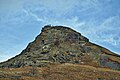
 Distant view of Rosebery Topping from Eston Moor - geograph.org.uk - 2387038.jpg 3,968 × 2,976; 2.78 MB
-

-
 Disused Railway Bridge over Belmangate, Guisborough - geograph.org.uk - 5662120.jpg 4,320 × 2,432; 4.34 MB
-
 Dog Rose on Brand Gate - geograph.org.uk - 865305.jpg 640 × 427; 171 KB
-
 Drive to Gisborough Hall Hotel - geograph.org.uk - 4812831.jpg 640 × 428; 203 KB
-
 Dry Stone Walling - geograph.org.uk - 3785707.jpg 640 × 427; 79 KB
-
 Dunsdale in the wet - geograph.org.uk - 3182585.jpg 640 × 480; 54 KB
-
 Dunsdale War Memorial - geograph.org.uk - 3841462.jpg 640 × 480; 60 KB
-
 Dusk view across the square - geograph.org.uk - 139224.jpg 640 × 480; 33 KB
-

-

-
 Eastern end of Guisborough bypass (A171) - geograph.org.uk - 2637278.jpg 3,648 × 2,736; 1.91 MB
-
 Edge of Woods at Wiley Cat Beck - geograph.org.uk - 1722775.jpg 640 × 427; 279 KB
-
 Ellers Wood - geograph.org.uk - 3841436.jpg 478 × 640; 133 KB
-

-
 Entering Dunsdale - geograph.org.uk - 3841460.jpg 640 × 480; 59 KB
-
 Entering Guisborough - geograph.org.uk - 2647799.jpg 640 × 428; 117 KB
-
 Entering Newton under Roseberry - geograph.org.uk - 2647761.jpg 640 × 428; 101 KB
-

-
 Entrance to I - 7 The Drill Hall, Park Lane - geograph.org.uk - 4419492.jpg 1,024 × 768; 167 KB
-
 Ernaldsti - Percy Cross Rigg - geograph.org.uk - 4833624.jpg 640 × 384; 63 KB
-
 Errington Wood trig point - geograph.org.uk - 5822369.jpg 1,600 × 1,200; 851 KB
-
 Esk Valley Railway Line - geograph.org.uk - 5263370.jpg 4,320 × 2,432; 4.39 MB
-
 Estate track beside Highcliffe Wood - geograph.org.uk - 5911856.jpg 1,600 × 1,200; 663 KB
-
 Eston Beacon - geograph.org.uk - 4693172.jpg 640 × 360; 64 KB
-
 Eston Hills OS 846 1948.jpg 1,325 × 661; 644 KB
-
 Eston Moor - geograph.org.uk - 4017613.jpg 3,000 × 2,000; 2.19 MB
-
 Eston Moor ridge view - geograph.org.uk - 2387063.jpg 3,968 × 2,976; 2.77 MB
-
 Eston Moor view south west - geograph.org.uk - 2387075.jpg 3,968 × 2,976; 2.8 MB
-
 Eston Nab - geograph.org.uk - 3364255.jpg 809 × 1,187; 237 KB
-
 Eston Nab - geograph.org.uk - 4017617.jpg 3,000 × 2,000; 2.3 MB
-
 Eston Nab - geograph.org.uk - 4786228.jpg 640 × 480; 64 KB
-
 Eston Nab - geograph.org.uk - 5263337.jpg 4,320 × 2,880; 5.04 MB
-
 Eston Nab and Eston - geograph.org.uk - 5263343.jpg 4,320 × 2,880; 5.09 MB
-
 Eston, Early Morning - geograph.org.uk - 4682567.jpg 640 × 358; 49 KB
-
 Evening View Across the Square - geograph.org.uk - 339299.jpg 640 × 427; 58 KB
-

-
 Farm track near Morton Carr - geograph.org.uk - 870684.jpg 640 × 480; 123 KB
-
 Farm track off Redcar Road, Dunsdale - geograph.org.uk - 3841467.jpg 640 × 480; 90 KB
-
 Farmland near Morton Grange - geograph.org.uk - 2672248.jpg 800 × 600; 38 KB
-
 Farmland near Snow Hall Farm - geograph.org.uk - 2672255.jpg 800 × 550; 33 KB
-
 Farmland off Hob Hill Lane - geograph.org.uk - 3839824.jpg 640 × 480; 40 KB
-
 Farmland towards Roseberry Topping - geograph.org.uk - 2672264.jpg 800 × 597; 38 KB
-
 Farmland, Thornton Fields - geograph.org.uk - 3841452.jpg 640 × 480; 42 KB
-
 Farmland, Upsall Carrs - geograph.org.uk - 2672242.jpg 800 × 589; 43 KB
-
 Fenced track to Upleatham - geograph.org.uk - 1919517.jpg 3,088 × 2,056; 4.37 MB
-
 Field and Wall Near Mill Farm - geograph.org.uk - 545117.jpg 640 × 427; 74 KB
-
 Field boundary and tree at Little Waterfall Farm - geograph.org.uk - 5654920.jpg 4,320 × 2,432; 4.17 MB
-
-
 Field, Scugdale Farm - geograph.org.uk - 137639.jpg 640 × 480; 78 KB
-
 Fields North of Langbaurgh Ridge - geograph.org.uk - 475852.jpg 640 × 427; 54 KB
-
 Finally some sunshine - geograph.org.uk - 6240380.jpg 640 × 360; 114 KB
-
 Footbridge on the Tees Link footpath north of Low Farm - geograph.org.uk - 5023713.jpg 1,600 × 1,200; 648 KB
-
 Footpath at Langbaurgh Quarry - geograph.org.uk - 5023829.jpg 1,600 × 1,200; 473 KB
-
 Footpath descending from Normanby Moor - geograph.org.uk - 5023697.jpg 1,600 × 1,200; 938 KB
-
 Footpath descending through Newton Wood - geograph.org.uk - 5023785.jpg 1,219 × 960; 1.15 MB
-
 Footpath Junction - geograph.org.uk - 4595778.jpg 1,024 × 683; 184 KB
-
 Footpath off the B1268 - geograph.org.uk - 3841414.jpg 640 × 480; 101 KB
-
 Footpath up Eston Moor from Flatts Lane - geograph.org.uk - 2387003.jpg 3,968 × 2,976; 2.78 MB
-
 Forest destruction - geograph.org.uk - 1628811.jpg 640 × 428; 94 KB
-
 Forest Edge - geograph.org.uk - 1800094.jpg 640 × 480; 84 KB
-
 Forest Harvesting - geograph.org.uk - 2748427.jpg 640 × 427; 269 KB
-
 Forest road in Guisborough Woods - geograph.org.uk - 5611535.jpg 1,326 × 1,600; 925 KB
-
 Forest road in Spring Wood - geograph.org.uk - 5611590.jpg 1,500 × 949; 1.46 MB
-
 Forest Road in Westworth Wood - geograph.org.uk - 5611486.jpg 1,500 × 1,033; 2.17 MB
-
 Forest Track - geograph.org.uk - 1800093.jpg 640 × 480; 103 KB
-
 Forest track now in the open - geograph.org.uk - 1886195.jpg 2,816 × 2,112; 2.76 MB
-

-
 Former Mine Buildings - geograph.org.uk - 641639.jpg 640 × 427; 289 KB
-
 Former Mine Buildings - geograph.org.uk - 641640.jpg 640 × 427; 73 KB
-
 Former Post Office - geograph.org.uk - 1278502.jpg 640 × 427; 49 KB
-
 Former South Lodge, Gisborough Hall - geograph.org.uk - 2639695.jpg 640 × 428; 166 KB
-
 Former tramway - geograph.org.uk - 4040436.jpg 2,814 × 2,010; 1,014 KB


_-_geograph.org.uk_-_3841417.jpg)


.jpg)


_-_geograph.org.uk_-_2387014.jpg)
_-_geograph.org.uk_-_2387023.jpg)


.jpg)


_-_geograph.org.uk_-_1630541.jpg)
_-_geograph.org.uk_-_1630533.jpg)
_-_geograph.org.uk_-_2637278.jpg)


