Category:Haagdijk 71, Breda
| Object location | | View all coordinates using: OpenStreetMap |
|---|
 | |||||
| Upload media | |||||
| Instance of |
| ||||
|---|---|---|---|---|---|
| Location | Breda, North Brabant, Netherlands | ||||
| Street address |
| ||||
| Heritage designation |
| ||||
 | |||||
|
This is a category about rijksmonument number 519005
|
| Address |
|
Media in category "Haagdijk 71, Breda"
The following 12 files are in this category, out of 12 total.
-
 Detail Haagdijk 71 DSCF4472.jpg 1,864 × 2,816; 2.46 MB
-
 Detail Haagdijk 71 DSCF4473.jpg 2,816 × 1,864; 2.52 MB
-
 Exterieur OVERZICHT VOORGEVEL - Breda - 20286041 - RCE.jpg 1,198 × 1,200; 314 KB
-
 Gedeelte voorgevel met portiek - Breda - 20332235 - RCE.jpg 1,189 × 1,200; 311 KB
-
 Haagdijk 71 DSCF4466.jpg 2,816 × 1,864; 2.48 MB
-
 Haagdijk 71 DSCF4470copy.jpg 1,864 × 2,816; 1.22 MB
-
 Haagdijk 71, Breda P1490023.jpg 2,672 × 4,000; 5.53 MB
-
 Haagdijk 71, Breda P1490025.jpg 2,672 × 4,000; 5.66 MB
-
 Overzicht voorgevel met straatbeeld - Breda - 20332234 - RCE.jpg 1,187 × 1,200; 293 KB
-
 P1030719Haagdijk.JPG 2,448 × 3,264; 3.71 MB
-
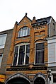
 RM519005 Breda - Haagdijk 71.jpg 1,171 × 2,195; 812 KB
-
 Voorgevels - Breda - 20041154 - RCE.jpg 821 × 1,200; 181 KB


