Category:Haller-Haus, Solothurn
| Object location | | View all coordinates using: OpenStreetMap |
|---|
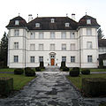
church residential building in the city of Solothurn, Switzerland  | |||||
| Upload media | |||||
| Instance of | |||||
|---|---|---|---|---|---|
| Part of | |||||
| Location | Solothurn, Solothurn District, Solothurn-Lebern, Solothurn, Switzerland | ||||
| Street address |
| ||||
| Heritage designation | |||||
 | |||||
Media in category "Haller-Haus, Solothurn"
The following 2 files are in this category, out of 2 total.
-
 Haller-Haus, Solothurn.jpg 2,308 × 2,304; 736 KB
-
 Haller-Hause Palais.jpg 3,373 × 2,228; 989 KB
