Category:Halstead, Essex
English: Halstead is a town and civil parish in the Braintree district, in the county of Essex, England.
town in Essex, England, UK  | |||||
| Upload media | |||||
| Instance of | |||||
|---|---|---|---|---|---|
| Location | Halstead, Braintree, Essex, East of England, England | ||||
| Different from | |||||
 | |||||
Subcategories
This category has the following 8 subcategories, out of 8 total.
A
- St. Andrew's Church, Halstead (63 F)
C
- Colne Valley Postal Museum (72 F)
- Courtauld Mill (7 F)
E
- Eurospares (4 F)
H
- Halstead railway station (3 F)
T
- Trinity House, Halstead (2 F)
Media in category "Halstead, Essex"
The following 200 files are in this category, out of 234 total.
(previous page) (next page)-
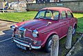 965EUW 1962 Riley 1.5, Halstead car park 180324.jpg 3,162 × 2,148; 2.14 MB
-
 A pretty Victorian Cottage - geograph.org.uk - 300944.jpg 640 × 480; 100 KB
-
 A1124 Colchester Road, Halstead - geograph.org.uk - 5967643.jpg 3,866 × 2,606; 2.87 MB
-
 A1124 Colchester Road, Halstead - geograph.org.uk - 5967674.jpg 4,000 × 2,884; 2.53 MB
-
 A1124 Colchester Road, Halstead - geograph.org.uk - 5967680.jpg 4,608 × 3,456; 4.23 MB
-
 A1124 Colchester Road, Halstead - geograph.org.uk - 5971992.jpg 4,608 × 3,456; 3.77 MB
-
 A1124 Colchester Road, Halstead - geograph.org.uk - 5971997.jpg 4,608 × 3,456; 3.77 MB
-
 A1124 Hedingham Road - geograph.org.uk - 561227.jpg 640 × 480; 87 KB
-
 A1124 Hedingham Road, Halstead - geograph.org.uk - 5968594.jpg 4,608 × 3,456; 4.36 MB
-
 A1124 Hedingham Road, Halstead - geograph.org.uk - 5968595.jpg 4,608 × 3,456; 4.26 MB
-
 A1124 Hedingham Road, Halstead - geograph.org.uk - 5968596.jpg 4,608 × 3,456; 4.38 MB
-
 A1124 Hedingham Road, Halstead - geograph.org.uk - 5968604.jpg 4,608 × 3,456; 4.02 MB
-
 A1124 Hedingham Road, Halstead - geograph.org.uk - 5968605.jpg 4,608 × 3,456; 3.92 MB
-
 A1124 Hedingham Road, Halstead - geograph.org.uk - 5970657.jpg 4,608 × 3,456; 3.87 MB
-
 A1124 Hedingham Road, Halstead - geograph.org.uk - 5970662.jpg 4,608 × 3,456; 4.39 MB
-
 A1124 Hedingham Road, Halstead - geograph.org.uk - 5970888.jpg 4,608 × 3,456; 3.82 MB
-
 A1124 Market Hill, Halstead - geograph.org.uk - 5971408.jpg 4,608 × 3,456; 3.99 MB
-
 A131 Head Street, Halstead - geograph.org.uk - 5971364.jpg 4,000 × 3,000; 2.95 MB
-
 A131 Head Street, Halstead - geograph.org.uk - 5971367.jpg 4,608 × 3,456; 3.83 MB
-
 A131 Head Street, Halstead - geograph.org.uk - 5971599.jpg 4,608 × 3,456; 3.87 MB
-
 A131 High Street, Halstead - geograph.org.uk - 5968593.jpg 4,608 × 3,456; 3.86 MB
-
 A131 High Street, Halstead - geograph.org.uk - 5971384.jpg 4,608 × 3,456; 4 MB
-
 A131 High Street, Halstead - geograph.org.uk - 5971386.jpg 4,608 × 3,456; 3.81 MB
-
 A131 road through Halstead - geograph.org.uk - 3040280.jpg 640 × 480; 148 KB
-
 A131, Bridge Street - geograph.org.uk - 941055.jpg 640 × 480; 80 KB
-
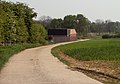
 Arable land near Brook Street, Halstead - geograph.org.uk - 5021393.jpg 3,648 × 2,432; 3.29 MB
-
 Barclays Bank, Halstead - geograph.org.uk - 668721.jpg 640 × 480; 80 KB
-
 Bend On Minor Road - geograph.org.uk - 5292031.jpg 1,024 × 768; 212 KB
-
 Bird in the Hand, Restaurant and Freehouse, Halstead - geograph.org.uk - 2494467.jpg 1,600 × 1,182; 491 KB
-

-
 Bridge on Elms Hall Road - geograph.org.uk - 300952.jpg 640 × 480; 108 KB
-
 Bridge Street, Halstead - geograph.org.uk - 1603983.jpg 640 × 461; 72 KB
-
 Brook Street, near Halstead - geograph.org.uk - 4941966.jpg 4,608 × 3,456; 3.37 MB
-
 Building detail, Trintity Street - geograph.org.uk - 1604193.jpg 640 × 480; 110 KB
-
 Buildings by the River Colne - geograph.org.uk - 1604002.jpg 640 × 472; 86 KB
-
 Bus Shelter on the A1124 Hedingham Road (geograph 5970695).jpg 4,608 × 3,456; 4.13 MB
-
 Cafe bus (RED BUS, ex-YHA 341J), 14 July 2013 (1).jpg 4,592 × 3,056; 2.52 MB
-
 Cafe bus (RED BUS, ex-YHA 341J), 14 July 2013 (2).jpg 4,592 × 3,056; 3.1 MB
-
 Cafe bus (RED BUS, ex-YHA 341J), 14 July 2013 (3).jpg 4,592 × 3,056; 3.58 MB
-
 Caretaker's house, Halstead cemetery - geograph.org.uk - 2494458.jpg 1,200 × 1,600; 455 KB
-
 Chapel Street Halstead - geograph.org.uk - 2075059.jpg 640 × 480; 81 KB
-
 Chapel Street, Halstead - geograph.org.uk - 668723.jpg 480 × 640; 69 KB
-
 Colchester Road from the churchyard - geograph.org.uk - 1604055.jpg 640 × 480; 135 KB
-
 Colne valley - geograph.org.uk - 260775.jpg 640 × 480; 138 KB
-
 CVHRsharp222.jpg 1,055 × 593; 221 KB
-
 E8R Door.jpg 877 × 1,792; 262 KB
-
 Empire Cinema - Theatre, Halstead - geograph.org.uk - 4368271.jpg 640 × 480; 99 KB
-
 Entering Halstead on the A1124 Hedingham Road - geograph.org.uk - 5969891.jpg 4,608 × 3,456; 3.92 MB
-
 Entering Halstead on the A1124 Hedingham Road - geograph.org.uk - 5970462.jpg 3,858 × 2,827; 6.77 MB
-
 Farmhouse at Letche's Farm - geograph.org.uk - 292741.jpg 640 × 471; 115 KB
-
 Fen Road George V Postbox - geograph.org.uk - 5971969.jpg 4,608 × 3,456; 4.23 MB
-
 Fenn Road George V Postbox - geograph.org.uk - 5971973.jpg 4,608 × 3,456; 4.08 MB
-
 Fenn Road George V Postbox - geograph.org.uk - 5971998.jpg 3,000 × 4,000; 7 MB
-
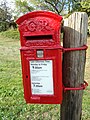 Fenn Road George V Postbox - geograph.org.uk - 5972023.jpg 3,000 × 4,000; 4.48 MB
-
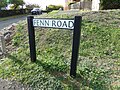 Fenn Road sign - geograph.org.uk - 5971645.jpg 4,608 × 3,456; 4.01 MB
-
 Fenn Road sign - geograph.org.uk - 5972018.jpg 4,608 × 3,456; 4.19 MB
-
 Fenn Road, Halstead - geograph.org.uk - 5971626.jpg 3,995 × 2,937; 3.88 MB
-
 Fenn Road, Halstead - geograph.org.uk - 5971637.jpg 4,608 × 3,456; 3.9 MB
-
 Fenn Road, Halstead - geograph.org.uk - 5971652.jpg 4,608 × 3,456; 3.85 MB
-
 Fenn Road, Halstead - geograph.org.uk - 5971657.jpg 4,608 × 3,456; 3.84 MB
-
 First Avenue, Halstead - geograph.org.uk - 5967648.jpg 4,608 × 3,456; 4.44 MB
-
 Fitz John Farm - geograph.org.uk - 453208.jpg 640 × 426; 110 KB
-
 Flats on Conies Road - geograph.org.uk - 1604269.jpg 640 × 480; 92 KB
-
 Flood Control Depot - geograph.org.uk - 2573437.jpg 640 × 429; 102 KB
-
 Flood Scheme Path - geograph.org.uk - 2573446.jpg 640 × 429; 60 KB
-
 Flood Scheme Plaque - geograph.org.uk - 2573439.jpg 640 × 431; 61 KB
-
 Floodgates and Control Depot - geograph.org.uk - 2573450.jpg 429 × 640; 78 KB
-

-
 Footpath on track to Wash Farm, Halstead - geograph.org.uk - 5021385.jpg 1,024 × 683; 329 KB
-
 Footpath to Halstead - geograph.org.uk - 416603.jpg 640 × 450; 75 KB
-
 Footpath To Halstead - geograph.org.uk - 4660255.jpg 1,024 × 768; 186 KB
-
 Footpath to The Colne - geograph.org.uk - 2573417.jpg 640 × 429; 66 KB
-
 Footpath What Footpath^ - geograph.org.uk - 453114.jpg 640 × 426; 112 KB
-
 Former cinema, Trinity Street, Halstead - geograph.org.uk - 4371705.jpg 640 × 428; 103 KB
-
 Full length PB.jpg 151 × 337; 11 KB
-
 Halstead - geograph.org.uk - 361220.jpg 640 × 480; 116 KB
-
 Halstead 032.jpg 3,648 × 2,736; 4.28 MB
-
 Halstead 033.jpg 3,648 × 2,736; 4.24 MB
-
 Halstead 034.jpg 3,648 × 2,736; 3.73 MB
-
 Halstead 035.jpg 2,736 × 3,648; 4.72 MB
-
 Halstead 036.jpg 2,736 × 3,648; 4.29 MB
-
 Halstead 037.jpg 2,736 × 3,648; 4.47 MB
-
 Halstead 038.jpg 3,648 × 2,736; 4.51 MB
-
 Halstead 039.jpg 3,648 × 2,736; 4.69 MB
-
 Halstead 040.jpg 2,736 × 3,648; 4.12 MB
-
 Halstead 041.jpg 3,648 × 2,736; 4.62 MB
-
 Halstead 042.jpg 2,736 × 3,648; 3.81 MB
-
 Halstead 043.jpg 3,648 × 2,736; 4.49 MB
-
 Halstead 044.jpg 3,648 × 2,736; 4.07 MB
-
 Halstead 045.jpg 3,648 × 2,736; 4.28 MB
-
 Halstead fire station - geograph.org.uk - 1910230.jpg 640 × 427; 194 KB
-
 Halstead Flood Protection Scheme - geograph.org.uk - 2573428.jpg 640 × 429; 69 KB
-
 Halstead Flood Reservoir (50845396427).jpg 5,472 × 2,689; 2.28 MB
-
 Halstead High Street, the A131 - geograph.org.uk - 6288639.jpg 5,472 × 3,648; 4.86 MB
-
 Halstead Hospital - geograph.org.uk - 5969899.jpg 4,608 × 3,456; 3.84 MB
-
 Halstead Hospital sign - geograph.org.uk - 5970720.jpg 4,608 × 3,456; 3.88 MB
-
 Halstead Hospital, Essex - geograph.org.uk - 151103.jpg 640 × 480; 73 KB
-
 Halstead Industrial Co-operative Society jubilee mug (49798588118).jpg 3,072 × 2,304; 1.3 MB
-

-
 Halstead Methodist Church - geograph.org.uk - 1605227.jpg 640 × 629; 110 KB
-
 Halstead old fire station - geograph.org.uk - 1910234.jpg 640 × 427; 249 KB
-
 Halstead River Walk - geograph.org.uk - 5021391.jpg 3,648 × 2,432; 4.83 MB
-

-
 Halstead Town Name sign on the A1124 Hedingham Road - geograph.org.uk - 5969894.jpg 4,000 × 3,000; 5.3 MB
-
 Halstead town park - geograph.org.uk - 1605222.jpg 640 × 480; 137 KB
-
-

-
 Halstead, The Empire Theatre - geograph.org.uk - 1463370.jpg 640 × 480; 57 KB
-

-

-
 Halstead-banner.jpg 3,925 × 639; 882 KB
-
 Head Street from St Andrew's churchyard - geograph.org.uk - 1604053.jpg 640 × 480; 114 KB
-
 Hedingham Road George VI Postbox - geograph.org.uk - 5970683.jpg 4,608 × 3,456; 4.01 MB
-
 Hedingham Road George VI Postbox - geograph.org.uk - 5970688.jpg 4,608 × 3,456; 3.86 MB
-
 Hedingham Road George VI Postbox - geograph.org.uk - 5970690.jpg 2,958 × 3,944; 5.63 MB
-
 Hedingham Road George VI Postbox - geograph.org.uk - 5971375.jpg 3,000 × 4,000; 4.73 MB
-
 Hedingham Road Halstead A1124 - geograph.org.uk - 2075046.jpg 640 × 480; 79 KB
-
 High Street sign on the A131 High Street - geograph.org.uk - 5971535.jpg 4,608 × 3,456; 3.64 MB
-
 High Street, Halstead - geograph.org.uk - 4207409.jpg 640 × 480; 87 KB
-
 High Street, Halstead - geograph.org.uk - 4496520.jpg 4,000 × 3,000; 2.47 MB
-
 Holy Trinity, Halstead, altar - geograph.org.uk - 6274917.jpg 480 × 640; 63 KB
-
 Holy Trinity, Halstead, art work - geograph.org.uk - 6274914.jpg 640 × 480; 43 KB
-
 Holy Trinity, Halstead, font - geograph.org.uk - 6274910.jpg 640 × 480; 66 KB
-

-
 Holy Trinity, Halstead, organ - geograph.org.uk - 6274916.jpg 480 × 640; 69 KB
-
 Holy Trinity, Halstead, path - geograph.org.uk - 6274928.jpg 640 × 480; 126 KB
-
 Holy Trinity, Halstead, pulpit - geograph.org.uk - 6274915.jpg 640 × 480; 71 KB
-
 Holy Trinity, Halstead, south door - geograph.org.uk - 6274926.jpg 480 × 640; 54 KB
-
-

-

-

-

-
-
-
 Holy Trinity, Halstead, war memorial - geograph.org.uk - 6274922.jpg 640 × 502; 77 KB
-
 House on Sudbury Road, Halstead - geograph.org.uk - 6089101.jpg 1,696 × 1,091; 787 KB
-
 House on Sudbury Road, Halstead - geograph.org.uk - 6089103.jpg 1,906 × 1,260; 916 KB
-

-
 Houses in Oak Road - geograph.org.uk - 4986795.jpg 3,648 × 2,736; 2.54 MB
-
 Houses near the post office - geograph.org.uk - 1604262.jpg 640 × 375; 69 KB
-
 Inside St Andrew, Halstead (A) - geograph.org.uk - 6274947.jpg 480 × 640; 47 KB
-
 Inside St Andrew, Halstead (B) - geograph.org.uk - 6274949.jpg 480 × 640; 43 KB
-
 Inside St Andrew, Halstead (C) - geograph.org.uk - 6274950.jpg 640 × 480; 53 KB
-
 Inside St Andrew, Halstead (D) - geograph.org.uk - 6274951.jpg 640 × 480; 73 KB
-
 Inside St Andrew, Halstead (E) - geograph.org.uk - 6274952.jpg 433 × 640; 53 KB
-
 Inside St Andrew, Halstead (F) - geograph.org.uk - 6274953.jpg 466 × 640; 54 KB
-
 Inside St Andrew, Halstead (G) - geograph.org.uk - 6274982.jpg 480 × 640; 60 KB
-
 Inside St Andrew, Halstead (H) - geograph.org.uk - 6274984.jpg 640 × 480; 94 KB
-
 Inside St Andrew, Halstead (I) - geograph.org.uk - 6274985.jpg 640 × 480; 87 KB
-
 Inside St Andrew, Halstead (J) - geograph.org.uk - 6274986.jpg 435 × 640; 83 KB
-
 Jubilee Kiosk K6 in the snow.jpg 2,366 × 3,591; 1.51 MB
-
 K8 by night 2.jpg 2,287 × 3,133; 701 KB
-
 KE7 with POD.jpg 441 × 966; 114 KB
-
 Kids Play House Cafe, Halsted - geograph.org.uk - 6087698.jpg 1,114 × 1,824; 1.07 MB
-
 Kids Playhouse in Trinity street - geograph.org.uk - 2075083.jpg 480 × 640; 108 KB
-
 Kiosks at Evening.jpg 2,971 × 2,831; 1.66 MB
-
 Lloyds TSB Bank, Halstead - geograph.org.uk - 941098.jpg 640 × 480; 75 KB
-
 Long building by the River Colne - geograph.org.uk - 1605218.jpg 640 × 430; 77 KB
-
 Looking along Trinity Street - geograph.org.uk - 1604200.jpg 640 × 480; 96 KB
-

-

-
-

-
 Lower end of Hedingham Road - geograph.org.uk - 2075054.jpg 640 × 480; 86 KB
-
 Market Hill sign - geograph.org.uk - 5971547.jpg 4,608 × 3,456; 3.75 MB
-
 Master Craftsmen, Halstead - geograph.org.uk - 6087697.jpg 1,880 × 1,216; 1.06 MB
-
 Mitchell Avenue - geograph.org.uk - 1604245.jpg 640 × 481; 96 KB
-
 Mitchell Avenue, Halstead - geograph.org.uk - 1604250.jpg 640 × 431; 73 KB
-
 Monument on the A131 High Street - geograph.org.uk - 5971394.jpg 3,000 × 4,000; 3.89 MB
-
 Morris J mail van SLO234 Colne Rd.jpg 2,066 × 1,418; 3.02 MB
-
 Morris J mail van SLO234 Sudbury Rd.jpg 2,884 × 2,660; 7.7 MB
-

-
 NatWest, Halstead - geograph.org.uk - 671749.jpg 640 × 480; 66 KB
-
 Neale Road, Halstead - geograph.org.uk - 1605232.jpg 640 × 480; 106 KB
-
 Offices on Mount Hill, Halstead - geograph.org.uk - 6087696.jpg 1,892 × 1,236; 1.08 MB
-
 Ordnance Survey Drawings - Halstead (OSD 144).jpg 4,000 × 2,107; 3.38 MB
-
 Ordnance Survey Flush Bracket S8916 - geograph.org.uk - 4496515.jpg 4,000 × 3,000; 3.69 MB
-

-
 Parsonage Street - geograph.org.uk - 1604015.jpg 640 × 509; 79 KB
-
 Path leading away from Brook Street - geograph.org.uk - 4942948.jpg 4,608 × 3,456; 3.33 MB
-
 Path leading away from Brook Street - geograph.org.uk - 4942950.jpg 4,608 × 3,456; 3.36 MB
-
 Path through meadow near Oak Road, Halstead - geograph.org.uk - 4517772.jpg 3,648 × 2,736; 5.01 MB
-
 Path to the Flood Scheme - geograph.org.uk - 2573442.jpg 640 × 429; 81 KB
-
 PB Cap.jpg 748 × 250; 41 KB
-
 Plaque on the Monument on the A131 High Street - geograph.org.uk - 5971531.jpg 2,867 × 3,822; 4.75 MB
-

-
 Post Office and Co-operative store - geograph.org.uk - 1604256.jpg 640 × 469; 108 KB
-
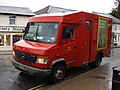 Post Office Mercedes-Benz Armoured Van.jpg 3,648 × 2,736; 4.12 MB
-
 Postbox and houses, Mitchell Avenue - geograph.org.uk - 1605237.jpg 640 × 532; 93 KB
-
 Postbox-Royal Cypher-EVIIIR.jpg 409 × 426; 33 KB
-
 Ravilious - halstead-road-in-snow-1935.jpg 280 × 226; 14 KB
-
 River Colne - geograph.org.uk - 2573431.jpg 640 × 429; 70 KB
-
 River Colne and Courtauld Mill - geograph.org.uk - 1510605.jpg 640 × 480; 89 KB
-
 River Colne in Halstead - geograph.org.uk - 1463170.jpg 640 × 480; 147 KB
-
 River Colne, Halstead (2) - geograph.org.uk - 2512410.jpg 1,600 × 1,200; 479 KB
-
 River Colne, Halstead - geograph.org.uk - 2512408.jpg 1,600 × 1,200; 492 KB
-
 Riverside Court, Halstead - geograph.org.uk - 4371725.jpg 640 × 428; 75 KB
-
 Roadsign on the A1124 Hedingham Road - geograph.org.uk - 5970890.jpg 4,608 × 3,456; 4 MB
-
 Route of the Colne Valley Railway through Halstead, Essex.jpg 4,000 × 2,250; 2.02 MB


.jpg)
,_14_July_2013_(1).jpg)
,_14_July_2013_(2).jpg)
,_14_July_2013_(3).jpg)


.jpg)


.jpg)


_-_geograph.org.uk_-_6274903.jpg)
_-_geograph.org.uk_-_6274906.jpg)
_-_geograph.org.uk_-_6274912.jpg)
_-_geograph.org.uk_-_6274913.jpg)
_-_geograph.org.uk_-_6274918.jpg)
_-_geograph.org.uk_-_6274919.jpg)
_-_geograph.org.uk_-_6274925.jpg)


_-_geograph.org.uk_-_6274947.jpg)
_-_geograph.org.uk_-_6274949.jpg)
_-_geograph.org.uk_-_6274950.jpg)
_-_geograph.org.uk_-_6274951.jpg)
_-_geograph.org.uk_-_6274952.jpg)
_-_geograph.org.uk_-_6274953.jpg)
_-_geograph.org.uk_-_6274982.jpg)
_-_geograph.org.uk_-_6274984.jpg)
_-_geograph.org.uk_-_6274985.jpg)
_-_geograph.org.uk_-_6274986.jpg)


.jpg)


_-_geograph.org.uk_-_2512410.jpg)


