Category:Hamford Water

inlet in Essex, England, UK  | |||||
| Upload media | |||||
| Instance of | |||||
|---|---|---|---|---|---|
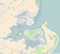
| Location |
| ||||
| Heritage designation | |||||
 | |||||
Media in category "Hamford Water"
The following 46 files are in this category, out of 46 total.
-
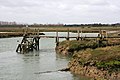
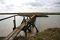
 "Irongate", private bridge in marshland - geograph.org.uk - 603386.jpg 640 × 480; 158 KB
-
 "No Footpath" - really^ - geograph.org.uk - 790610.jpg 640 × 480; 180 KB
-
 Access Road - geograph.org.uk - 1182513.jpg 640 × 457; 163 KB
-
 Alison HH988 in Hamford Water - geograph.org.uk - 1390183.jpg 640 × 428; 43 KB
-
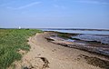
 Beach at Hamford Water - geograph.org.uk - 1182539.jpg 640 × 457; 153 KB
-
 Boat moored in Hamford Water - geograph.org.uk - 749709.jpg 640 × 424; 83 KB
-
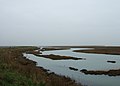
 Creek in Hamford Water - geograph.org.uk - 749647.jpg 640 × 427; 73 KB
-
 Dugmore Creek outflow - geograph.org.uk - 836939.jpg 640 × 392; 183 KB
-
 Dugmore Creek outflow, looking south - geograph.org.uk - 836941.jpg 640 × 240; 109 KB
-

-
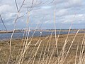
 Grassland at Hamford Water - geograph.org.uk - 1182572.jpg 640 × 457; 154 KB
-
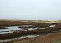
 Hamford Water - geograph.org.uk - 1182577.jpg 640 × 457; 132 KB
-
 Hamford water - geograph.org.uk - 665203.jpg 640 × 480; 32 KB
-
 Hamford Water National Nature Reserve - geograph.org.uk - 1182562.jpg 640 × 457; 169 KB
-

-

-
 Hamford Water NNR - geograph.org.uk - 1182523.jpg 640 × 457; 146 KB
-
 Hamford Water NNR - geograph.org.uk - 1390163.jpg 640 × 428; 54 KB
-
 Hamford Water.png 1,360 × 1,219; 546 KB
-
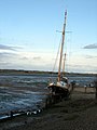
 Houseboat up the creek - geograph.org.uk - 603855.jpg 640 × 480; 174 KB
-
 Island Lane - geograph.org.uk - 1142269.jpg 640 × 480; 77 KB
-
 Kirby Quay from across the mud - geograph.org.uk - 790883.jpg 640 × 480; 194 KB
-
 Lagoon, Hamford Water NNR - geograph.org.uk - 1182531.jpg 640 × 457; 130 KB
-
 Landing stage in Hamford Water - geograph.org.uk - 749644.jpg 640 × 427; 79 KB
-
 Remote mooring - geograph.org.uk - 790716.jpg 480 × 640; 186 KB
-
 Road to the Naze - geograph.org.uk - 1187837.jpg 640 × 457; 154 KB
-
 Salt marsh and sky, an Atlantic grey seal - panoramio.jpg 3,888 × 2,592; 1.42 MB
-
 Salt marsh and sky, passing Titchmarsh Marina - panoramio.jpg 3,888 × 2,592; 1.56 MB
-
 Salt marsh and sky, the Hamford Water National Nature Reserve - panoramio (1).jpg 3,888 × 2,592; 1.55 MB
-
 Salt marsh and sky, the Hamford Water National Nature Reserve - panoramio (2).jpg 3,888 × 2,592; 1.54 MB
-
 Salt marsh and sky, the Hamford Water National Nature Reserve - panoramio (3).jpg 3,888 × 2,592; 1.48 MB
-
 Salt marsh and sky, the Hamford Water National Nature Reserve - panoramio (4).jpg 3,888 × 2,592; 1.21 MB
-
 Salt marsh and sky, the Hamford Water National Nature Reserve - panoramio (5).jpg 3,888 × 2,592; 1.72 MB
-
 Salt marsh and sky, the Hamford Water National Nature Reserve - panoramio (6).jpg 3,888 × 2,592; 1.24 MB
-
 Salt marsh and sky, the Hamford Water National Nature Reserve - panoramio.jpg 3,888 × 2,592; 1.6 MB
-
 Sea wall - geograph.org.uk - 1182600.jpg 640 × 457; 54 KB
-
 Sea wall at Hamford Water - geograph.org.uk - 1182559.jpg 640 × 457; 130 KB
-
 Seawall at Hamford Water - geograph.org.uk - 1182550.jpg 640 × 457; 129 KB
-

-
 South shore of Pewit Island - geograph.org.uk - 836928.jpg 640 × 403; 186 KB
-
 The Naze (32934454254).jpg 4,160 × 3,120; 2.22 MB
-
 Titchmash Marina - geograph.org.uk - 1294485.jpg 640 × 480; 48 KB
-
 View over Hamford Water - geograph.org.uk - 1017455.jpg 640 × 218; 154 KB
-
-
 Wildfowlers' walkway - geograph.org.uk - 749722.jpg 640 × 410; 64 KB
-
 Yacht at a small quay on Landermere Creek - geograph.org.uk - 603497.jpg 480 × 640; 205 KB


.jpg)
.jpg)
.jpg)
.jpg)
.jpg)
.jpg)


.jpg)


