Category:Harrietsham
English: Harrietsham is a village and civil parish in the Maidstone District of Kent, England. According to the United Kingdom Census 2001, it has a population of around 1,504. The parish is located on the slope of the North Downs, east of Maidstone. Within its boundaries are settlements at Marley, Pollhill and Fairbourne.
a village located in Maidstone, United Kingdom  | |||||
| Upload media | |||||
| Instance of | |||||
|---|---|---|---|---|---|
| Location | Maidstone, Kent, South East England, England | ||||
| Said to be the same as | Harrietsham (Wikimedia duplicated page, civil parish) | ||||
 | |||||
Subcategories
This category has the following 6 subcategories, out of 6 total.
B
- Bell Farm House, Harrietsham (1 F)
G
- Greenway Forstal Farm (2 F)
O
P
- Pollhill (8 F)
R
- Harrietsham railway station (17 F)
Media in category "Harrietsham"
The following 200 files are in this category, out of 325 total.
(previous page) (next page)-
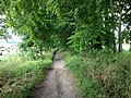
 A claggy bit of the Pilgrim's Way - geograph.org.uk - 137030.jpg 640 × 480; 155 KB
-
 A coombe in the North Downs - geograph.org.uk - 2264503.jpg 640 × 430; 117 KB
-
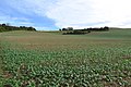
 A field of oilseed rape - geograph.org.uk - 4484906.jpg 4,000 × 3,000; 4.09 MB
-
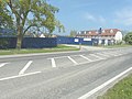
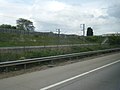
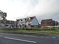
 A20 (Ashford Road), Harrietsham - geograph.org.uk - 3721449.jpg 640 × 480; 260 KB
-
 A20, Ashford Road - geograph.org.uk - 3721451.jpg 640 × 480; 342 KB
-
 Access to The Hollies from the A20 - geograph.org.uk - 3468468.jpg 881 × 660; 145 KB
-
 Access Track leading onto Fairbourne Lane - geograph.org.uk - 5078274.jpg 1,600 × 1,067; 785 KB
-
 Alexander Road access to The Hollies - geograph.org.uk - 3624450.jpg 1,077 × 807; 216 KB
-
 Alexander Road entrance to The Hollies - geograph.org.uk - 3468450.jpg 946 × 709; 163 KB
-
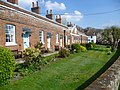
 Alms houses, East Street, Harrietsham - geograph.org.uk - 64933.jpg 640 × 480; 106 KB
-
 Almshouses at East Street, Harrietsham - geograph.org.uk - 3911836.jpg 4,000 × 3,000; 4.24 MB
-
 Almshouses at East Street, Harrietsham - geograph.org.uk - 3914511.jpg 4,000 × 3,000; 4.28 MB
-
 Almshouses at East Street, Harrietsham - geograph.org.uk - 3914521.jpg 4,000 × 3,000; 4.41 MB
-

-
 Ashford Road approaching Harrietsham - geograph.org.uk - 4996071.jpg 2,048 × 1,536; 945 KB
-
 Ashford Road east of Harrietsham - geograph.org.uk - 4996105.jpg 2,048 × 1,536; 1.53 MB
-
 Ashford Road, Harrietsham - geograph.org.uk - 4995318.jpg 2,026 × 1,508; 805 KB
-
 Ashford Road, Harrietsham - geograph.org.uk - 4996098.jpg 2,048 × 1,536; 1.4 MB
-
 Ashford Road, near Harrietsham - geograph.org.uk - 4751577.jpg 2,272 × 1,704; 873 KB
-
 At the top of the scarp slope above Harrietsham - geograph.org.uk - 4484137.jpg 4,000 × 3,000; 4.1 MB
-
 Birds Nest by the Maidstone East line - geograph.org.uk - 2260115.jpg 640 × 430; 106 KB
-
 Br Percival - geograph.org.uk - 5472396.jpg 2,268 × 4,032; 5.22 MB
-
 Bridleway junction in King's Wood - geograph.org.uk - 1189258.jpg 640 × 481; 136 KB
-
-

-

-

-
 Burchells Wood Road - geograph.org.uk - 4692080.jpg 640 × 480; 161 KB
-
 Burchells Wood Road, Harrietsham - geograph.org.uk - 5017162.jpg 3,264 × 2,448; 1.93 MB
-
 Burchells Wood Road, Harrietsham - geograph.org.uk - 5111896.jpg 3,264 × 2,448; 1.65 MB
-
 Burchells Wood Road, near Harrietsham - geograph.org.uk - 5111898.jpg 3,264 × 2,448; 2.49 MB
-
 Byway through No Man's Acre - geograph.org.uk - 1195941.jpg 640 × 481; 137 KB
-
 Carpark off Harrison Drive - geograph.org.uk - 4746079.jpg 3,264 × 2,448; 2.35 MB
-
 Catholic Church of the Good Shepherd - geograph.org.uk - 1189188.jpg 640 × 481; 86 KB
-
 Champion Hill from the footpath N - geograph.org.uk - 4209156.jpg 1,024 × 682; 357 KB
-
 Champion Hill Shaw - geograph.org.uk - 2263196.jpg 640 × 430; 111 KB
-
 Channel Tunnel Rail Link bridge 822 - geograph.org.uk - 66985.jpg 640 × 480; 89 KB
-
 Channel Tunnel Rail Link tunnel-bridge - geograph.org.uk - 2577383.jpg 3,640 × 2,494; 1.04 MB
-
-
 Chegworth Lane, Chegworth - geograph.org.uk - 5032806.jpg 3,264 × 2,448; 2.46 MB
-
 Chegworth Lane, Chegworth - geograph.org.uk - 5032839.jpg 3,264 × 2,448; 2.22 MB
-
 Chegworth Lane, Chegworth - geograph.org.uk - 5032872.jpg 3,264 × 2,448; 2.33 MB
-
 Church Crescent, Harrietsham - geograph.org.uk - 4751738.jpg 2,272 × 1,704; 728 KB
-
 Church Lane, Harrietsham - geograph.org.uk - 4751586.jpg 2,272 × 1,704; 740 KB
-
 Church Lane, Harrietsham - geograph.org.uk - 4751744.jpg 2,272 × 1,704; 761 KB
-
 Church on Church Lane, Lenham - geograph.org.uk - 1189180.jpg 640 × 481; 93 KB
-
 Church Road, Harrietsham - geograph.org.uk - 4751732.jpg 2,272 × 1,704; 926 KB
-
 Colesdane and Colesdane Wood - geograph.org.uk - 3492908.jpg 4,608 × 3,456; 3.93 MB
-
 Cottages at East Street, Harrietsham - geograph.org.uk - 3914614.jpg 4,000 × 3,000; 4.25 MB
-
 Countryside by Poplar Farm - geograph.org.uk - 5078281.jpg 1,600 × 1,067; 605 KB
-
 Countryside near Greenway Court - geograph.org.uk - 2260054.jpg 640 × 430; 111 KB
-
 Court Lodge Cottages - geograph.org.uk - 2263151.jpg 640 × 430; 152 KB
-
 Court Lodge Farm - geograph.org.uk - 141607.jpg 640 × 480; 114 KB
-
 Court Lodge Farm - geograph.org.uk - 2263171.jpg 640 × 430; 135 KB
-
 Court Lodge Farm - geograph.org.uk - 2263177.jpg 640 × 430; 126 KB
-
 Court Lodge farm from the Pilgrims Way - geograph.org.uk - 4209151.jpg 1,024 × 683; 370 KB
-
 Court Lodge Road, Harrietsham - geograph.org.uk - 4751735.jpg 2,272 × 1,704; 841 KB
-
 Court Lodge Road, Harrietsham - geograph.org.uk - 5024561.jpg 3,264 × 2,448; 1.3 MB
-
 Court Lodge Road, Harrietsham - geograph.org.uk - 5024571.jpg 3,264 × 2,448; 1.98 MB
-
 Court Lodge Road, Harrietsham - geograph.org.uk - 5025387.jpg 3,264 × 2,448; 2.1 MB
-
 Court Lodge Road, Harrietsham - geograph.org.uk - 5025392.jpg 3,264 × 2,448; 2.35 MB
-
 Cowl of Oast House - geograph.org.uk - 6248899.jpg 3,456 × 3,456; 381 KB
-
 Daffodils at East Street, Harrietsham - geograph.org.uk - 3914609.jpg 4,000 × 3,000; 4.07 MB
-
 Dead mouse on the Pilgrim's Way - geograph.org.uk - 141421.jpg 640 × 481; 124 KB
-
 Deans Hill, Harrietsham - geograph.org.uk - 5017131.jpg 3,264 × 2,448; 1.93 MB
-

-
 Downlands at the junction of Ashford Road - geograph.org.uk - 4997642.jpg 2,048 × 1,536; 959 KB
-
 Downlands, Harrietsham - geograph.org.uk - 4751584.jpg 2,272 × 1,704; 861 KB
-
 Dutch House - geograph.org.uk - 2263153.jpg 640 × 430; 179 KB
-
 East Street, Harrietsham - geograph.org.uk - 3914620.jpg 4,000 × 3,000; 4.44 MB
-
 East Street, Harrietsham - geograph.org.uk - 5025430.jpg 3,264 × 2,448; 1.8 MB
-
 East Street, Harrietsham - geograph.org.uk - 5025439.jpg 3,264 × 2,448; 1.97 MB
-

-
 Extension of 14 Quested Way - geograph.org.uk - 3620652.jpg 848 × 636; 134 KB
-
 Fairbourn Mill - geograph.org.uk - 4990510.jpg 640 × 480; 105 KB
-

-
 Fairbourne Lane Bridge, M20 - geograph.org.uk - 4572783.jpg 640 × 430; 34 KB
-

-
 Fairbourne Lane goes over the M20 - geograph.org.uk - 4065634.jpg 1,600 × 1,200; 1.03 MB
-
 Fairbourne Lane, near Harrietsham - geograph.org.uk - 2077522.jpg 2,711 × 1,999; 1.25 MB
-
 Fairbourne Mill Barn - geograph.org.uk - 1189225.jpg 640 × 481; 90 KB
-
 Fallen Tree in King's Wood - geograph.org.uk - 1189252.jpg 640 × 481; 127 KB
-
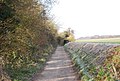
 Farmland by Pilgrims' Way - geograph.org.uk - 2263188.jpg 640 × 430; 120 KB
-
 Farmland near Goddington Wood - geograph.org.uk - 2260061.jpg 640 × 430; 104 KB
-
 Field by Pilgrims' Way near Stede Wood - geograph.org.uk - 2263019.jpg 640 × 430; 163 KB
-
 Field edge near Hogbarn - geograph.org.uk - 4483266.jpg 4,000 × 3,000; 4.24 MB
-
 Field edge near Stedehill Wood - geograph.org.uk - 4483228.jpg 4,000 × 3,000; 4.12 MB
-
 Field edge near Stedehill Wood - geograph.org.uk - 4483235.jpg 4,000 × 3,000; 4.31 MB
-
 Field north of Burchells Wood Road - geograph.org.uk - 4692093.jpg 640 × 480; 92 KB
-
 Flooded Road Junction - geograph.org.uk - 1730921.jpg 640 × 480; 65 KB
-
 Footpath across a field - geograph.org.uk - 2263161.jpg 640 × 430; 113 KB
-
 Footpath across a field - geograph.org.uk - 4483225.jpg 4,000 × 3,000; 4.21 MB
-
 Footpath by the Pilgrims Way looking S - geograph.org.uk - 4209153.jpg 1,024 × 683; 432 KB
-
 Footpath N off the Pilgrims Way - geograph.org.uk - 4209155.jpg 673 × 1,024; 395 KB
-
 Footpath near Marley Court - geograph.org.uk - 4483210.jpg 4,000 × 3,000; 4.08 MB
-
 Footpath through oilseed rape - geograph.org.uk - 4484900.jpg 4,000 × 3,000; 4.24 MB
-
 Footpath to Harrietsham - geograph.org.uk - 4483204.jpg 4,000 × 3,000; 4.15 MB
-
 Footpath to Lower Deans Farm - geograph.org.uk - 140905.jpg 640 × 480; 118 KB
-
 Footpath to the crest of the North Downs - geograph.org.uk - 4483691.jpg 4,000 × 3,000; 4 MB
-
 Footpath to the North Downs - geograph.org.uk - 4483212.jpg 4,000 × 3,000; 4.33 MB
-
 Forge Meadow, Harrietsham - geograph.org.uk - 4751748.jpg 2,272 × 1,704; 851 KB
-
 Forge Meadow, Harrietsham - geograph.org.uk - 5033278.jpg 3,264 × 2,448; 1.57 MB
-
 Former Harrietsham Primary School - geograph.org.uk - 4751604.jpg 2,272 × 1,704; 883 KB
-

-
 Gate and pre-fab hut, Pilgrims' Way - geograph.org.uk - 2261869.jpg 640 × 430; 158 KB
-
 Glebe Croft - geograph.org.uk - 2263010.jpg 640 × 430; 121 KB
-
 Goddington Lane - geograph.org.uk - 4691830.jpg 640 × 480; 193 KB
-
 Goddington Lane, Harrietsham - geograph.org.uk - 5033250.jpg 3,264 × 2,448; 2.77 MB
-
 Goddington Lane, Harrietsham - geograph.org.uk - 5033254.jpg 3,264 × 2,448; 2.19 MB
-
 Goddington Lane, Harrietsham - geograph.org.uk - 5033255.jpg 3,264 × 2,448; 2.56 MB
-
 Goddington Lane, Harrietsham - geograph.org.uk - 5033257.jpg 3,264 × 2,448; 2.65 MB
-
 Goddington Lane, Harrietsham - geograph.org.uk - 5033265.jpg 3,264 × 2,448; 2.26 MB
-
 Goddington Wood - geograph.org.uk - 2260063.jpg 640 × 430; 100 KB
-
 Greenway Forstal Lane, near Harrietsham - geograph.org.uk - 5033246.jpg 3,264 × 2,448; 1.66 MB
-
 Greenway Forstal Lane, near Harrietsham - geograph.org.uk - 5033247.jpg 3,264 × 2,448; 1.49 MB
-
 Greenway Lane - geograph.org.uk - 1730953.jpg 640 × 427; 80 KB
-
 Greenway Lane, Harrietsham, Kent - geograph.org.uk - 62682.jpg 600 × 450; 217 KB
-
 Harrietsham church - geograph.org.uk - 4691970.jpg 640 × 480; 104 KB
-
 Harrietsham church - geograph.org.uk - 4691973.jpg 640 × 480; 114 KB
-
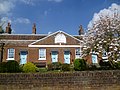
 Harrietsham Manor - geograph.org.uk - 163753.jpg 640 × 480; 121 KB
-

-
 Harrietsham station - geograph.org.uk - 4691966.jpg 640 × 480; 135 KB
-
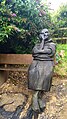
 Harrietsham Village Sign - geograph.org.uk - 1190663.jpg 481 × 640; 47 KB
-
 Harrietsham Village Sign - geograph.org.uk - 1504846.jpg 480 × 640; 75 KB
-
 Harrietsham, Ashford Road - geograph.org.uk - 3721447.jpg 640 × 480; 276 KB
-
 Hedgeline at the foot of the North Downs - geograph.org.uk - 4483218.jpg 4,000 × 3,000; 3.95 MB
-
 Hoarding, 10, West Street - geograph.org.uk - 5098732.jpg 3,264 × 2,448; 1.69 MB
-
 Hogbarn Caravan Park - geograph.org.uk - 4209256.jpg 1,024 × 683; 324 KB
-
 Hogbarn Lane - geograph.org.uk - 1730966.jpg 640 × 480; 100 KB
-
 Hogbarn Lane, Harrietsham - geograph.org.uk - 5017158.jpg 3,264 × 2,448; 2.12 MB
-
 Hogbarn Lane, Harrietsham - geograph.org.uk - 5111888.jpg 3,264 × 2,448; 2.11 MB
-
 Holm Mill Lane - geograph.org.uk - 3744485.jpg 4,000 × 3,000; 4.49 MB
-
 Holm Mill Lane - geograph.org.uk - 4691855.jpg 640 × 480; 175 KB
-
 Holm Mill Lane, Harrietsham - geograph.org.uk - 5033249.jpg 3,264 × 2,448; 1.92 MB
-
 Hook Lane, Harrietsham - geograph.org.uk - 5033272.jpg 3,264 × 2,448; 1.94 MB
-
 Hook Lane, Harrietsham - geograph.org.uk - 5033274.jpg 2,567 × 2,003; 1.07 MB
-
 Horses by Pilgrims' Way - geograph.org.uk - 2263016.jpg 640 × 430; 177 KB
-
 Horses, Summoner's farm - geograph.org.uk - 2263014.jpg 640 × 430; 145 KB
-
 Houses by Ashford Road, Harrietsham - geograph.org.uk - 4995320.jpg 2,048 × 1,536; 940 KB
-

-
 Ink Cap Mushroom - geograph.org.uk - 63842.jpg 433 × 640; 165 KB
-
 Inscription on the almshouses at East Street, Harrietsham - geograph.org.uk - 3911842.jpg 4,000 × 3,000; 4.06 MB
-
 Keep Out^ - geograph.org.uk - 66088.jpg 640 × 480; 141 KB
-
 Lakelands, Harrietsham - geograph.org.uk - 4751733.jpg 2,272 × 1,704; 704 KB
-
 Lane near Stedehill Wood - geograph.org.uk - 4483243.jpg 4,000 × 3,000; 4.3 MB
-
 Lenham Sports Cars Ltd, Harrietsham - geograph.org.uk - 2077508.jpg 3,488 × 2,616; 2.32 MB
-
 Looking east along Horwood Way, The Hollies - geograph.org.uk - 4169472.jpg 1,175 × 881; 200 KB
-
 Looking east-northeast along Horwood Way - geograph.org.uk - 4634787.jpg 3,264 × 2,448; 2.48 MB
-

-
 Looking north along Alexander Road, The Hollies - geograph.org.uk - 4169524.jpg 1,096 × 809; 193 KB
-
 Looking up the North Downs scarp slope - geograph.org.uk - 2263183.jpg 640 × 430; 112 KB
-
 Lower Deans Farm - geograph.org.uk - 4483689.jpg 4,000 × 3,000; 4.39 MB
-
 M20 bridge carries minor road south of Harrietsham - geograph.org.uk - 2577455.jpg 3,648 × 2,736; 1.2 MB
-

-
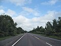
 M20, coastbound - geograph.org.uk - 4572779.jpg 640 × 519; 46 KB
-
 M20, coastbound - geograph.org.uk - 4572780.jpg 640 × 514; 44 KB
-
 M20, coastbound - geograph.org.uk - 4572786.jpg 640 × 465; 33 KB
-
 Mallard duck and large Goose - geograph.org.uk - 63921.jpg 471 × 640; 125 KB
-
 Malthouse, East Street - geograph.org.uk - 4418575.jpg 2,000 × 1,333; 869 KB
-
 Manhamead, Pilgrims' Way - geograph.org.uk - 2261866.jpg 640 × 430; 134 KB
-
 Manor Barn - geograph.org.uk - 1189240.jpg 640 × 481; 85 KB
-
 Marley Court - geograph.org.uk - 778397.jpg 640 × 480; 76 KB
-
 Marley Rd - geograph.org.uk - 2261872.jpg 640 × 430; 147 KB
-
 Marley Road - geograph.org.uk - 4692069.jpg 640 × 480; 146 KB
-
 Marley Works - new buildings (1) - geograph.org.uk - 778399.jpg 640 × 481; 63 KB
-
 Marley Works - new buildings (2) - geograph.org.uk - 778403.jpg 640 × 480; 39 KB
-
 Mass bank of Crocuses - geograph.org.uk - 1181201.jpg 640 × 481; 155 KB
-
 Merlewood Farm House - geograph.org.uk - 1169182.jpg 640 × 481; 99 KB
-
 Mile Hill - geograph.org.uk - 1169171.jpg 640 × 481; 76 KB
-
 Mile Hill - geograph.org.uk - 4990612.jpg 640 × 480; 95 KB
-

-
 Narrow Lane outside Poplar Farm - geograph.org.uk - 5078286.jpg 1,600 × 1,067; 858 KB
-
 New barn, Court Lodge Farm - geograph.org.uk - 2263175.jpg 640 × 430; 117 KB
-
 New houses on Ashford Road, Harrietsham - geograph.org.uk - 4995327.jpg 2,048 × 1,536; 945 KB
-
 Newly erected houses - geograph.org.uk - 4634824.jpg 3,183 × 2,448; 2.38 MB
-
 NNE towards Coles Deane - geograph.org.uk - 4209144.jpg 683 × 1,024; 579 KB
-
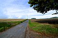
 North Downs Way - geograph.org.uk - 2263150.jpg 640 × 430; 184 KB
-
 North Downs Way - geograph.org.uk - 2263157.jpg 640 × 430; 181 KB
-
 North Downs Way - geograph.org.uk - 2263167.jpg 640 × 430; 195 KB
-
 North Downs Way - geograph.org.uk - 2263186.jpg 640 × 430; 155 KB
-
 North Downs Way - geograph.org.uk - 2263194.jpg 640 × 430; 161 KB
-
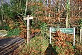 North Downs Way sign, Pilgrims' Way - geograph.org.uk - 2263050.jpg 640 × 430; 217 KB
-
 NW Near the Pilgrims Way - geograph.org.uk - 4209148.jpg 1,024 × 683; 374 KB
-
 NW Near the Pilgrims Way - geograph.org.uk - 4209150.jpg 683 × 1,024; 463 KB
-
 NW on the Pilgrims Way - geograph.org.uk - 4209152.jpg 1,024 × 683; 435 KB
-
 NW towards Court Lodge Farm - geograph.org.uk - 4209143.jpg 1,024 × 683; 326 KB
-
 NW towards Court Lodge Farm from foot path - geograph.org.uk - 4209134.jpg 1,024 × 683; 295 KB
-
 Oast House - geograph.org.uk - 6248896.jpg 5,184 × 3,456; 1.13 MB
-
 Oasts at Fairbourne Mill - geograph.org.uk - 5078266.jpg 1,600 × 1,067; 783 KB
-
 Ockley Mead - geograph.org.uk - 3313898.jpg 640 × 426; 58 KB
-
 Old petrol pumps, Harrietsham - geograph.org.uk - 1946317.jpg 3,072 × 2,304; 2.76 MB
-

-
 Ordnance Survey Flush Bracket 2907 - geograph.org.uk - 4934979.jpg 4,000 × 3,000; 2.9 MB
-
 Overgrown banks of a drainage ditch - geograph.org.uk - 4634802.jpg 3,264 × 2,448; 3.95 MB
-
 Paddock North of Chegworth - geograph.org.uk - 5078886.jpg 1,600 × 1,067; 616 KB
-
 Parkwood Close - geograph.org.uk - 4634779.jpg 3,120 × 2,448; 2.52 MB
-
 Path across a field - geograph.org.uk - 4480286.jpg 4,000 × 3,000; 3.93 MB
-
 Path near Dean's Hill - geograph.org.uk - 4480856.jpg 4,000 × 3,000; 4.28 MB
-
 Path through a sea of oilseed rape - geograph.org.uk - 4480284.jpg 4,000 × 3,000; 4.03 MB
-
 Path through oilseed rape - geograph.org.uk - 4484894.jpg 4,000 × 3,000; 4.03 MB


,_Harrietsham_-_geograph.org.uk_-_3721449.jpg)


_-_geograph.org.uk_-_778399.jpg)
_-_geograph.org.uk_-_778403.jpg)


