Category:Harrington, Lincolnshire
English: Harrington is a civil parish and hamlet. The hamlet is located 6 miles (10 km) west of Alford. The civil parish covers just over 1000 acres (4 km²).

village and civil parish in Lincolnshire, United Kingdom  | |||||
| Upload media | |||||
| Instance of | |||||
|---|---|---|---|---|---|
| Location | East Lindsey, Lincolnshire, East Midlands, England | ||||
 | |||||
Subcategories
This category has the following 4 subcategories, out of 4 total.
F
H
Media in category "Harrington, Lincolnshire"
The following 29 files are in this category, out of 29 total.
-
-

-
 Bridleway to Belmont Plantation - geograph.org.uk - 3546038.jpg 640 × 427; 79 KB
-
 Ford on the River Lymm near Aswardby. - geograph.org.uk - 1858434.jpg 3,872 × 2,592; 2.4 MB
-
 Green Lane to Brinkhill - geograph.org.uk - 3546030.jpg 640 × 427; 89 KB
-
 Harrington Carr, aerial 2019 - geograph.org.uk - 6334023.jpg 800 × 533; 79 KB
-
 Harrington Hall, aerial 2014 - geograph.org.uk - 3891949.jpg 427 × 640; 70 KB
-
 Harrington Hill, aerial 2016 - geograph.org.uk - 5229042.jpg 640 × 427; 58 KB
-
 Harrington Hill, aerial 2017 - geograph.org.uk - 5471056.jpg 427 × 640; 52 KB
-
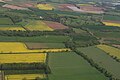
 Harrington, aerial 2016 - geograph.org.uk - 5229037.jpg 427 × 640; 42 KB
-
 Harrington, aerial 2017 - geograph.org.uk - 5391130.jpg 640 × 427; 49 KB
-

-
 Ordnance Survey Cut Mark - geograph.org.uk - 5481724.jpg 640 × 411; 128 KB
-
 Partridges coming of age - geograph.org.uk - 4045146.jpg 640 × 427; 89 KB
-
 Partridges coming of age - geograph.org.uk - 4045152.jpg 640 × 427; 61 KB
-

-
 Road junction, Harrington - geograph.org.uk - 3614576.jpg 1,600 × 1,064; 490 KB
-
 Road towards Stockwith Mill - geograph.org.uk - 3633531.jpg 2,256 × 1,504; 2.06 MB
-

-

-
 Smackdam Cottage - geograph.org.uk - 521570.jpg 640 × 427; 113 KB
-
 Sutterby, aerial 2016 - geograph.org.uk - 5228998.jpg 640 × 427; 54 KB
-
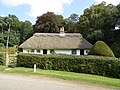 Thatched Cottage near Bag Enderby - geograph.org.uk - 4150059.jpg 1,600 × 1,200; 510 KB
-
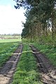 Track at edge of Fairy Wood - geograph.org.uk - 2919441.jpg 682 × 1,024; 290 KB
-
 View of junction from Aswardby Road - geograph.org.uk - 1939221.jpg 640 × 480; 49 KB
-
 Cinder Hill - geograph.org.uk - 426256.jpg 640 × 480; 107 KB
-
 Five bar gate - geograph.org.uk - 511857.jpg 640 × 427; 99 KB
-
 Plantation View - geograph.org.uk - 692025.jpg 640 × 480; 101 KB
-
 Sutterby Holt - geograph.org.uk - 112911.jpg 640 × 427; 91 KB


