Category:Hartest
English: The village is centred on the large village green, fringed by an array of brightly coloured cottages, the village hall or institute, the medieval All Saints church and the Crown public house, formerly Hartest Hall the local landowner's seat.
Svenska: Hartest är en by (village) och en civil parish i Babergh, Suffolk i östra England. Orten har 427 invånare.
village in Suffolk, England, UK  | |||||
| Upload media | |||||
| Instance of | |||||
|---|---|---|---|---|---|
| Location | Babergh, Suffolk, East of England, England | ||||
 | |||||
Subcategories
This category has the following 5 subcategories, out of 5 total.
C
- Cross Green, Hartest (1 F)
H
- Hartest Hill (2 F)
- Hartest War Memorial (10 F)
M
- Mile End, Suffolk (1 F)
Media in category "Hartest"
The following 119 files are in this category, out of 119 total.
-
 B1066 passing Hartest village green - geograph.org.uk - 972097.jpg 640 × 506; 106 KB
-
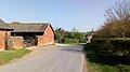
 Barns - geograph.org.uk - 2595300.jpg 1,024 × 768; 214 KB
-
 Boxted and Hartest Institute - geograph.org.uk - 4365372.jpg 4,320 × 3,240; 3.61 MB
-
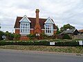 Boxted and Hartest Institute - geograph.org.uk - 6256106.jpg 800 × 600; 108 KB
-
 Boxted and Hartest village hall - geograph.org.uk - 4631299.jpg 1,240 × 930; 448 KB
-
 Bridge House, Hartest - geograph.org.uk - 3935119.jpg 2,816 × 2,112; 707 KB
-
 Bridge House, Hartest - geograph.org.uk - 6256112.jpg 800 × 600; 93 KB
-

-

-
 Chadacre Road, Hartest - geograph.org.uk - 6256113.jpg 800 × 600; 160 KB
-
 Colourful cottages at Hartest, Suffolk - geograph.org.uk - 1936434.jpg 1,024 × 709; 222 KB
-

-
 Concrete 'Public Bridleway' sign - geograph.org.uk - 4631305.jpg 1,240 × 930; 446 KB
-
 Concrete Footpath Sign - geograph.org.uk - 2595454.jpg 768 × 1,024; 230 KB
-
 Cooks Farm On Lawshall Road - geograph.org.uk - 6128075.jpg 1,024 × 576; 129 KB
-
 Cottages on the village green, Hartest - geograph.org.uk - 4365335.jpg 4,320 × 3,240; 5.2 MB
-
 Country Road - geograph.org.uk - 2595479.jpg 1,024 × 768; 230 KB
-
 Countryside near Hartest - geograph.org.uk - 971455.jpg 640 × 464; 86 KB
-
 Crop field off Lawshall Road - geograph.org.uk - 6256118.jpg 800 × 600; 110 KB
-
 Crop harvesting off Somerton Road - geograph.org.uk - 6256105.jpg 800 × 548; 91 KB
-
 Different window styles at Hartest - geograph.org.uk - 1953852.jpg 640 × 439; 81 KB
-
 Entering Brockley - geograph.org.uk - 2849743.jpg 1,024 × 768; 197 KB
-
 Farm track (bridleway) off Lawshall Road - geograph.org.uk - 6256117.jpg 800 × 600; 106 KB
-

-
 Field margin south of Hartest - geograph.org.uk - 3935107.jpg 2,816 × 2,112; 1.21 MB
-
 Footbridge near Hartest Church - geograph.org.uk - 3935098.jpg 2,112 × 2,816; 1.38 MB
-
 Footpath - geograph.org.uk - 2595464.jpg 1,024 × 768; 262 KB
-
 Footpath Sign - geograph.org.uk - 2595458.jpg 768 × 1,024; 278 KB
-
 Footpath sign near Kewgardens Farm - geograph.org.uk - 2076628.jpg 640 × 480; 54 KB
-
 Footpath Sign Post - geograph.org.uk - 2595278.jpg 1,024 × 768; 272 KB
-
 Footpath to Boxted - geograph.org.uk - 195843.jpg 640 × 427; 66 KB
-
 Footpath to Boxted - geograph.org.uk - 196047.jpg 640 × 427; 89 KB
-
 Footpath to Boxted - geograph.org.uk - 198153.jpg 427 × 640; 117 KB
-
 Footpath To Chadacre Park - geograph.org.uk - 2595288.jpg 1,024 × 768; 203 KB
-
 Footpath to Hartest - geograph.org.uk - 3935138.jpg 2,816 × 2,112; 1.22 MB
-
 Grazing off Lawshall Road - geograph.org.uk - 6256114.jpg 800 × 564; 83 KB
-
 Hardstanding near Ashen Wood - geograph.org.uk - 3935131.jpg 2,816 × 2,112; 794 KB
-
 Hartest - geograph.org.uk - 2595522.jpg 768 × 1,024; 281 KB
-
 Hartest Garage - geograph.org.uk - 2076655.jpg 640 × 447; 85 KB
-
 Hartest Garage - geograph.org.uk - 2595492.jpg 1,024 × 768; 276 KB
-
 Hartest Green - geograph.org.uk - 3033833.jpg 1,600 × 1,200; 897 KB
-
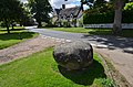 Hartest Stone - Glacial erratic - geograph.org.uk - 3594208.jpg 640 × 424; 287 KB
-
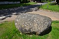 Hartest Stone - Glacial erratic - geograph.org.uk - 3594212.jpg 640 × 424; 285 KB
-
 Hartest Stone - Glacial erratic - geograph.org.uk - 3594218.jpg 640 × 424; 307 KB
-
 Hartest village green - geograph.org.uk - 1953840.jpg 468 × 640; 115 KB
-
 Hartest Village Green - geograph.org.uk - 4000909.jpg 3,648 × 2,052; 3.02 MB
-
 Hartest village scene - geograph.org.uk - 971494.jpg 640 × 388; 87 KB
-
 Hartest village sign (detail) - geograph.org.uk - 4292864.jpg 513 × 640; 80 KB
-
 Hartest village sign - geograph.org.uk - 4292865.jpg 480 × 640; 56 KB
-
 Hartest Wood - geograph.org.uk - 2076640.jpg 640 × 480; 113 KB
-
 Hill Farm above Hartest - geograph.org.uk - 971427.jpg 640 × 459; 73 KB
-
 Houses in Hartest village - geograph.org.uk - 971528.jpg 640 × 465; 103 KB
-
 Houses on the green at Hartest - geograph.org.uk - 4637208.jpg 1,600 × 1,064; 358 KB
-
 Houses on the green at Hartest - geograph.org.uk - 4737567.jpg 1,600 × 1,064; 498 KB
-
 Houses on the green, Hartest - geograph.org.uk - 2076647.jpg 640 × 480; 97 KB
-
 Keep To Footpath - geograph.org.uk - 2595445.jpg 1,024 × 768; 318 KB
-

-
 Lawshall Road - geograph.org.uk - 6256115.jpg 800 × 600; 131 KB
-
 Lawshall Road - geograph.org.uk - 6256119.jpg 800 × 600; 94 KB
-
 Local signs - geograph.org.uk - 2595451.jpg 768 × 1,024; 275 KB
-
 Looking down a valley from Somerton Road - geograph.org.uk - 6256103.jpg 800 × 600; 101 KB
-
 Looking Towards Hartest Across Farmland - geograph.org.uk - 6128069.jpg 1,024 × 576; 166 KB
-
 Lord's Farm, Hartest - geograph.org.uk - 2076666.jpg 640 × 480; 51 KB
-
 Mile End Farm - geograph.org.uk - 6256102.jpg 800 × 600; 129 KB
-
 Millhill farmhouse - geograph.org.uk - 1083706.jpg 640 × 480; 84 KB
-
 More colourful cottages in Hartest - geograph.org.uk - 971539.jpg 640 × 513; 103 KB
-
 Nuclear Monitoring Post - geograph.org.uk - 2595297.jpg 1,024 × 768; 317 KB
-
 Nursery at Gifford's Hall - geograph.org.uk - 196049.jpg 640 × 427; 84 KB
-
 Old Engine - geograph.org.uk - 2595511.jpg 1,024 × 768; 250 KB
-
 Old garage, Hartest - geograph.org.uk - 4365404.jpg 4,320 × 3,240; 4.56 MB
-
 Old garage, Hartest - geograph.org.uk - 4637211.jpg 1,600 × 1,064; 393 KB
-

-
 Overlooking Hartest village - geograph.org.uk - 971445.jpg 640 × 456; 110 KB
-
 Part of Chadacre Road near Hartest - geograph.org.uk - 2959048.jpg 3,648 × 2,736; 2.83 MB
-
 Part of Cooks Farm - geograph.org.uk - 2437936.jpg 3,648 × 2,736; 1.04 MB
-
 Part of the village green at Hartest - geograph.org.uk - 2105029.jpg 3,648 × 2,736; 1.28 MB
-
 Ploughed Field - geograph.org.uk - 2595476.jpg 1,024 × 768; 220 KB
-
 Ploughed field with set-aside strip - geograph.org.uk - 2076662.jpg 640 × 480; 72 KB
-
 Ploughing - geograph.org.uk - 2595471.jpg 1,024 × 768; 208 KB
-
 Postbox and telephone box, Hartest - geograph.org.uk - 6256216.jpg 800 × 636; 177 KB
-
 Public footpath to Chadacre Park - geograph.org.uk - 2959074.jpg 3,648 × 2,736; 2.82 MB
-
 Red Boxes And Cottages - geograph.org.uk - 2595564.jpg 1,024 × 768; 211 KB
-
 Riders approaching from Hartest Hill - geograph.org.uk - 971400.jpg 640 × 359; 67 KB
-
 Roger's Lane, Boxted - geograph.org.uk - 1323732.jpg 425 × 640; 118 KB
-
 Smithbrook Lane - geograph.org.uk - 1089108.jpg 480 × 640; 100 KB
-
 Somerton Road west of Hartest - geograph.org.uk - 971573.jpg 640 × 424; 74 KB
-
 Somerton Road, Mile End - geograph.org.uk - 6256104.jpg 800 × 600; 133 KB
-
 Splash of colour on Hartest Green - geograph.org.uk - 4631295.jpg 1,240 × 930; 711 KB
-
 Start Of Public Road - geograph.org.uk - 2595444.jpg 1,024 × 768; 310 KB
-
 Sunflowers - geograph.org.uk - 2595448.jpg 1,024 × 768; 248 KB
-
 The Gift By Geoffrey Clarke RA - geograph.org.uk - 6128114.jpg 576 × 1,024; 220 KB
-
 The Green, Hartest - geograph.org.uk - 5009096.jpg 640 × 476; 135 KB
-
 The Hatch - geograph.org.uk - 2595486.jpg 1,024 × 768; 238 KB
-
 The Hopleys, Horringer - geograph.org.uk - 22450.jpg 640 × 430; 106 KB
-
 The view from Hartest Hill, approaching Hartest village - geograph.org.uk - 2105008.jpg 3,648 × 2,736; 1.3 MB
-
 The Village Green, Hartest - geograph.org.uk - 1323036.jpg 640 × 425; 87 KB
-
 The War Grave of Private Charles Arthur Pawsey - geograph.org.uk - 5301402.jpg 1,944 × 2,592; 369 KB
-
 Tower Farm - geograph.org.uk - 971370.jpg 480 × 640; 105 KB
-
 Tower Lodge, under repair - geograph.org.uk - 3935128.jpg 2,816 × 2,112; 981 KB
-
 Valley scene near Hartest - geograph.org.uk - 972093.jpg 640 × 446; 80 KB
-

-

-
 View over High Suffolk - geograph.org.uk - 1323236.jpg 640 × 425; 78 KB
-
 View west from Lawshall Road - geograph.org.uk - 2076632.jpg 640 × 480; 58 KB
-
 Village green, Hartest - geograph.org.uk - 4365351.jpg 4,320 × 3,240; 5.57 MB
-
 Village hall, Hartest - geograph.org.uk - 5009105.jpg 509 × 640; 163 KB
-
 Village Sign - geograph.org.uk - 2595519.jpg 768 × 1,024; 333 KB
-
 Village view from Hartest Hill - geograph.org.uk - 3935113.jpg 2,816 × 2,112; 1.23 MB
-
 Waldegrave Farm, near Hartest - geograph.org.uk - 2076623.jpg 640 × 480; 62 KB
-
 War Memorial and village green, Hartest - geograph.org.uk - 6256108.jpg 800 × 600; 121 KB
-
 A footpath close to Millhill Farm - geograph.org.uk - 1400788.jpg 640 × 480; 73 KB
-
-
 Bridleway to Boxted - geograph.org.uk - 196050.jpg 640 × 427; 55 KB
-
 Bridleway to Chadacre Hall - geograph.org.uk - 196044.jpg 640 × 427; 87 KB
-
 Fields near Waldegrave Farm - geograph.org.uk - 195817.jpg 640 × 427; 63 KB
-
 Footpath to Stowehill - geograph.org.uk - 195831.jpg 427 × 640; 97 KB
-
 Hartest - geograph.org.uk - 38061.jpg 640 × 414; 175 KB
-
 Hartest Wood - geograph.org.uk - 195826.jpg 640 × 427; 100 KB
-
 Kewgardens Farm - geograph.org.uk - 195822.jpg 640 × 427; 88 KB


_off_Lawshall_Road_-_geograph.org.uk_-_6256117.jpg)


_-_geograph.org.uk_-_4292864.jpg)


